
Research Highlights
Oceanus Magazine
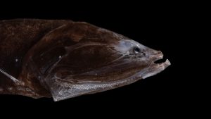
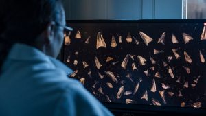
Fossilized teeth show bristlemouth fish evolved during one of the ocean’s hottest periods
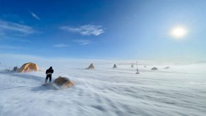
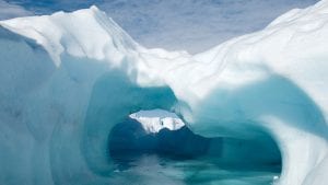
After recovering ice that dates back 6 million years, Sarah Shackleton hopes to dig deeper into Earth’s history from a remote Antarctic moraine

WHOI scientists study the paleo record to understand how the ocean will look in a warmer climate
Abundant life in hotter ancient seas gives one paleontologist optimism for the future
News Releases
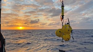
Study of Gofar transform fault on the Pacific seafloor points to mitigating effects of “barrier zones” that keep ruptures from spreading.
A new study suggests Jupiter’s icy moon lacks geophysical activity, changing how scientists think about life there

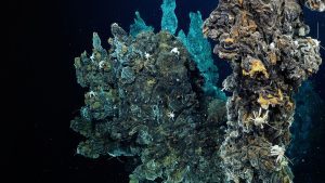
Researchers use vanadium isotopes to track the rise of oxygen in ancient seas
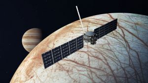
The Investigating Ocean Worlds project will seek to improve the analysis of data related to carbon-rich molecules that could be an indicator of biological activity.
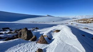
This is the most significant discovery to date for COLDEX, an NSF Science and Technology Center funded in 2021 to explore the Antarctic ice sheet, which is the largest ice mass on the planet.
News & Insights

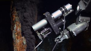
First-of-its-kind research expedition studies massive freshwater aquifer under the ocean floor off Cape Cod

This week, NASA’s Perseverance Rover lands on Mars to continue the search for life on the Red Planet. At the same time, WHOI scientists and engineers are applying their experience exploring the deepest parts of planet Earth to the quest…
As glaciers melt at unprecedented rates, WHOI’s Simon Pendleton is looking back to historical records to predict whether this new cool runoff will slow ocean circulation and cool the northern hemisphere––findings which could mean adjustments to some climate predictions.

WHOI looks back at the legacy of co-founder of MIT-WHOI Joint Program, former Director of Research and Provost at WHOI, Art Maxwell
As I reached the end of April, I realized that too much of my time was getting consumed by zoom calls and email in a bid to over-compensate for not being able to interact with people on-site at WHOI. So…