Marine Magnetometer
Why do scientists and engineers use it?
A magnetometer is a scientific instrument used to measure magnetic field strength. On land, magnetometers can be used to find iron ore deposits for mining. Under the sea, marine geophysicists, ocean engineers and nautical archeologists use marine magnetometers to detect variations in the total magnetic field of the underlying seafloor.
Usually, the increased magnetization is caused by the presence of ferrous (unoxidized) iron on the seafloor, whether from a shipwrecked boat made of steel or a volcanic rock containing grains of magnetite, a highly magnetic mineral.
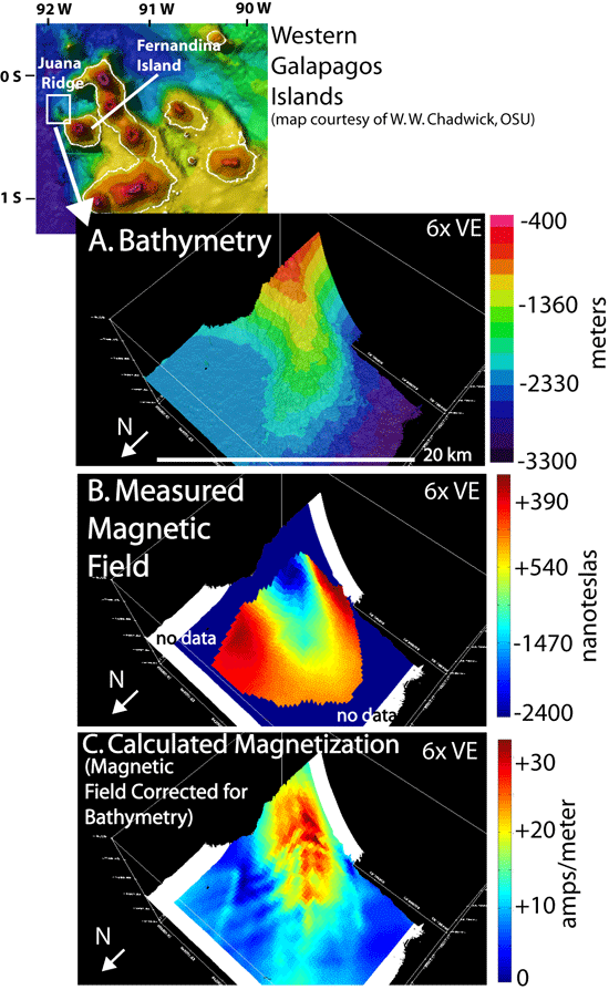
After corrections are made to measurements of the total magnetic field, scientists can use magnetic data to estimate the age and thickness of volcanic lava flows at mid-ocean ridges and ocean island hot spots; to locate pipelines, undersea cables and bridge foundations; and to identify important archeological sites.
How does the instrument work?
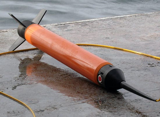
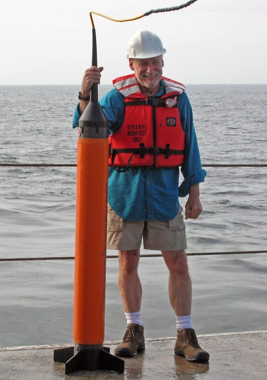
Marine magnetometers are generally “fish-type” instruments (so-called because they are sleek and only a few meters in length). They are towed at least two and a half ship-lengths behind the ship, so that the ship’s magnetic field does not interfere with magnetic measurements.
Marine magnetometers can be scalar, measuring the total strength of the magnetic field; or vector, resolving the magnetic field into the vectors of strength, inclination (the angle at which magnetic field lines intersect the surface of the earth, 0° at the equator and 90° at magnetic poles) and declination (the angle the magnetic field makes with geographic north).
Marine magnetometers contain a chamber filled with a liquid rich in hydrogen atoms, like kerosene or methanol. Electrons dissolved in the liquid are excited by a radio frequency (RF) power source and pass on their energy to the hydrogen atoms’ nuclei (protons), altering their spin states. The transfer of energy from electrons to the protons in the hydrogen atoms is called the “Overhauser Effect” (after the American physicist Albert Overhauser who discovered it in the early 1950s) and the magnetometers that use the effect are called “Overhauser Magnetometers.”
Once the protons are spinning, the RF power is removed, and the protons spiral back to their original alignment with the total geomagnetic field. The frequency of their spiralling, or “precession,” is measured with a coil, and is dependent on a known constant, the “gyromagnetic ratio,” and the total geomagnetic field. Thus, if the frequency is measured, and the constant is known, the total geomagnetic field can be calculated.
What platforms are needed for its use?
Different types of marine magnetometers require different platforms. Surface-towed magnetometers are towed close to the surface of the ocean and far enough behind the ship so that the ship’s magnetization does not interfere with the measurements. Deep-towed magnetometers are often attached to a remotely-operated vehicle (such as the WHOI Towed Camera System).
What are the advantages of this instrument?
Overhauser magnetometers are vastly more energy efficient than their predecessors, proton precession magnetometers, which relied on excitement of protons by a direct current (DC) source. Overhauser magnetometers also have faster cycling rates (up to five magnetic measurements taken each second) and higher sensitivities than the older proton precession magnetometers. The power saving improvement is very important, because Overhauser magnetometers can be mounted on remotely operated vehicles that have limited battery power, thereby improving the spatial coverage of magnetic mapping surveys.
The design of most marine magnetometers makes them light weight, so they are quite simple to load onto the ship and deploy. Surface-towed magnetometers can cover larger areas and are relatively inexpensive. Deep-towed magnetometers can cover detailed areas of the seafloor and have higher sensitivities than surface-towed magnetometers.
What are the disadvantages of using this instrument?
Surface-towed magnetometers have lower sensitivities than near-bottom magnetometers. Near bottom magnetometers are more expensive and cover smaller areas than surface-towed magnetometers.
Is there a patent?
The SeaSPY magnetometer featured in this article is patented, manufactured and distributed by Marine Magnetics, Ontario, Canada.
Sources
Kearey, P., and Brooks, M. 1984. An Introduction to Geophysical Exploration. Blackwell Scientific Publications (Oxford, UK).
Jennifer Glass Woods Hole Oceanographic Institution; University of Washington (Seattle, WA) Geology & Geophysics (WHOI); School of Oceanography & Department of Earth and Space Sciences (UW) Summer Student Fellow (WHOI); Alumni (UW)
Clare Williams; Woods Hole Oceanographic Institution; Geology & Geophysics MIT-WHOI Joint Program Student
Maurice Tivey; Woods Hole Oceanographic Institution; Geology & Geophysics; Associate Scientist


