
Research Highlights
Oceanus Magazine
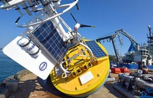
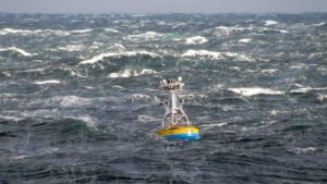
The Ocean Observatories Initiative has reached a major milestone: Its network of ocean sensor systems is now fully operational and sending a broad, continuous stream of data back to shore. Funded by the National Science Foundation with a planned life of 25 years, the OOI provides online access to a growing trove of multidisciplinary oceanographic data, freely available to researchers, educators, and the public worldwide.
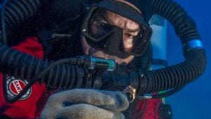
There’s a great need to collect ocean temperature data. And there are millions of scuba divers out there.
News Releases
Findings could lead to locating nutrient sources and providing management options

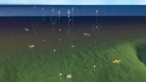
The OOI collects and serves measurements from more than 900 autonomous instruments on the seafloor and on moored and free-swimming platforms.
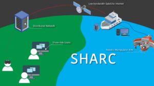
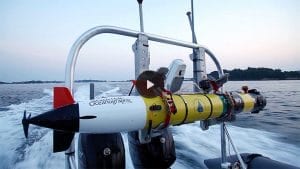
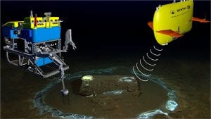
The Shared Autonomy for Remote Collaboration (SHARC) framework “enables remote participants to conduct shipboard operations and control robotic manipulators.
Opportunistic sampling shows geographic scope of distribution, offer some of the first sampling opportunities
New location offers opportunities for new science observations with continued open access
News & Insights
Fishing community and OOI scientists unite to study how the ocean is changing & what it means for global fishing industries
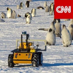
NSF program fosters collaboration between indigenous communities and traditional scientists, allowing WHOI’s autonomous vehicles to shed light on a changing Arctic
An investigative report this week in the LA Times features the work of WHOI’s marine geochemistry lab in identifying the discarded barrels and analyzing samples from the discovery.
DUNEX is a multi-agency, academic and stakeholder collaborative community experiment to study nearshore processes during coastal storms. Use this ArcGIS map to learn more about all the project sites along the North Carolina coastline.