
Geology & Geophysics
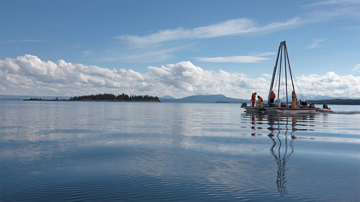
 Tourists visiting Yellowstone National Park can see steaming fissures, bubbling mudpots, and explosive geysers from roadside stops. But beneath the surface of Yellowstone Lake, hidden from view, is a fount of hydrothermal activity. WHOI scientist Rob Sohn, who has explored hydrothermal vents on the deep seafloor, is leading the HD-YLAKE project—a multiyear expedition that brings deep-sea technology to investigate the lake bottom. The research team emloyed a drilling platform operated by the National Lacustrine Core Facility at the University of Minnesota to extract long sediments cores from the lake floor, which hold clues to past events in the lake’s geologic and climate history. (Photo by Chris Linder, Woods Hole Oceanographic Institution)
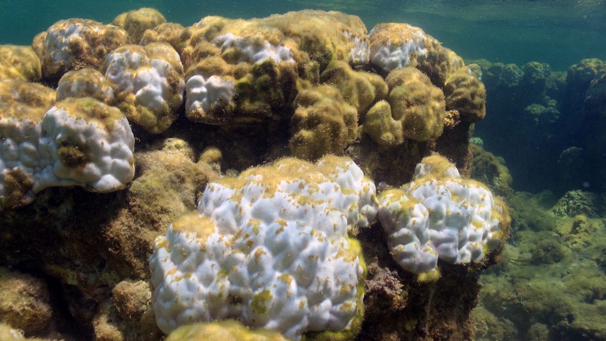
- Corals on Dongsha Atoll, a remote coral reef ecosystem in the northern South China Sea, were severely damaged in June 2015 when a 2°C rise in ocean temperature was amplified to 6°C on the reef by unusually calm weather. The study, published in Scientific Reports and led by Tom DeCarlo, former MIT-WHOI Joint Program student in WHOI scientist Anne Cohen's lab, highlights the danger to shallow water reefs of even moderate levels of warming. In response to the hike in temperature, this Porites colony ejected its algal symbionts, causing the coral polyps to turn white. Without their symbionts, the polyps starve and eventually die. Some parts of this coral are already dead and covered with turf algae. (Photo by Tom DeCarlo, Woods Hole Oceanographic Institution)
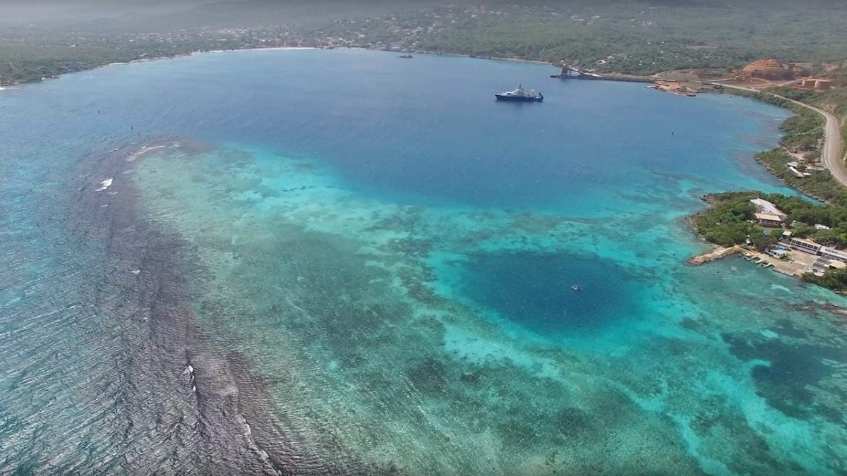
- The dark blue patch in the bottom right of this aerial shot of Discovery Bay, Jamaica, is a “blue hole.” These large sinkholes formed as caves on land during the last ice age, when sea levels were hundreds of feet lower than today. Eventually the caves collapsed and filled with water as sea levels rose again. For WHOI coastal geologist Jeff Donnelly, blue holes provide a perfect trap for sediments and debris that passing hurricanes leave behind. From a floating platform, barely visible in the blue hole's center, Donnelly collects sediment samples, which he uses to trace the history of hurricanes. More samples were collected from R/V Atlantis in the bay, which itself is an even larger blue hole. (Still from video by Richard Sullivan, Woods Hole Oceanographic Institution)
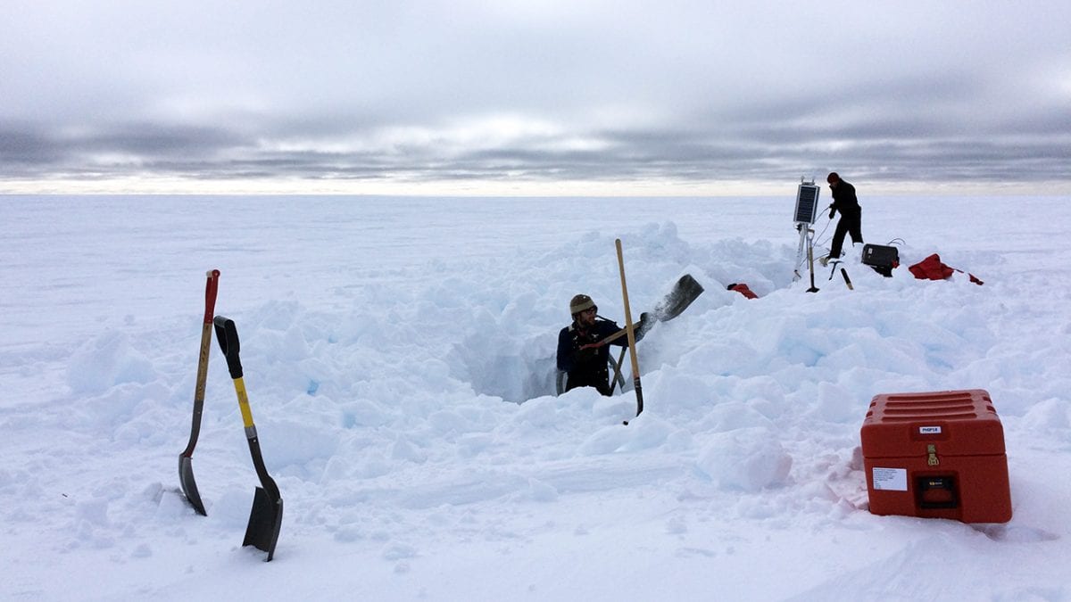
- WHOI seismologist Ralph Stephen and collaborators at Scripps Institution of Oceanography, Washington University in St. Louis, and Colorado State University are leading an effort to better understand the disintegration of the ice shelves. A science team including MIT-WHOI Joint Program student Laura Stevens went to Antarctica in November, and—with some effort—retrieved instruments that had been installed on the Ross Ice Shelf in 2014. The instruments were seismic sensors that measured vibrations in the ice caused by waves hitting the seaward edge of the ice shelf. Scientists will analyze the speed and amplitude of those vibrations to identify areas of weakness and fracturing in the ice shelf. (Photo by Laura Stevens, Woods Hole Oceanographic Institution)
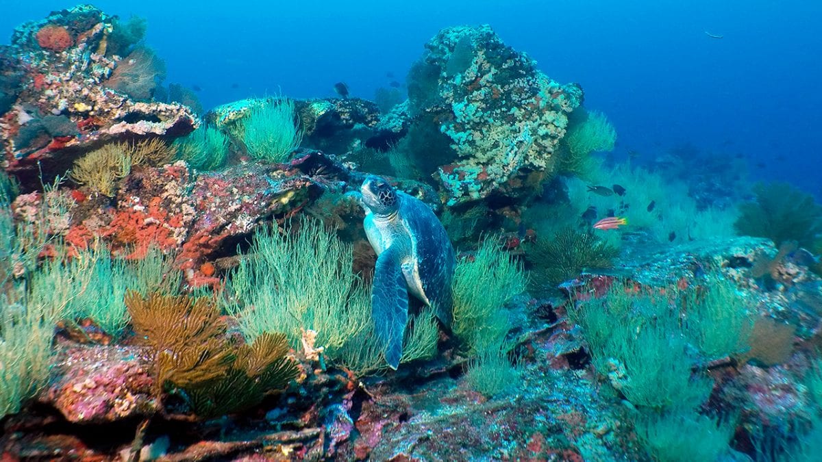
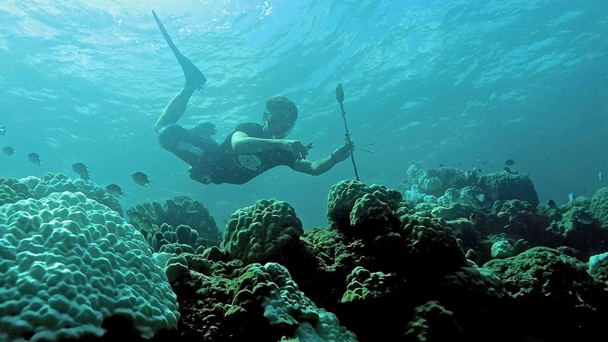
- A green turtle makes its way through the diverse reef community on a seamount in the Galápagos archipelago. In 2015, an expedition led by WHOI geologist Adam Soule conducted acoustic mapping with the research vessel Alucia and the autonomous vehicle REMUS 600 to survey over 70 volcanic seamounts, or undersea mountains. This mapping revealed dozens of previously unknown seamounts, which are home to many unique species. The mapped areas were included in the new Galápagos Marine Reserve and will hopefully facilitate further study of the volcanic processes and biodiversity of the Galápagos platform. (Photo by Woods Hole Oceanographic Institution Multidisciplinary Instrumentation in Support of Oceanography Facility)
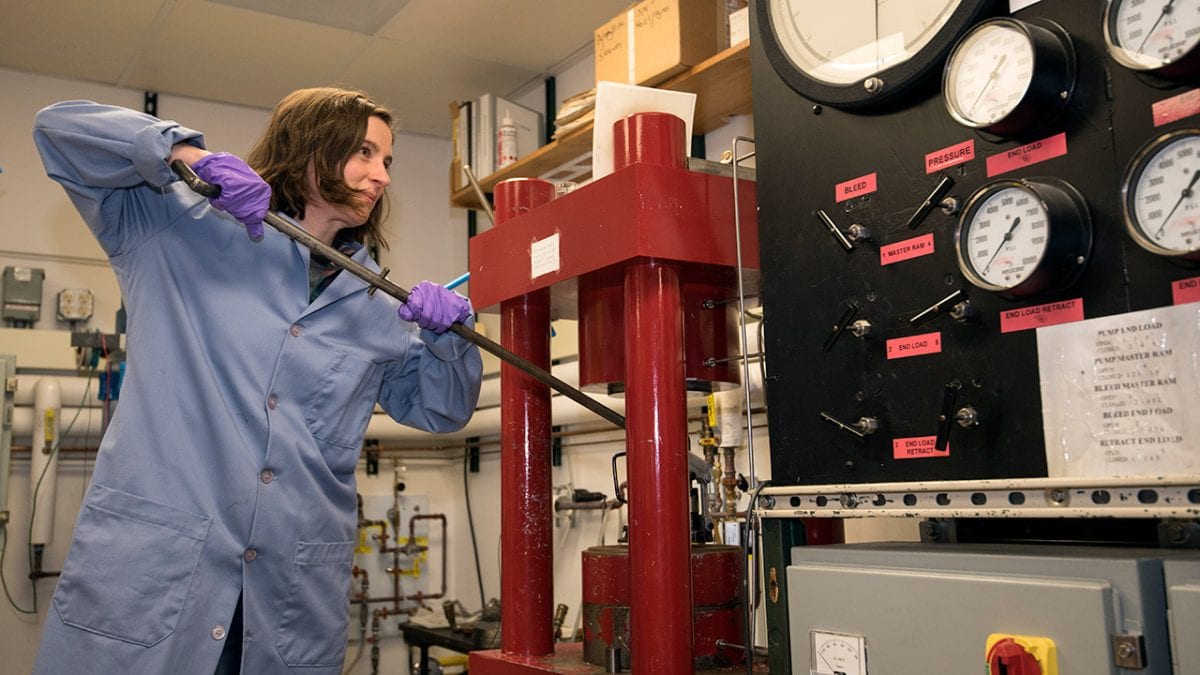
- MIT-WHOI Joint Program student Emily Sarafian wields a hydraulic jack to demonstrate how to set up a piston-cylinder apparatus. She uses the device to carry out high-temperature, high-pressure experiments on rock samples, simulating conditions inside Earth’s upper mantle. In research published recently in the journal Science, Sarafian combined two very different approaches to geological research—experimental petrology and magnetotellurics, a branch of geophysics—and discovered that the mantle beneath the sea floor could be as much as 110°F hotter than previously thought. A hotter mantle would be more fluid, helping to explain the movement of Earth's rigid tectonic plates. (Photo by Véronique LaCapra, Woods Hole Oceanographic Institution)
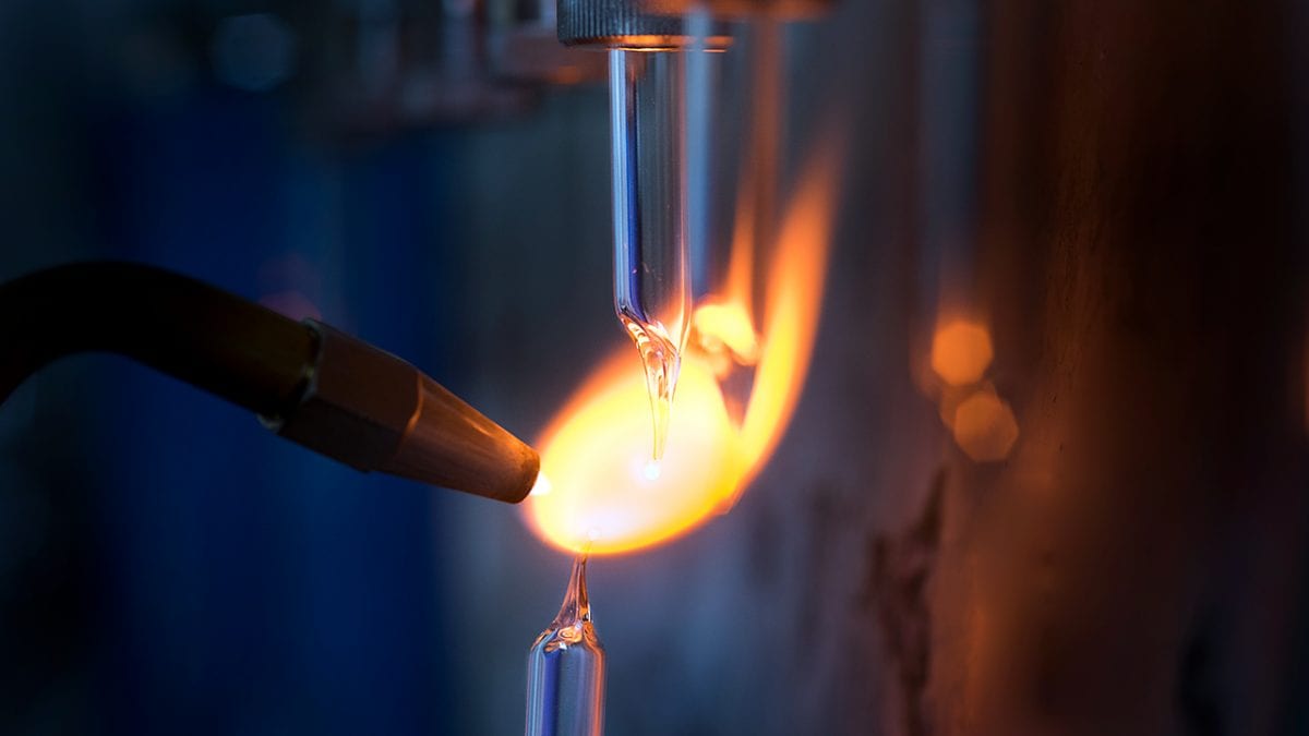
- A sample is flame-sealed by Kathryn Elder for radiocarbon analysis at the National Ocean Sciences Accelerator Mass Spectrometry (NOSAMS) facility at WHOI. The facility provides a range of radiocarbon dating services to the ocean sciences research community and many others worldwide. Elder recently developed a new, single-step method to convert organic samples to graphite for measurement on either of NOSAMS's two accelerators. The method is less labor intensive and cheaper than the previous method, which involved multiple steps. The new technique pictured here allows the rapid analysis of a large number of samples at lower cost. (Photo by Tom Kleindinst, Woods Hole Oceanographic Institution)
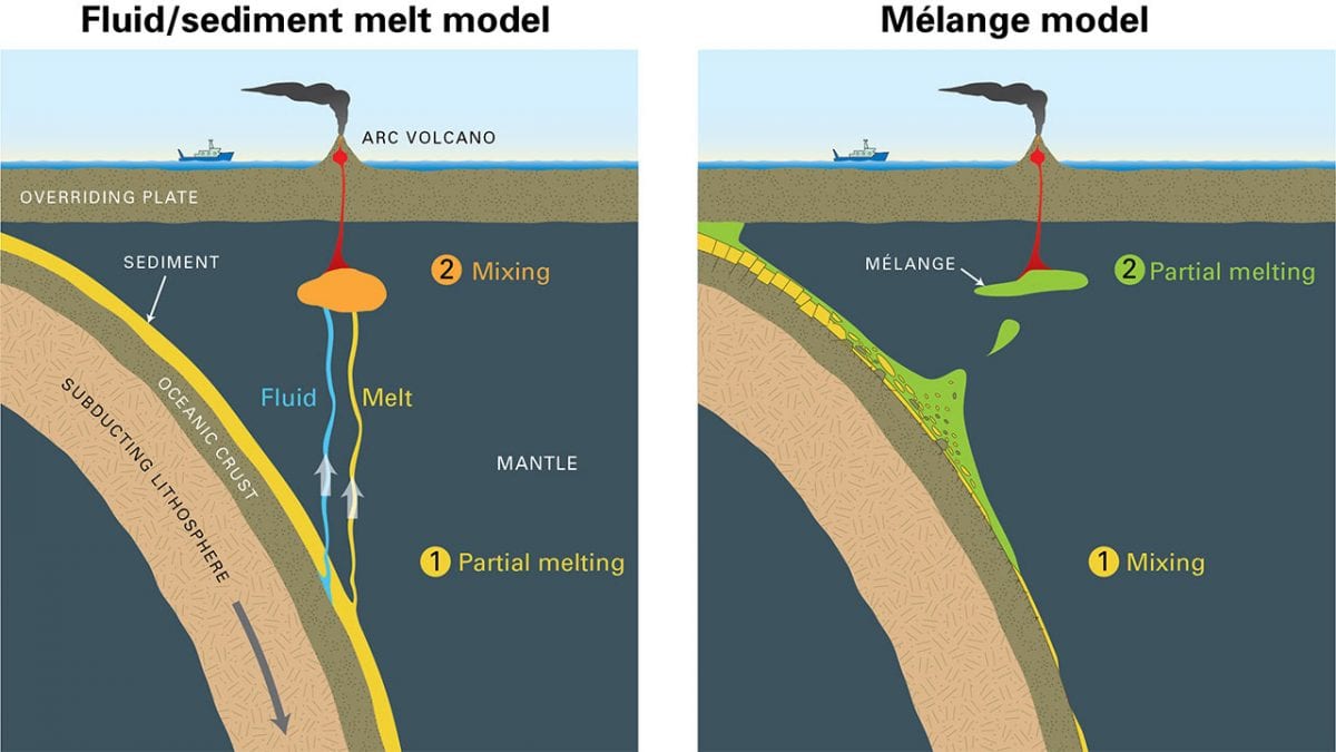
- A new study changes our understanding of how lavas are formed at volcanic arcs, and may have implications for the study of earthquakes and the risks posed by volcanic eruption. WHOI researchers discovered a previously unknown process involving the melting of intensely-mixed metamorphic rocks—known as mélange rocks—that form through high stress during subduction at the slab-mantle boundary. It was long thought that fluids from a subducted tectonic plate and melted sediments percolated into the mantle where they mixed (triggering more melting) and eventually erupted at the surface (left). Mixing and melting are reversed in the new mélange model (right). (Illustration by Jack Cook, WHOI Graphic Services)
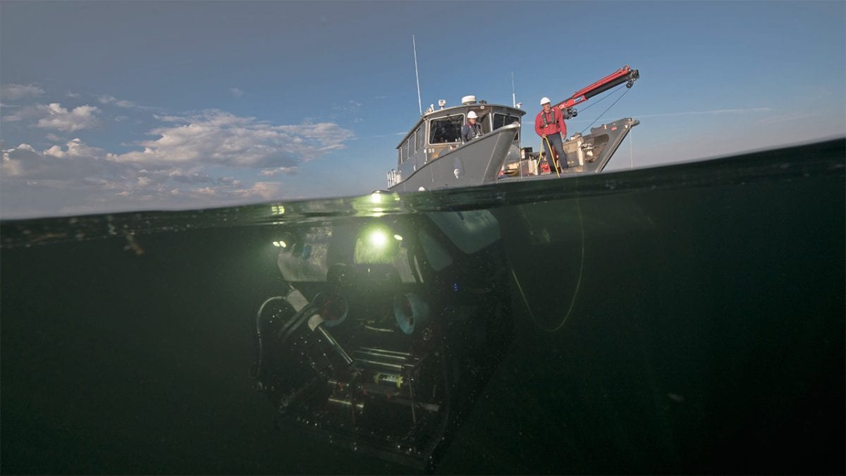
- Dave Lovalvo, president of Global Foundation for Ocean Exploration, deploys a remotely operated vehicle (ROV) to examine the geothermically active bottom of Yellowstone Lake in Wyoming. WHOI scientist Rob Sohn, who has explored hydrothermal vents on the deep seafloor, is leading the HD-YLAKE project a multiyear expedition that brings technology normally used in the deep ocean to investigate the hidden fount of hydrothermal activity going on beneath the lake surface. Yellowstone Lake has the world’s largest hydrothermal explosion craters—formed by catastrophic explosions of steam. The ROV is named Yogi after the inquisitive picnic basket-stealing cartoon bear that inhabited “Jellystone.” (Photo by Chris Linder, Woods Hole Oceanographic Institution)
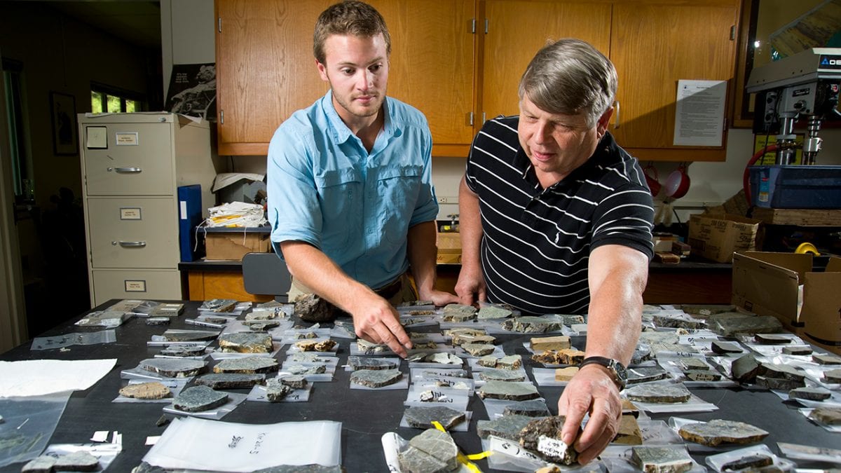
- Former WHOI Summer Student Fellow and current MIT-WHOI Joint Program graduate student Benjamin Urann (left) and his mentor, WHOI geologist Henry Dick, examine slabs cut from rocks collected during a cruise to the Mid-Atlantic Ridge. Dick studies the evolution of Earth's crust at mid-ocean ridges and recently led an effort to begin drilling to the transition zone between the crust and mantle known as the Moho. His "seminal contributions toward understanding abyssal peridotites and their importance for understanding the Earth's upper mantle" led the American Association for the Advancement of Science (AAAS) to name Dick a 2016 AAAS Fellow. He will receive the honor during the AAAS annual meeting in Boston later this week. (Photo by Tom Kleindinst, Woods Hole Oceanographic Institution)
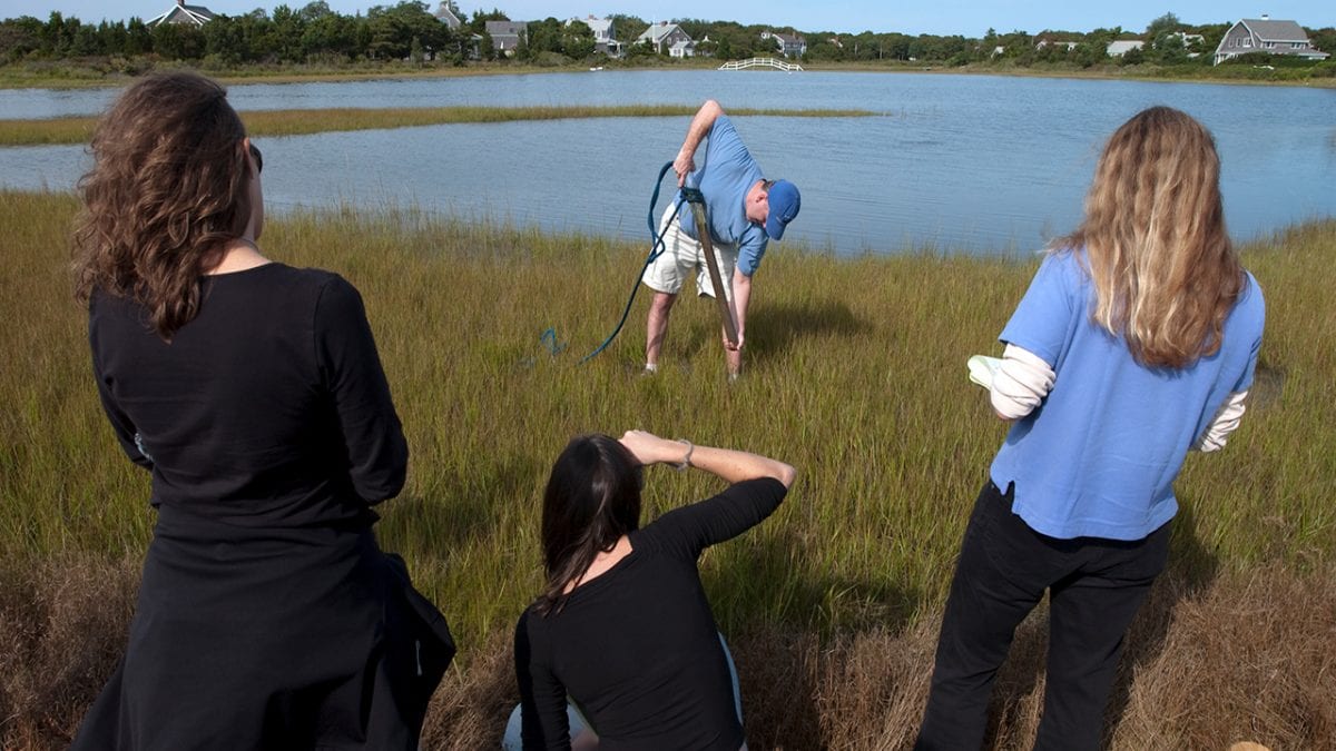
- WHOI coastal geologist Jeff Donnelly extracts a tube of sediment from a Cape Cod marsh as participants in the Ocean Science Journalism Fellowship look on. Sediment in a marsh builds up in layers over time. By examining the composition of those layers, Donnelly can learn how past storm events altered the local coast and project how future changes to climate might affect it. He discussed climate change, hurricanes, and rising sea levels with actor Ian Somerhalder in Gathering storm, a recent episode of National Geographic’s Years of Living Dangerously, and in a subsequent blog post. (Photo by Tom Kleindinst, Woods Hole Oceanographic Institution)
- MIT-WHOI Joint Program student Thomas DeCarlo recovers a data logger that recorded temperatures on Dongsha Atoll during a recent bleaching event. Water temperatures on Dongsha, a coral reef ecosystem in the northern South China Sea, increased by 6°C in June 2015 as a local wind and wave anomaly amplified El Niño-driven warming of the open ocean surrounding the atoll. DeCarlo, his advisor WHOI scientist Anne Cohen, and project dive master Pat Lohmann witnessed the start of the bleaching event and returned two weeks later to find 40 percent of the corals already dead. DeCarlo is now a postdoctoral researcher at the University of Western Australia. (Photo by Pat Lohmann, Woods Hole Oceanographic Institution)
The Department of Geology and Geophysics (G&G) conducts research aimed at furthering our understanding of the dynamic processes of the Earth/Ocean/Atmosphere system, including connections between the solid earth, oceans, and cryosphere. We study the role of oceans in controlling Earth’s climate using natural archives such as sediments, corals, ice cores, tree rings and shark denticles to understand past climate and use numerical modeling to project that understanding into the future. We study a range of coastal processes, including variability of storminess through time and the impacts of climate change and storms on coastal regions. We study the dynamics of the solid earth, including the formation of oceanic plates at mid-ocean ridges, the return of those plates into Earth’s mantle at subduction zones, crustal formation that transfers minerals and gasses from the solid earth to the oceans and atmosphere at those plate boundaries, and the earthquakes that occur at all plate boundaries. We study a wide range of fluid-mediated processes, including those occurring at hydrothermal vents, at shelf-edge seeps and in subduction zone settings; and we study links between fluid flow, microbial activity and the subseafloor biosphere, which together exert strong controls on global geochemical fluxes. We also study how all of these systems on Earth might be expressed on other planets and moons, possibly creating conditions for life on other ocean worlds.
The Department today consists of about 30 Ph.D. level Scientific Staff and another 26 Technical Staff (many of whom hold Ph.D. degrees). In addition, there are about 20 graduate students pursuing their Ph.D. through the WHOI/MIT Joint Program and roughly 11 Postdoctoral Scholars, Fellows and Investigators.
The Scientific and Technical staff carry out research that involves sea-going deployments of instruments built in house; laboratory studies using high precision analytical facilities; and theoretical and computational studies of ocean and climate processes and geodynamics.
The G&G Department provides many of these capabilities to the broader scientific community by hosting national facilities, including the National Ocean Sciences Accelerator Mass Spectrometry Facility (NOSAMS), the Northeast National Ion Microprobe Facility (NENIMF), the national Ocean Bottom Seismograph Instrument Center (OBSIC), and the WHOI Seafloor Samples Laboratory.
Dan Lizarralde
Department Chair
Geology & Geophysics Department
Meet the Chair
Academics
- Programs
- Student Research
- Through the Porthole
A newsletter by MIT-WHOI Joint Program Graduate Students