In this section
Ocean Topics
- Climate & Weather
- How the Ocean Works
- Ocean & Human Lives
- Ocean Life
- Sustainable Ocean
- Ocean Tech
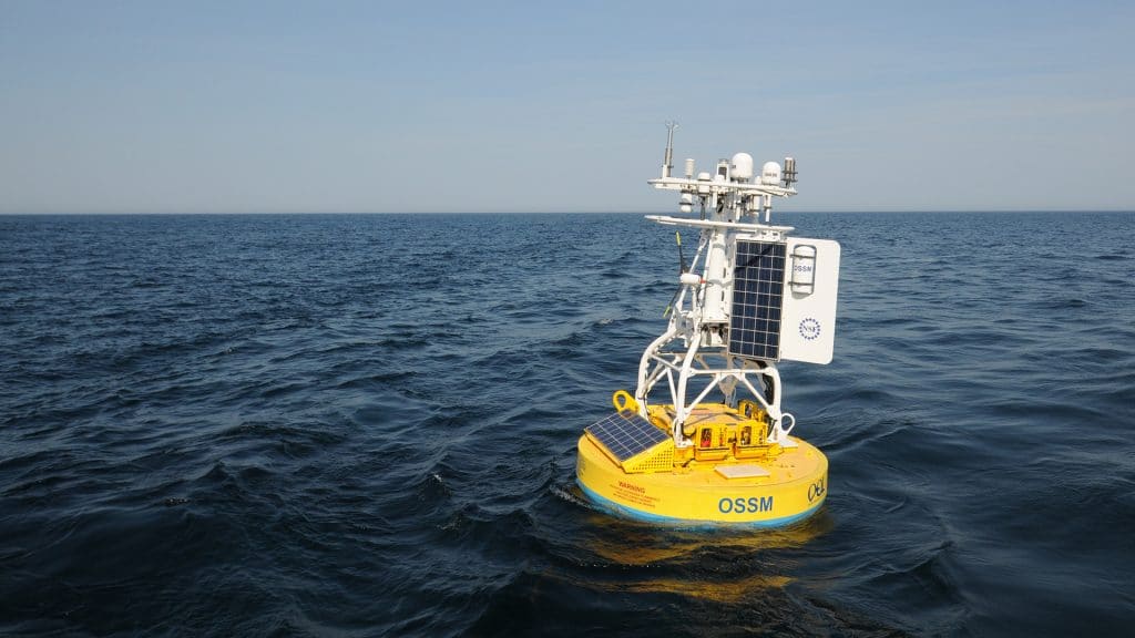
An observatory surface mooring deployed moorings off the New England Coast. (Woods Hole Oceanographic Institution)
Many ocean processes that scientists want to study are either invisible from the surface or they play out over long periods of time and wide geographic expanses. Measurements from a ship only provide a brief snapshot or a short glimpse of conditions. As a result, oceanographers find they often need to send instruments deep beneath the surface for long periods of time to measure water properties and record data to quantify changing conditions in the ocean.
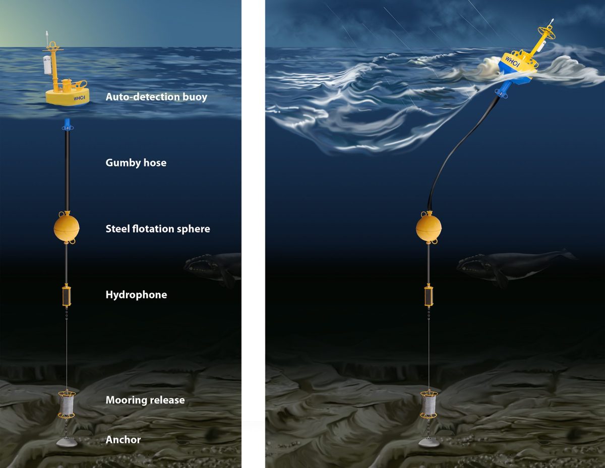
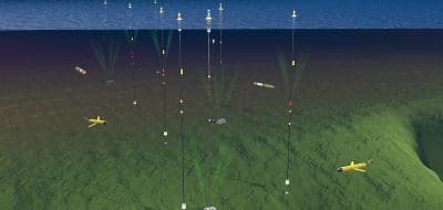
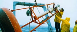
To obtain this longer view, ocean scientists and engineers often deploy moored instruments or buoys. An oceanographic mooring consists of a long line or cable with an anchor at one end, a float at the other, and instruments attached to the line in between or to a float at the surface. These allow researchers to measure such properties as water velocity, salinity, and temperature in several places and for long periods of time. They also allow scientists to explore the complex interactions between the ocean and atmosphere that are difficult to monitor from satellites.
The anchor keeps the mooring in one place, and the float keeps the line vertical in the water column. The float may bob on the surface, in which case it is a buoy, or, below the surface to keep the line stationary and out of the way of ships. Surface buoys can hold meteorological instruments such as rain, sun, and wind gauges. They can also hold communications equipment that permits scientists to monitor information from instruments far from land in real-time.
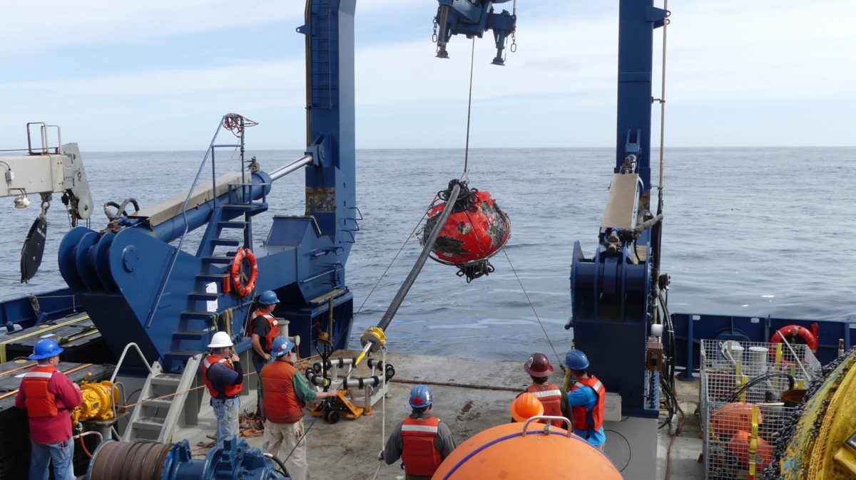
Surface buoys, moored systems, and the instruments they carry are very challenging to design and deploy. The cables can be more than three miles long, and the instruments and floats have to withstand corrosion, freezing cold, pressure up to 10,000 pounds per square inch, powerful currents, surging waves, and even fish that mistake them for food.
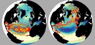
Buoys and moorings have been deployed singly or in lines across key areas such as the Gulf Stream. They have also been placed in vast arrays to blanket a large area of the ocean with instruments. In the 1970s and 1980s, several large ocean science projects used moored instruments to reveal major current systems such as the ocean conveyor in the North Atlantic that play a critical role in Earth’s climate system. Buoys and moorings also provide continuous data from hard-to-reach places about critical processes such as the movement of tsunamis across ocean basins or the air-sea interactions in the central Pacific that produce El Niño and La Niña events.
Ocean scientists and engineers are currently developing even more sophisticated mooring arrays as part of the Ocean Observatories Initiative. Some will serve as “home base” for autonomous underwater vehicles; others will act as automated chemistry and biology laboratories in the sea.
Articles Related to Moorings & Buoys
From Oceanus Magazine
Navigating new waters
5 essential ocean-climate technologies
From the sound: A future powered by the sea
Measuring the great migration
Data with a side of sass
A ‘Ticking Time Bomb’ in the Arctic
Mysteries of the Red Sea
The Young Woman and the Sea
News Releases
NASA/WHOI Voyage Set to Explore Link Between Sea Saltiness and Climate
Tsunami Warning Buoy Deployed off Chile
News & Insights
Stratus Mooring Q&A
HOV Alvin temporarily halts engineering test dives
Meet the Alvin 6500 Team: Drew Bewley
Ocean science into action
Meet the Alvin 6500 Team: Danik Forsman
Meet the Alvin 6500 Team: Lane Abrams
Meet the Alvin 6500 Team: Francis Elder
Could listening to the deep sea help save it?
WHOI in the News
NC coast new home for complex ocean-observing system
OOI‘s Pioneer Array Relocating to Southern Mid-Atlantic Bight
INCOIS to go for airline mapping of ocean floor
New Technology Can Save the Whales from Ship Collisions
Deploying seismometers where they’re needed most
Scientists to discuss decline in right whale population
Ocean Tech Features
Ocean models are mathematical models of ocean properties and circulation, which helps us to better understand the ocean's influence on…
Ocean observatories have suites of instruments and sensors with long-term power supplies and permanent communications links that feed data in…
Oceanographers rely on sophisticated ships to get a firsthand look at the ocean environment and to carry their tools and…
Oceanographic observing tools has grown to include human-occupied submersibles, remote-controlled vehicles, and autonomous robots.
A strong understanding of how sound behaves in different conditions in the ocean helps scientists answer fundamental questions about the…
Underwater imaging continues to advance in technology, allowing research to be conducted in the pressure-filled, extreme environments of the ocean.
Echo sounding uses sound waves bounced off the ocean bottom to calculate depth. The faster the sound waves return, the…
An Acoustic Doppler Current Profiler (ADCP) uses sound waves to measure water current speed at multiple depths, helping scientists study…
Ocean Tech Related Links
Building Them Tough and Bringing Them Back
The pioneering WHOI Buoy group has been developing and deploying moorings and buoys for over 50 years.
ASIMET System
A set of seven very precise sensors that measure how energy and water move between the ocean and atmosphere.
Nootka Buoy
Wireless hotspot in the middle of the deep ocean.
Moored Profiler
Makes repeated measurements of ocean currents and water properties up and down through almost the entire water column
Sediment Trap
Containers placed in the water to collect particles falling toward the sea floor.
Improved Meteorological Packages (IMET)
An array of sensors used to understand air-sea interactions.
Mooring Operations, Engineering & Field Support Group
An array of sensors used to understand air-sea interactions.
Upper Ocean Processes Group
An array of sensors used to understand air-sea interactions.
Ocean Observatory Initiative
Coastal & Global Scale Nodes