
Stratus Mooring Q&A
Published: April 28, 2023
By Ken Kostel | April 28, 2023

The paper appears in the April 2023 issue of the Bulletin of the American Meteorological Society (BAM)
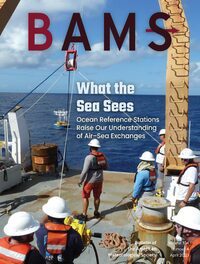
The April 2023 cover of the Bulletin of the American Meteorological Society (BAM) features a research paper by WHOI scientists Bob Weller, Al Plueddemann, and Sebastien Bigorre, along with colleagues from the University of Hawaii and NOAA’s Physical Science Lab. In “Ocean Reference Stations: Long-Term, Open-Ocean Observations of Surface Meteorology and Air–Sea Fluxes Are Essential Benchmark,” the authors compare observations from three long-term Ocean Reference Sites (ORS), highly reliable, highly accurate moorings that provide data used to verify global climate models and satellite measurements.
Release of the paper coincided with the twentieth replacement, or turn, of the Stratus mooring in the eastern tropical Pacific, a critical location for monitoring the El Nino Southern Oscillation, which is responsible for the El Nino and La Nina phenomena that affect global weather patterns and oceanographic conditions. We sat down with lead author Bob Weller to find out more about the Stratus mooring, its important role as one of the longest, continuous surface morning locations, and the important data it provides.
What is the Stratus mooring?
Bob Weller: The Stratus mooring is a surface buoy anchored, or moored, to the seafloor off the coast of northern Chile in the eastern tropical Pacific near 20°S, 85°W. The buoy holds a collection of instruments above and below the water that measure the salinity, temperature, and current velocity of the seawater, as well as incident sunlight, infrared radiation, rain, barometric pressure, wind speed, air temperature, and humidity just above the sea surface. It also carries an instrument from the NOAA Pacific Marine Environmental Laboratory (PMEL) to measure carbon dioxide dissolved in seawater.
Is the Stratus mooring part of a larger network?
BW: The Stratus mooring is a part of the OceanSITES network of moorings that provide fixed-point time-series observations from critical or representative locations in the global ocean. Stratus, in particular, is positioned to observe and understand air-sea interactions in a part of the ocean that provides telltale signs of the irregular shift between El Niño and La Niña conditions. It is also located in a region that experiences persistent, low-level marine stratus clouds that are not adequately represented in global climate models, resulting in a warm bias for sea-surface temperatures in the region in many models.
How is this information used?
BW: Stratus mooring data are not incorporated into models, but rather, are used to verify model results and to drive improvements in model representations of the ocean-atmosphere processes critical to the global climate system. A recent paper discusses the importance of the Stratus mooring and two other similar moorings maintained by WHOI’s Upper Ocean Processes Group in the OceanSITES component of the Global Ocean Observing System (GOOS).
What is notable about this replacement of the Stratus mooring?
BW: On February 28, 2023, with the help of the Chilean Navy (Armada de Chile), a team from WHOI made the 2 replacement, or turn, of the Stratus mooring. Each turn of the mooring requires the close cooperation of many individuals and organizations working in difficult conditions to ensure that the mooring and its scientific instruments are safely and accurately positioned in order to maintain continuity in the long-term string of data from the Stratus site—one of the longest continuously occupied surface mooring locations in the world.
What do you attribute this long record to?
BW: This long record is a testament to the commitment by the Global Ocean Monitoring and Observing (GOMO) program office of NOAA, as well as the commitment by sea-going scientists, engineers, and technicians at WHOI’s Upper Ocean Processes Group, which has led efforts to maintain Stratus since the first mooring was placed in October 2000.
What has data from the Stratus mooring shown?
BW: Data from the recently recovered Stratus mooring have provided a near real-time look at the diminishing La Niña conditions–which NOAA officially declared ended on March 9, 2023. La Niña is a cooling of the tropical Pacific sea surface that is responsible for a range of extreme weather phenomena around the world that includes drought in southern South America, as well as a northward shift of the jet stream over North America that results in warmer, drier conditions in the southern and southeastern U.S. and wetter conditions along the Pacific Coast. This particular La Niña period was especially long, lasting more than a year and a half, and likely helped intensify snow and rain events this winter from California to British Columbia.
Long-term data from Stratus have also revealed that global climate models may be significantly underestimating the amount of heat entering the surface ocean in trade-wind regions, which lie between roughly 30 degrees north and south of the equator. This is important because heat in the upper 200 meters (660 feet) of the ocean is a principal source of energy fueling large tropical storms that can threaten people and property in small island nations, coastal residents, and even communities far inland across the Pacific and Indian Ocean basins. Ensuring that climate models accurately represent the heat available to storms as they grow and traverse open water is critical to emergency preparedness and hazard risk mitigation worldwide.