Ocean Topics

(Woods Hole Oceanographic Institution)
Echo sounding is the key method scientists use to map the seafloor today. The technique, first used by German scientists in the early 20th century, uses sound waves bounced off the ocean bottom.
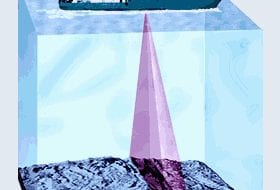
Echo sounders aboard ships have components called transducers that both transmit and receive sound waves. Transducers send a cone of sound down to the seafloor, which reflects back to the ship. Just like a flashlight beam, the cone of sound will focus on a relatively small area in places where the ocean is shallow, or spread out over the size of a football field when water depths reach 3,000 meters. The returned echo is received by the transducer, amplified electronically, and recorded on graphic recorders.
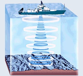
The time taken for the sound to travel through the ocean and back is then used to calculate water depths. The faster the sound waves return, the smaller the water depths and the higher the elevation of the seafloor. Echo sounders repeatedly “ping” the seafloor as a ship moves along the surface, producing a continuous line showing ocean depths directly beneath the ship.
In the early days of ocean exploration until as recently as 20 years ago, marine geologists wrote down individual readings from recorders, plotted them on navigation charts showing their ship’s position, and then drew contour lines joining points of equal depth. In this way, they produced “bathymetry maps” that displayed the ocean’s changing water depths (and hence changes in seafloor elevation). These charts were accurate only within about 20-50 m, but that was good enough for scientists to discover the mid-ocean ridge system in the Atlantic and Pacific Oceans.
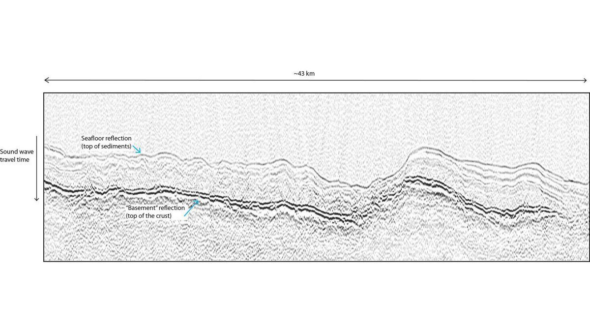
Echo sounders use different frequencies of sound to find out different things about the seafloor. Scientists typically use echo sounders that transmit sound at 12 kiloHertz (kHz) to determine how far down the seafloor lies. However, they use a lower frequency (3.5 kHz) sound, which penetrates the seafloor, if they want to “see” accumulated layers of sediments below it.