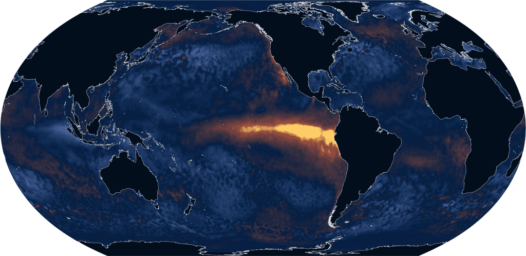
What is El Niño?
The Pacific Ocean drives the El Niño-Southern Oscillation (ENSO), which has three states: El Niño (a positive or warm state), La Niña (negative or cool), and a neutral state. ENSO is a naturally occurring cycle that involves temperature changes in the Pacific Ocean and the resulting atmospheric responses to seawater as it warms and cools. It involves feedback loops in which the ocean alters atmospheric systems, which in turn affect the ocean. Although it occurs repeatedly every two to seven years, ENSO does not have a regular, predictable rhythm.
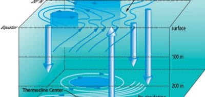
As the largest ocean on Earth, the Pacific receives vast amounts of sunlight. Its waters absorb and store the sun’s heat, which warms the ocean to a depth of about 200 meters (650 feet). Earth’s rotation creates easterly winds that blow from east to west across the equatorial Pacific. During neutral ENSO conditions, these trade winds force warm surface water westward, piling it up near Indonesia. This movement thins the layer of warm surface waters off the coast of Ecuador and Peru, allowing cold waters from the depths to well up.
The resulting east-west temperature differential drives large-scale weather patterns: warm air rises near Indonesia, which leads to low atmospheric pressure, persistent storms, and abundant rainfall. As the air rises, it flows eastward, eventually sinking again in the eastern Pacific. The rising air masses draw air from surrounding areas. This helps maintain the trade winds near the ocean’s surface and completes the atmospheric circulation pattern known as Walker Circulation.
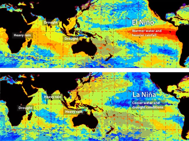
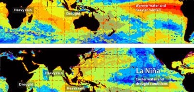
During an El Niño event, heat stored in the central Pacific builds up. It warms the overlying air mass, creating a broad area of low pressure. Because the location of the low-pressure system is in the middle of the ocean, it weakens the trade winds. No longer pushed westward, warm surface waters slide east, and storm systems move with it. This change in airflow alters rainfall across the Pacific basin and beyond, leading to flooding in some areas and drought in others.
Why is it important?
While El Niño events do not cause long-term global warming, they amplify the warming caused by greenhouse gas buildup by temporarily moving stored heat from the ocean into the atmosphere. As a result, they have led to some of the hottest years on record.
Because El Niño affects weather patterns, it strongly affects people living near the equatorial Pacific. Excessive rainfall can trigger flooding and landslides in areas unused to large amounts of rain, such as the desert coastal areas of Peru. At the same time, locations such as northern South America, Indonesia, and northern Australia that rely on rainfall generated by neutral or La Niña ENSO states can experience prolonged drought.
Although the equatorial Pacific drives the ENSO system, its effects are not restricted to the equator or the Pacific Ocean. El Niño-driven changes in the atmosphere can shift the locations of jet streams, bringing wet weather to the California coast and southeastern United States. Despite lying thousands of miles from the Pacific, Africa is also affected, with some regions experiencing flooding and others drought. Because these shifts in weather patterns can damage infrastructure and affect agriculture, accurate forecasting and preparation are essential to reduce the impact on people.
La Niña causes similar natural disasters, but they occur in different locations.
How does El Niño affect the ocean?
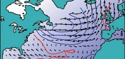
Atmospheric changes caused by El Niño impact wind speeds around the globe, which can affect the formation of hurricanes over the Atlantic Ocean. El Niño increases high-level wind speeds over the Atlantic, creating wind shear that effectively cuts the top off of developing storms. Without the ability to grow vertically, tropical storms struggle to gain strength. Consequently, El Niño is typically associated with fewer, weaker hurricanes. The Pacific Ocean experiences the opposite effect, with warm El Niño waters increasing the number of tropical storms in central and eastern regions and the intensity of typhoons in the west.
Reduced upwelling along the west coast of North and South America can have widespread effects. Phytoplankton form the base of the marine food web. These tiny marine plants require nutrients from the cold depths to flourish, but during an El Niño event, a layer of warm water reduces upwelling, cutting off these essential microorganisms from the nutrients they need. Depleted phytoplankton populations lead to reduced populations of zooplankton, small fish, and other organisms that feed larger marine animals. Extreme El Niño events can lead to large-scale die-offs when animals are deprived of food.
Hot water can harm marine ecosystems, particularly when residents are unable to relocate to cooler waters. Heat stress can cause corals to eject their symbiotic algae, which leads to coral bleaching. Without the algae to help provide energy, corals can begin to die off, which reduces habitat for other animals, upending the reef ecosystem.
What is a “super” El Niño?
Scientists declare that El Niño has begun when the sea surface temperatures in central and eastern Pacific reach 0.5 degrees Celsius (0.9 degree Fahrenheit) above average. So-called “super” El Niño events, which scientists refer to as “very strong” El Niños, require an increase of at least 2 degrees Celsius (3.6 degrees Fahrenheit) above average. These supercharged warming events are becoming more likely as climate change leads to global increases in sea surface temperature.
How do researchers study El Niño?
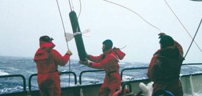
Scientists use a combination of satellite data and data collected from the oceans to track the various phases of the El Niño-Southern Oscillation. Satellites measure temperature at the sea’s surface, along with rainfall and the speed and direction of trade winds. When combined with data from recorders on boats, buoys, and deep-water monitoring stations, scientists get a full picture of the three-dimensional temperature changes happening in the ocean and overlying atmosphere.
Other important satellite data include sea surface height and ocean color. Because easterly trade winds blow water westward, the sea’s height near Indonesia is 40 to 50 centimeters (15 to 20 inches) higher than it is off the coast of Peru during a neutral year. As El Niño weakens the trade winds, that water sloshes eastward, leveling sea height across the Pacific, and satellite data can detect this shift. Scientists also track the color of the ocean, which reflects the presence or absence of phytoplankton and gives insight into the potential impacts of the El Niño event on marine ecosystems.
Scientific monitoring is essential to help prepare communities likely to be affected by the changing climatic conditions as El Niño forms.
References
Barnston, A. May 19, 2014. How ENSO leads to a cascade of global impacts. Climate.gov. https://www.climate.gov/news-features/blogs/enso/how-enso-leads-cascade-global-impacts
Columbia University. Why do we care about El Niño and La Niña? https://iri.columbia.edu/our-expertise/climate/enso/why-do-we-care-about-el-nino-and-la-nina/
Kinsella, Alex, personal communication
Lehodey, P. et al. ENSO Impact on Marine Fisheries and Ecosystems. In: El Niño Southern Oscillation in a Changing Climate, Geophysical Monograph 253, First Edition. Edited by Michael J. McPhaden, Agus Santoso, and Wenju Cai. 2021. John Wiley and Sons, Inc.
Masters, J. May 22, 2026. El Niño expected to help spur intense hurricane and typhoon seasons in the North Pacific. Yale Climate Connections.
Mukherjee, S. et al. 2023. Chapter 10 – El Niño Southern Oscillation and its effects. In: Visualization Techniques for Climate Change with Machine Learning and Artificial Intelligence. Pp. 207-228. doi: 10.1016/B978-0-323-99714-0.00013.3.
NASA. El Niño. https://science.nasa.gov/earth/explore/el-nino/
National Oceanic and Atmospheric Administration. Understanding El Niño. https://www.noaa.gov/understanding-el-nino
Witze, A. Are we really headed for a ‘super’ El Niño? What the science says. Nature. May 14, 2026. https://www.nature.com/articles/d41586-026-01538-0
More topics like this
AMOC—The Atlantic Ocean’s conveyor belt
The ocean's conveyor-like global circulation influences today's climate system.
Arctic ocean circulation
The complex ocean circulation system in the Arctic — which impacts the entire food web — is in a delicate balance.
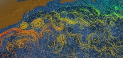
Currents, gyres, & eddies
At the surface and beneath, currents, gyres and eddies physically shape the coasts and ocean bottom.
Oceanus magazine
[ ALL ]In-depth research on El Niño
WHOI News Room
[ ALL ]Press releases
Studies investigate marine heatwaves, shifting ocean currents
Study reveals Missoula Floods impact on past abrupt climate changes
Study Finds No Direct Link Between North Atlantic Ocean Currents, Sea Level Along New England Coast
WHOI, NEAQ Embark on Expedition to the Phoenix Islands
Get the ocean in your inbox
Fresh discoveries, research, and stories from WHOI — free, every week.