In this section
Ocean Topics
- Climate & Weather
- How the Ocean Works
- Ocean & Human Lives
- Ocean Life
- Sustainable Ocean
- Ocean Tech

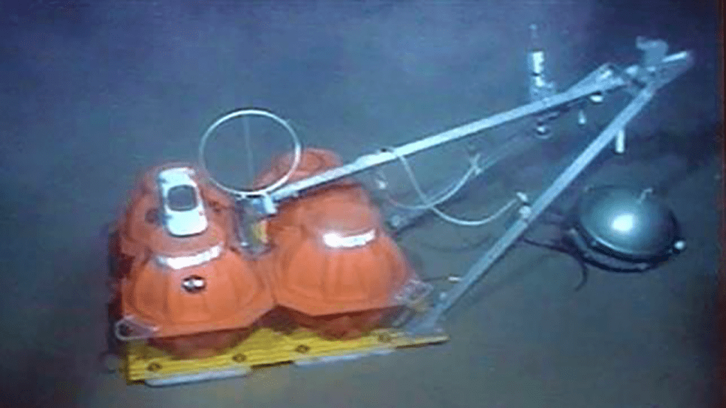
An ocean bottom seismograph sits on the seafloor. It records seismic waves that move through the ocean, ocean crust, or upper mantle. The waves can come from natural sources such as earthquakes or from artificial sources, such as airguns, which scientists use to investigate undersea features. (ROV Jason, Woods Hole Oceanographic Institution)
When an earthquake occurs, rocks at a fault line slip or break, and two sections of Earth’s crust physically move relative to one another. That movement releases energy, and two types of seismic waves radiate outward from the earthquake through Earth’s interior and along its surface. Compression waves alternately compress and release rocks in the direction the waves are moving (similar to the air compression we hear as sound). Shear waves move rocks perpendicular to the direction the waves are moving.
Seismographs (seismometers and associated recording systems) detect and measure these waves. Compression and shear waves travel through the planet at different speeds. By measuring the arrival times of the waves at different locations around the world, scientists draw inferences about the temperature, composition, and degree of deformation of the material that the waves travel through. These details provide a more thorough understanding of hidden processes that occur Earth’s core, mantle, and crust.
With seismic measurements scientists can also pinpoint an earthquake’s hypocenter--its source beneath the surface. The characteristics of an earthquake itself, such as its location, magnitude, fault orientation, and fault slip, are important for understanding tectonic processes at global and regional scales, and seismology is essential for understanding the physics of earthquake initiation and rupture.

Articles Related to Earthquakes and Seismic Waves
From Oceanus Magazine
Can seismic data mules protect us from the next big one?
Lessons from the 2011 Japan Quake
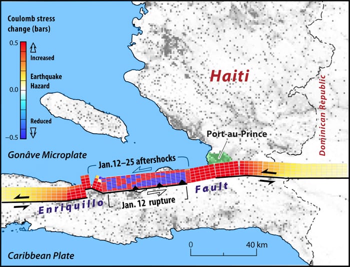
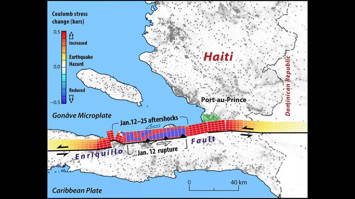
Lessons from the Haiti Earthquake
Seismometer Deployed Atop Underwater Volcano
Worlds Apart, But United by the Oceans
Oceanographic Telecommuting
Rapid Response
In the Tsunami’s Wake, New Knowledge About Earthquakes
Ears in the Ocean
Earthshaking Events
Peering into the Crystal Fabric of Rocks
Listening Closely to ‘See’ Into the Earth
Ocean Seismic Network Seafloor Observatories
News Releases
Volcanic Arcs Form by Deep Melting of Rock Mixtures
New Explanation for Slow Earthquakes on San Andreas
WHOI Receives $1Million from Keck Foundation for First Real-Time Seafloor Earthquake Observatory at Cascadia Fault
WHOI Experts Stress Lessons From Japan Earthquake
New Instrumentation May Help Scientists Understand Earthquake Mechanics
Assessing Algerian Earthquake Risk
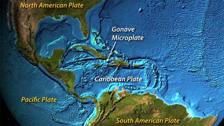
Major Caribbean Earthquakes and Tsunamis a Real Risk
Monitoring Undersea Earthquakes, Deep Sea Tides and Magnetic Fields
News & Insights
What happens to natural gas in the ocean?
WHOI-assisted study finds ocean dumping of DDT waste was “sloppy”
Examining Connections Between the Ocean and Human Health
How Long Does Plastic Persist in the Ocean?
The many lifetimes of plastics
Forged in fire: WHOI recalls the Deepwater Horizon crisis
Summer’s coming: Will Cape Cod beaches be safe?
Fifty years later, the West Falmouth oil spill yields lasting contributions to remediation efforts
Rapid Response at Sea
Putting the ‘nuclear coffin’ in perspective
WHOI prepares for 2019 Atlantic Hurricane Season
Hurricane Clues from a Caribbean Blue Hole
WHOI in the News
California’s historic storms continue. Here’s how much scientists say it’s being driven by climate change
Winter storm barrage likely to continue
Second storm whacks Vineyard
South-facing beaches hit hard by Monday’s storm
Florida fishers faced Ian, fleeing shrimp, climate change effects
Cape Cod’s first climate change tour opens in Woods Hole
Climate change and El Niño battle it out this hurricane season
We’re decoding ancient hurricanes’ traces on the seafloor—and evidence from millennia of Atlantic storms is not good news for the coast
Mysterious Tectonic Fault Zone Detected Off The Coast of California
The ghosts of ancient hurricanes live in Caribbean blue holes
In the Blue Holes of the Bahamas, Secrets of Hurricanes Past
Features
Our ocean planet is dynamic and constantly changing, sometimes resulting in dramatic threats to humans.
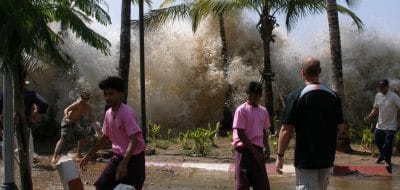
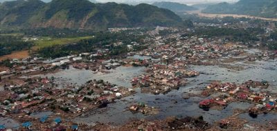
A tsunami is a massive, fast-moving wave created by an underwater earthquake or landslide. Displaced ocean water creates waves with…
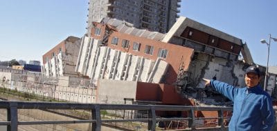
An earthquake is a shaking of the ground that occurs when two large blocks of Earth's crust slip suddenly past…
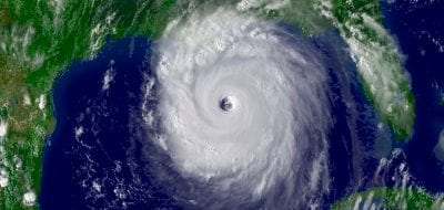
Hurricanes are large rotating tropical storms with winds in excess of 119 kilometers per hour. They usually form in the…