
Feature
Mid-Atlantic Ridge Volcanic Processes
Long before the plate-tectonic revolution began in the 1960s, scientists envisioned drilling into the ocean crust to investigate Earth’s evolution.
Read MoreIndian Ocean’s Atlantis Bank Yields Deep-Earth Insight
I never imagined I would spend six weeks of my life “wandering around” the seafloor exploring an 11 million year old beach, and it never occurred to me to look for a fossil island. But that’s what I did, and that’s what we found on two research voyages separated by more than a decade.
Read MoreMelt Extraction from the Mantle Beneath Mid-Ocean Ridges

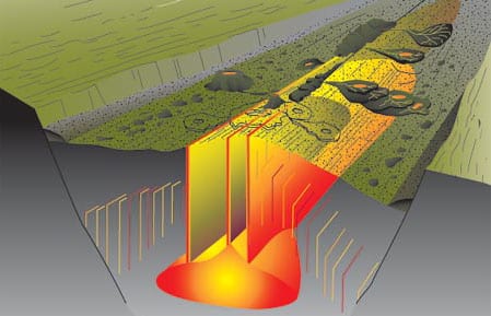
As the oceanic plates move apart at mid-ocean ridges, rocks from Earth’s mantle, far below, rise to fill the void, mostly via slow plastic flow.
Read MoreExploring The Global Mid-Ocean Ridge
There is a natural tendency in scientific investigations for increased specialization. Most important advances are made by narrowing focus and building on the broad foundation of earlier, more general research.
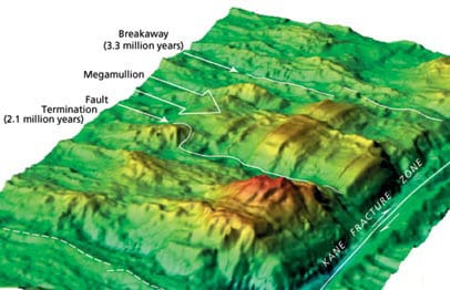
Read MoreDiscovery of “Megamullions” Reveals Gateways Into the Ocean Crust and Upper Mantle
urposes. From the end of the nineteenth into the first half of the twentieth century, drilling was used to penetrate the reef and uppermost volcanic foundation of several oceanic islands, and these glimpses of oceanic geology whetted the scientific community’s appetite for deeper and more complete data.
Read MoreOcean Seismic Network Seafloor Observatories
Our knowledge of the physical characteristics of Earth’s deep interior is based largely on observations of surface vibrations that occur after large earthquakes. Using the same techniques as CAT (Computer Aided Tomography) scans in medical imaging, seismologists can “image” the interior of our planet. But just as medical imaging requires sensors that surround the patient, seismic imaging requires sensors surrounding the earth.
Read MoreThe Women of FAMOUS
My FAMOUS story begins during my first year in graduate school at Dalhousie University in Nova Scotia.
Read MoreA Current Affair
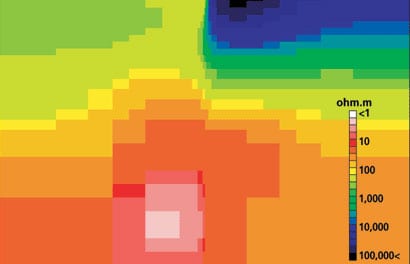
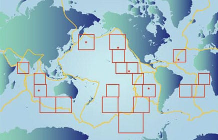
oal of probing the earth’s inaccessible deep interior. But the technique remains something of a mystery even to many marine scientists. It has been used widely on land, particularly for regional-scale surveys, but only a few full-scale MT surveys have been carried out on the seafloor.
Read MoreThe Oceanic Flux Program
The predawn hours at sea have a unique feel—an eerie stillness, regardless of weather. This morning is no exception as the Bermuda Biological Station’s R/V Weatherbird II approaches the OFP (Oceanic Flux Program) sediment trap mooring some 75 kilometers southeast of Bermuda.
Read MoreMarine Snow and Fecal Pellets
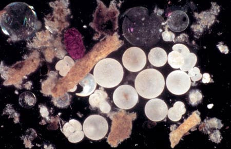
Until about 130 years ago, scholars believed that no life could exist in the deep ocean. The abyss was simply too dark and cold to sustain life. The discovery of many animals living in the abyssal environment by Sir Charles Wyville Thompson during HMS Challenger’s 1872-1876 circumnavigation stunned the late 19th century scientific community far more than we can now imagine.
Read MoreExtreme Trapping
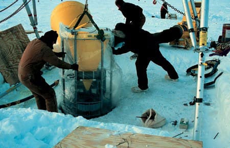
One of oceanography’s major challenges is collection of data from extraordinarily difficult environments. For those who use sediments traps, two examples of difficult environments are the deepest oceans and the permanently ice-covered Arctic Basin.
Read MoreThe Rain of Ocean Particles and Earth’s Carbon Cycle
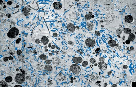
WHOI Phytoplankton photosynthesis has provided Earth’s inhabitants with oxygen since early life began. Without this process the atmosphere would consist of carbon dioxide (CO2) plus a small amount of nitrogen, the atmospheric pressure would be 60 times higher than the air we breathe, and the planet’s air temperatures would hover around 300°C. (Conditions similar to these are found on Earth’s close sibling Venus.
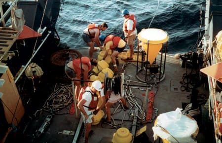
Read MoreDeploying the Rain Catchers
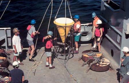
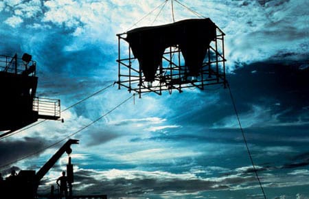
Deployment of a deep-ocean sediment trap mooring begins with the ship heading slowly into the wind.
Read MoreMonsoon Winds and Carbon Cycles in the Arabian Sea
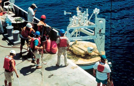
The monsoon, a giant sea breeze between the Asian massif and the Indian Ocean, is one of the most significant natural phenomena that influences the everyday life of more than 60 percent of the world’s population.
Read MoreA New Way to Catch the Rain
The carbon budget of the upper ocean includes an important loss to the deep ocean due to a very slowly falling rain of organic particles, usually called sediment. As this sediment falls through the upper water column it is consumed, mainly by bacteria, and the carbon is recycled into nonsinking forms (dissolved or colloidal organic carbon or inorganic forms). Thus the sediment rain decreases with increasing depth in the water column, and only a tiny fraction reaches the deep sea floor, less than about one percent.
Read MoreContinental Margin Particle Flux
The boundaries between the oceans and the continents are dynamic regions for the production, recycling, and deposition of sedimentary particles. In general, rates of biological productivity along continental margins are significantly higher than in the open ocean. This is due to a variety of factors including coastal upwelling of nutrient-rich waters and nutrient input from continental runoff. While continental margins account for only about 10 percent of the global ocean area, 50 percent of the total marine organic carbon production is estimated to occur in this limited region, with much of it exported to the deep sea.
Read MoreGeochemical Archives Encoded in Deep-Sea Sediments Offer Clues for Reconstructing the Ocean’s Role in Past Climatic Changes
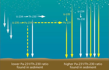
Geochemical Archives Encoded in Deep-Sea Sediments Offer Clues for Reconstructing the Ocean’s Role in Past Climatic Changes
Paleoceanographers are trying to understand the causes and consequences of global climate changes that have occurred in the geological past. One impetus for gaining a better understanding of the factors that have affected global climate in the past is the need to improve our predictive capabilities for future climate changes, possibly induced by the rise of anthropogenic carbon dioxide (CO2) in the atmosphere.
Ground-Truthing the Paleoclimate Record
Sediment Trap Observations Aid Paleoceanographers
The geological record contains a wealth of information about Earth’s past environmental conditions. During its long geological history the planet has experienced changes in climate that are much larger than those recorded during human history; these environmental conditions range from periods when large ice sheets covered much of the northern hemisphere, as recently as 20,000 years ago, to past atmospheric concentrations of greenhouse gases that warmed Earth’s polar regions enough to melt all of the ice caps 50 million years ago. Since human civilization has developed during a fairly short period of unusually mild and stable climate, humans have yet to experience the full range of variability that the planet’s natural systems impose. Thus, the geological record has become an extremely important archive for understanding the range of natural variability in climate, the processes that cause climate change on decadal and longer time scales, and the background variability from which greenhouse warming must be detected
Catching the Rain: Sediment Trap Technology
WHOI Senior Engineer Ken Doherty developed the first sediment trap in the late 1970s for what has come to be known as the WHOI PARFLUX (for “particle flux”) group. Working closely with the scientific community, Doherty has continued to improve sediment traps for two decades, and these WHOI-developed instruments are widely used both nationally and internationally in the particle flux research community.
Read MoreReplacing the Fleet
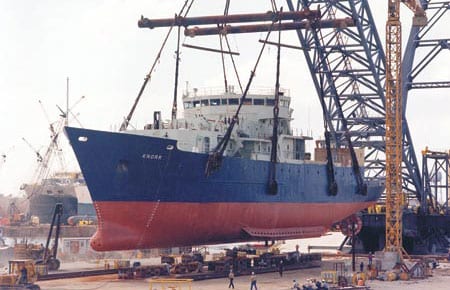
When R/V Atlantis arrived in Woods Hole for the first time on a bright, beautiful April 1997 day, it represented not only a welcome addition to the WHOI fleet but also the culmination of a 15-year UNOLS fleet modernization.
Read MoreWHOI and Access to the Sea
In the mid-term future, two WHOI ships (Knorr in about 2006 and Oceanus in about 2009) will reach the end of their planned service lives. There is general agreement that WHOI should work to replace them with two vessels.
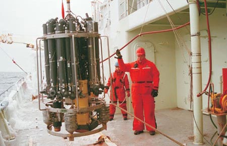
Read MoreA Northern Winter
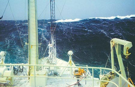
As the 1996-1997 ship schedule began to take shape in 1995, we learned that Voyage 147 would take R/V Knorr into the North Atlantic from October ’96 through March of ’97. The various science missions would require station keeping during CTD casts, deployment of current drifters, and expendable bathythermograph (XBT) launches, as well as weather system analysis designed to put Knorr in the path of the harshest weather conditions possible during the winter season. Long before the cruise, we began to tap all available assets that would help us with this challenge.
Read MoreAdventure in the Labrador Sea
The sound of the general alarm bell reverberated through the ship. At 2:30 AM, this couldn’t be a drill. Even more puzzling, we were still dockside in Halifax, four hours from our scheduled departure for the Labrador Sea.
Read More“What a Year!”
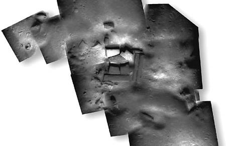
Four technologies that have been developing separately for some time were brought together this year by WHOI’s Deep Submergence Laboratory (DSL) to serve three very different user communities. With images from the towed vehicle Argo II and the remotely operated vehicle Jason, DSL scientists and engineers created mosaic images of a sunken British cargo ship and 20-meter-tall hydrothermal vent chimneys, both in the Pacific Ocean, and ancient shipwreck sites in the Mediterranean. The three expeditions thus served the marine safety, scientific, and archaeological communities.
Read More