
Oceanus Online Archive
A Fatal Attraction for Harmful Algae
Estuaries are the borderlands between salt and freshwater environments, and they are incredibly diverse
both biologically and physically. The diversity and the high
energy of the ecosystem make estuaries remarkably resilient.
With a better understanding of these systems, we can reverse
their decline and restore the ecological richness of these
valuable, albeit muddy, environments.
Rites of Passage for Juvenile Marine Life
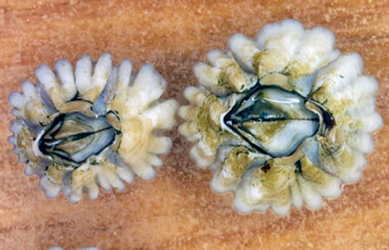
The childhood of a barnacle is fraught with challenges. It hatches in shallow waters close to shore as a tiny larva, no bigger than a speck of dust. Currents sweep it to deeper, choppy waters, sometimes miles offshore. In these proving grounds each larva floats, at the mercy of hungry fish and swift ocean currents. Billions of larvae?including fish, lobsters, clams, starfish, and sea cucumbers?begin life this way. Only a few survive and return to shore, where they settle on rocks or sandy seafloor to become adults. Why larvae make their offshore journey remains unclear, but we are beginning to uncover the intricacies of their return trip?learning how waves, currents, eddies, tides, and other phenomena bring larvae back toward the shore.
Read More
The New Wave of Coastal Ocean Observing
Estuaries are the borderlands between salt and freshwater environments, and they are incredibly diverse both biologically and physically. The diversity and the high energy of the ecosystem make estuaries remarkably resilient. With a better understanding of these systems, we can reverse
their decline and restore the ecological richness of these valuable, albeit muddy, environments.
Read More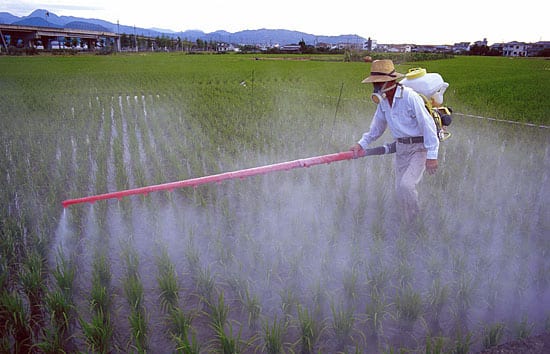
Red Tides and Dead Zones
The most widespread, chronic environmental problem in the coastal ocean is caused by an excess of chemical nutrients. Over the past century, a wide range of human activities—the intensification of agriculture, waste disposal, coastal development, and fossil fuel use—has substantially increased the discharge of nitrogen, phosphorus, and other nutrients into the environment. These nutrients are moved around by streams, rivers, groundwater, sewage outfalls, and the atmosphere and eventually end up in the ocean.
Read More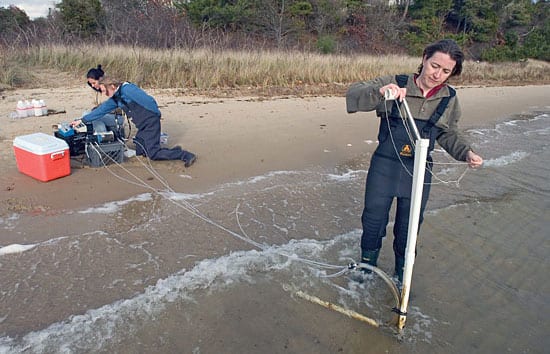
Water Flowing Underground
Groundwater discharge appears to be an important factor for determining the chemistry of the coastal ocean. As fresh groundwater flows toward the sea, it rises up over denser, salty water. The fresh and salty water mix along the interface, and the resulting fluid discharges at the shoreline. This interface between underground water masses has recently been described as a “subterranean estuary,” a mixing zone between fresh and salty water analogous to the region where a river meets the ocean.
Read More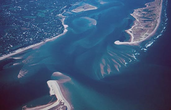
Rising Sea Levels and Moving Shorelines
Changes to the shoreline are inevitable and inescapable. Shoals and sandbars become islands and then sandbars again. Ice sheets grow and shrink, causing sea level to fall and rise as water moves from the oceans to the ice caps and back to the oceans. Barrier islands rise from the seafloor, are chopped by inlets, and retreat toward the mainland. Even the calmest of seas are constantly moving water, sand, and mud toward and away from the shore, and establishing new shorelines.
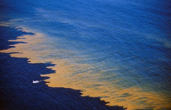
The Growing Problem of Harmful Algae
Harmful algal blooms are natural and they are not new. But ocean scientists are growing concerned that they are now all too common. The unprecedented growth of human activities in coastal watersheds—including agriculture, aquaculture, industry, housing, and recreation—has drastically increased the amount of fertilizer flowing into coastal waters and fueled unwanted algal growth.
Read MoreIntroducing…the Asian Oyster
As native oysters decline, officials seek to restore fishery with disease-resistant species “O Oysters,” said the Carpenter, “You’ve had a pleasant run! Shall we be trotting home again?” But answer…
Read More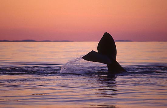
Scientists Muster to Help Right Whales
It is a sad irony that we have cataloged individual photographs of the remaining North Atlantic right whales and given each of them unique numbers and sometimes names, yet still know too little about their physiology, behavior, and habitats to take effective steps toward ensuring their survival as a species.
Read More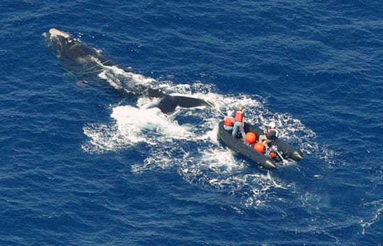
Whither the North Atlantic Right Whale?
“Today only a remnant of the population survives, no more than 350 whales clustered in calving and feeding grounds along the eastern seaboard of North America. Only occasional right whale sightings in the Gulf of St. Lawrence or in the waters between Iceland, Greenland, and Norway give echoes of their once substantially greater range.
Read More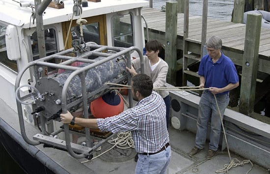
Revealing the Ocean’s Invisible Abundance
Finding minuscule life forms in a seemingly infinite ocean isn’t trivial. But in recent years, oceanographers have been developing new techniques and instruments to identify and count marine microorganisms. Year by year, we are learning more and more about them and discovering that they are even more numerous, varied, and important than we previously thought.
Read More
Shedding Light on Light in the Ocean
Light in the ocean is like light in no other place on Earth. It is a world that is visibly different from our familiar terrestrial world, and one that marine animals, plants, and microbes are adapted to in extraordinary ways. Light behaves very differently when it moves from air into water. It moves through the expansive depths of an ocean that is devoid of solid surfaces. These and other factors combine to create an environment that has no equivalent on land.
Read More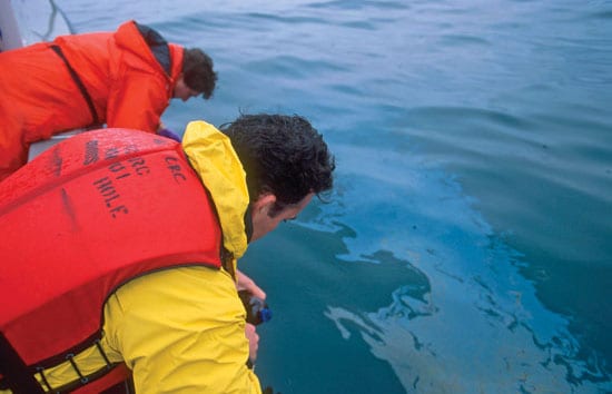
Oil in Our Coastal Back Yard
On September 16, 1969, the barge Florida ran aground off Cape Cod, rupturing its hull and spilling 189,000 gallons of No. 2 fuel oil. Winds and waves pushed the oil onto the beaches and marshes of West Falmouth, Massachusetts, carrying with it dead lobsters, scup, and cod.
Read More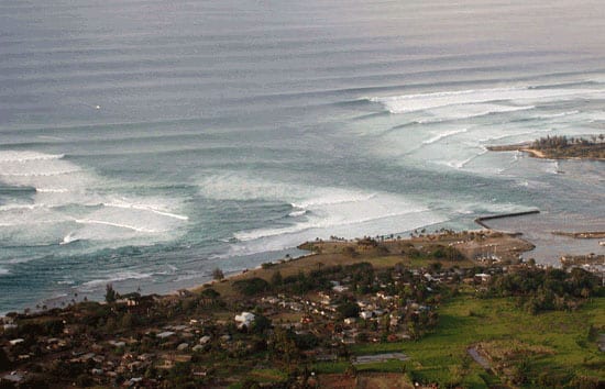
Shaping the Beach, One Wave at a Time
For years, scientists who study the shoreline have wondered at the apparent fickleness of storms, which can devastate one part of a coastline, yet leave an adjacent part untouched. How can this be? The answer lies in the physics of the nearshore region?the stretch of sand, rock, and water between the dry land behind the beach and the beginning of deep water far from shore.
Read More
Down on the Farm…Raising Fish
Aquaculture, or fish farming, is changing how we think about one of our main sources of protein. With many fish stocks shrinking due to overfishing or environmental degradation, aquaculture holds the promise of more reliable and more sustainable seafood production. The economic and social benefits could be significant for both consumers and producers.
Read More
Life in the Arctic Ocean
Capped with a formidable ice and snow cover, plunged into total darkness during the winter, buffeted by blizzard winds,and bitterly cold, the Arctic Ocean is one of the most inaccessible and yet beautiful environments on Earth. Life here endures some of the greatest extremes in light and temperature known to our planet. Yet despite these inhospitable conditions, the Arctic Ocean is teeming with life.
Read More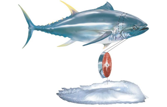
In Tiny Ear Bones, the Life Story of a Giant Bluefin Tuna
The Atlantic bluefin tuna, Thunnus thynnus, is one of the fastest, most powerful and most beautiful of fish. It is also the most expensive. Highly prized by sushi connoisseurs, a…
Read More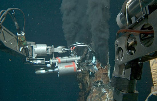
The Deep Ocean Exploration Institute
This may sound like heresy, but for some of us at Woods Hole Oceanographic Institution, the ocean is a bit of a nuisance. All that lovely blue water can get in the way.
Read More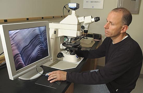
The Secret Lives of Fish
“We have found that otoliths of fish born in each of the five natal estuaries had different, unique isotope and element compositions, or “signatures.” All their lives, these fish had carried a natural tag, encoding the location where they were hatched.
Read More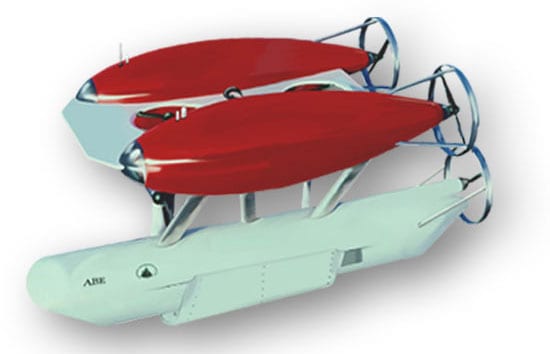
Realizing the Dreams of da Vinci and Verne
Leonardo da Vinci made the first drawings of a submarine more than 500 years ago, and Jules Verne published 20,000 Leagues Under the Sea in 1875. But only in the past few decades has the dizzying pace of technological advances allowed us to realize their dreams of exploring the ocean depths and taking humans to the seafloor.
Read More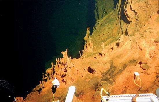
Living Large in Microscopic Nooks
Newly discovered deep-sea microbes rearrange thinking on the evolution of the Eart—and life on it.
Read More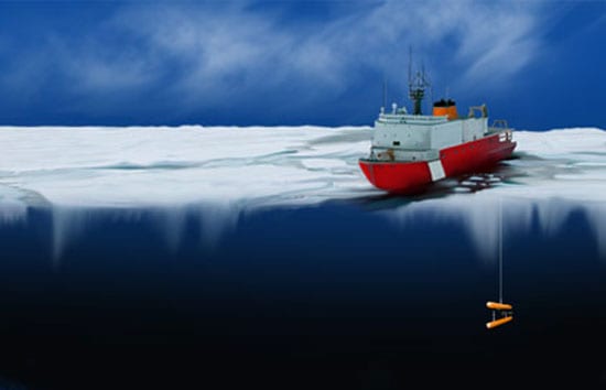
Unique Vehicles for a Unique Environment
For climatologists and physical oceanographers, it is often said that the Arctic is a canary in the environmental coal mine. In the isolated Arctic Ocean Basin, a variety of oceanographic and other processes have conspired to create a layer of cold, salty water called a halocline, which shields the sea ice from underlying warmer waters that would otherwise melt it.
Read More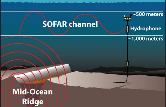
Ears in the Ocean
If you sought to delve into the forces that drive and shape the face of the earth and that distinguish it from all other planets in our solar system, you would shine a spotlight on the mid-ocean ridges.
Read More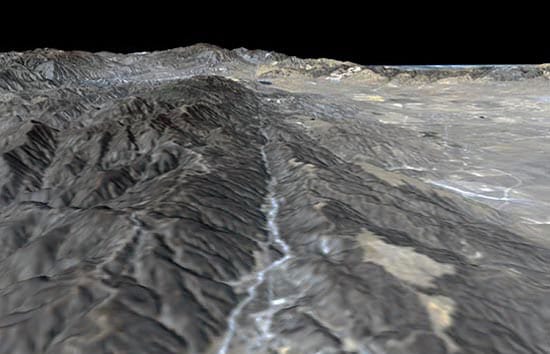
Earthshaking Events
When I was still a schoolboy in China, two major earthquakes occurred, about a year apart. They had a profound impact on my life and on the Chinese people. The…
Read More