Navigating the Changing Arctic
New glider will collect critical-but-scarce ice thickness measurements
By Evan Lubofsky | April 25, 2019

As the fastest warming region on Earth, the Arctic is shedding its ice-covered skin at unprecedented rates. It’s lost 95% of its oldest (and most resilient) sea ice in recent decades, and some models suggest that if things continue to heat up, we could see an ice-free Arctic Ocean by mid-century.
To understand just how thin the ice cover has become, WHOI scientists are developing a new autonomous underwater vehicle (AUV) that will measure ice thickness from below the surface for thousands of miles at a time, all with the power draw of a cell phone. It’s one of ten “Big Ideas” set forth by the National Science Foundation (NSF) that will help positioning the U.S. at the cutting edge of global science and engineering leadership.
“Understanding ongoing changes in ice thickness in the Arctic will allow us to identify trends that help long-term forecasting,” said Rich Camilli, a scientist at WHOI who spearheaded the development of the new instrument. “But under sea ice observations have been extremely difficult and expensive to make, and are very sparse as result. This new glider vehicle we’re developing overcomes many of the previous limitations and will make remote measurements of ice thickness—from below the ice—more logistically and economically-feasible than it’s been in the past.”
Removing the guesswork
Surveying ice from below the surface offers a number of advantages over measurements taken from above. Satellites can measure ice thickness above water, but they have trouble determining the submerged thickness and overall mass of the ice. “Snow depth and densities must be assumed,” said Camilli, “even though it can vary widely. By making measurements below the ice, we don’t have to rely on guesstimates.”
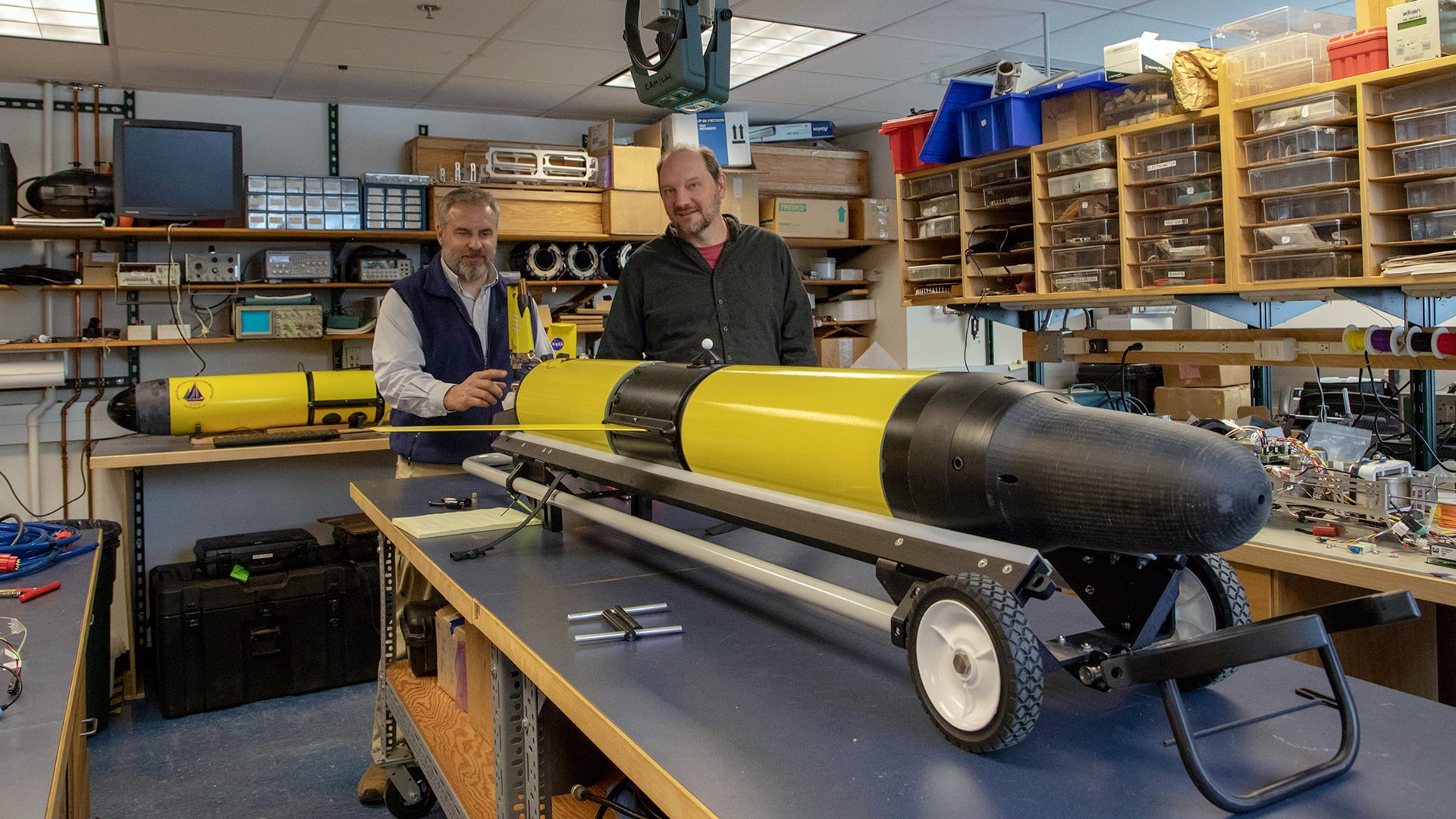
The new glider looks like a cruise missile with wings, and has bells and whistles that would excite any oceanographer attempting long-range under ice surveys. Up top in the vehicle’s nose is a sonar system that surveys and measures the ice as it cruises several meters below the cover. A high-efficiency thruster in the rear of the vehicle keeps the glider going across huge swaths of the ocean, and ensure that it stays ahead of the fast-moving ice pack. And, a Doppler sonar module provides navigational guidance based on the terrain of the seafloor. This, according to WHOI scientist Ted Maksym, is key since the glider is fully autonomous and doesn’t rely on commands from ship or shore.
“Traditionally, you put out an acoustic network to communicate with an undersea vehicle to know where it is when it’s under the ice and can’t surface,” he said. “But in this case, the idea was to be able to not have to have a network out there. We’ve designed this instrument so you can launch it from the shore and forget about it. The idea is to not have to rely on a network out there, and to have enough range so that you don’t need an icebreaker to help the glider get to where it needs to go.”
Low power, big smarts
Power optimization is the other big story here. The drone’s efficient low-power design helps ensure that it doesn’t run out of battery before making the return trip home—which is one of the biggest issues with long-range AUVs. “If the weather’s bad, the glider can go on standby to conserve energy and wait for pickup, and it has the smarts to stay ahead of ocean currents as it cruises to reduce power consumption. It’s kind of similar to when an airplane hops on a jet stream to conserve fuel.”
Camilli and Maksym are in the final stages of the initial build, and plan to begin field tests off Cape Cod during the Summer of 2019. Assuming the trials go to plan, the scientists hope to deploy the drones in the Arctic to begin collecting the critical ice thickness measurements that have been so scarce in Arctic research. This could help in long-term forecasting of when summer ice may disappear for good, or how much warming the Arctic will experience in the future. And they see other possibilities.
“Having sustained access to the underside of the ice will eventually allow us to do a host of other things, like monitoring oil spills under the ice, that have always been logistically challenging to do,” said Maksym. “The idea is to help open the door to doing things we would normally need an icebreaker to do.”
Funding for this research was provided through National Science Foundation award #1839063 to R. Camilli, B. Claus, T. Maksym and A. Mallios.

