Multimedia Items
Atlantic Ocean currents circulation
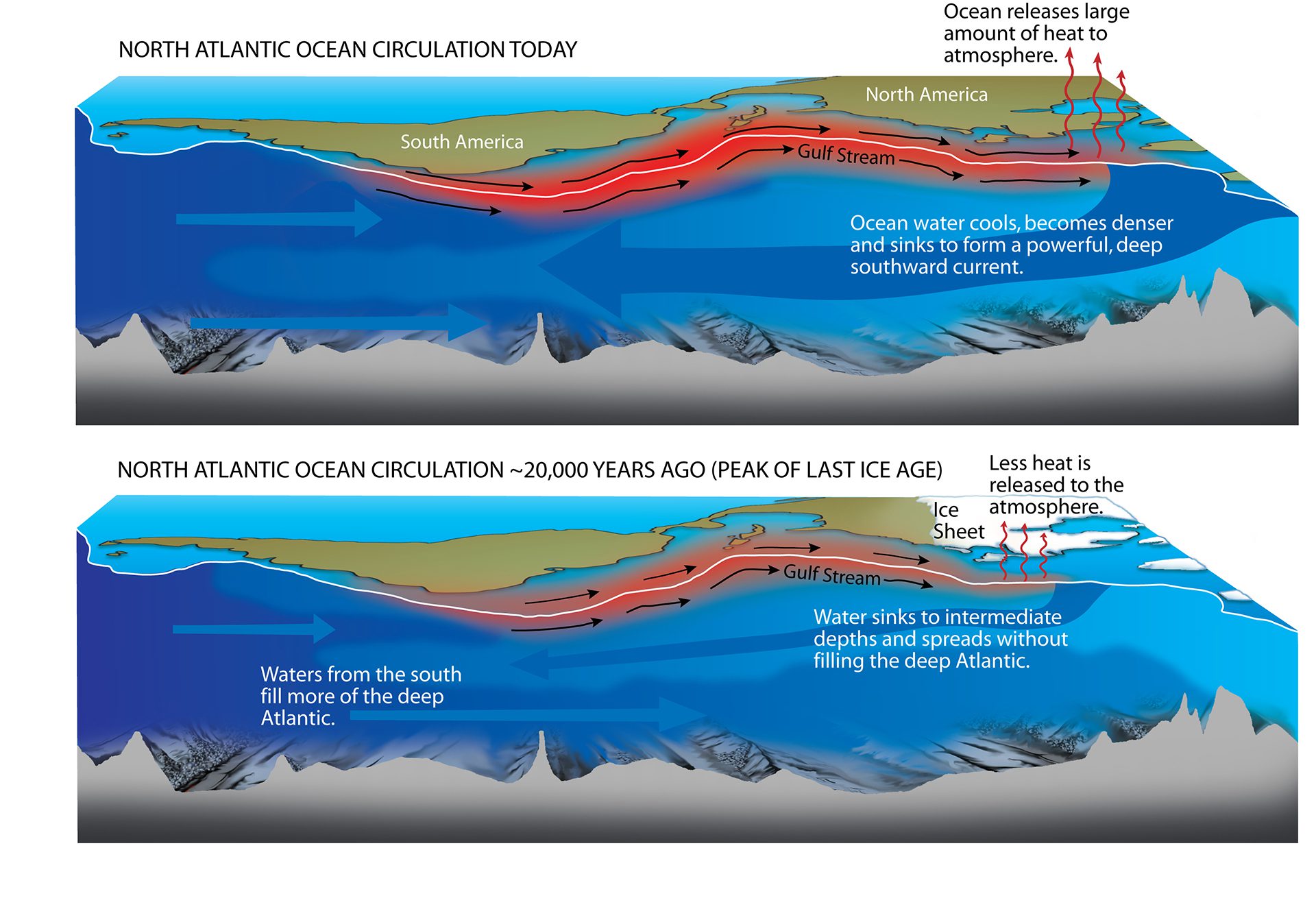
To reconstruct climate changes over millennia, scientists like WHOI’s Delia Oppo and former colleague Jerry McManus use conceptual models, like the one depicted here, that simulate the workings of the […]
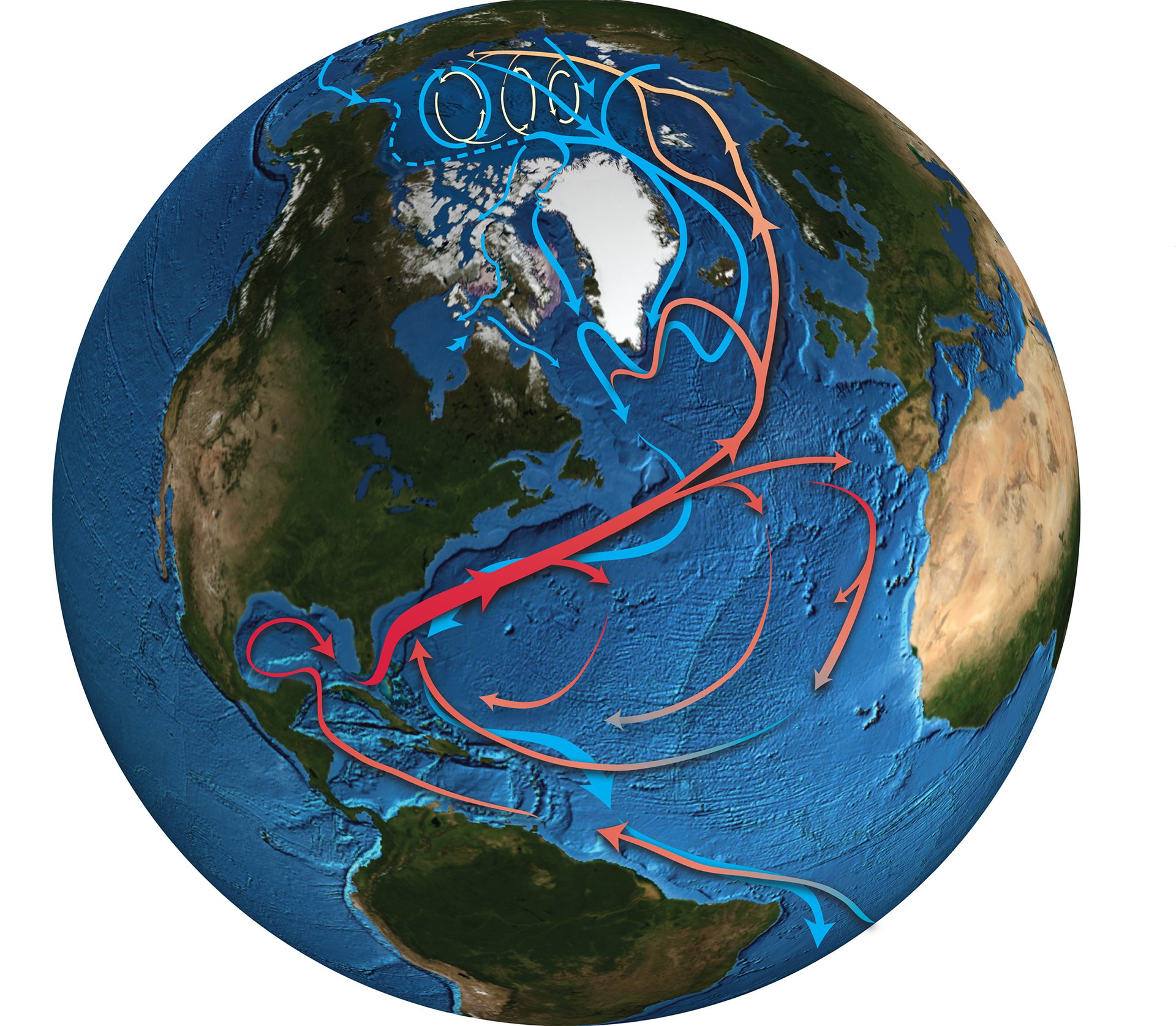
Read MoreAtlantic and Arctic Oceans currents
Atlantic and Arctic Oceans currents. (Illustration by Jack Cook, © Woods Hole Oceanographic Institution)
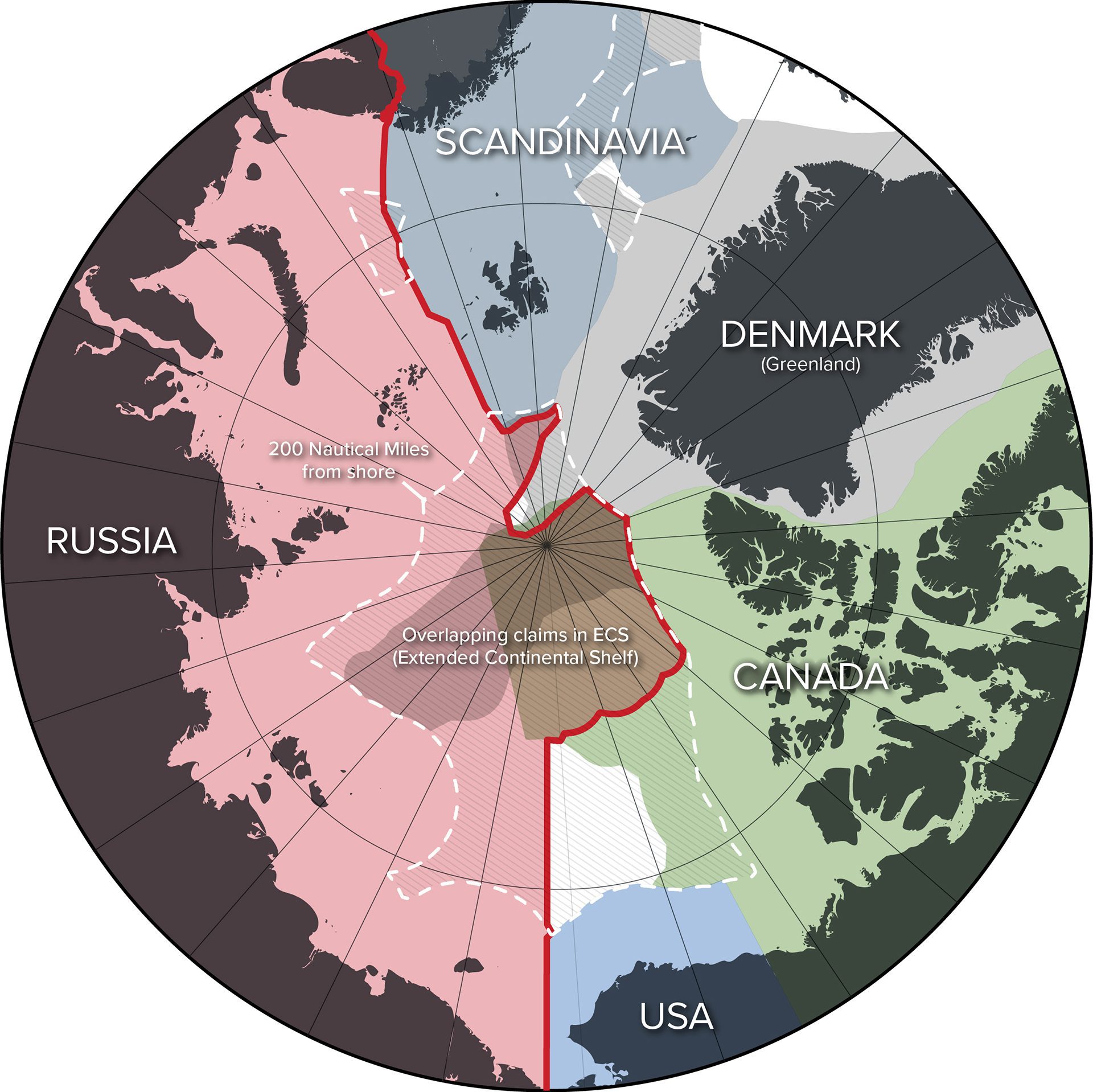
Read MoreTerritorial Arctic map
Multiple countries control territories within the Arctic circle, with Russia alone accounting for 53% of the Arctic coastline. (Illustration by Natalie Renier, as sourced from Natural Earth, Flanders Marine Institute […]
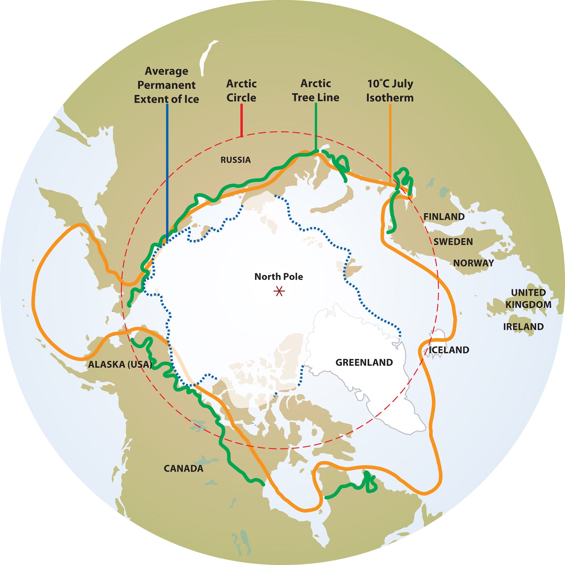
Read MoreIllustration showing the global boundaries of the Arctic region
Illustration showing the global boundaries of the Arctic region. (Illustration by Jack Cook, © Woods Hole Oceanographic Institution)
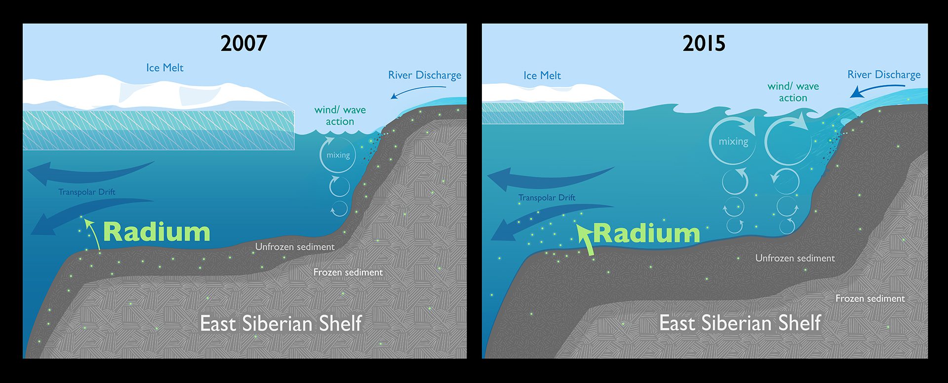
Read MoreChanges from 2007 to 2015 on the release of radium in the Arctic
Diminishing sea ice near the Arctic coast leaves more open water for winds to create waves. The increased wave action reaches down and stirs up sediments on shallow continental shelves, […]
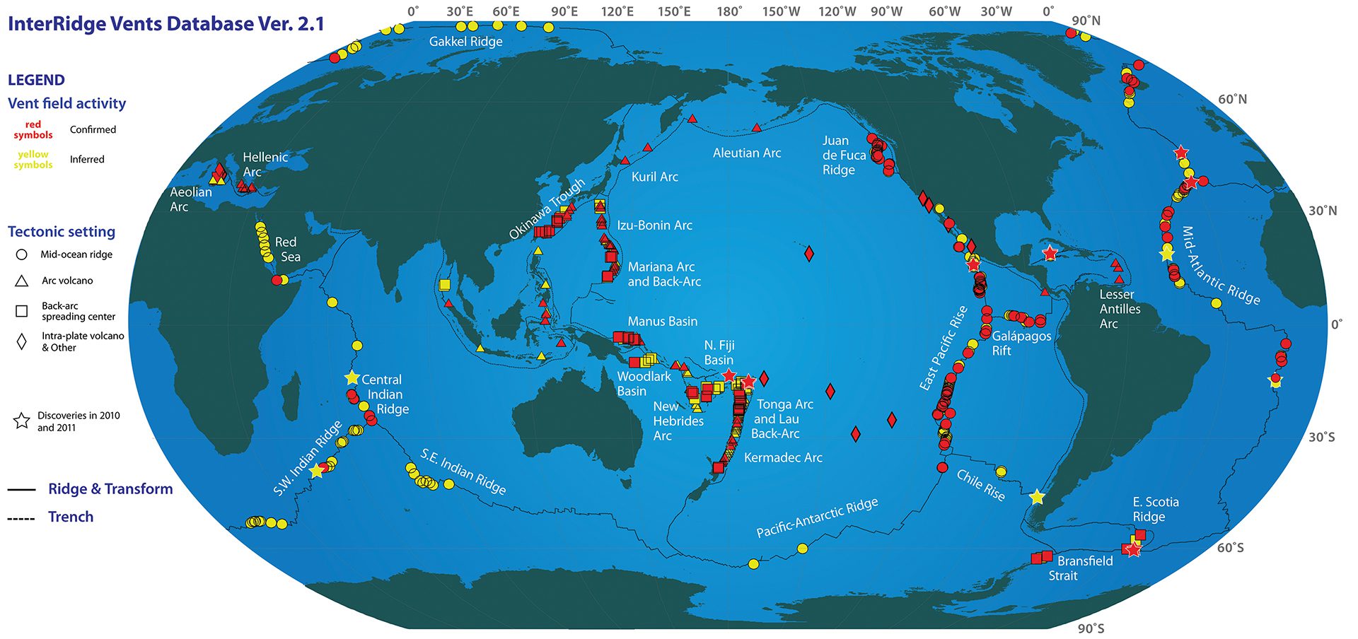
Read More2011 Global Hydrothermal Vents map
2011 Global Hydrothermal Vents map. Updated data source: InterRidge Vents Database, Version 2.1, release date 8 November 2011. (S. E. Beaulieu, E. T. Baker, C. R. German, and A. Maffei […]
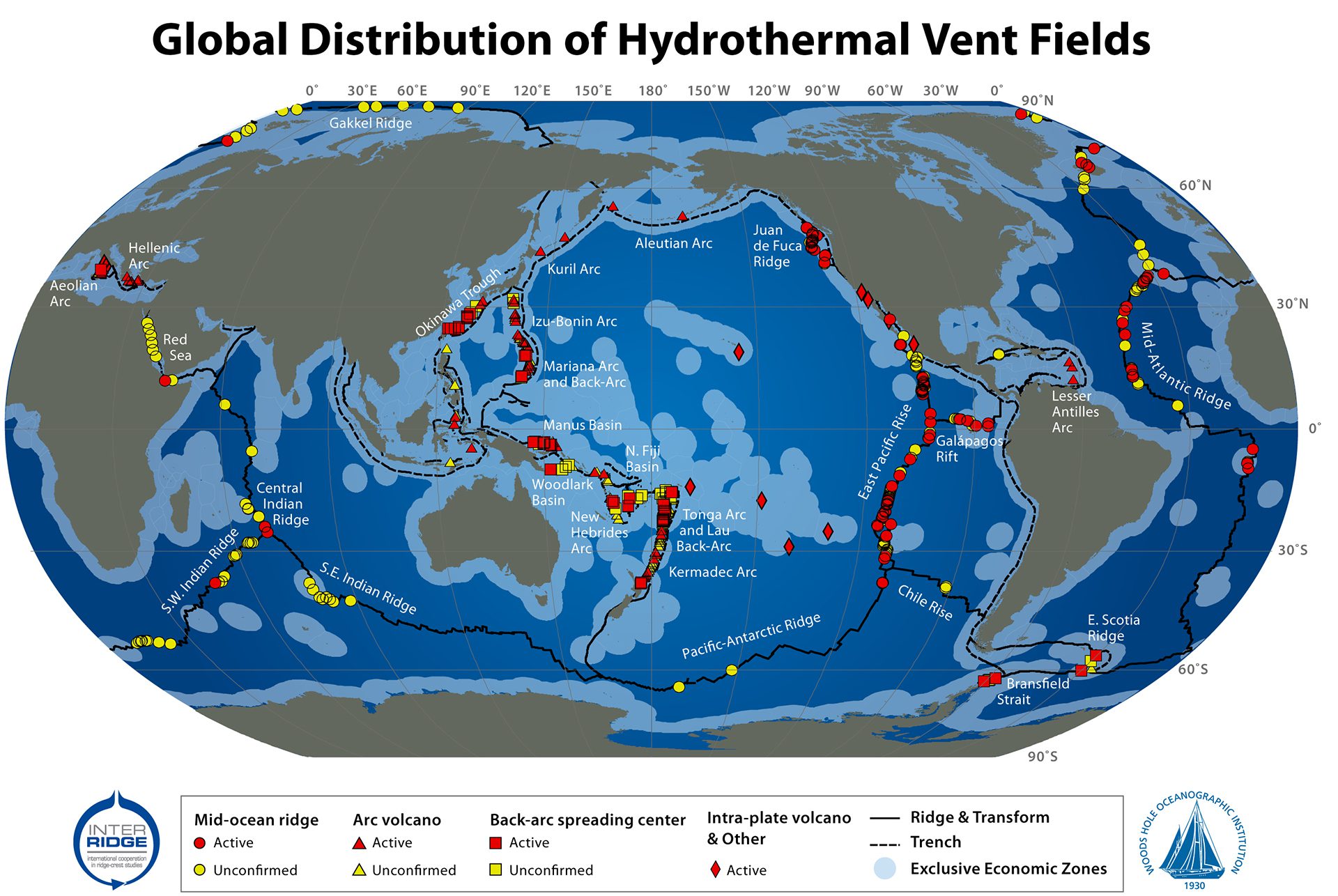
Read More2009 Global Hydrothermal Vents map
2009 Global Hydrothermal Vents map. Funding from InterRidge and Morss Colloquium Program at WHOI. Data sources: InterRidge Vents Database, Version 2.0, release date 5 Mar. 2010; University of Texas PLATES […]
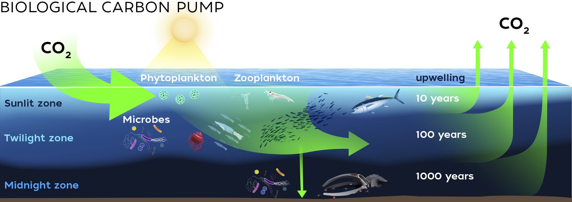
Read MoreBiological Carbon Pump
Biological Carbon Pump Once the solubility pump introduces carbon into surface waters, the ocean twilight zone’s biological carbon pump (BCP) plays an important role in the rapid removal of a […]
Read MoreMixing layer diagram
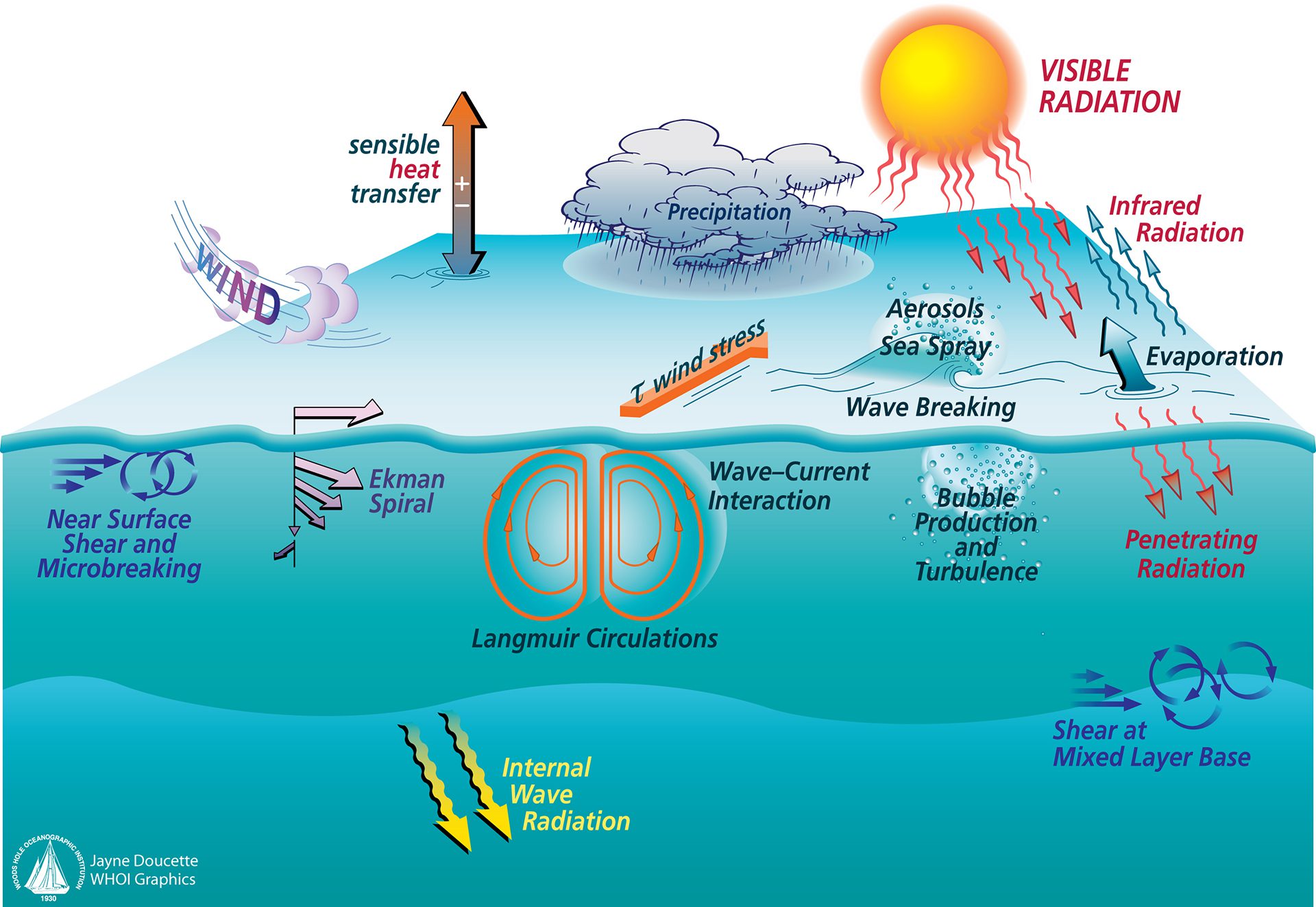
Mixing layer diagram. (Illustration by Jayne Doucette, © Woods Hole Oceanographic Institution)
Read MoreThe life cycle of Greenland’s meltwater lakes
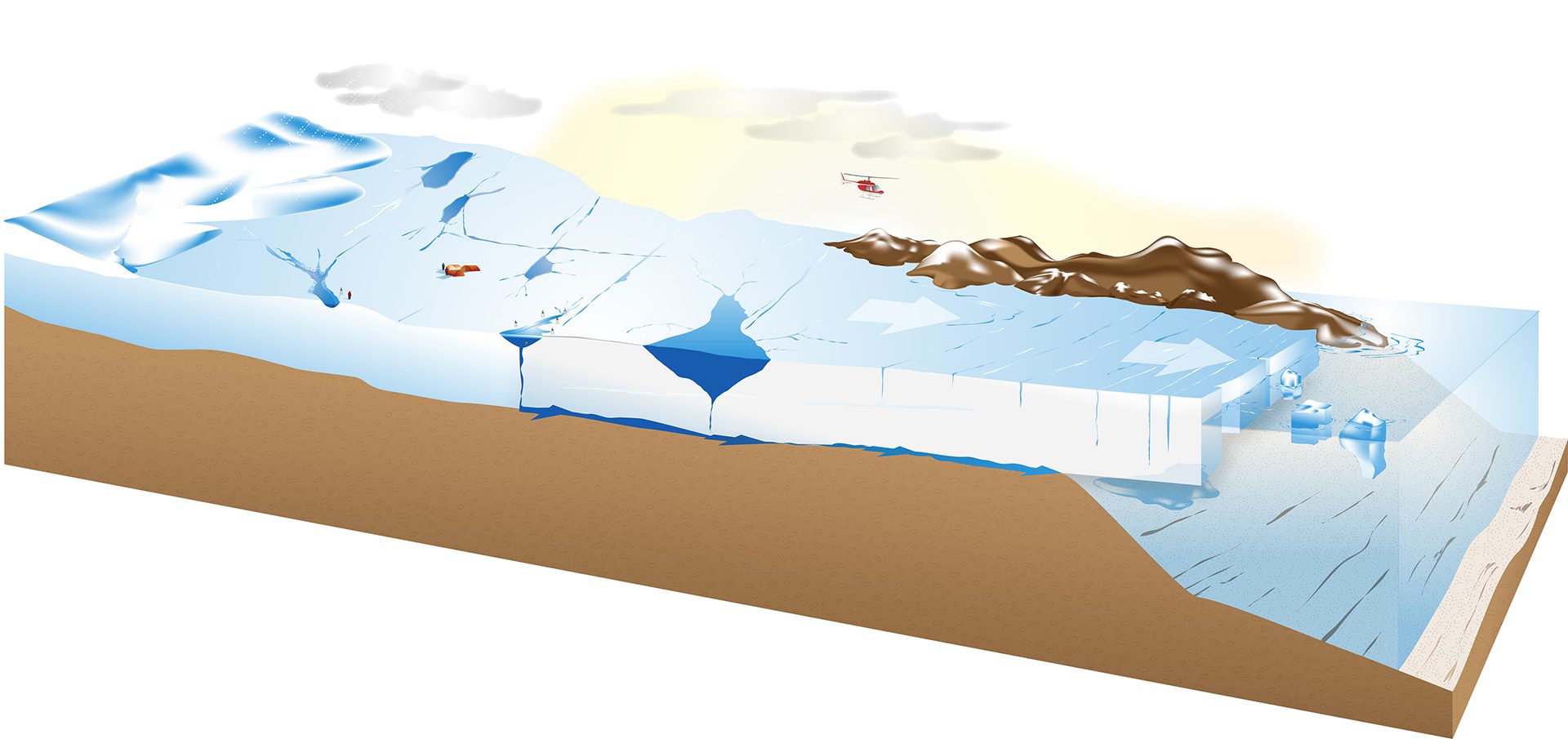
Meltwater lakes pool on Greenland’s ice sheet each spring and summer, then drain through cracks to bedrock, and ultimately out to the ocean. these lakes could accelerate global sea level […]
Read MoreThe location of the power plant disaster and the story of its continued effects
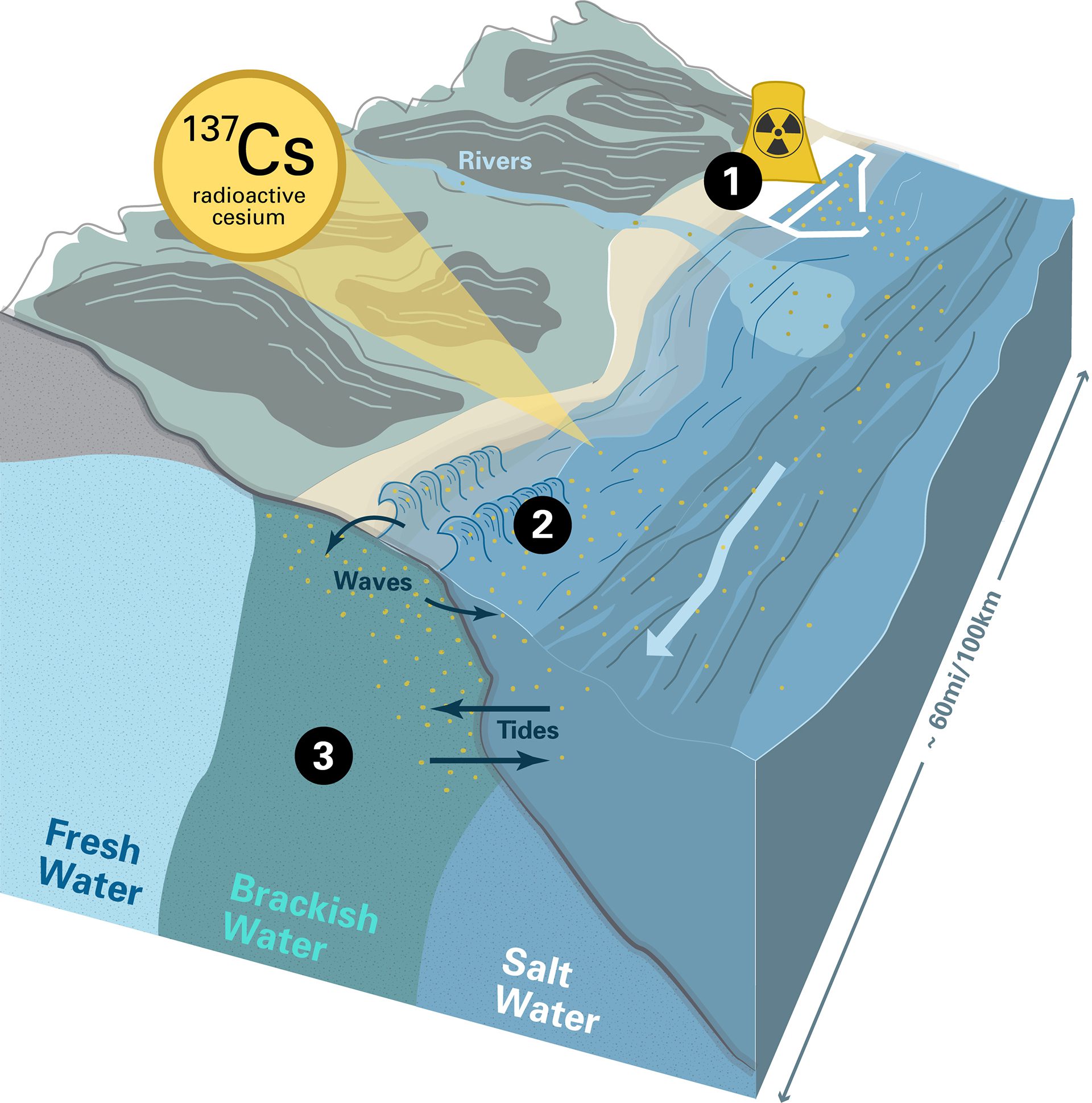
Fukushima Dai-ichi Nuclear Power Plant.
1. High levels of radioactive cesium-137 released in the 2011 accident were transported along the coast by ocean currents.
2. Waves and tides brought the […]
The Ocean of Things 2-page illustration
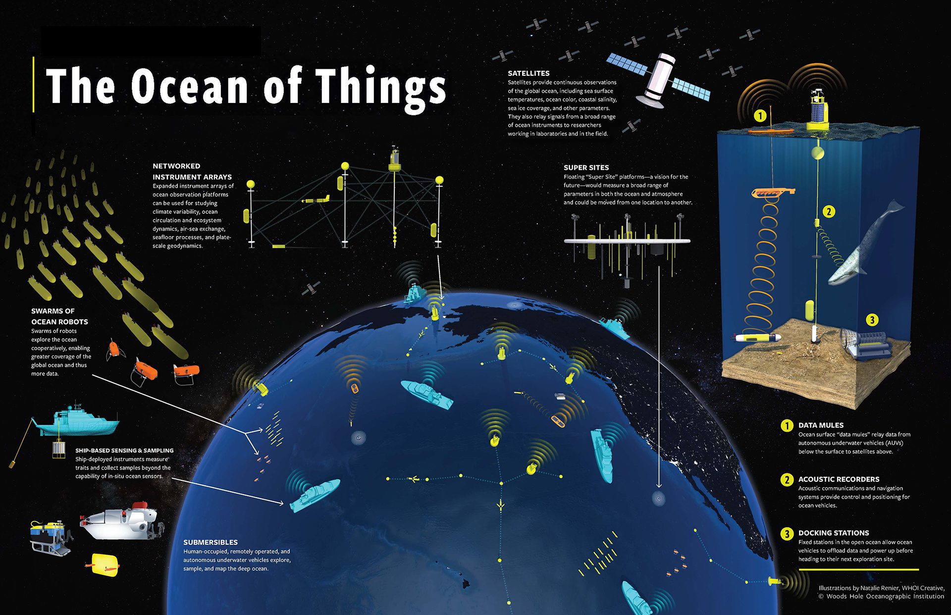
The digital ocean ecosystem of the future—the Networked Ocean—will rely on an integrated network of underwater vehicles, sensors, and communications systems that will cover the ocean in an ‘always on, […]
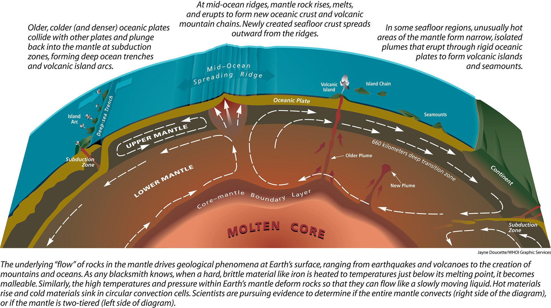
Read MoreIs the mantle one big pot or is it double-decked?
Drawn for authors Robert Detrick and Stanley Hart and Oceanus Magazine, DOEI, Vol. 42, No. 2, 2004. (Illustration by Jayne Doucette, © Woods Hole Oceanographic Institution)
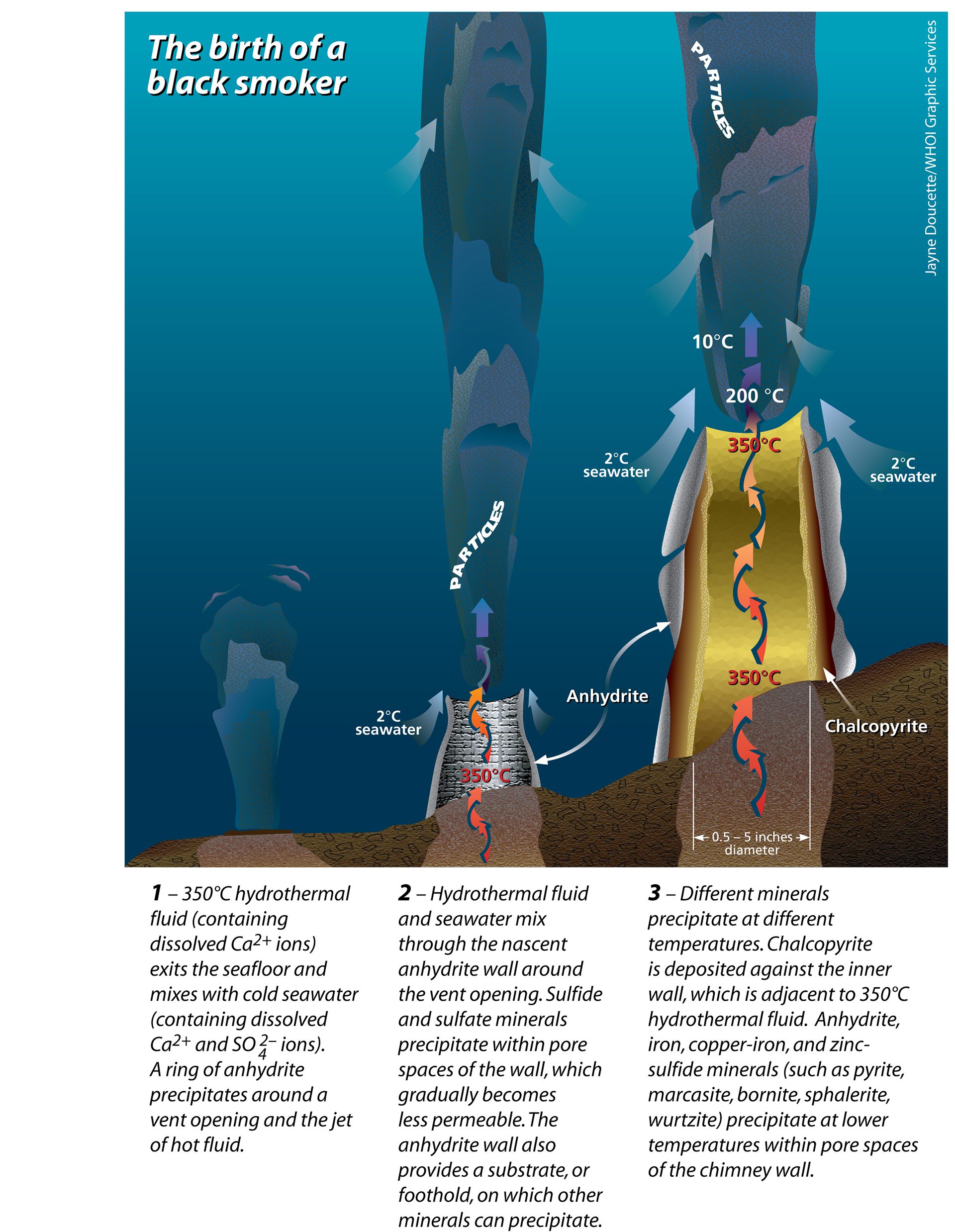
Read MoreThe birth of a black smoker
During Stage 1 of black smoker chimney growth, hot, calcium-rich vent fluid mixes turbulently with cold, sulfate and calcium-rich seawater, resulting in precipitation of a ring of calcium sulfate (anhydrite) […]
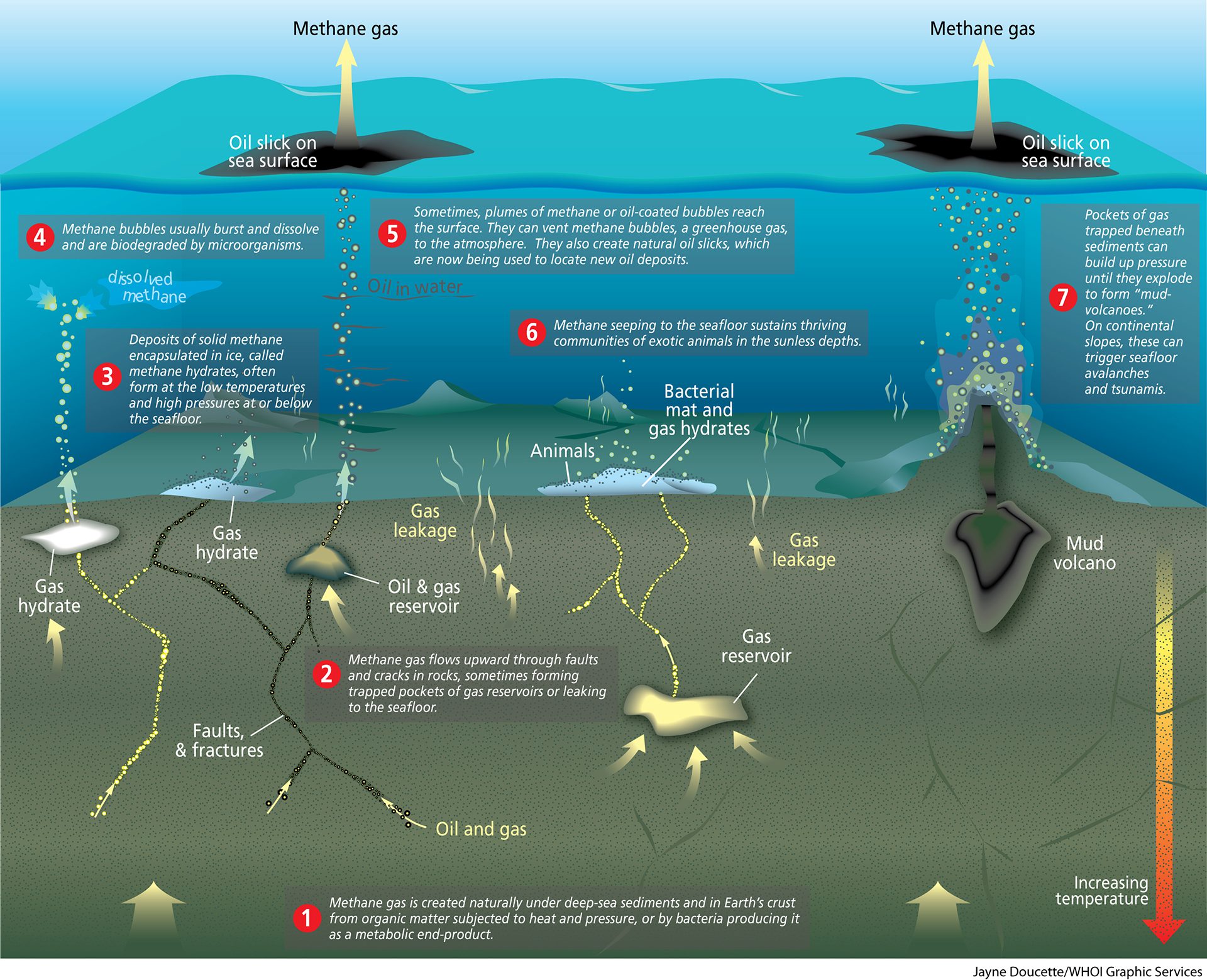
Read MoreThe seafloor is teeming with methane
(Illustration by Jayne Doucette, © Woods Hole Oceanographic Institution)
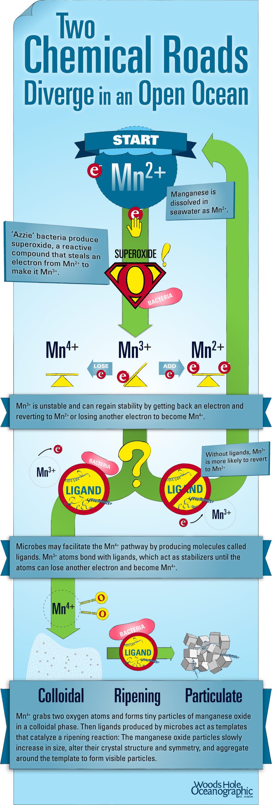
Read MoreTwo Chemical Roads Diverge in an Open Ocean illustration
Two Chemical Roads Diverge in an Open Ocean illustration. (Illustration by Eric S. Taylor, © Woods Hole Oceanographic Institution)
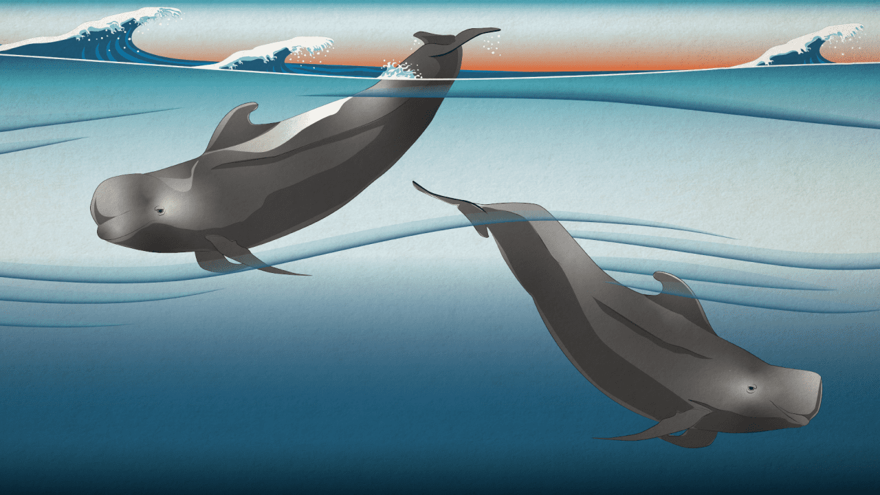
Read MoreTwo newly identified as unique subspecies of Pilot Whales
Short-finned pilot whales have been recognized as a single species, but a recent study found that two unique subspecies actually exist. (Illustration by Natalie Renier, © Woods Hole Oceanographic Institution)
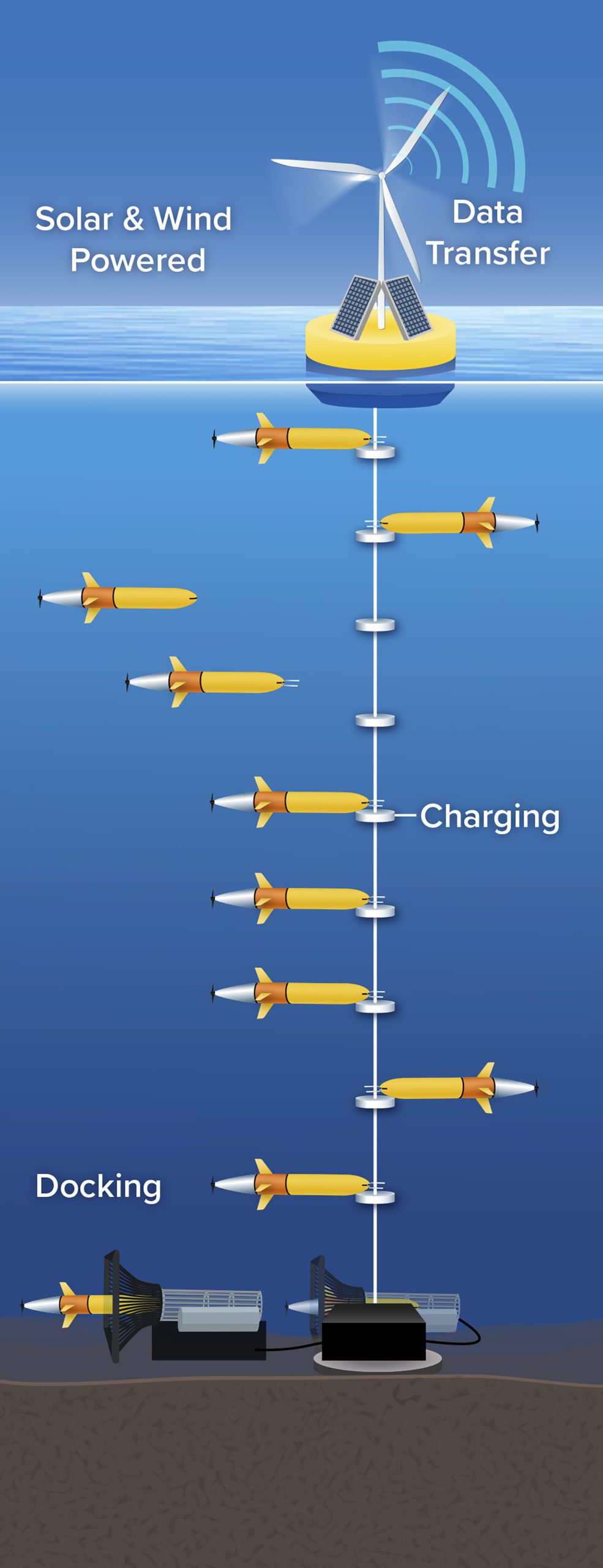
Read MoreUnderwater charging stations positioned along a mooring line
Underwater charging stations, like the one rendered above, could allow ocean robots to run longer-distance missions while reducing the time and costs associated with ship-based recovery and recharging operations. (Illustration […]
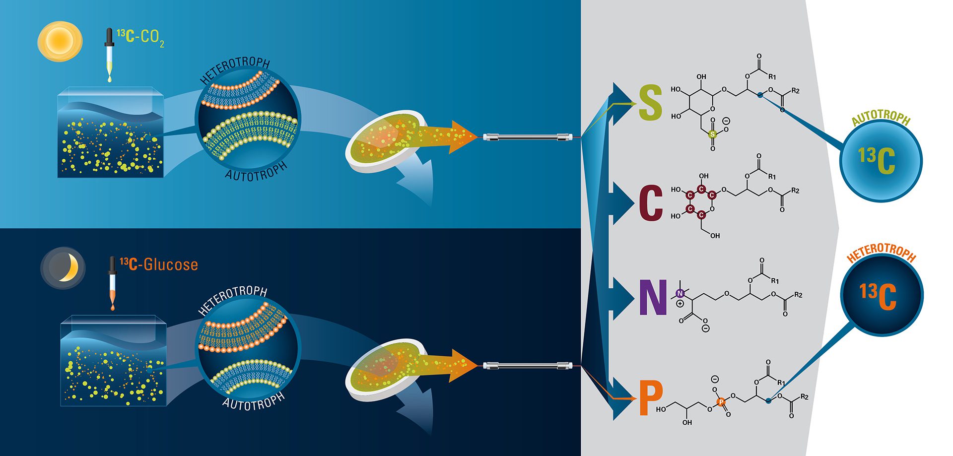
Read MoreUse of lipids to study the relationship between microbes and carbon
The ocean has two kinds of microbes: Autotrophs use sunlight to convert carbon dioxide into organic carbon, while heterotrophs convert organic carbon such as glucose into nutrients. Scientists are developing […]
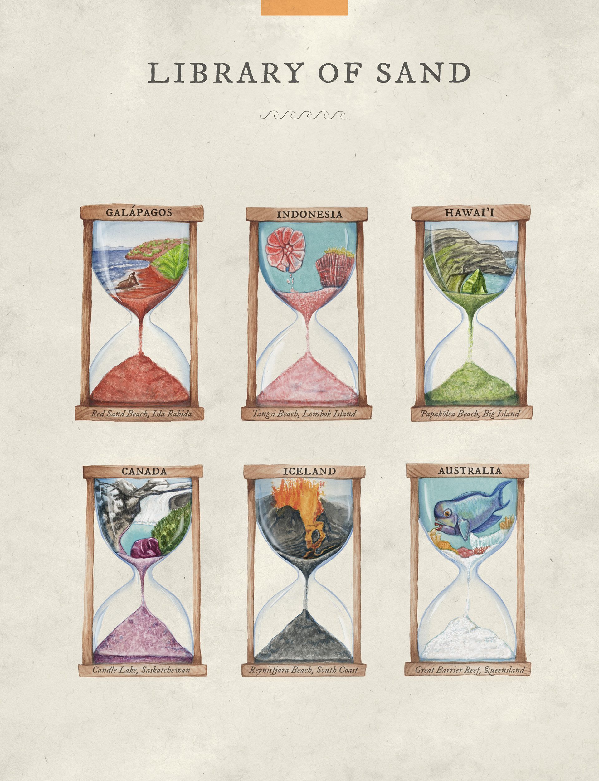
Read MoreVarious types of sand from around the world
Nothing says coastline like sand, that soft edge between land and sea. Sand takes millions of years to form, created as nearby rock weathers into fine grains. While light brown […]
Read MoreVent chemistry illustration
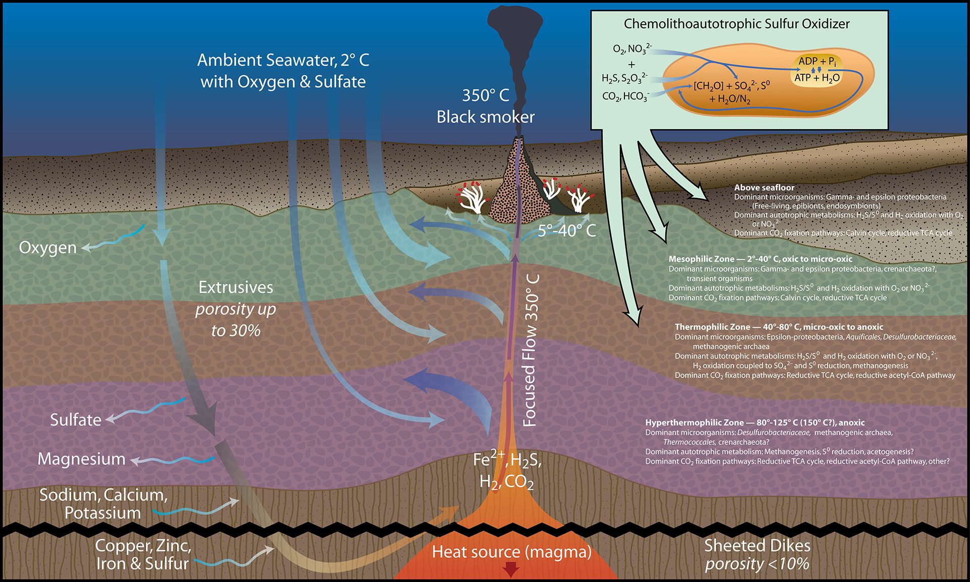
Vent chemistry. (Illustration by Jack Cook, © Woods Hole Oceanographic Institution)
Read MoreVisual explanation of how cystic fibrosis affects the lungs
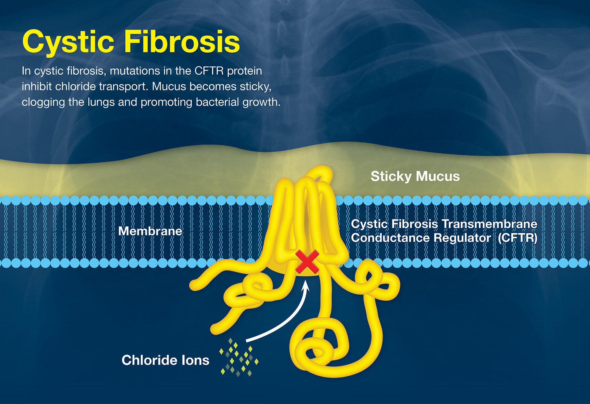
Visual explanation of how cystic fibrosis affects the lungs. (Illustration by Eric S. Taylor, © Woods Hole Oceanographic Institution)
Read MoreVisualization of the Polar Jet Stream
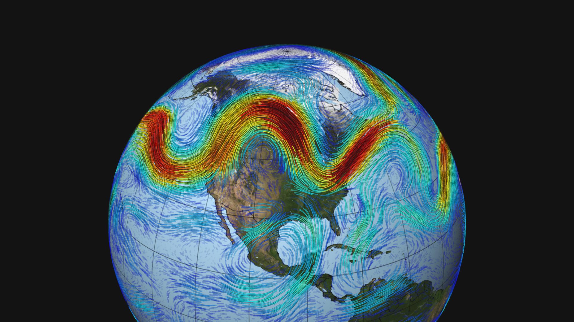
The polar jet stream, depicted above, is a fast-moving belt of westerly winds that traverses the lower layers of the atmosphere. The jet is created by the convergence of cold […]
Read MoreVisualization showing plume profiles representing CTD data
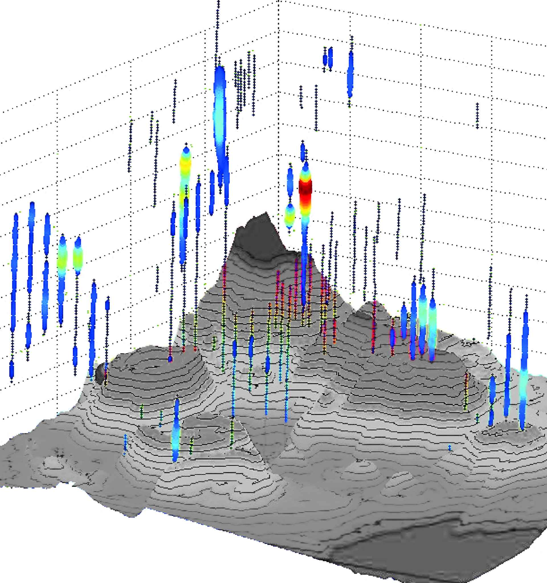
For oceanographers, the thermometer and smoke detector hanging down is called a CTD , which measures conductivity (salinity) and temperature at various depths. This tried-and-true instrument is scientists’ first tool […]
Read More
