
Image
Blue Holes and Hurricanes
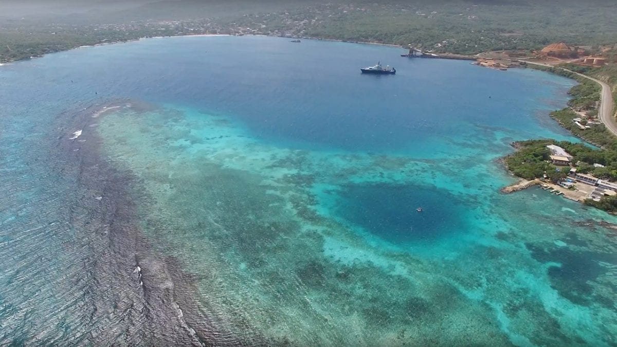
February 28, 2017The dark blue patch in the bottom right of this aerial shot of Discovery Bay, Jamaica, is a “blue hole.” These large sinkholes formed as caves on land during the last ice age, when sea levels were hundreds of feet lower than today. Eventually the caves collapsed and filled with water as sea levels rose again. For WHOI coastal geologist Jeff Donnelly, blue holes provide a perfect trap for sediments and debris that passing hurricanes leave behind. From a floating platform, barely visible in the blue hole’s center, Donnelly collects sediment samples, which he uses to trace the history of hurricanes. More samples were collected from R/V Atlantis in the bay, which itself is an even larger blue hole. (Still from video by Richard Sullivan, Woods Hole Oceanographic Institution)
Image and Visual Licensing
WHOI copyright digital assets (stills and video) contained on this website can be licensed for non-commercial use upon request and approval. Please contact WHOI Digital Assets at images@whoi.edu or (508) 289-2647.