Salty Oceans Can Forecast Rain on Land

December 16, 2016
At this week’s American Geophysical Union meeting, a team of researchers from the Woods Hole Oceanographic Institution (WHOI) presented their latest research findings on the long-range predictions of rainfall on land. Their method is based on ocean salinity rather than sea surface temperatures, which has been the standard for decades.
Using this method, a research team led by Ray Schmitt, a physical oceanographer at WHOI, was able to successfully predict the extreme rainfall event that flooded states throughout the Midwest in the summer of 2015. The results of the study will be published in a paper currently in review.
Researchers analyzed more than 60 years of global ocean salinity and terrestrial rainfall data and found that year-to-year variations in salinity, or saltiness, in certain parts of the ocean can be used to make accurate predictions of seasonal rainfall on land, often thousand of miles away.
“When we started analyzing the records, we found these ‘teleconnections’ between regions of ocean salinity and certain regions of higher precipitation on land,” he explains.
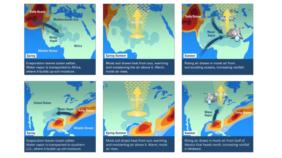
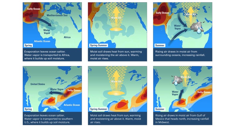
Schmitt and his colleagues first found evidence of a clear link between higher sea surface salinity levels in the North Atlantic Ocean and increased rainfall on land in the African Sahel—the area between the Sahara Desert and the savannah across Central Africa. The results were published in the May 6, 2016 issue of Science Advances.
Schmitt and his colleagues also found that high springtime salinity in the western North Atlantic correlates with high summer rainfall in the U.S. Midwest. Those results were published in the May 1, 2016 issue of the Journal of Climate.
“We can use patterns of salinity variations to predict rain a season in advance because there is about a three-month delay between the high ocean salinity patterns and the resulting rainfall on land. Also, low springtime salinity is a good predictor of summer drought in the Midwest.” Schmitt says. Their analysis uses sophisticated “machine learning” techniques to identify and rank the best climate variables for rainfall predictions and salinity proves to be the most reliable for many areas.
Now the research team, which includes Laifang Li, a former postdoctoral researcher in Schmitt’s lab, presently at Duke University, Tianjia Liu of Columbia University, and WHOI colleague Caroline Ummenhofer, is presenting the latest updates on this exciting new technique.
The research team found that by including salinity signals from around the globe rather than just the North Atlantic they can make even more accurate predictions and develop rainfall predictions for other regions, including the U.S. Southwest.
Finding the Salty Signals
The salinity, or saltiness, of seawater depends largely on how much moisture is pulled into the air as winds sweep over the ocean. Each year, 100,000 cubic miles of water evaporates from the surface of the ocean, which is enough to flood the entire continental U.S. up to a depth of 180 feet. About 90 percent of the moisture falls back into the ocean as precipitation, while the rest is carried over land where it eventually becomes rainfall.
When rain falls over the ocean, the sea surface becomes less salty. At the same time, evaporation makes the sea surface saltier by removing fresh water to the atmosphere. Thus, if a region gets saltier than normal it means that there will be more rain in some other part of the Earth. Similarly, a fresher than normal salinity indicates that the ocean has retained more water and there will be less rain somewhere else.
“This basic idea motivated us to look at the high-salinity areas of the ocean to see if the surface salinity variations could be used for rainfall predictions on land,” Schmitt says.
Schmitt says salinity is a better predictor of rainfall than ocean temperatures because the latter is subject to daily variations due to weather. “Salinity is an average of what’s been going on over the last few months,” he says. “It’s a better indicator of how much water and energy the ocean has exported from a given region, because evaporation represents the primary way that the ocean drives the atmosphere. The energy provided by heating due to temperature differences is more than an order of magnitude smaller.”
Both evaporation and precipitation are increasing with global climate change, making the differences more pronounced.
“Salty areas have gotten saltier and the fresh areas have gotten fresher, which means that we should expect dry areas to become dryer and wet areas to get wetter for us on land,” Schmitt adds.
“The more data we have, the easier it will be to improve seasonal climate forecasts and anticipate extreme droughts and floods, which will likely be more common in a warming world,” Schmitt says.
This research was funded by the National Aeronautics and Space Administration (NASA), the National Science Foundation (NSF), and the WHOI Ocean and Climate Change Institute and the WHOI Postdoctoral Scholar program.
The Woods Hole Oceanographic Institution is a private, non-profit organization on Cape Cod, Mass., dedicated to marine research, engineering, and higher education. Established in 1930 on a recommendation from the National Academy of Sciences, its primary mission is to understand the ocean and its interaction with the Earth as a whole, and to communicate a basic understanding of the ocean’s role in the changing global environment. For more information, please visit www.whoi.edu.

