
shipstech
 REMUS SharkCam captures an upclose encounter with a great white shark. (Woods Hole Oceanographic Institution)
- In May 2013, R/V Knorr sailed through a spectacular sunset on the western Atlantic Ocean near the equator. On the trip, Knorr took a group of scientists from WHOI and other institutions in search of dissolved organic matter (DOM) in the deep ocean. With over 44 years of exploring the ocean under her belt Knorr has seen many a sunset and covered well over one million miles. R/V Neil Armstrong is scheduled to replace Knorr in 2015. (Photo by Krista Longnecker, Woods Hole Oceanographic Institution)
- Members of WHOI's Deep Submergence Lab took the new Nereid Under Ice (nUI) vehicle through tank tests in 2013. The vehicle uses the same fiber optic technology first used in the hybrid remotely operated vehicle Nereus plus extra power and a hydrodynamic shape to give it unmatched lateral range from its support ship. This will permit scientists to make extensive observations and collect samples from beneath floating glacial ice tongues and ice-shelves, as well as undisturbed sea ice.
(Photo by Tom Kleindinst, Woods Hole Oceanographic Institution) - In October 2012, engineers from WHOI's Deep Submergence Laboratory deployed the SeaBED-class vehicle Jaguar into the East Antarctic Sea to create three-dimensional maps of the underside of sea ice. (Image courtesy Hanu Singh, Woods Hole Oceanographic Instituiton)
- Profile view of the new Neil Armstrong research vessel that WHOI is scheduled to begin operating in 2015. (Image courtesy Guido Perla & Associates Inc.)
- The REMUS 100 autonomous underwater vehicle works just below the surface in Glover's Reef Marine Reserve off Belize, while the crew watch from the launch boat. Their effort was part of a study of the larvae of the Nassau grouper, how they are dispersed, and what that means for the connectivity of the populations on various reefs. The REMUS vehicle was used to map the bathymetry—shape, depth, and topography, of the seafloor and the water properties around Glover's Reef. (Woods Hole Oceanographic Institution)
- John Kemp is lowered by the ship's crane to hook a group of floats, as part of the Beaufort Gyre Freshwater Experiment in 2005. A 4,000-meter (13,123-foot) mooring was retrieved from the heavy ice; the buoy was one of four measuring the effects of climate change in the Beaufort Sea north of Alaska. (Photo by Chris Linder, Woods Hole Oceanographic Institution)
- Frank Bahr deploys a conductivity, temperature, density instrument, or CTD, from the coastal research vessel Tioga off the New Jersey coast during a recent experiment. The instrument measures water temperature, salinity (salt content), and conductivity, and it is the primary tool for determining essential physical properties of sea water. (Photo by Christopher Linder, Woods Hole Oceanographic Institution)
- The first buoy designed for the Ocean Observatory Initiative (OOI) undergoes testing at the dock. As part of OOI's global array of tools to collect ocean data and observations, the buoys will be linked to shore via satellite. (Photo by Tom Kleindinst, Woods Hole Oceanographic Institution)
- The 279-foot (85-meter) vessel, Knorr can stay at sea for up to eight weeks. It is equipped with sophisticated navigation and communication systems and can accommodate a wide variety of scientific projects. (Photo by Tom Kleindinst, WHOI)
- In April 2010, the deep submersible Alvin (shown here with its support ship, R/V Atlantis in the background) carried out a month-long expedition to to the Galapagos Spreading Center in the Pacific Ocean to study the size, speed, and length of eruptions at a mid-ocean ridge with an intermediate spreading rate. (Photo by Mark Spear, WHOI)
- The autonomous underwater vehicle (AUV) Sentry is recovered to during a cruise to the Gulf of Mexico in May 2011. The goal of the cruise was to look for deepwater coral communities that may have been impacted by the 2010 Gulf oil spill. During the trip, Sentry spent nearly 250 hours in the water, including its longest to date—a 36-hour mission, and captured 68,000 photos of the ocean bottom. (Photo by Walter Cho, WHOI)
- The Slocum glider is an autonomous vehicle that moves up and down in the ocean by changing buoyancy, using only heat energy from the ocean. As it ascends sensors in the glider's bow measure water temperature and salinity. At the surface, the glider reports its position and transmits data via satellite. Scientists can also transmit commands, redirecting the glider on a new route, for example.The glider was named for Joshua Slocum, the first man to sail around the world alone, and for his boat. (Paul Fucile, WHOI)
- Remotely operated vehicle Jason at the seafloor. (WHOI Archives)
- The human occupied vehicle Alvin, collects samples and deploys and recover equipment at a deep-sea coral community in the Gulf of Mexico. (Image courtesy of Chuck Fisher, Pennsylvania State University and Timothy Shank, Woods Hole Oceanographic Institution)
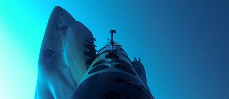
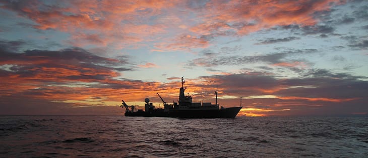
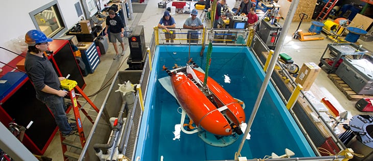
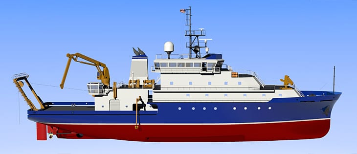
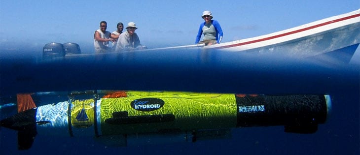
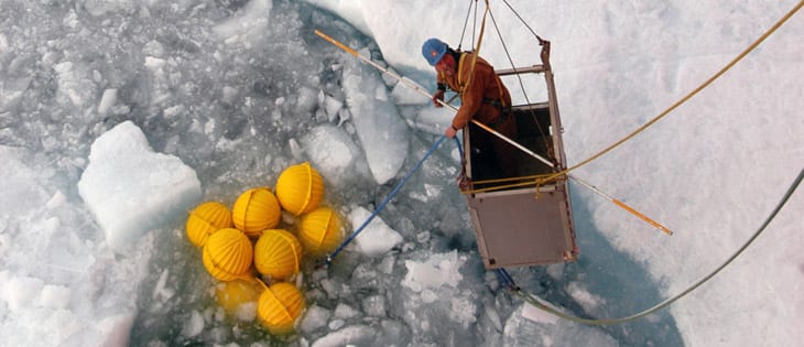
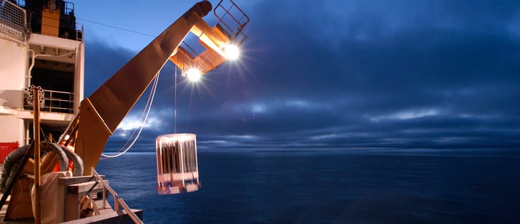
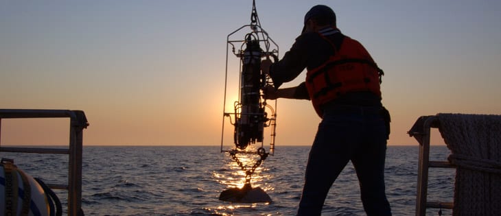
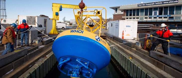
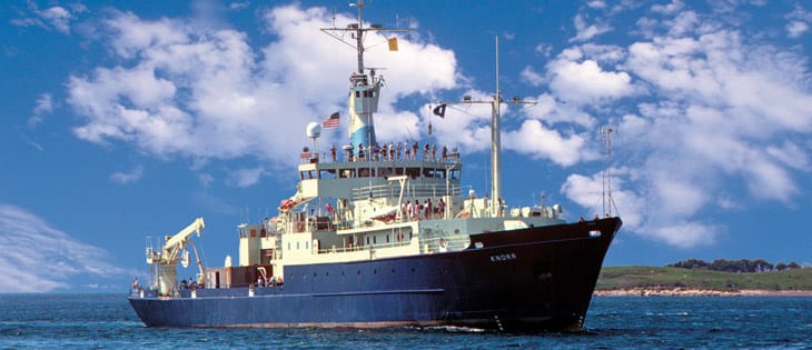
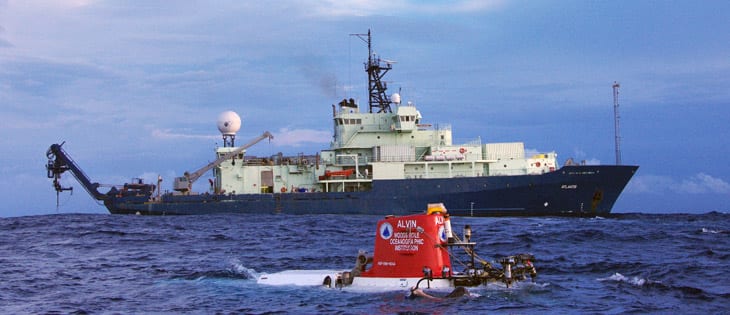
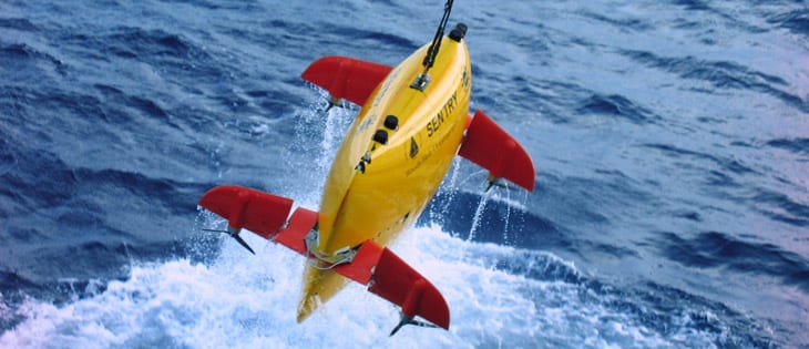
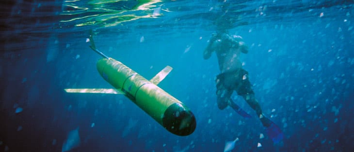
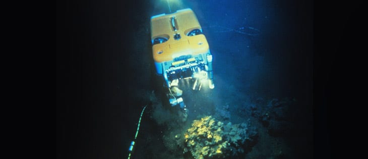
Image and Visual Licensing
WHOI copyright digital assets (stills and video) contained on this website can be licensed for non-commercial use upon request and approval. Please contact WHOI Digital Assets at images@whoi.edu or (508) 289-2647.