
Image
Mapping Vents
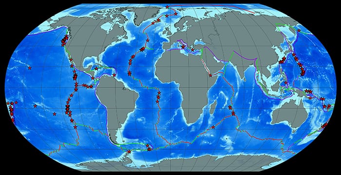
January 10, 2015Hydrothermal vents are not nearly as rare as initially thought when they were first discovered in 1977. Since then, scientists have come to better understand the conditions that create the wide variety of hot springs that gush and seep fluids from the seafloor. In 2014, WHOI biologist Stace Beaulieu worked with staff at the Ocean Explorium in New Bedford, Mass., to create videos for the Science on a Sphere system installed in museums and aquaria around the world that included this map of known hydrothermal vent sites in relation to spreading (red), transform (green), and subduction faults (purple). (Image courtesy of Stace Beaulieu, Woods Hole Oceanographic Institution)
Image and Visual Licensing
WHOI copyright digital assets (stills and video) contained on this website can be licensed for non-commercial use upon request and approval. Please contact WHOI Digital Assets at images@whoi.edu or (508) 289-2647.