Ice-Covered Arctic Lakes May Harbor Signs of Climate Change
May 1, 2007
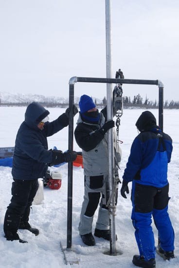
Arctic coastal environments are some of the most vulnerable to climate change. A team of WHOI researchers visited Canada’s Mackenzie River Delta in April 2007 to find out just how vulnerable. Marine geochemists Tim Eglinton, Daniel Montluçon, and Angie Dickens, and geologist Liviu Giosan trekked into the frozen wilderness to drill through ice and water and into the sediments on the bottoms of lakes within the delta. Each spring, as the Canadian interior thaws and snow melts, a sediment-laden pulse of melt water surges down the streams and rivers, inundating the delta, flooding river banks, and filling the numerous low-lying lakes. The sediments that settle to the bottom comprise old carbon (derived from plants, microbes, and animals) that has been sequestered for many years in Arctic soils within the watershed. These sediments can tell the history of past river flows and floods up to the globally warming present. This spring, Eglinton and colleagues collected sediment cores stretching back for at least 1,000 years, and they hope to decipher how the discharge of the river has changed. The increasing flow into the ice-capped lakes of the Mackenzie Delta is a clear sign of increased melting in the Arctic; it may also suggest that more organic carbon will be released from the Arctic permafrost soils and back into the ocean and atmosphere. This year’s expedition was launched to prove that researchers could recover useful data from the delta. Eglinton is now planning to return in 2008 for more extensive sampling.
Related Links
» Follow the Carbon Trail from Oceanus magazine
» The Once and Future Danube Delta from Oceanus magazine