
Image
Data Retrieval
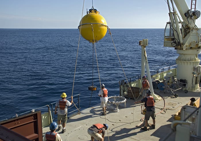
October 27, 2012A Subsurface Mooring Operations crew on a cruise to Line W recovers a buoy that collected data for the Access to the Sea program. Named in memory of Val Worthington, a WHOI oceanographer devoted to understanding the properties and flow of the Gulf Stream, Line W is one component of a long-term climate observing system established to study the Atlantic portion of the meridonial overturning circulation (MOC). Also known as the “ocean conveyor belt,” the MOC transports vast amounts of warm, salty water poleward at the surface and returns colder, relatively fresh water at depth, redistributing heat and helping regulate climate worldwide.(Photo by John Lund, Woods Hole Oceanographic Institution)
Image and Visual Licensing
WHOI copyright digital assets (stills and video) contained on this website can be licensed for non-commercial use upon request and approval. Please contact WHOI Digital Assets at images@whoi.edu or (508) 289-2647.