
Multimedia
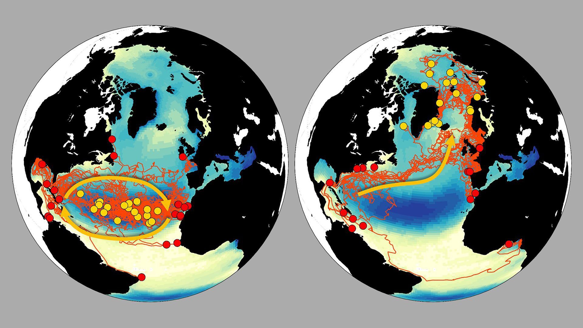
North Atlantic circulation
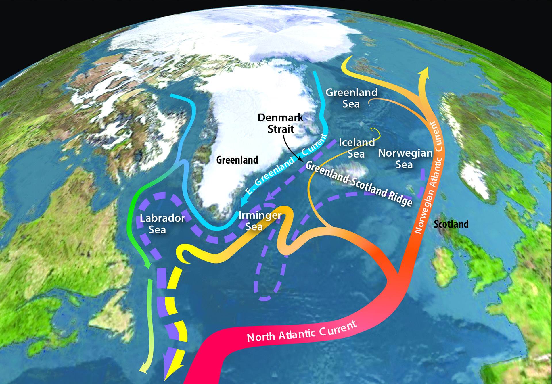
Global map illustrating general circulation patterns in the Northern Hemisphere with a focus on the Greenland Strait.
Read MoreDiatoms and Coccoliths carbon-dioxide carbon removal from atmosphere
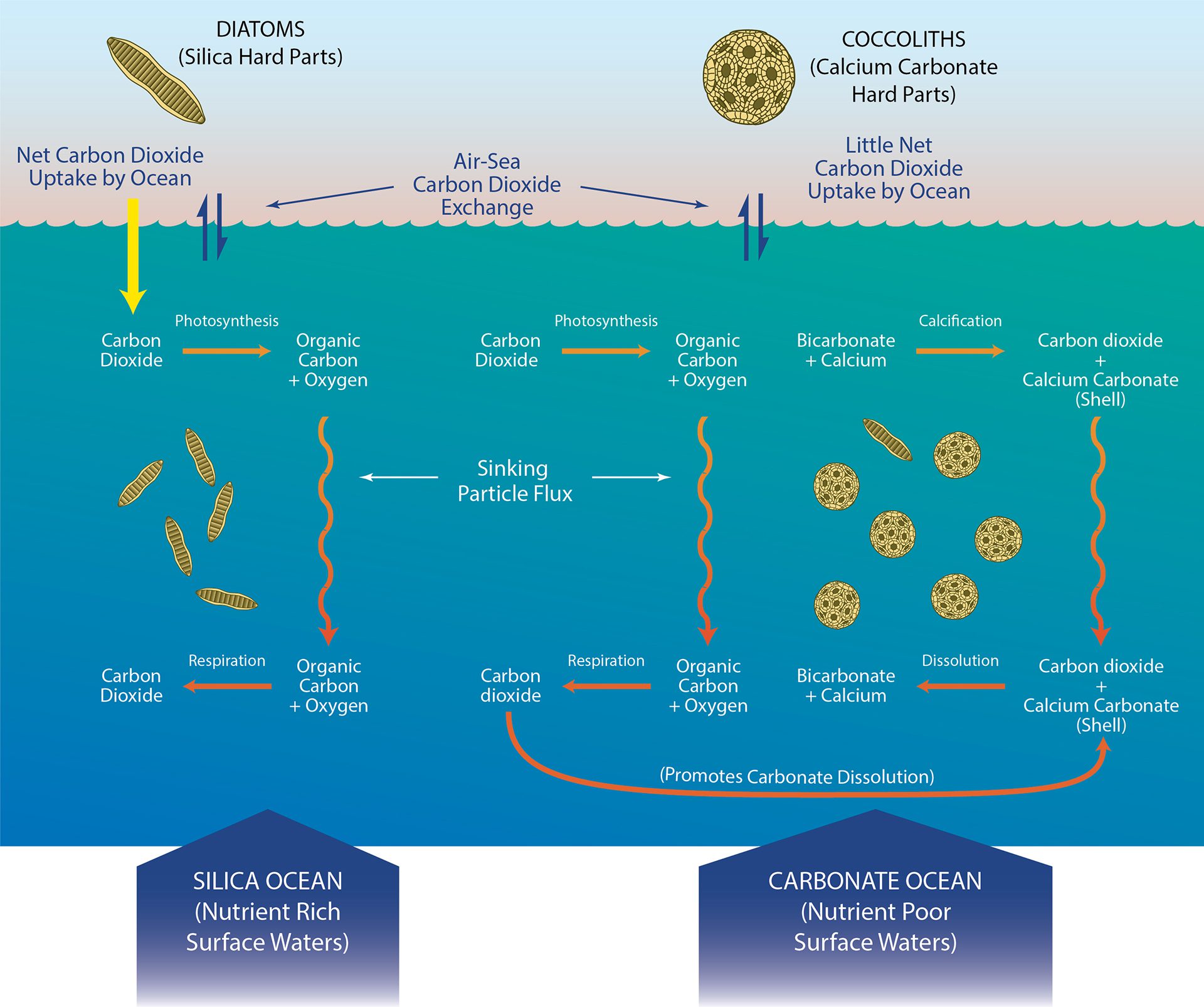
Conditions that influence how diatoms and coccoliths removal of carbon-dioxide — from the atmosphere to the deep ocean.
Read MoreDrawing of Timoides agassizii by Henry Bigelow
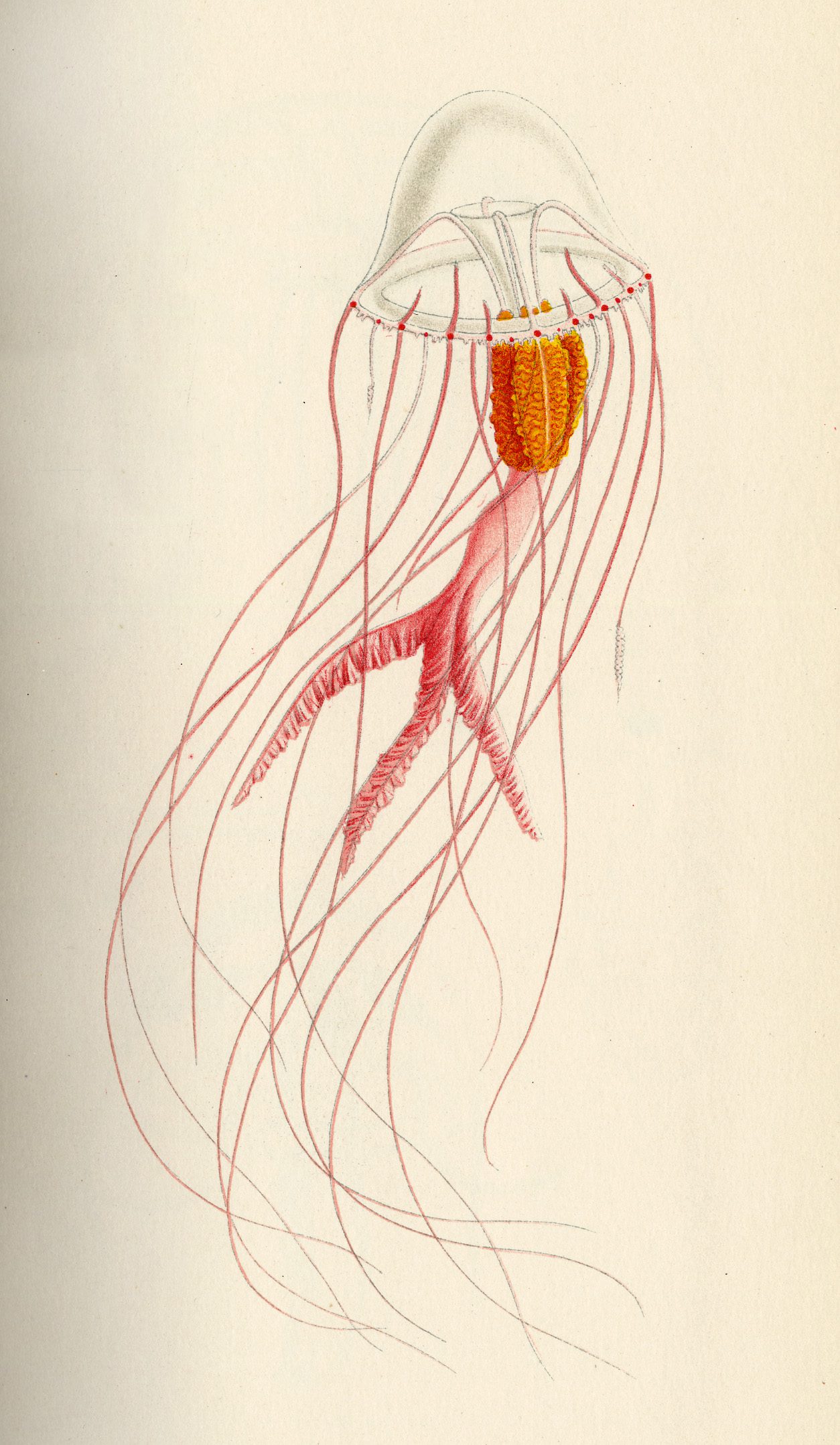
Henry Bigelow, WHOI’s founding director, began his oceanography career on a 1901 Maldives expedition, where he studied and sketched gelatinous sea life.
Read MoreKuroshio Current: Both highway and barrier for Fukushima radiation
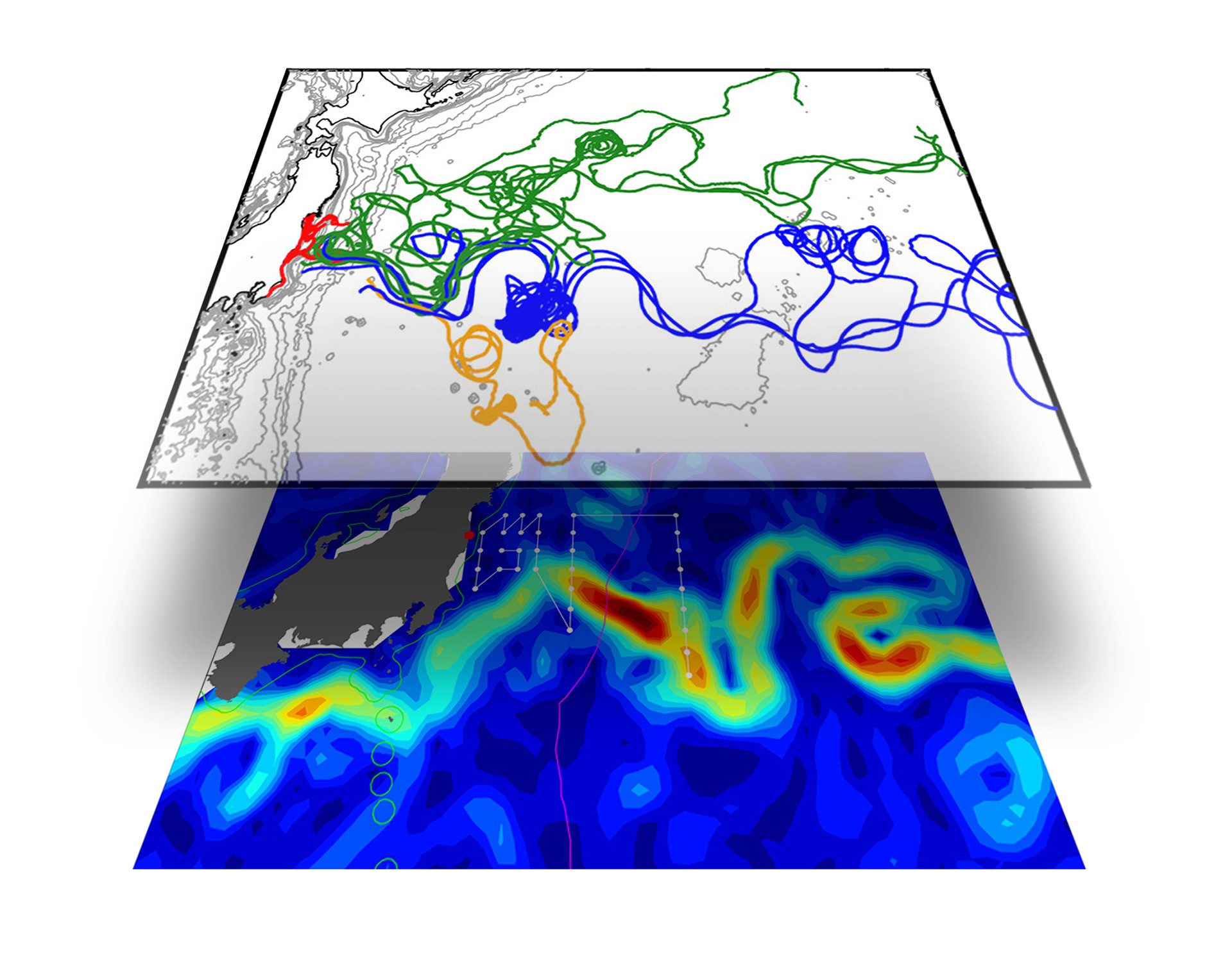
Map of drifter flow lines overlaid on the Kuroshio Current shows how Fukushima disaster radiation was swept away from shore, but blocked from flowing South.
Read MoreDTAG data plot showing whale could dive deeper after disentanglement
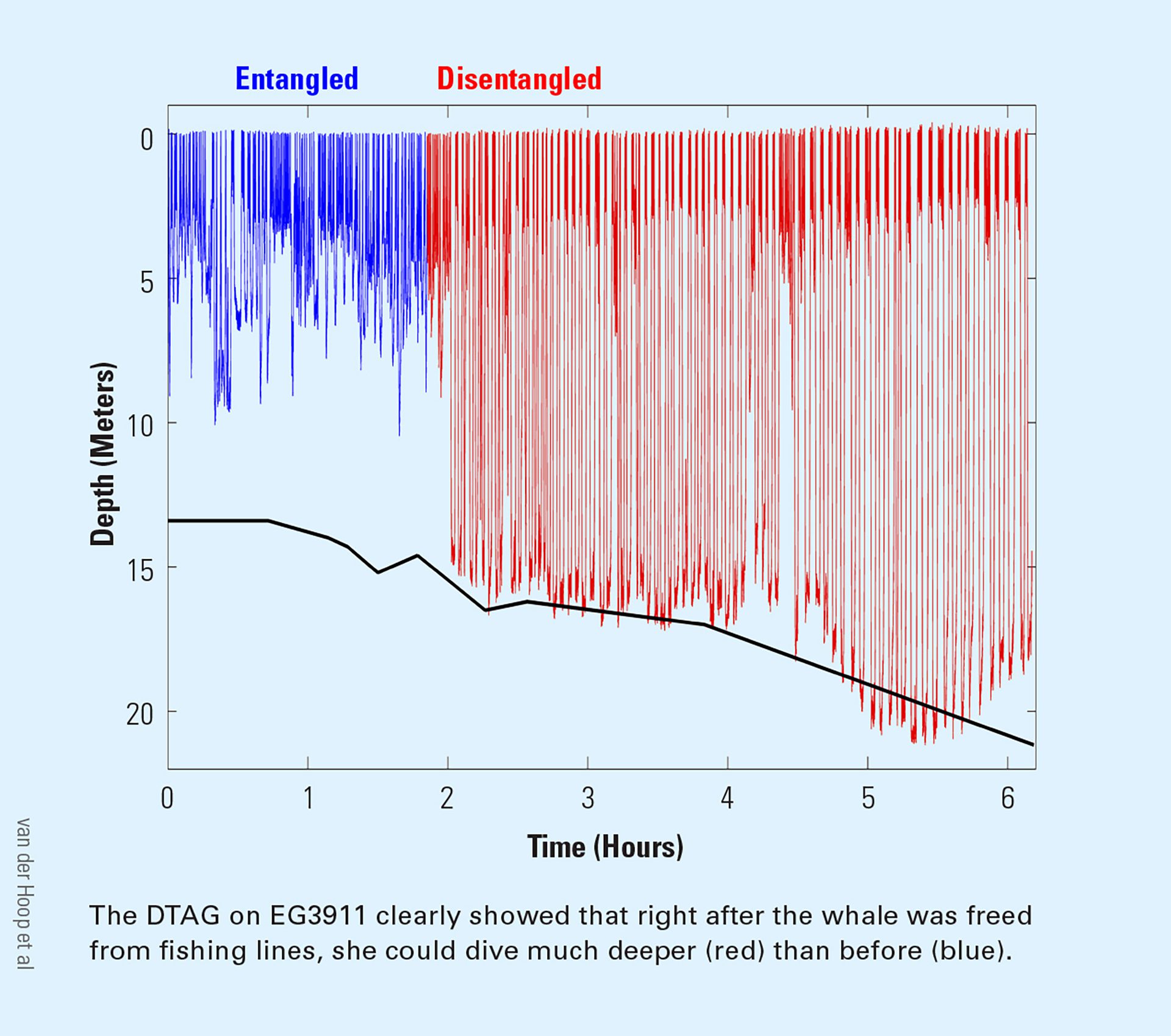
Tracking showed an entangled right whale dove shallowly, but after rescue, dove much deeper—revealing how gear hinders whale movement and effort.
Read MoreSharks ride eddies to the depths
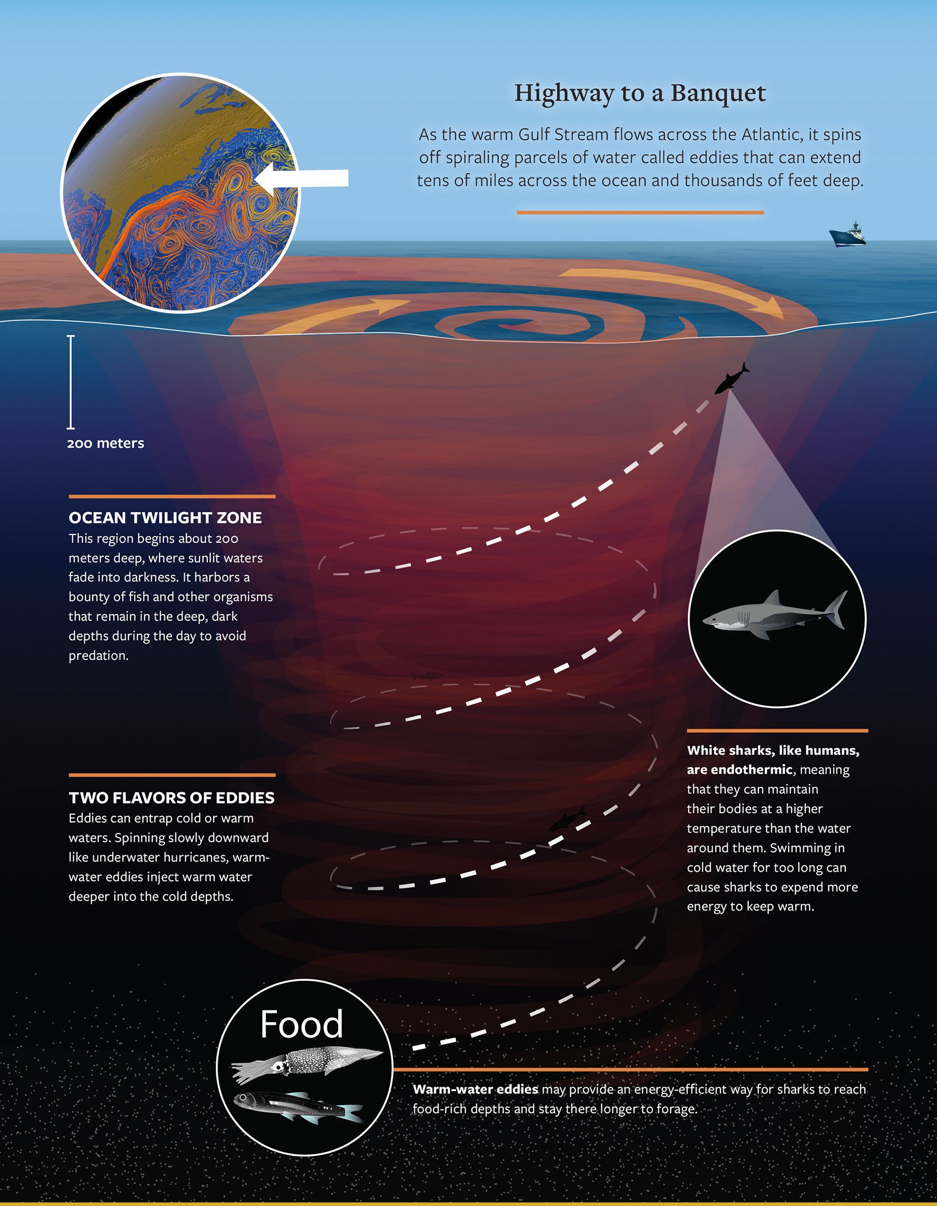
White sharks in the open ocean seem to seek out eddies for a surprising reason: The eddies offer a beeline to a banquet of food.
Read MoreEffects of light penetrating the ocean
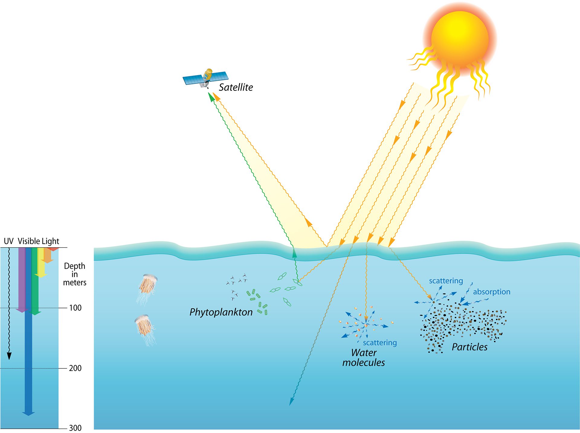
Phytoplankton absorb red and blue light but reflect green, which satellites can detect—revealing life and particles in sunlit ocean surface waters.
Read MoreEl Nino
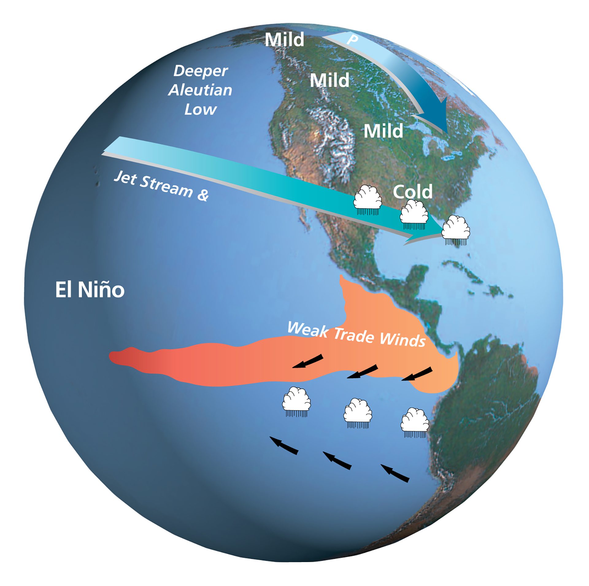
Global map illustrating changes in sea surface temperatures, wind, and weather patterns that define an El Niño event.
Read MoreEruptions along the North American Plate and Yellowstone hotspot

The North American Plate has slowly moved westward over an active magma chamber, leaving a trail of past eruptions. The hotspot now lies beneath Yellowstone Park.
Read MoreTitanic debris-field
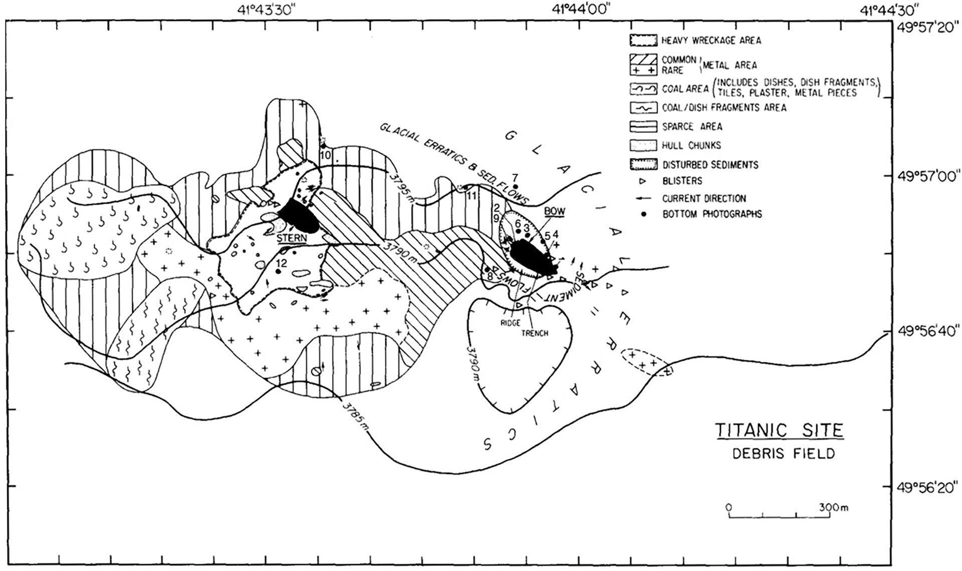
First map of Titanic shipwreck debris field, provides a detailed layout of the scattered remains, seafloor/ocean characteristics and existing photographs.
Read MoreBiomass of mesopelagic organisms in Ocean Twilight Zone (OTZ)
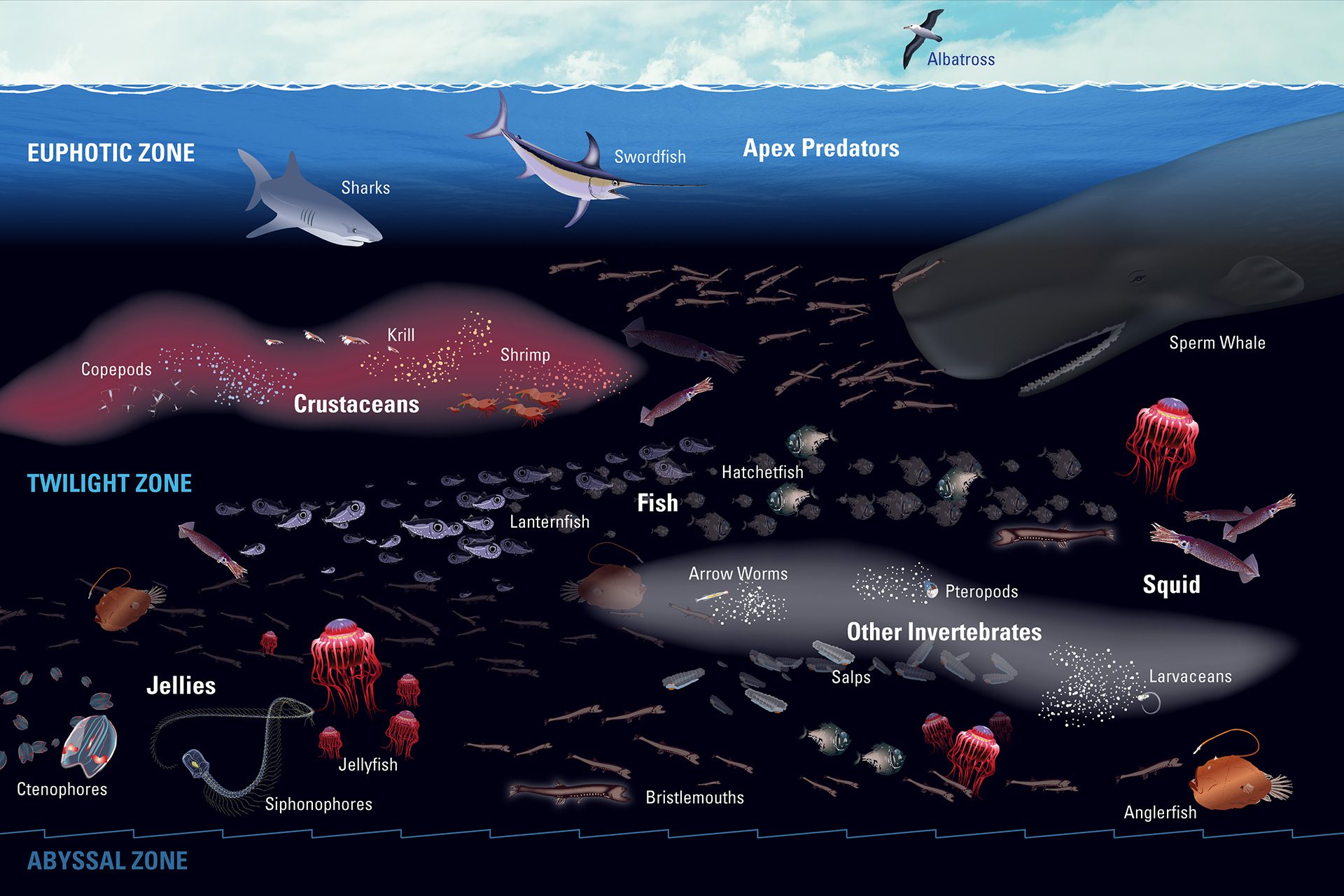
The ocean twilight zone hosts Earth’s largest animal migration and plays a key role in the climate by helping move carbon from the surface to the deep sea.
Read MoreCarbon drawn into the ocean by plankton sinks and dissipates with depth
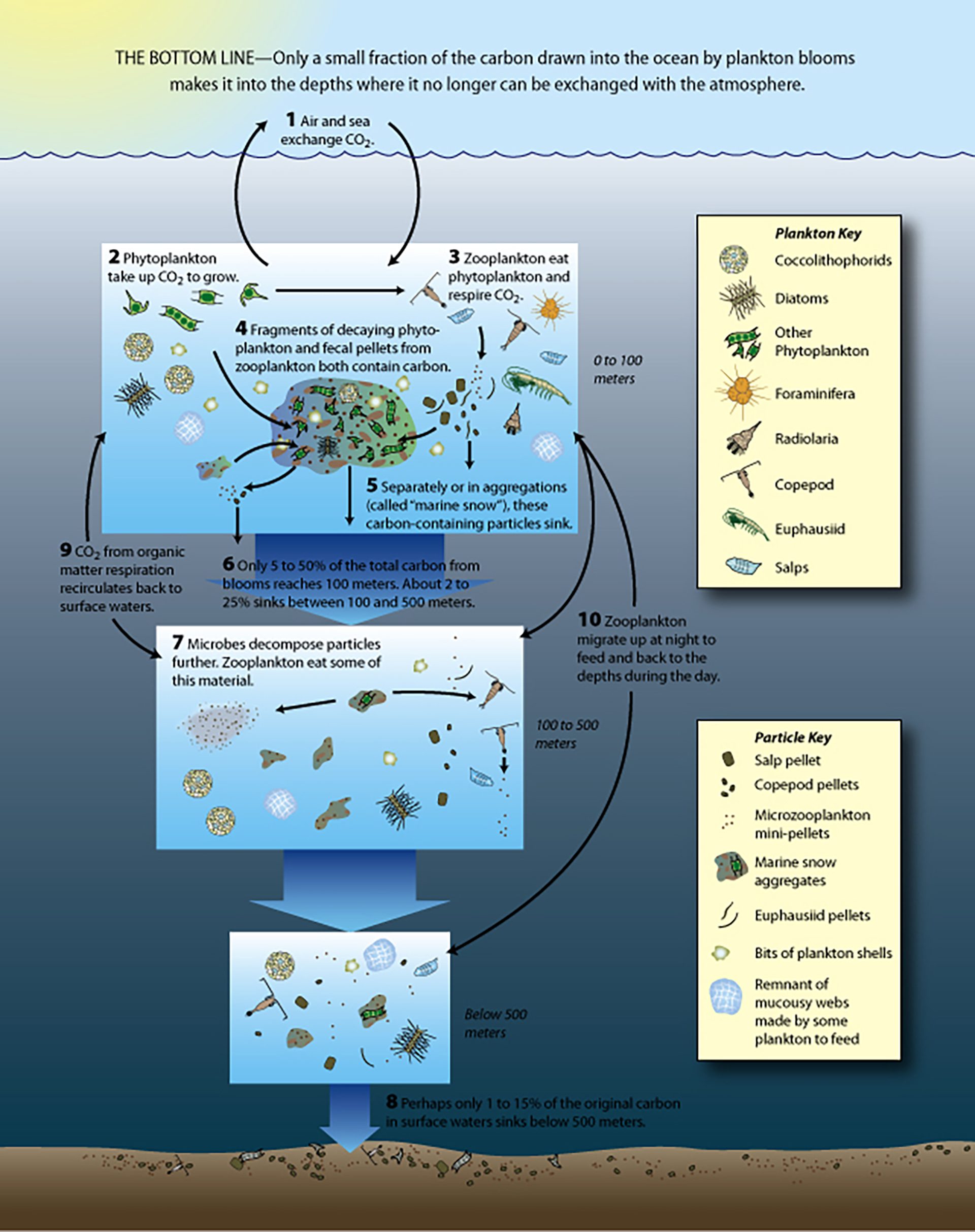
Only a small fraction of the carbon drawn into the ocean by plankton blooms makes it into the depths where it no longer can be exchanged with the atmosphere.
Read MoreCarbon emissions projection featuring possible reduction methods called "wedges"
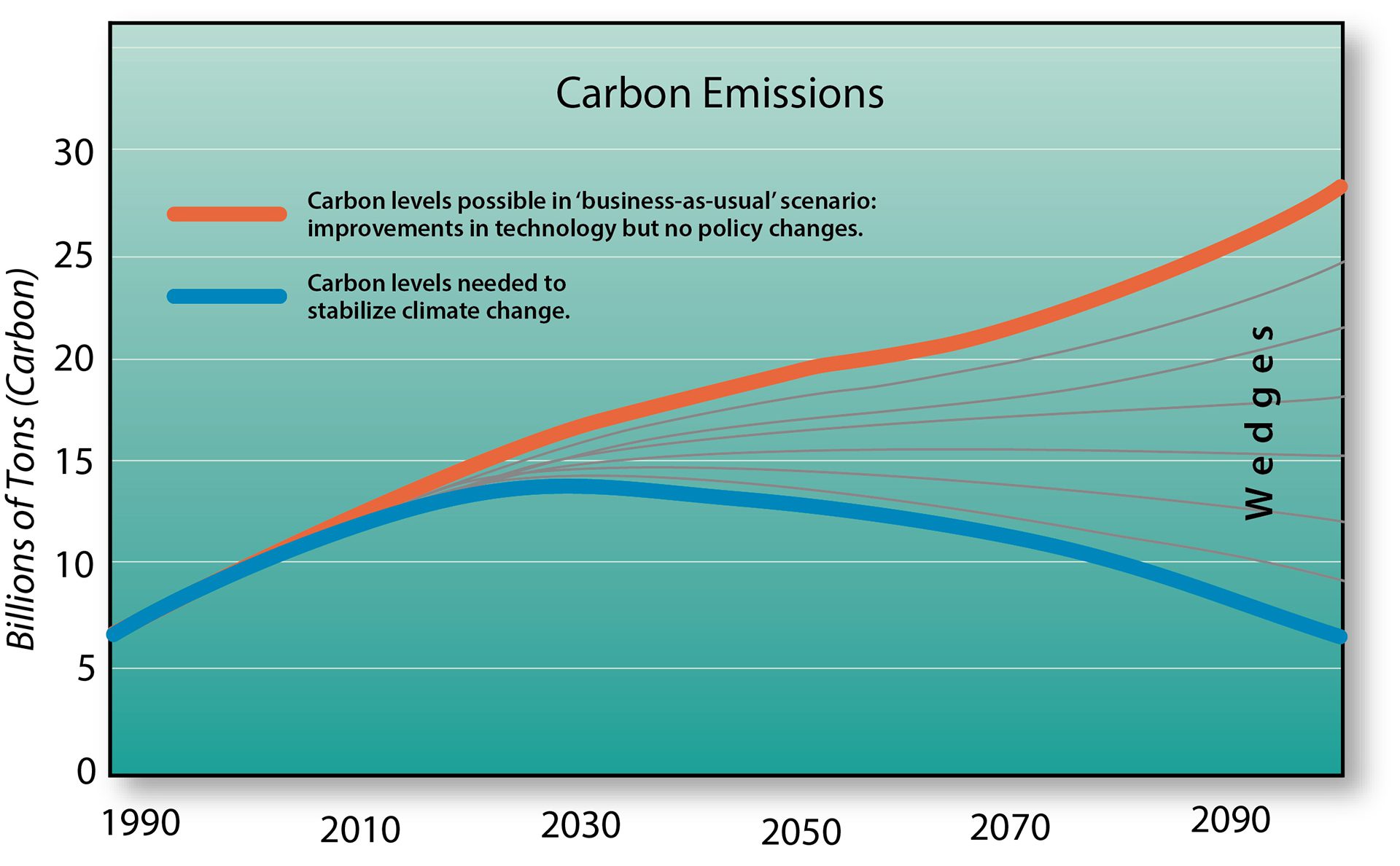
Without climate action, emissions will keep rising. To close the gap, multiple solutions—including ocean iron—may be needed to reach carbon reduction targets.
Read MoreCarbon without Borders, conventional vs sustainable farming
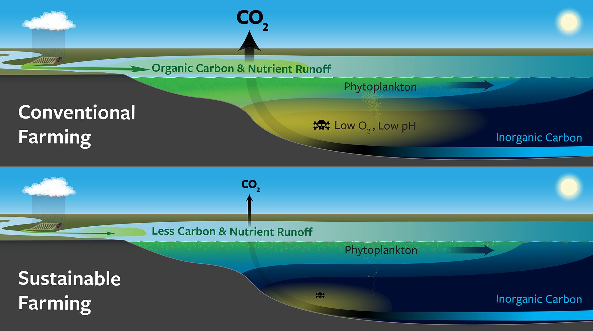
This illustration shows the difference between conventional and sustainable farming on land, and how that affects carbon and pH levels in the ocean.
Read MoreCarbon-14 natural cycle
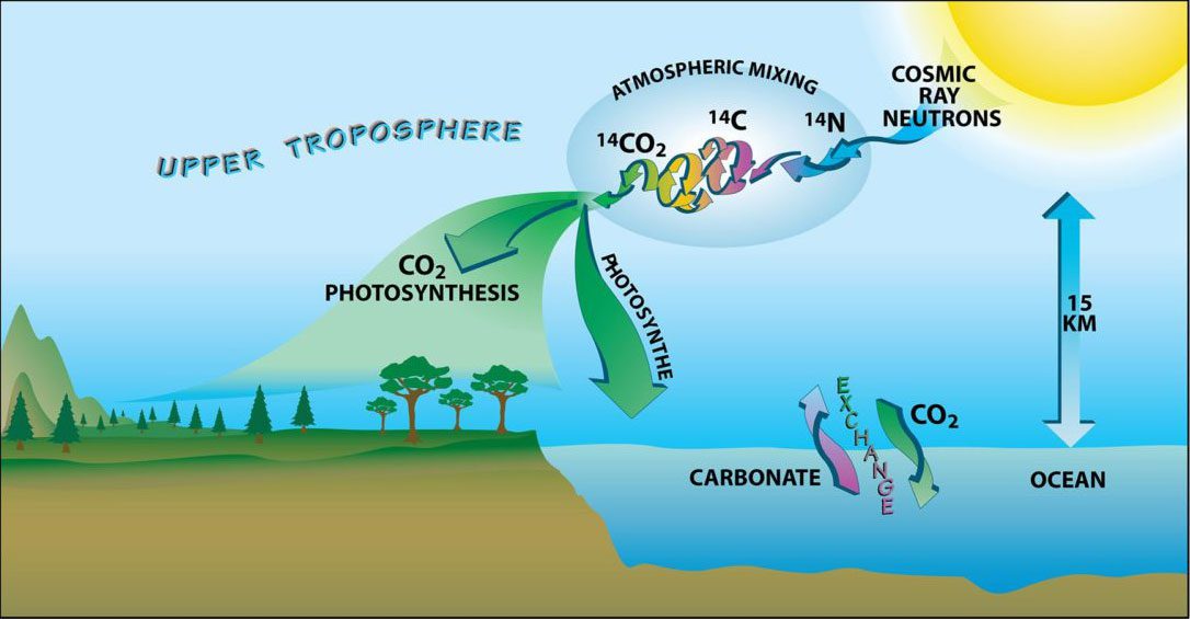
An illustration showing the natural carbon-14 cycle through the atmosphere, land and ocean.
Read MoreChemical process by which phytoplankton and harmful algal blooms grown
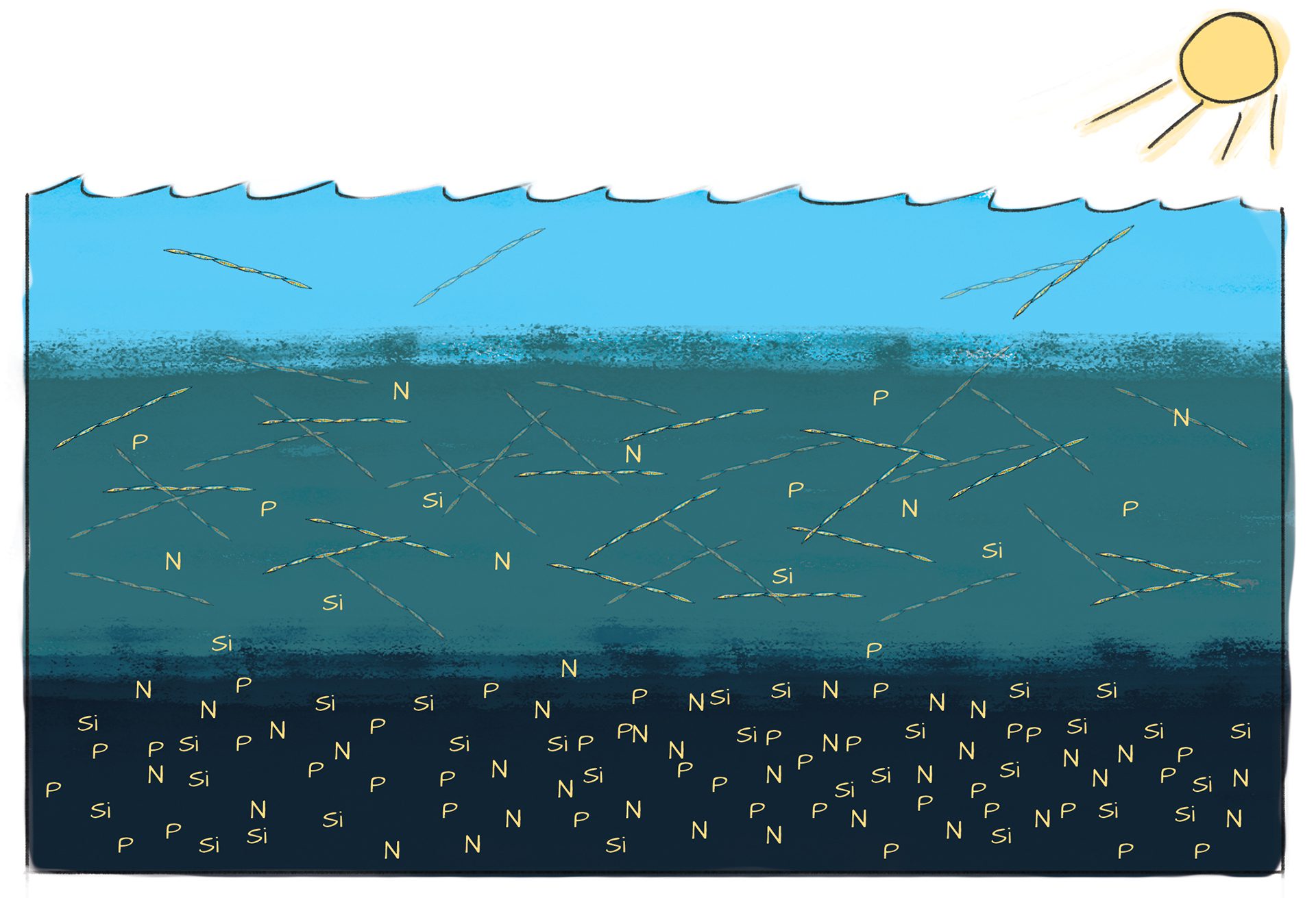
Phytoplankton thrive where sunlight and nutrients overlap—often just below the surface—creating a “sweet spot” for growth that fuels ocean life and ecosystems.
Read MoreCiguatera Fish Poisoning cycle
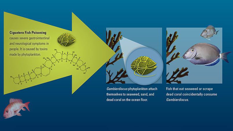
Ciquatera fish poisoning, caused by toxins made by phytoplankton, can cause several gastrointestinal and neurological symptoms in people.
Read MoreCO Solubility Pump
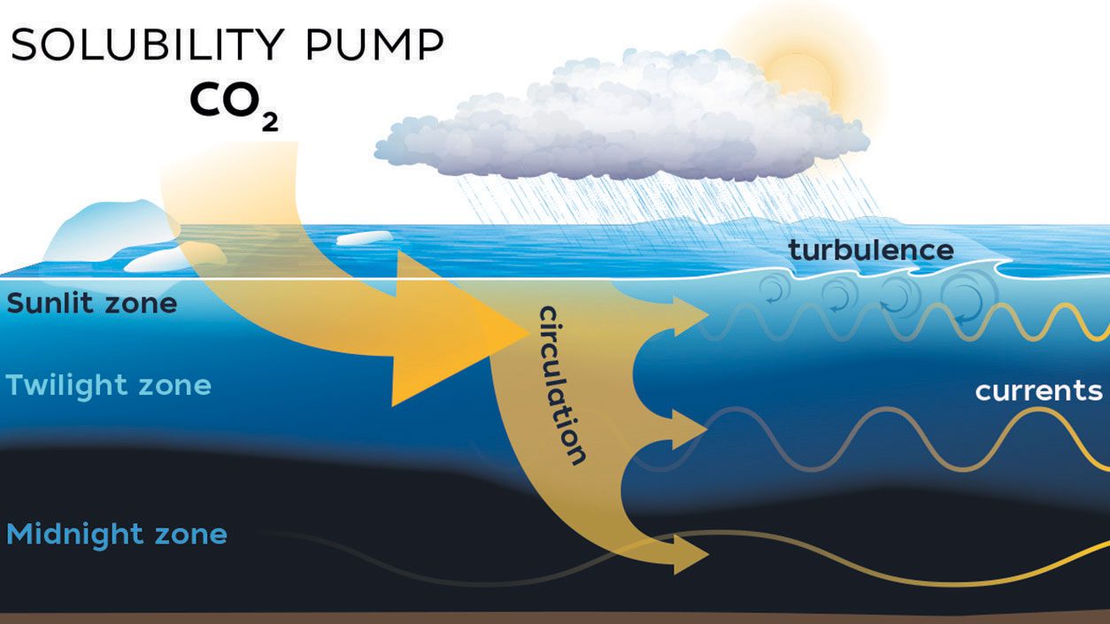
Cold seawater absorbs CO? from the atmosphere, which sinks to the deep ocean via circulation, storing carbon long-term in the solubility pump process.
Read MoreComparing carbon loss considering different sunlight penetration depths
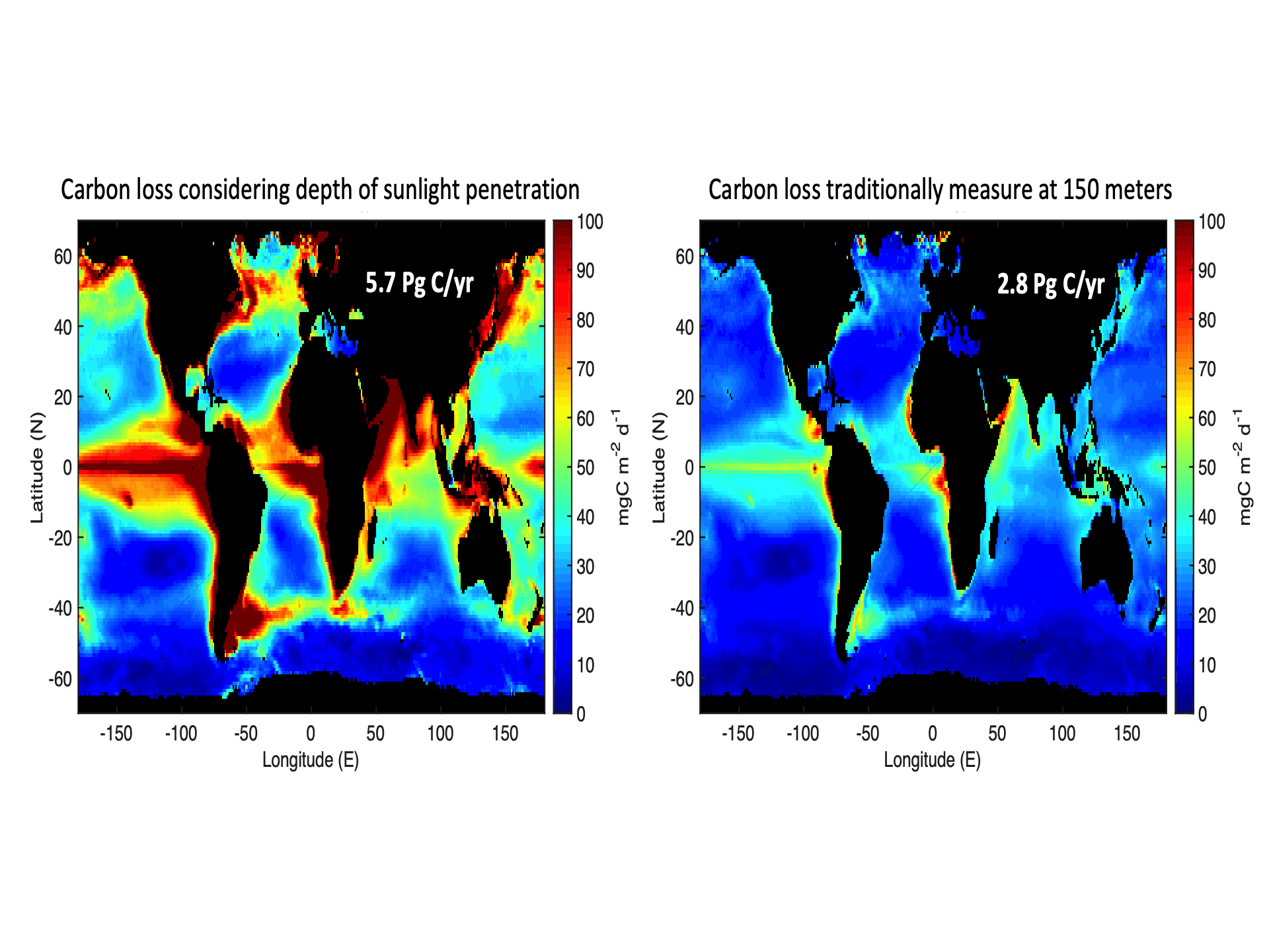
Global maps of ocean carbon estimates highlighting the need to account for sunlight (Buesseler et al., 2020).
Read MoreComparison of oil dispersant effectiveness in different weather
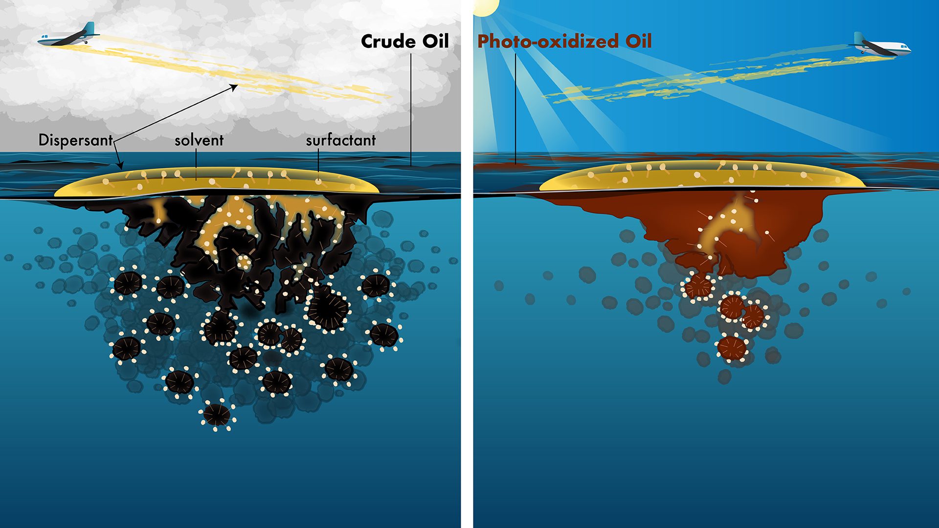
Sunlight changes oil chemistry on the ocean surface, reducing dispersant effectiveness by limiting how well surfactants break oil into small droplets.
Read MoreComparison of radioactivity sources in the ocean
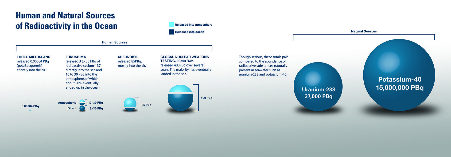
The background level of radiation in the ocean varies around the globe. The primary source has been nuclear weapons testing in the Pacific Ocean.
Read MoreTransport of microplastics in the North Atlantic
Global maps illustrating how microplastics may travel through the North Atlantic and Arctic, based on global transport simulations.
Read MoreConceptual cross-section view of Yellowstone Lake geothermal dynamics
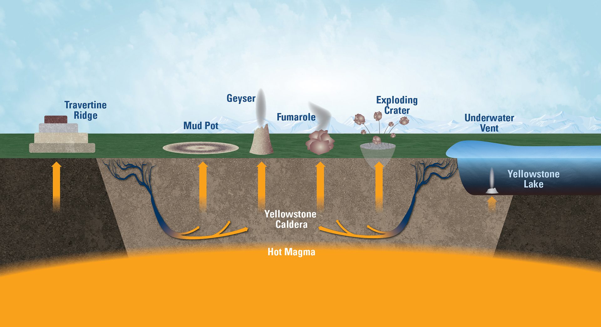
Yellowstone’s colorful pools and geysers are surface features of a vast geothermal system that stretches beneath the northern half of Yellowstone Lake.
Read MoreConfiguration of tsunami warning pressure sensor system
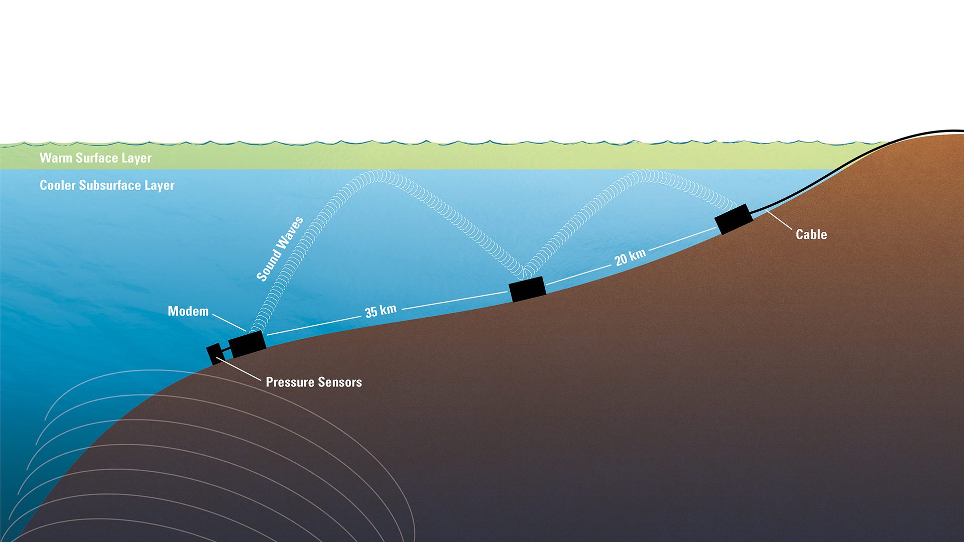
Tsunami pressure sensors send underwater sound signals that bounce off warm surface layers to relay stations, triggering alerts sent to officials on shore.
Read More