
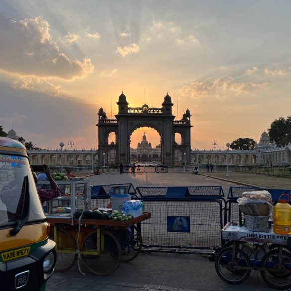
A sunset peppered with cumulus clouds over the renowned palace of Mysore, India. Photo provided by Alex Kinsella.
by Alex Kinsella
Every year around the beginning of June, a huge shift occurs in the ocean and atmosphere as the northern hemisphere’s monsoons roar back to life. The South Asian summer monsoon is the rainy season over the Northern Indian Ocean and adjacent countries and is the largest weather system on Earth. It provides over 70% of the annual rainfall in India, including over 90% in central India, where staple crops are primarily grown. WHOI scientists have participated in multiple field campaigns designed to study the South Asian monsoon. Aboard research vessels, they have gathered oceanic and atmospheric data in the Bay of Bengal and the Arabian Sea, the two portions of the Northern Indian Ocean that lie on either side of the Indian peninsula. These ocean regions together contribute to driving the monsoon by transferring heat and moisture from the sea surface to the overlying air. Although the monsoon is known primarily for its effects on the atmosphere — prodigious rain and high winds — it is an ocean phenomenon as well, profoundly affecting the temperature, salinity, and currents in the northern Indian Ocean. I recently traveled to India for four weeks, not at sea this time but instead collaborating with scientists on land, researching the interaction between ocean and atmosphere to get to the bottom of how the monsoon changes in strength throughout the summer season.
I spent my first two weeks at the Indian Institute of Tropical Meteorology (IITM) in Pune, a city in the lee of the Western Ghats, the north-south mountain range along India’s western coast that receives copious amounts of rainfall during the monsoon season. The mountains force the westerly winds upward as they come ashore, wringing out the moisture carried by the wind from the Arabian Sea or even more distant ocean regions. In the pre-monsoon season, when I visited, Pune is dry and the hills are brown. But as the summer monsoon arrives, the mountains will grow lush with greenery and waterfalls.
IITM is a government research lab where scientists study the monsoon, climate change, and the tropical atmosphere. I was visiting to discuss my work in collaboration with Dr. Amala Mahadevan, a senior research scientist at WHOI, on the role of sea surface temperatures in driving the South Asian monsoon. The thunderstorms that comprise the monsoon feed off the warm waters of the Bay of Bengal, whose surface generally stays above a balmy 28 degrees Celsius (82 degrees Fahrenheit) for the whole monsoon season. The surface temperatures of the bay respond in turn to the storms, whose winds cool the bay by evaporating surface water and whose clouds block incoming sunlight. As stormy weather travels up the bay, it creates north-south gradients in sea surface temperature. These gradients can encourage the further development of the unsettled weather, and the envelopes of storms eventually reach land, bringing active periods of nourishing rainfall. I presented my work to the scientists at IITM, benefitting from their feedback and insights. I also learned more about their work, which focuses on predicting the behavior of the summer monsoon rainfall all the way from the current season to decades away. Several groups at IITM are developing models that generate monsoon forecasts on different timescales by simulating its seasonal development as well as its interaction with various oscillations in the ocean and atmosphere. Such forecasts are critical for informing policy and agriculture decisions in this region that is sustained by regular summer monsoon rainfall.
The second half of my trip was spent at the International Center for Theoretical Sciences on the outskirts of Bangalore, situated on a beautiful tree-covered campus interspersed with blackboards surrounded by chalk-wielding physicists. I was there along with Dr. Mahadevan to collaborate with Professor Rama Govindarajan, an expert in fluid mechanics, on some basic questions about how raindrops behave within clouds. We were working on a question so fundamental it sounds silly: how can clouds rain? This question has vexed the cloud physics community for decades, because it is still not clear how a raindrop can grow from a microscopic size to the large droplets that we experience in everyday rainstorms. It is generally thought that turbulent eddies — small, vigorous swirls of air — are responsible for the growth of the droplets in this critical size range, but these are so small that they are nearly impossible to measure directly and also difficult to simulate. Our collaboration is trying to quantify when this turbulence may aid or hinder rain formation, with possible applications to the clouds that generate the rainfall of the South Asian monsoon. Oceanic clouds are the ideal laboratory for this study, because they form in cleaner air than land-based clouds, which makes it easier for them to rain. Thus, we have been collating data from previous oceanic field work campaigns, searching for the connection between turbulence and rain.
And there are connections beyond the obvious: the problem of studying the distribution of sizes of raindrops within a cloud is in many ways parallel to the study of the distribution of particulate organic matter in the ocean, meaning the aggregation of tiny dead creatures and fecal matter that slowly sinks through the water to the deep ocean. When this biological matter sinks, it exports carbon from the surface ocean to the deep, making it an important part of the ocean carbon cycle. But the speed of the sinking depends on the size of the particles, so again we have a research area where we want to understand how the sizes of particles in a fluid are determined and also how they change over time. That sounds like raindrops! If tools from one discipline can be made useful in the other, we may discover new conceptual links between vastly different parts of the climate system.
Soon I will head to India again, this time for a three-week research cruise on the Arabian Sea to study the interaction of the ocean and atmosphere just after the onset of the monsoon. I had a wonderful time visiting and collaborating on land, and now I can’t wait to see a new ocean and experience the glory of being within the monsoon at sea. With the storm clouds above and the monsoon winds at our backs, we’ll continue to gather the data that’s illuminating how the atmosphere and the ocean work together to sustain the lives of billions of people.
Above is a timelapse of 45 minutes of cumulus cloud activity (sped up by a factor of 100) from a balcony at the International Center for Theoretical Sciences in Bangalore, India. Notice the lenticular “cap” cloud that appears on the left around the 11 second mark, just before the cloud takes off upward. This is a sign of a very strong updraft. Over the ocean, some of these clouds likely would have produced rainfall.