WHOI Science Mission to Study Deepwater Horizon Spill Using Mass Spectrometry and AUV Sentry
June 23, 2010
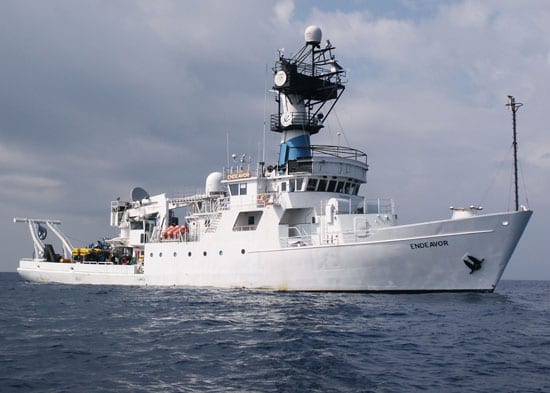
A multidisciplinary team of investigators from Woods Hole Oceanographic Institution embarked June 17 on a twelve-day research effort in the Gulf of Mexico aboard the R/V Endeavor, conducting three simultaneous projects funded through the National Science Foundation (NSF) “RAPID” program.
The projects aim to characterize subsurface oil plumes extending from the Deepwater Horizon well head using novel technology and the latest in biogeochemical techniques. The research should help answer looming questions about the fate of oil released into the water, examining the physical extent, chemical composition, and biological impact of subsea plumes.
“The project has been implemented in a remarkably short period of time, deploying some of the most advanced technology available for underwater chemical sampling, and underwater autonomous vehicles,” said Phillip Taylor, acting director of NSF’s Division of Ocean Sciences. “The effort is another example of research scientists stepping up quickly to address the crucial and challenging questions about the fate and environmental consequences of the spilled oil.”
Four WHOI principal investigators will each focus on different but complementary problems associated with the oil spill.
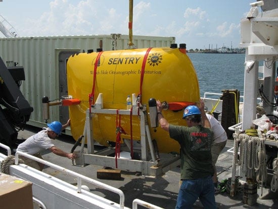
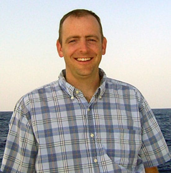
In addition to coordinating all the research efforts, the expedition’s Chief Scientist, Rich Camilli will use underwater mass spectrometers called TETHYS on two subsea platforms — an enhanced water sampler or CTD rosette and the autonomous underwater vehicle (AUV) Sentry — to investigate underwater hydrocarbon plumes.
Unlike most mass spectrometers, which are quite large—sometimes the size of a small house, TETHYS is one of the smallest mass spectrometer designs in the world –- it can fit within a shoebox. Camilli developed the instrument in close industrial partnership with Monitor Instruments Co., through a grant from the National Ocean Partnership Program. The TETHYS design is capable of identifying minute quantities of petroleum and other chemical compounds in seawater instantly, and has used it to help federal agencies with oil spill cleanup efforts in the Gulf of Mexico following hurricanes Katrina and Rita.
“Everyone understands the stakes. Our effort draws upon the excellent work of many scientists and researchers throughout the country,” said Camilli. “We have studied archived oil spill reports stretching back over 40 years, and have received data and advice from colleagues at other institutions who have recently surveyed the site. Over the coming two weeks our team will build on their results using our own unique scientific tools to better understand the spill’s extent, composition, and impact in the marine subsurface.”
WHOI Senior Scientist Dana Yoerger, a robotic vehicle specialist and a principal developer of the autonomous underwater vehicle (AUV) Sentry (its development supported through a grant by the NSF), has been working closely with Camilli to integrate TETHYS into Sentry as a payload sensor, enabling chemical measurements to be used as a guidance system for the vehicle.
“We will be applying techniques that we developed under a NASA-sponsored research program to search autonomously for environments capable of supporting life. These same techniques are applicable for characterizing this environmental threat,” said Yoerger.
This capability, combined with the vehicle’s maneuverability, enables Sentry to follow the hydrocarbon signal throughout the water column and build three-dimensional maps of hydrocarbons in real time.
“The TETHYS payload on Sentry can be used to efficiently track plumes in the water column,” said Camilli, “not only to define their shape, but to ‘fingerprint’ the individual chemicals within the plume.”
The data they collect will be used by colleagues Chris Reddy and Ben Van Mooy, two WHOI chemists who are studying how oil degrades over time and distance from the source and how much is degraded by microbes. Armed with data collected by TETHYS and Sentry, the chemists will be better able to determine where to make important measurements using a CTD water sampler.
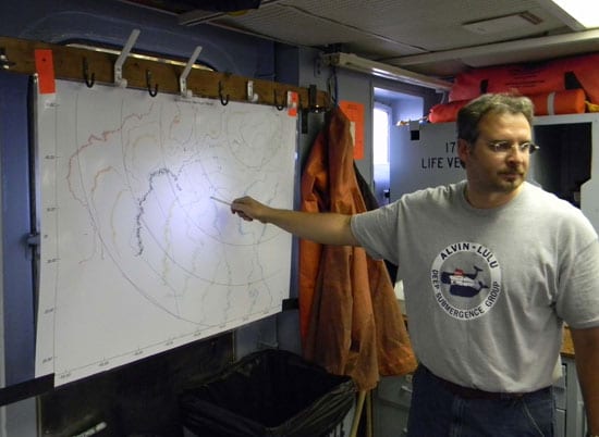
“TETHYS tells me where I want to invest my time,” said Reddy. “I’ll look at the map and decide where to take samples that will help answer lots of questions about the plume, such as: Has it changed in the middle? Has it changed at the edges? Is it mixing inside? and Why is it changing? Addressing such questions can shed light on the wide range of processes that may act on oil in the ocean and be applied to understanding this spill and planning for future ones.”
For Van Mooy, the samples will help him piece together how much of the oil is being eaten by microbes. “Natural microbial degradation plays an important role in the remediation of crude oil released into the ocean,” he said. “Yet microbes cannot survive on oil alone, they need nutrients from the water to grow and degrade the oil.”
Nutrients are thought to be scarce in surface waters, while by contrast, nutrients are likely to be abundant within the subsurface plume. “Work conducted during the Ixtoc disaster [in 1979] showed very clearly that nutrients played a huge role in regulating the extent of oil degradation,” added Van Mooy.
Understanding microbes’s ability to break down the oil from this spill and the role that specific nutrients play in that ability, could partially determine how long the oil will remain in the environment, and could point to novel remediation strategies.
The team will be accompanied by observers from the Environmental Protection Agency, U.S. Coast Guard, and NOAA as well as a representative from BP to oversee that the samples are collected and processed according to the natural resources damage assessment (NRDA) regulations.
The powerful combination of robotics, advanced sensors, and enhanced programming represents a novel approach to this kind of science. Camilli and Reddy call it the “hunter-gatherer” approach, where Sentry hunts for oil in the water and then the scientists use the CTD to gather appropriate samples. All told, the information will help tell the story of what has happened to the oil as it is released into the water a mile below the surface.
“It’s like balancing your checkbook,” Reddy said. “This much evaporated, this much biodegraded, this much dissolved into the water. We hope to track where all the compounds went.”
The team will share the information the collect with colleagues to help guide future sampling by other researchers who don’t have this technology.
“Oceanographers usually have a year or more to prepare for an expedition of this magnitude, but these are extraordinary times. We have gone from a concept to operational state in less than two weeks. It is a great credit to the National Science Foundation, University of Rhode Island, the numerous Federal agencies, our colleagues at WHOI and elsewhere, all working in high gear to make this expedition successful,” Camilli said.
The Woods Hole Oceanographic Institution is a private, independent organization in Falmouth, Mass., dedicated to marine research, engineering, and higher education. Established in 1930 on a recommendation from the National Academy of Sciences, its primary mission is to understand the oceans and their interaction with the Earth as a whole, and to communicate a basic understanding of the oceans’ role in the changing global environment.

