
News Releases
Re-envisioning Underwater Imaging
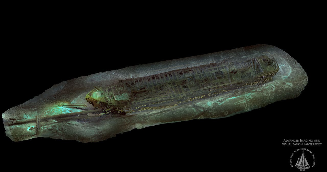
The Advanced Imaging and Visualization Laboratory (AIVL) at the Woods Hole Oceanographic Institution (WHOI) working with Marine Imaging Technologies has developed a revolutionary new multi-function, underwater imaging system capable of generating ultra-high definition television (UHDTV) video, 2-D mosaic imaging, and 3-D optical models of seafloor objects and environments. The new state-of-the-art technology is currently being field-tested on several submerged shipwreck sites in both the U.S. and Europe.
Read MoreVolcanic Arcs Form by Deep Melting of Rock Mixtures
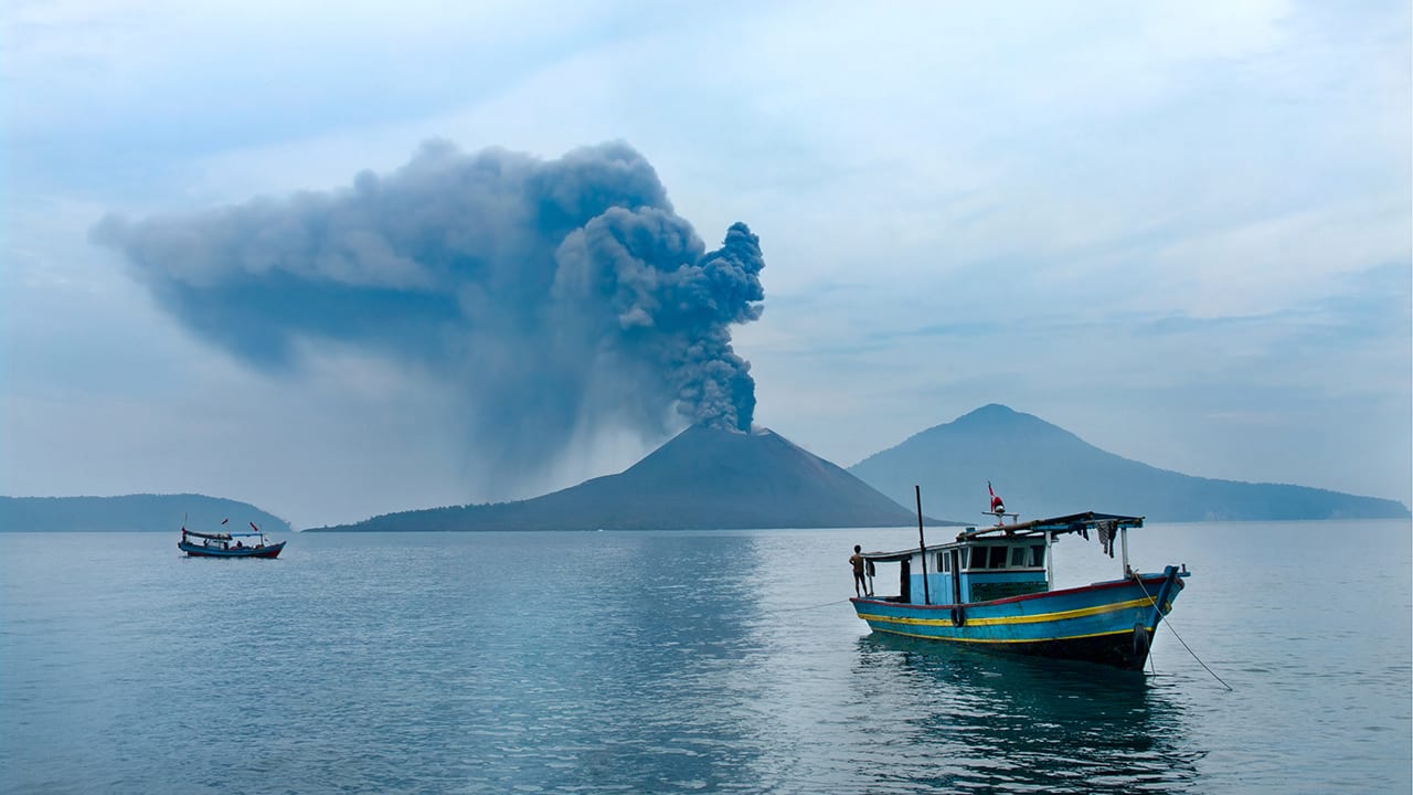
A new study published in the journal Science Advances changes our understanding of how volcanic arc lavas are formed, and may have implications for the study of earthquakes and the risks of volcanic eruption.
Read MoreAncient Skeleton Discovered on Antikythera Shipwreck
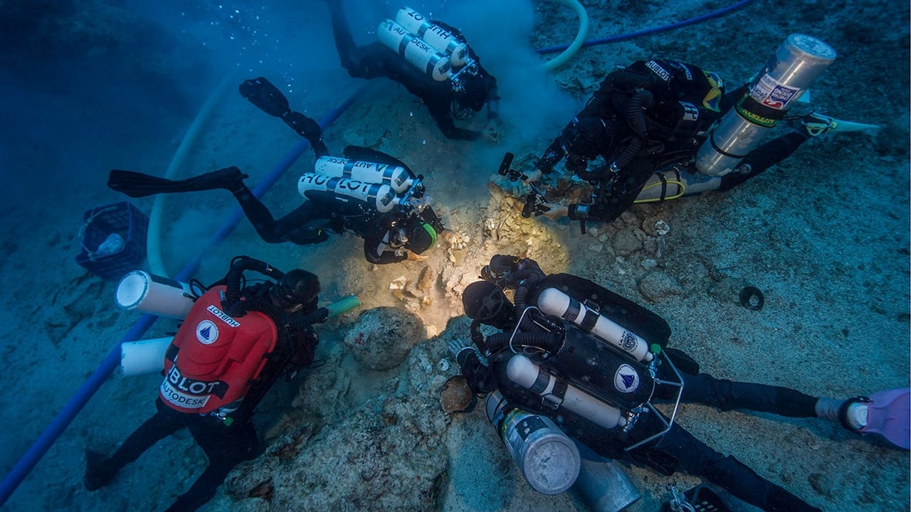
An international research team discovered a human skeleton during its ongoing excavation of the famous Antikythera Shipwreck (circa 65 B.C.) this month. The shipwreck, which holds the remains of a Greek trading or cargo ship, is located off the Greek island of Antikythera in the Aegean Sea. The first skeleton recovered from the wreck site during the era of DNA analysis, this find could provide insight into the lives of people who lived 2100 years ago.
Read MoreArtifacts Discovered on Return Expedition to Antikythera Shipwreck
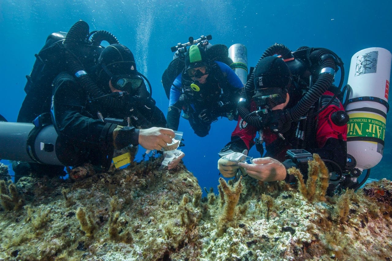
An international research team led by archaeologists and technical experts from the Hellenic Ministry of Culture and Sports and WHOI has discovered spectacular artifacts during its ongoing excavation of the famous ancient Antikythera Shipwreck off the Greek island of Antikythera in the Aegean Sea.
Read MoreWHOI Technology Used in Locating El Faro Data Recorder
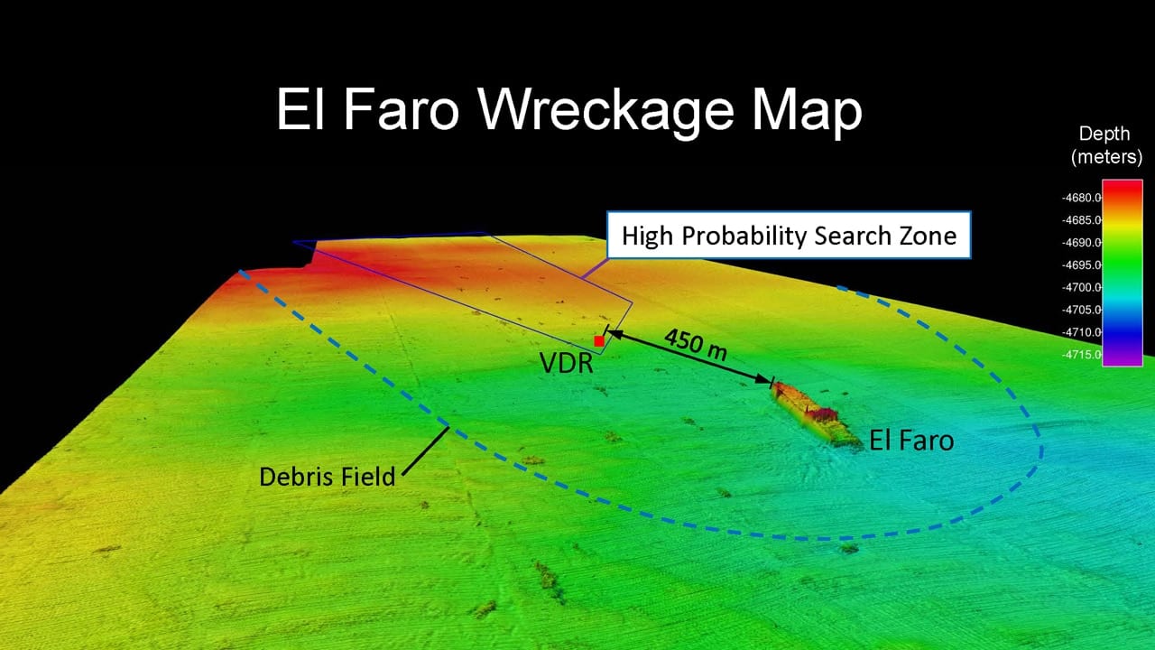
Technology and vehicles developed and operated by Woods Hole Oceanographic Institution (WHOI) scientists and engineers were instrumental in assisting the NTSB in locating the voyage data recorder (VDR) of El Faro.
Read MoreFukushima Site Still Leaking After Five Years, Research Shows
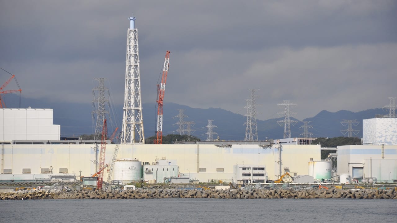
Five years after the Fukushima accident, scientific data about the levels of radioactivity in the ocean off our shores are available publicly thanks to ongoing efforts of independent researchers, including WHOI radiochemist Ken Buesseler, who has led the effort to create and maintain an ocean monitoring network along the U.S. West Coast.
Read MoreStudy Reveals Climate Change Impacts on Buzzards Bay
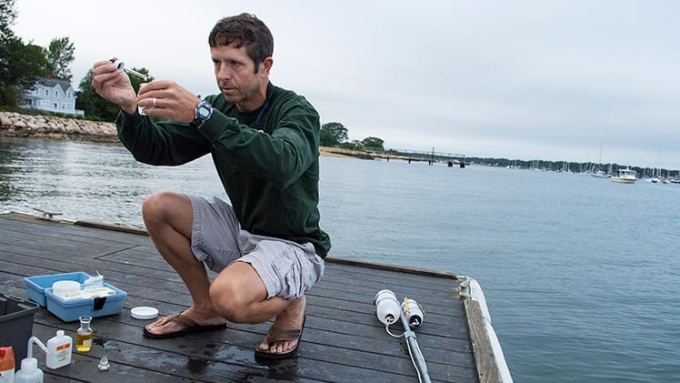
Utilizing 22 years of data collected by a network of citizen scientists, researchers from the Woods Hole Oceanographic Institution (WHOI) and their colleagues at the Buzzards Bay National Estuary Program, the Buzzards Bay Coalition, and the Marine Biological Laboratory found that average summertime temperatures in embayments throughout Buzzards Bay warmed by almost 2 degrees Celsius—roughly 4 degrees Fahrenheit.
Read MoreHigher Levels of Fukushima Cesium Detected Offshore
Scientists monitoring the spread of radiation in the ocean from the Fukushima nuclear accident report finding an increased number of contaminated sites off the US West Coast, along with the highest detection level to date, from a sample collected about 1,600 miles west of San Francisco. The level of cesium in the sample is 50 percent higher than other samples collected, but is still more than 500 times lower than US government safety limits for drinking water and well below limits of concern for direct exposure while swimming, boating, or other recreational activities.
Ken Buesseler, a marine radiochemist with the Woods Hole Oceanographic Institution (WHOI) and director of the WHOI Center for Marine and Environmental Radioactivity, was among the first to begin monitoring radiation in the Pacific, organizing a research expedition to the area just three months after the start of the ongoing accident. Through a citizen science sampling effort, Our Radioactive Ocean, as well as research funded by the National Science Foundation, Buesseler and his colleagues are using sophisticated sensors to measure minute levels of ocean-borne radioactivity from Fukushima. In 2015, they have added more than 50 new sample locations in the Pacific to the more than 200 previously collected and posted on the Our Radioactive Ocean web site.
Read MoreMarine Archaeologists Excavate Greek Antikythera Shipwreck
Archaeologists excavating the famous ancient Greek shipwreck that yielded the Antikythera mechanism have recovered more than 50 items including a bronze armrest (possibly part of a throne), remains of a bone flute, fine glassware, luxury ceramics, a pawn from an ancient board game, and several elements of the ship itself.
“This shipwreck is far from exhausted,” reports project co-Director Dr. Brendan Foley, a marine archaeologist with the Woods Hole Oceanographic Institution (WHOI). “Every single dive on it delivers fabulous finds, and reveals how the ‘1 percent’ lived in the time of Caesar.”
The shipwreck dates to circa 65 B.C., and was discovered by Greek sponge fishermen in 1900 off the southwestern Aegean island of Antikythera. They salvaged 36 marble statues of mythological heroes and gods; a life-sized bronze statue of an athlete; pieces of several more bronze sculptures; scores of luxury items; and skeletal remains of crew and passengers. The wreck also relinquished fragments of the world’s first computer: the Antikythera Mechanism, a geared mechanical device that encoded the movements of the planets and stars and predicted eclipses.
The 2015 expedition is part of a long-term research program at the site, which began in 2014. It was the first scientific excavation of the wreck, and launched the first comprehensive study of all of its artifacts. During the new multi-year program the team expects to recover artifacts and ancient artwork still buried in the seafloor, and recreate the history of the ship’s exquisite cargo and its final voyage.
Read MoreExamining the Fate of Fukushima Contaminants
An international research team reports results of a three-year study of sediment samples collected offshore from the Fukushima Daiichi Nuclear Power Plant in a new paper published August 18, 2015, in the American Chemical Society’s journal, Environmental Science and Technology. The research aids in understanding what happens to Fukushima contaminants after they are buried on the seafloor off coastal Japan.
Read MoreGulf of Maine Red Tide Bloom Expected to Be Similar to Past Three Years
New England’s spring and summer red tides will be similar in extent to those of the past three years, according to the 2015 Gulf of Maine red tide seasonal forecast. The forecast is the eighth seasonal Gulf of Maine red tide forecast funded by NOAA and issued by scientists from the Woods Hole Oceanographic Institution and North Carolina State University.
The forecast is part of a larger NOAA effort to deliver ecological forecasts that support human health and well-being, coastal economies, and coastal and marine stewardship.
Red tide, a type of harmful algal bloom (HAB) caused by the alga Alexandrium fundyense, produces a toxin that can lead to paralytic shellfish poisoning, which can result in serious or even fatal illness in humans who eat contaminated shellfish. In 2005, an unusually large red tide event caused $23 million in lost shellfish sales in Massachusetts and Maine.
Read MoreTrace Amounts of Fukushima Radioactivity Detected Along Shoreline of British Columbia
Scientists at the Woods Hole Oceanographic Institution (WHOI) have for the first time detected the presence of small amounts of radioactivity from the 2011 Fukushima Dai-ichi Nuclear Power Plant accident in a seawater sample from the shoreline of North America. The sample, which was collected on February 19 in Ucluelet, British Columbia, with the assistance of the Ucluelet Aquarium, contained trace amounts of cesium (Cs) -134 and -137, well below internationally established levels of concern to humans and marine life.
Read MoreNew Museum Program Focuses on Impacts of Fukushima on the Ocean
Four years after the Fukushima Dai-ichi nuclear power plant accident, Japan is still recovering and rebuilding from the disaster. In March 2011 one of the largest earthquakes ever recorded shook Japan, creating a devastating tsunami and damaging the Fukushima Dai-ichi nuclear power plant. The accident resulted in the largest unintentional release of radioactivity into the ocean in history.
On the fourth anniversary of the disaster, Woods Hole Oceanographic Institution (WHOI) and the Long Beach, CA-based Aquarium of the Pacific will debut a new program about ocean radioactivity motivated by the Fukushima nuclear accident. The program will be projected daily in the Aquarium’s Ocean Science Center on the National Oceanic and Atmospheric Administration’s (NOAA) Science on a Sphere® and will be made available to more than 100 institutions around the world through NOAA’s SOS Network with a capacity to reach over 50 million combined visitors.
Read MoreMonster hurricanes reached U.S. during prehistoric periods of ocean warming
Intense hurricanes, possibly more powerful than any storms New England has experienced in recorded history, frequently pounded the region during the first millennium, from the peak of the Roman Empire into the height of the Middle Ages, according to a new study. The findings could have implications for the intensity and frequency of hurricanes the U.S. could experience as ocean temperatures increase as a result of climate change, according to the study’s authors.
Read MoreFukushima Radioactivity Detected Off West Coast
Monitoring efforts along the Pacific Coast of the U.S. and Canada have detected the presence of small amounts of radioactivity from the 2011 Fukushima Dai-ichi Nuclear Power Plant accident 100 miles (150 km) due west of Eureka, California. Scientists at the Woods Hole Oceanographic Institution (WHOI) found the trace amounts of telltale radioactive compounds as part of their ongoing monitoring of natural and human sources of radioactivity in the ocean.
Read MoreStudy Provides Some Answers to Fate of Deepwater Horizon Oil
Nearly five years after the Deepwater Horizon explosion spilled roughly 200 million gallons of oil into the Gulf of Mexico, scientists are still working to answer the question: Where did all the oil go?
A paper published today in the Proceedings of the National Academy of Sciences provides a piece of the puzzle with an analysis of the oil that ended up on the seafloor, establishing its footprint, rough quantity and likely deposition mode, and pegging its source to that deep ocean plume of oil.
Read MoreStunning Finds from Ancient Greek Shipwreck
A Greek and international team of divers and archaeologists has retrieved stunning new finds from an ancient Greek treasure ship that sank more than 2000 years ago off the remote island of Antikythera. The rescued antiquities include tableware, ship components, and a giant bronze spear that would have belonged to a life-sized warrior statue.
Read MoreDavid Gallo Selected for Explorers Club Lowell Thomas Award

The Explorers Club has chosen David Gallo, Director of Special Projects at the Woods Hole Oceanographic Institution (WHOI), as one of the recipients of this year’s Lowell Thomas Award. He is among six recipients who will be honored for their “imagination in exploration” at a dinner on October 11, 2014, at the Bowers Museum in Southern California.
Read MoreDispersant from Deepwater Horizon Spill Found to Persist in the Environment
A new study by scientists at Haverford College and Woods Hole Oceanographic Institution (WHOI) has found that the dispersant compound DOSS, which decreases the size of oil droplets and hampers the formation of large oil slicks, remains associated with oil and can persist in the environment for up to four years.
Read MoreNew Sensor Array to Monitor Impacts of Changing Gulf of Maine Conditions on New England Red Tide
Scientists from the Woods Hole Oceanographic Institution (WHOI) are kicking off an innovative NOAA-funded pilot program using robotic instruments and computer modeling analysis to shed light on changing ocean conditions in the Gulf of Maine as they relate to the harmful algal bloom (HAB) phenomenon commonly known as the New England red tide.
Read MoreRadioactive Ocean Website a Success
With concern among the public over the plume of radioactive ocean water from Fukushima arriving on the West Coast of North America and no U.S. government or international plan to…
Read MoreHow Radioactive is Our Ocean?
Woods Hole Oceanographic Institution (WHOI) marine chemist Ken Buesseler began sampling and analyzing seawater surrounding the Fukushima Dai-ichi nuclear power plant three months after the 2011 disaster. Today, he launched…
Read MoreNew Explanation for Slow Earthquakes on San Andreas
New Zealand’s geologic hazards agency reported this week an ongoing, “silent” earthquake that began in January is still going strong. Though it is releasing the energy equivalent of a 7.0…
Read MoreNew Robotic Instruments to Provide Real-Time Data on Gulf of Maine Red Tide
A new robotic sensor deployed by Woods Hole Oceanographic Institution (WHOI) in Gulf of Maine coastal waters may transform the way red tides or harmful algal blooms (HABs) are monitored…
Read More