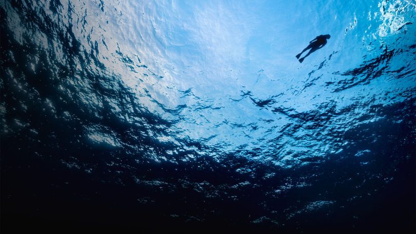
The unseen toll of war on science
As the changing climate accelerates the spread of toxic algal blooms in the Arctic, the Russia–Ukraine war is cutting off critical international collaboration needed to understand and protect vulnerable ecosystems and communities.

The human cost of Brazil’s floods
New research maps social vulnerability after the 2024 deluge

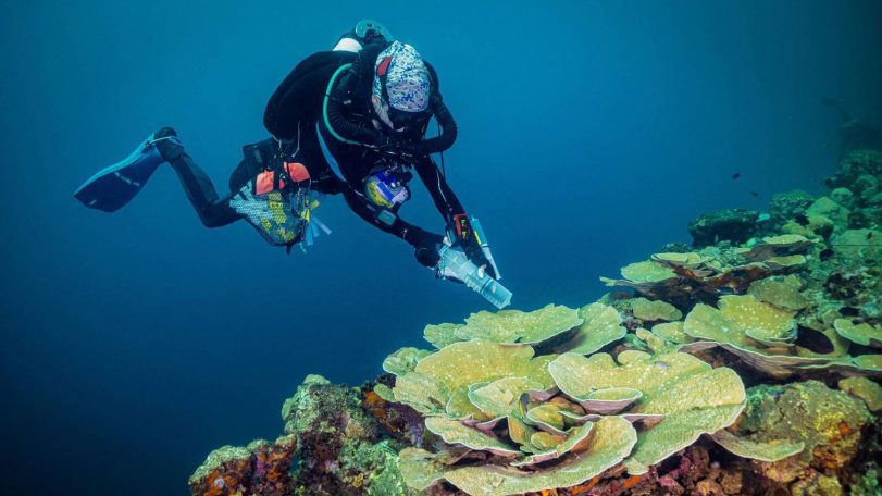
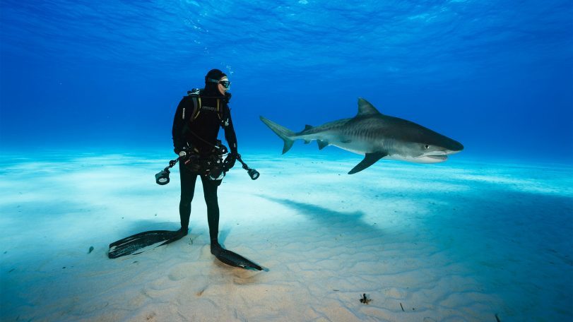
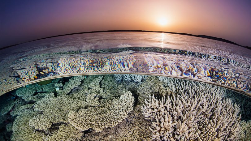
From ruin to reef
What Pacific wrecks are teaching us about coral resilience—and pollution
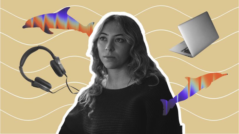
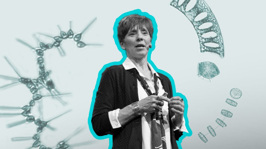
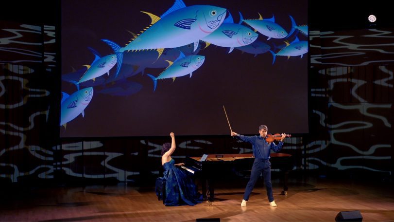
One researcher, 15,000 whistles: Inside the effort to decode dolphin communication
Scientists at WHOI analyze thousands of dolphin whistles to explore whether some sounds may function like words
Remembering Tatiana Schlossberg, a voice for the ocean
Environmental journalist and author Tatiana Schlossberg passed away after battling leukemia on December 30, 2025….
As the ocean warms, a science writer looks for coral solutions
Scientist-turned-author Juli Berwald highlights conservation projects to restore coral reefs
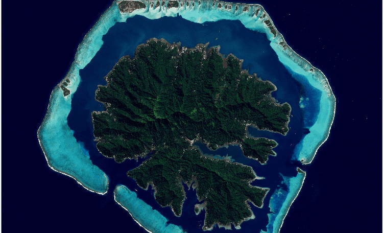
How an MIT-WHOI student used Google Earth to uncover a river–coral reef connection
Google Earth helps researcher decode how rivers sculpt massive breaks in coral reefs

and get Oceanus delivered to your door twice a year as well as supporting WHOI's mission to further ocean science.
Our Ocean. Our Planet. Our Future.
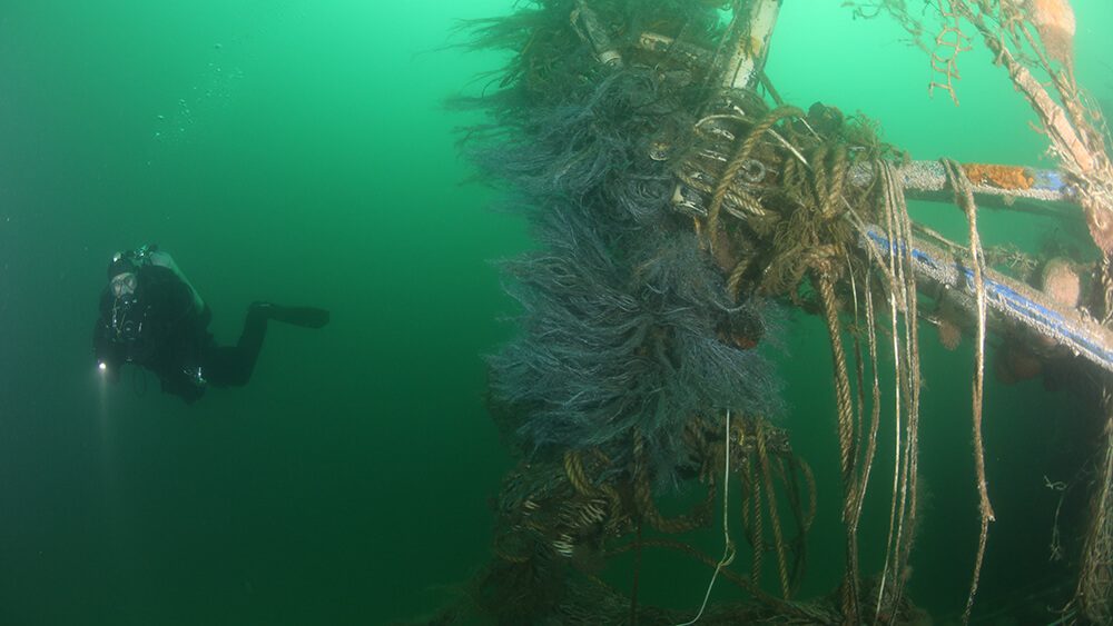
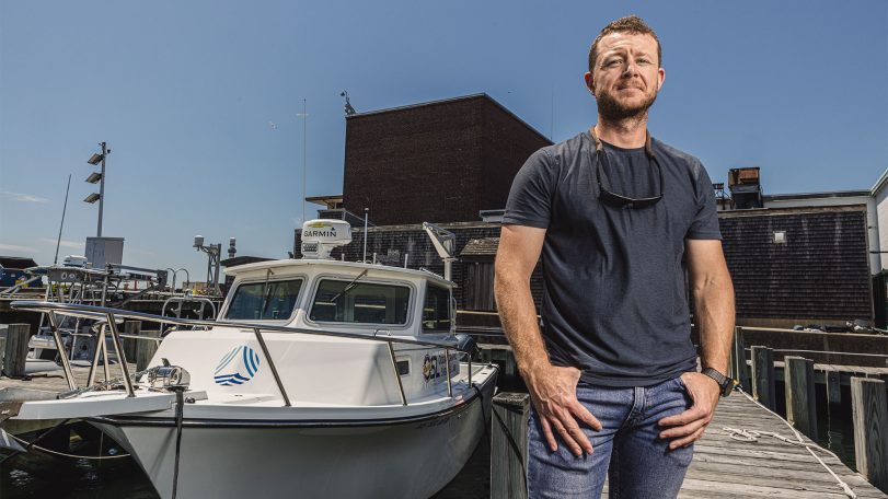
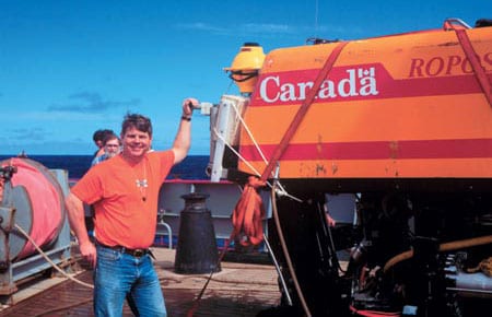
A new underwater robot could help preserve New England’s historic shipwrecks
WHOI’s ResQ ROV to clean up debris in prominent marine heritage sites
The little big picture
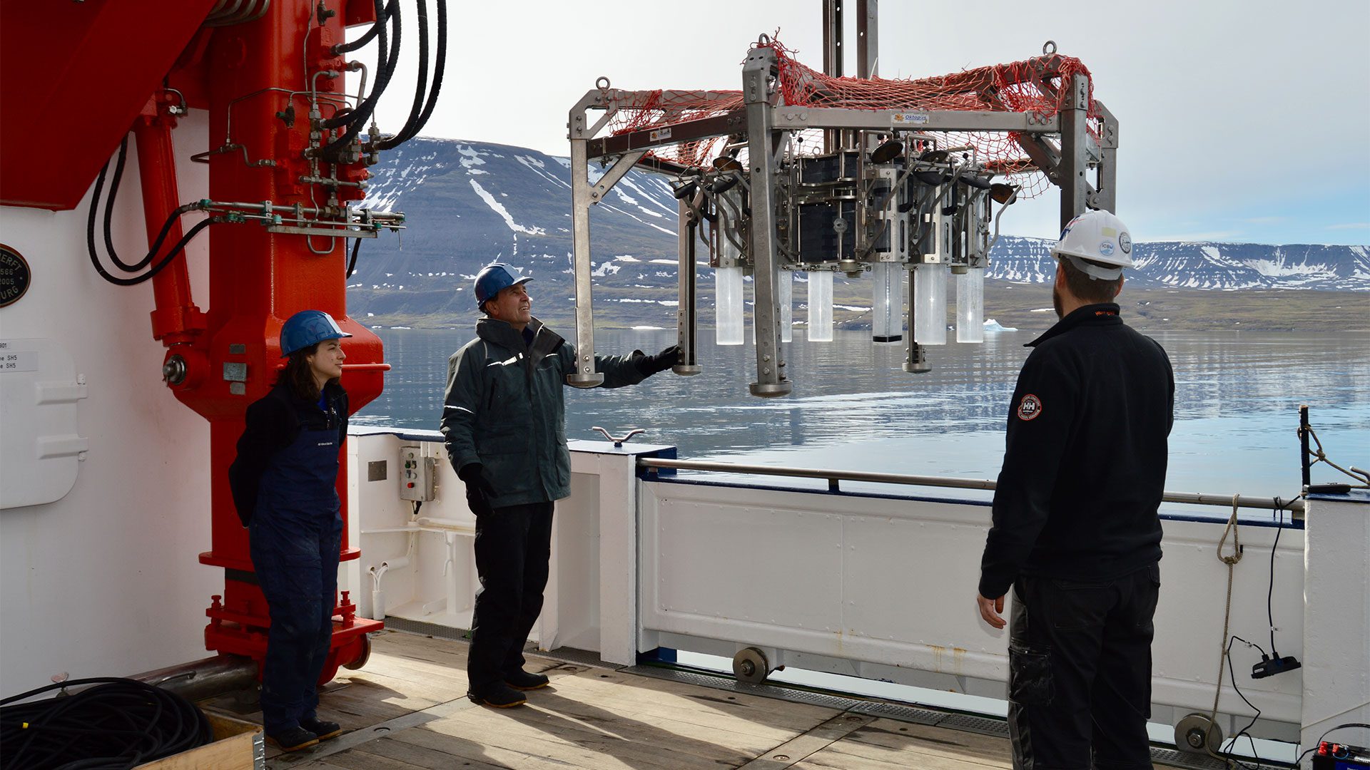
WHOI senior biologist Heidi Sosik on the critical need for long-term ocean datasets
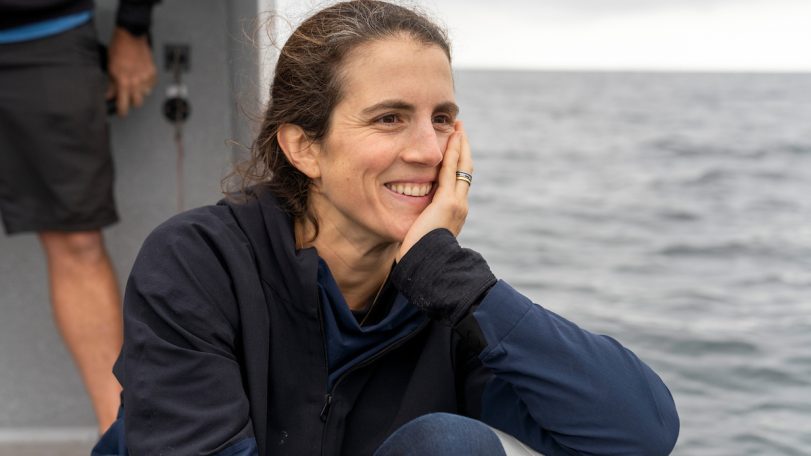
Lessons from a lifetime of exploration
Award-winning ocean photographer Brian Skerry shares insights from a career spent around ocean life and science

The ocean weather nexus, explained
The vital role of ocean observations in extreme weather forecasting

Breaking down plastics together
Through a surprising and successful partnership, WHOI and Eastman scientists are reinventing what we throw away
Three questions with Carl Hartsfield
Captain Hartsfield, USN retired, discusses the role ocean science plays in our national defense
The Ocean (Re)Imagined
How expanding our view of the ocean can unlock new possibilities for life
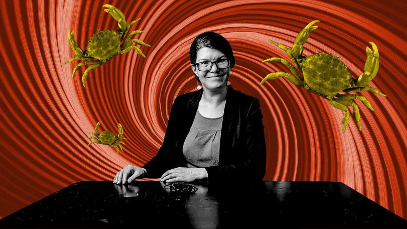
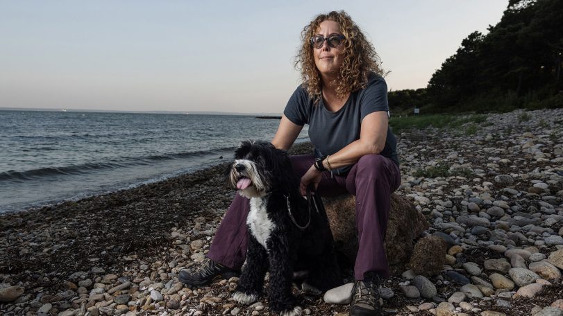
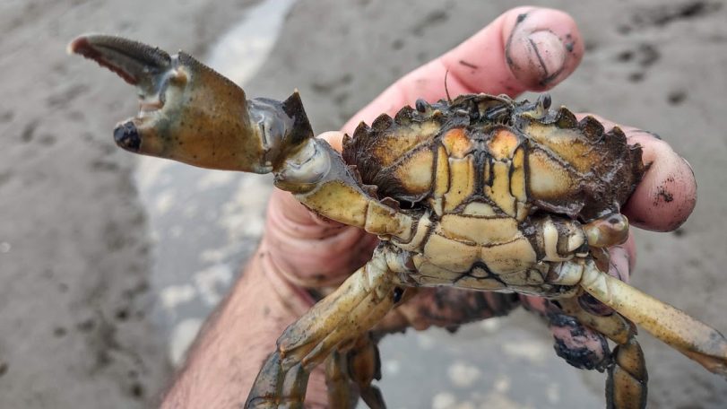
Body snatchers are on the hunt for mud crabs
WHOI biologist Carolyn Tepolt discusses the biological arms race between a parasite and its host

Looking for something specific?
We can help you with that. Check out our extensive conglomeration of ocean information.
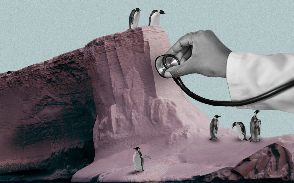
A polar stethoscope
Could the sounds of Antarctica’s ice be a new bellwether for ecosystem health in the South Pole?
Secrets from the blue mud
Microbes survive—and thrive—in caustic fluids venting from the seafloor
Top 5 ocean hitchhikers
As humans traveled and traded across the globe, they became unwitting taxis to marine colonizers

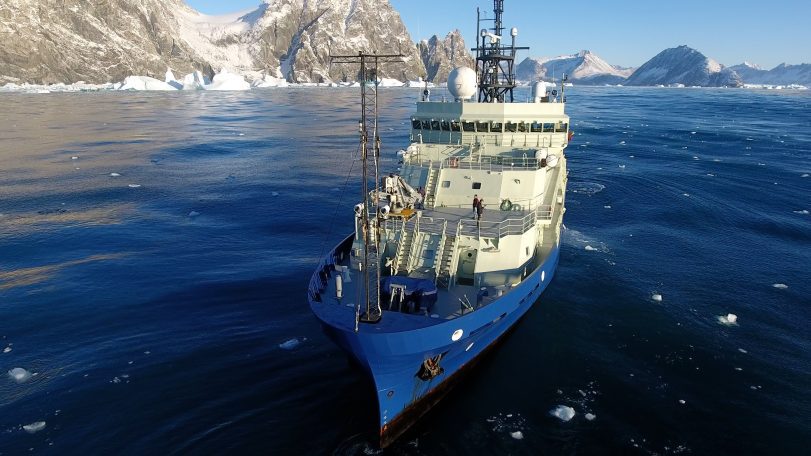
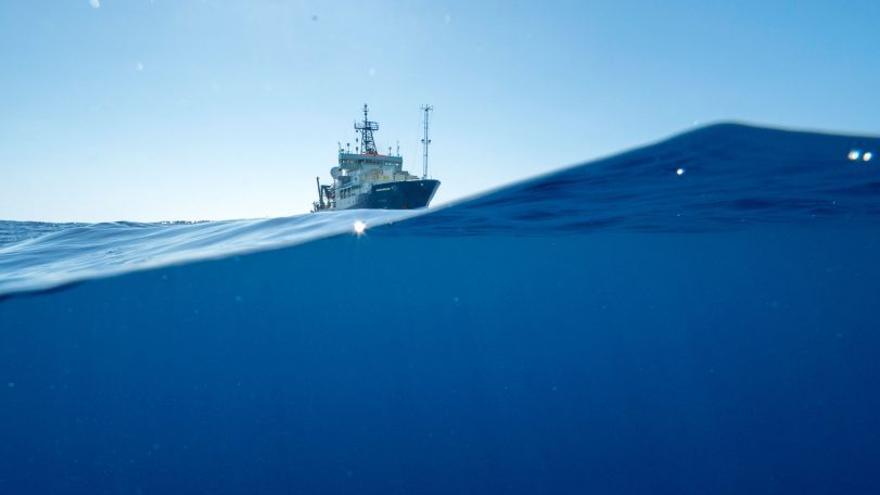
Following the Polar Code
Crew of R/V Neil Armstrong renew their commitment to Arctic science with advanced polar training
Harnessing the ocean to power transportation
WHOI scientists are part of a team working to turn seaweed into biofuel
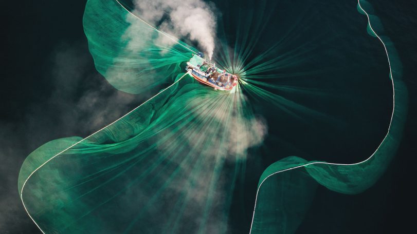
Casting a wider net
The future of a time-honored fishing tradition in Vietnam, through the eyes of award-winning photographer Thien Nguyen Noc
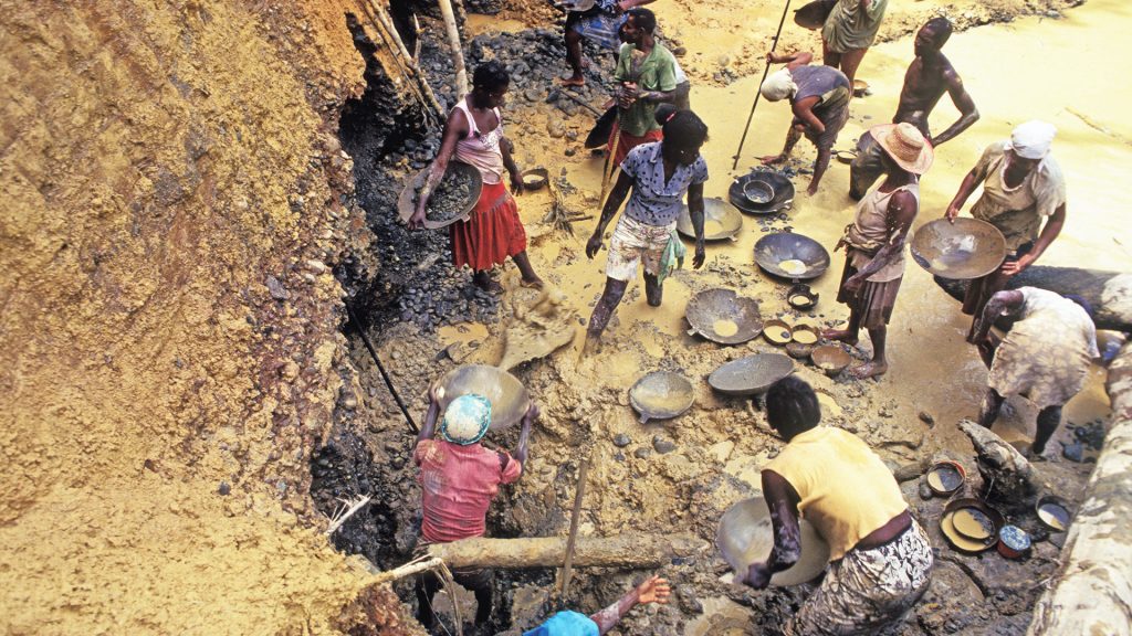
Gold mining’s toxic legacy
Mercury pollution in Colombia’s Amazon threatens the Indigenous way of life
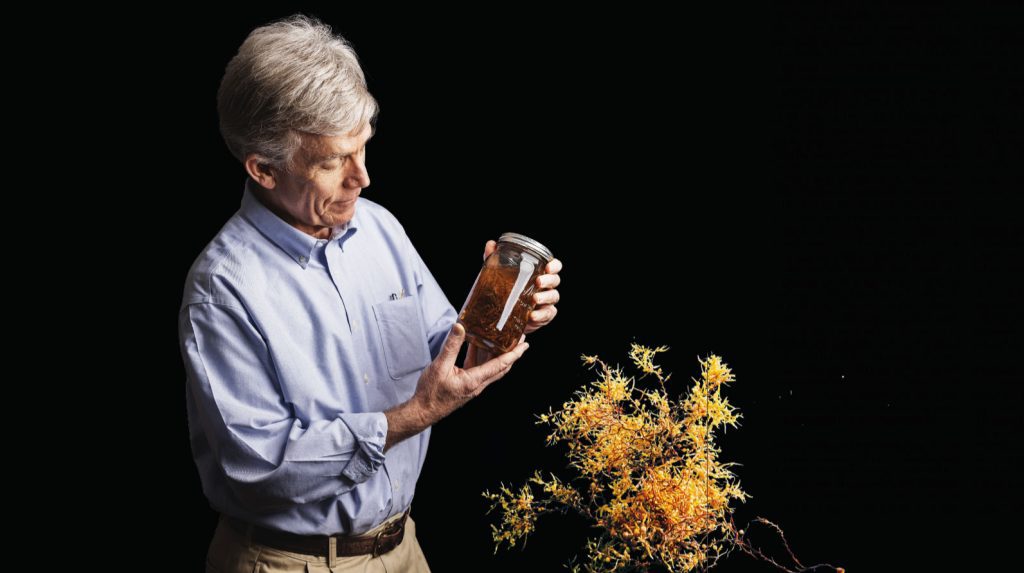
How do you solve a problem like Sargassum?
An important yet prolific seaweed with massive blooms worries scientists
Deep-Sea Diaspora
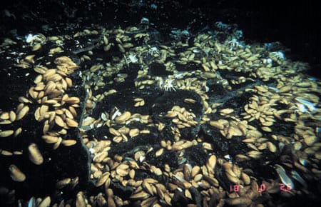
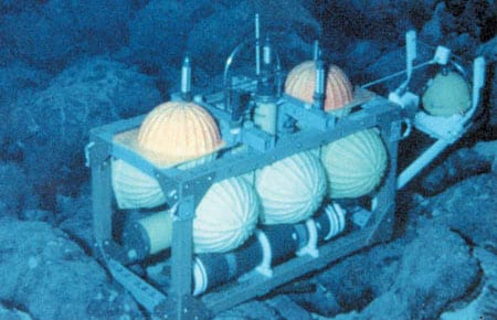
When spectacular biological communities were first discovered at hydrothermal vents in 1977, biologists puzzled over two main questions: How did these oases of large and abundant animals persist in the deep sea, where food is typically scarce? And how did these unusual species, which occur only at vents, manage to colonize new vents and avoid extinction when old vents shut down?
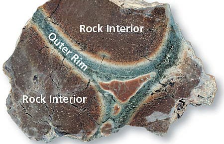
The Cauldron Beneath the Seafloor
Just over 20 years ago, scientists exploring the mid-ocean ridge system first made the spectacular discovery of black smokers—hydrothermal chimneys made of metal sulfide minerals that vigorously discharge hot, dark, particulate-laden fluids into the ocean.
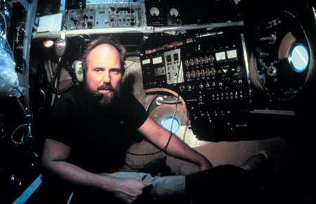
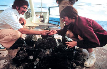
“Nothing Could Diminish the Excitement Of Seeing the Animals for the First Time”
The scientists who made the surprising discovery of teeming life around hydrothermal vents of the Galápagos Rift in 1977 were geologists and geochemists. They had not expected to find spectacular colonies of previously unknown, large animals on the deep seafloor.
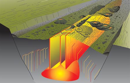
The Big MELT
More than 95 percent of the earth’s volcanic magma is generated beneath the seafloor at mid-ocean ridges.
Mid-Atlantic Ridge Volcanic Processes
Long before the plate-tectonic revolution began in the 1960s, scientists envisioned drilling into the ocean crust to investigate Earth’s evolution.
Indian Ocean’s Atlantis Bank Yields Deep-Earth Insight
I never imagined I would spend six weeks of my life “wandering around” the seafloor exploring an 11 million year old beach, and it never occurred to me to look for a fossil island. But that’s what I did, and that’s what we found on two research voyages separated by more than a decade.
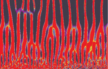
Melt Extraction from the Mantle Beneath Mid-Ocean Ridges
As the oceanic plates move apart at mid-ocean ridges, rocks from Earth’s mantle, far below, rise to fill the void, mostly via slow plastic flow.
Exploring The Global Mid-Ocean Ridge
There is a natural tendency in scientific investigations for increased specialization. Most important advances are made by narrowing focus and building on the broad foundation of earlier, more general research.
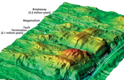
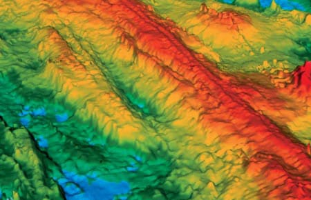
Discovery of “Megamullions” Reveals Gateways Into the Ocean Crust and Upper Mantle
urposes. From the end of the nineteenth into the first half of the twentieth century, drilling was used to penetrate the reef and uppermost volcanic foundation of several oceanic islands, and these glimpses of oceanic geology whetted the scientific community’s appetite for deeper and more complete data.
Ocean Seismic Network Seafloor Observatories
Our knowledge of the physical characteristics of Earth’s deep interior is based largely on observations of surface vibrations that occur after large earthquakes. Using the same techniques as CAT (Computer Aided Tomography) scans in medical imaging, seismologists can “image” the interior of our planet. But just as medical imaging requires sensors that surround the patient, seismic imaging requires sensors surrounding the earth.
The Women of FAMOUS
My FAMOUS story begins during my first year in graduate school at Dalhousie University in Nova Scotia.
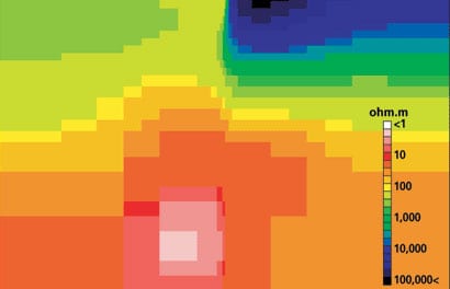
A Current Affair
oal of probing the earth’s inaccessible deep interior. But the technique remains something of a mystery even to many marine scientists. It has been used widely on land, particularly for regional-scale surveys, but only a few full-scale MT surveys have been carried out on the seafloor.