Five feet above a rising ocean
As the seas rise in Woods Hole, one of the institution’s chief stewards recalls past storms to plan for the future
By Daniel Hentz | December 4, 2020

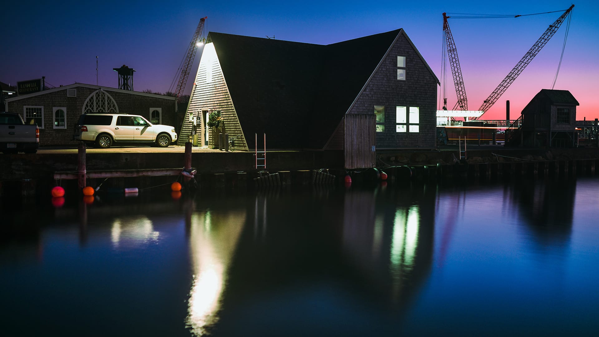
One building was made to see it all. Adjacent to Water Street in Woods Hole there’s a small edifice that used to be a hangar for water planes in the 1960s. Because of that, it’s still precariously perched less than 5 feet above the water level, atop Dyer’s Dock. Now it’s become WHOI facility director Dave Derosier’s vantage point for risings seas.
After 17 years of working at the institution, Derosier has been thankful to experience only a handful of monster hurricane threats—most notably the 2012 superstorm, Hurricane Sandy, that delivered more than 6 feet of storm surge along New York and New Jersey. But in that time, deeper reaching king tides and stronger hurricanes have made him weary about future conditions in Woods Hole. We sat down with him to talk about how he and his crew of 70 help ready the institution for impending storms and what insights he’s gleaned as the community prepares for at least 2 feet of sea level rise in the next century.
Oceanus: You work just a few feet above the resting sea level in Woods Hole. Tell us about sea level rise from your unique vantage point.

Dave Derosier is the director of facilities and services at the Woods Hole Oceanographic Institution. (Tom Kleindinst, © Woods Hole Oceanographic Institution)
Dave: I’m very fortunate to have made a home out of this building that we call, "the Hangar." I get to look out on the main WHOI dock and see everything going on in our immediate environment. But over the years at this desk, I haven’t had any doubts about climate change. Often, I can look out during an extra high tide event and say, “Well, that’s a new high!” even when there’s no storm and nothing causing it other than a king tide. But even then, it’s easy to notice the waters reaching further inland to a point that it had only previously reached during Hurricane Sandy, for example. We’re still decades away from [coastal flooding] being a daily or even monthly type of problem. But, for me, what all this means is that when a storm does come, it’s starting at a higher point and buildings that maybe weren’t as vulnerable 30 or 40 years ago are now. Our water is definitely higher than when I started here, that’s clear.
Oceanus: Scientists estimate that Woods Hole has already experienced one foot of sea level rise in the last century, with a conservative estimate of an additional 2.5 to 4 feet in the next. How vulnerable is Woods Hole village right now?
Dave: Where I’m sitting, I’m five feet above the NAVD-1988—a benchmark that NOAA uses as a baseline water level. So, if we get called to prepare for 5-foot storm surge above that level, that means my feet are getting wet. That’s not a lot of wiggle room when you think about storm surge these days.
Oceanus: Other than sending out alerts to WHOI researchers, what are some of the ways you help the institution brace for flooding events?
Dave: There’s a lot we can do to reduce damages. You can make smarter decisions about what is and isn’t worth saving. For instance, Smith and Bigelow Laboratories have important boiler rooms that are fairly low and are at risk of flooding from underneath. In that case, underground conduits, which we have a lot of, may be a way for seawater to leak in—even if you stopped that flooding at the door. Our procedures call for removing one vital burner from each boiler room and move it to the second floor. If we didn’t do that, and lost a burner during, say, September or October, I may not be able to find a replacement until winter. The electric rooms that are at grade in the waterfront buildings are also very vulnerable. So, elevating those electrical distribution areas is something we’re working on as part of the new waterfront reconfiguration and planning.
In our own office during Sandy, we took everything that was 3 feet off the ground or less in our building and moved it out. Sure enough, the surge water was at our door threshold when the storm veered towards Long Island Sound.
WHOI's water plane was purchased in 1959 and used until 1970, when it was sold. Because of its position for launch, the Hangar remains closer to the water than other WHOI buildings to this day. (© Woods Hole Oceanographic Institution)
Oceanus: WHOI leadership announced plans for CWATER: a new plan to elevate the main dock where the institution’s research ships berth. What would be at stake if we instead continued on with business as usual?
Dave: Ignoring the rising tide and aging dock is not an option. Left alone we would eventually have to reduce activities on the main dock and would have increased risk of serious flooding events. Before Sandy, the Woods Hole community would recall the devastation of Hurricane Bob (c.1991). Back then, water was splashing onto the main dock and flooding most of the Smith parking lot. In fact, there was a car left in the corner of the lot...it was floating by the end of the storm.
At the time, the Hangar was pretty much a bare bones building with just studded out walls that didn’t even have sheetrock––that flooded 2.5 to 3 feet up the walls. The point is, if the ocean’s coming in, you’re not going to stop it. We do what we can to mitigate damages, but, while we wait to upgrade our vulnerable facilities, it’s mostly about recovery post storm.
