
Multimedia
Cystic fibrosis
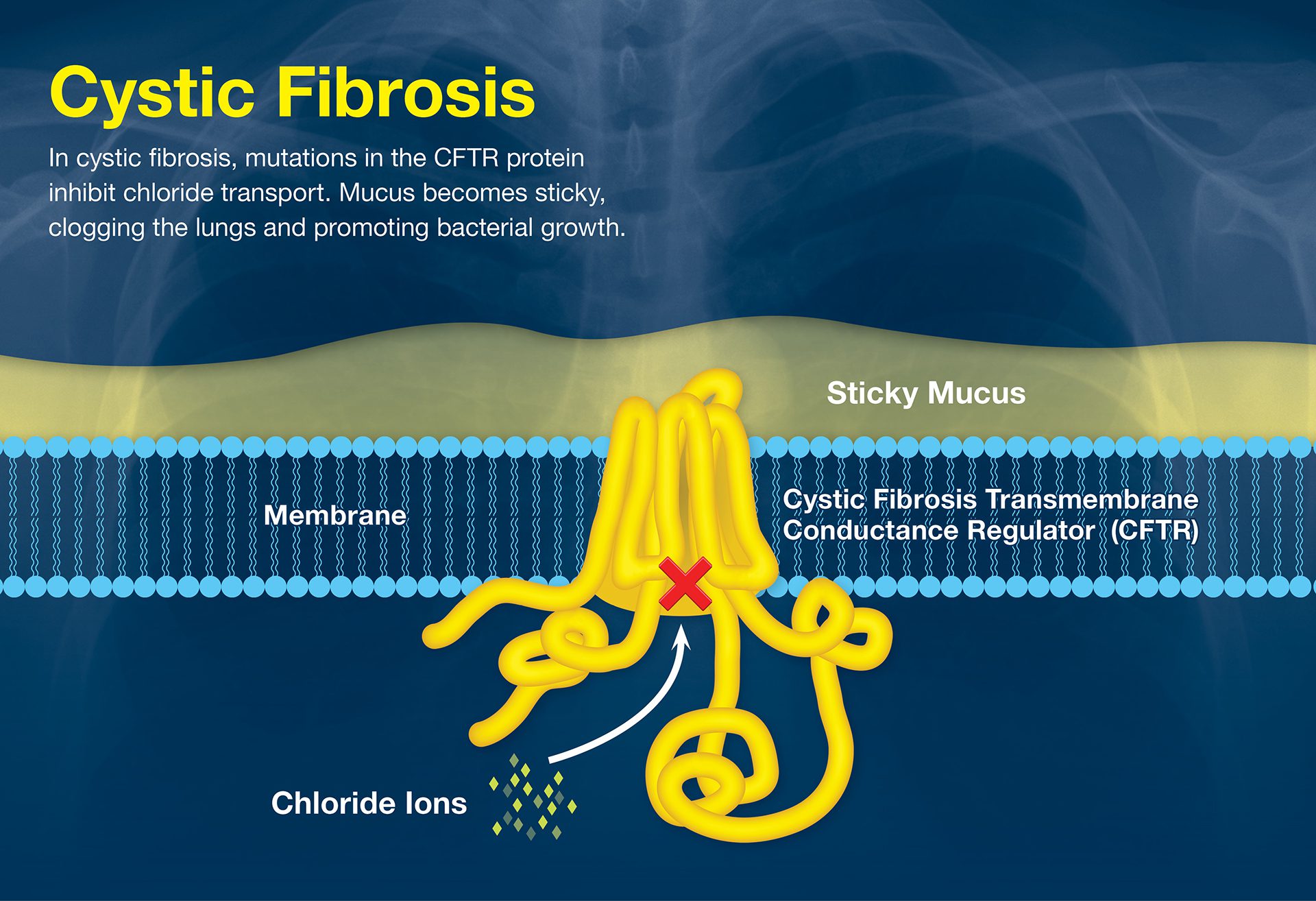
Cystic fibrosis impairs lung function due to a faulty protein. WHOI scientists seek marine molecules that might help restore normal function.
Read MoreHunting hydrothermal plumes with a CTD Tow-Yo
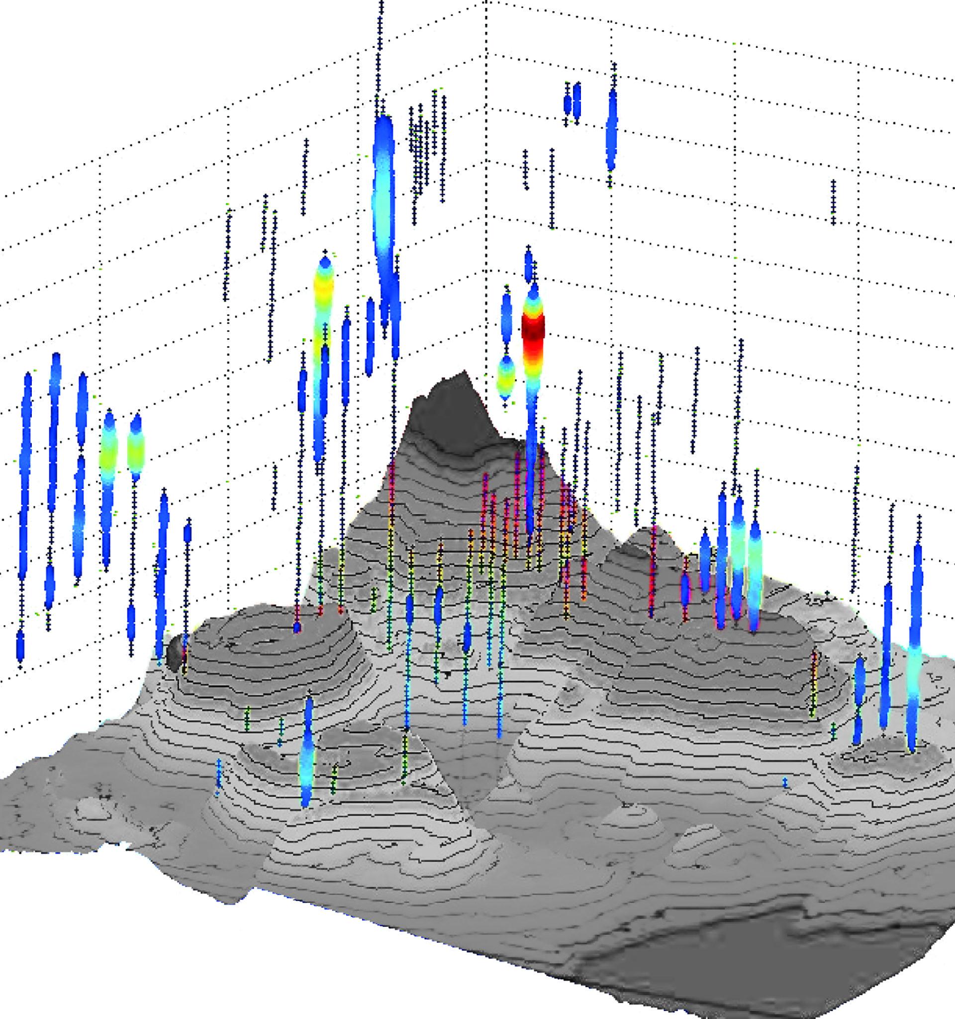
Oceanographers use a CTD—an instrument towed through deep water—to detect hydrothermal plumes by sensing heat, minerals, and chemicals below the surface.
Read MoreAnimals of the open ocean
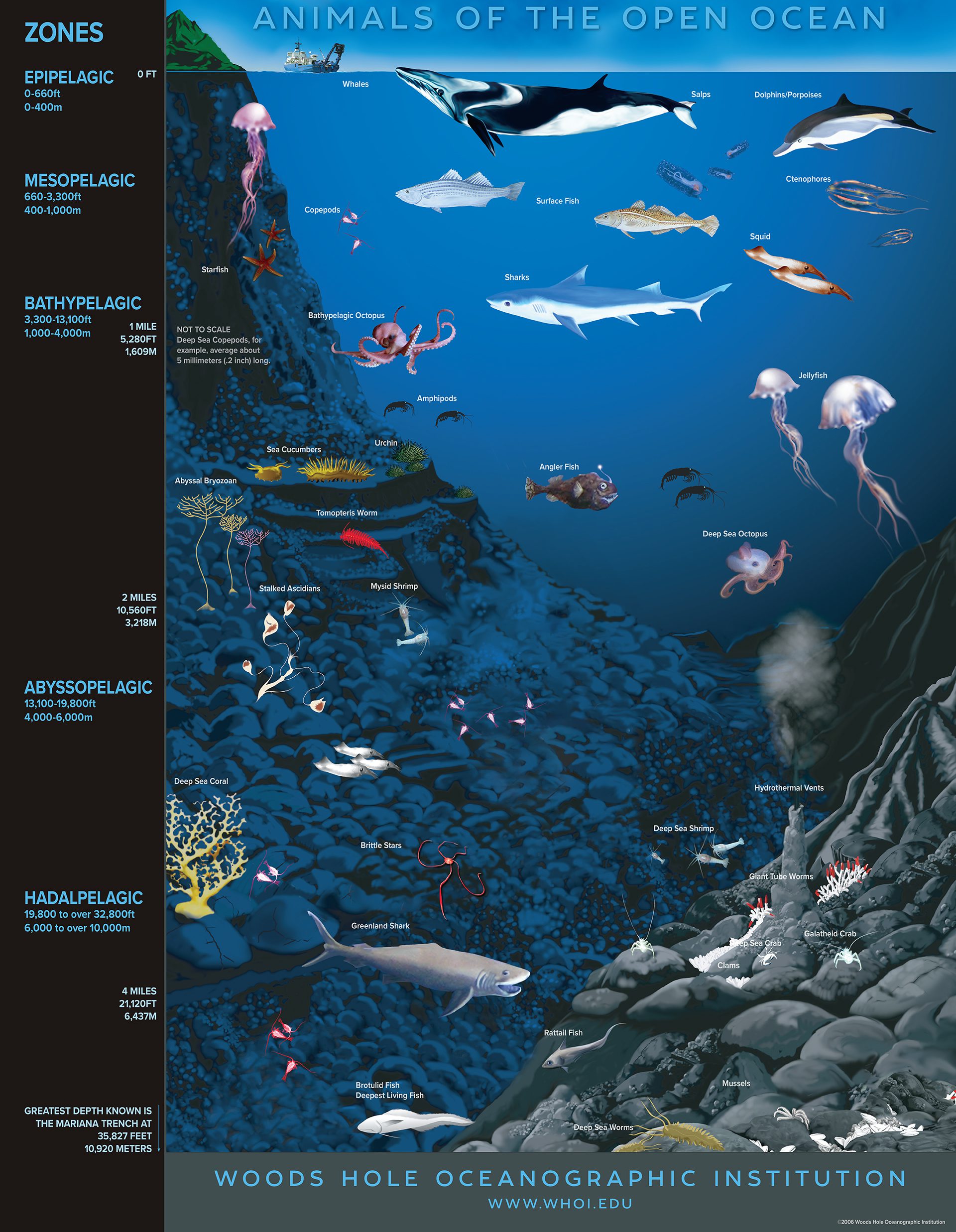
A cross-section of the ocean, showcasing various marine life at different depths, from the sunlit surface to the dark abyssal plains.
Read MorePlankton blooms at ocean fronts
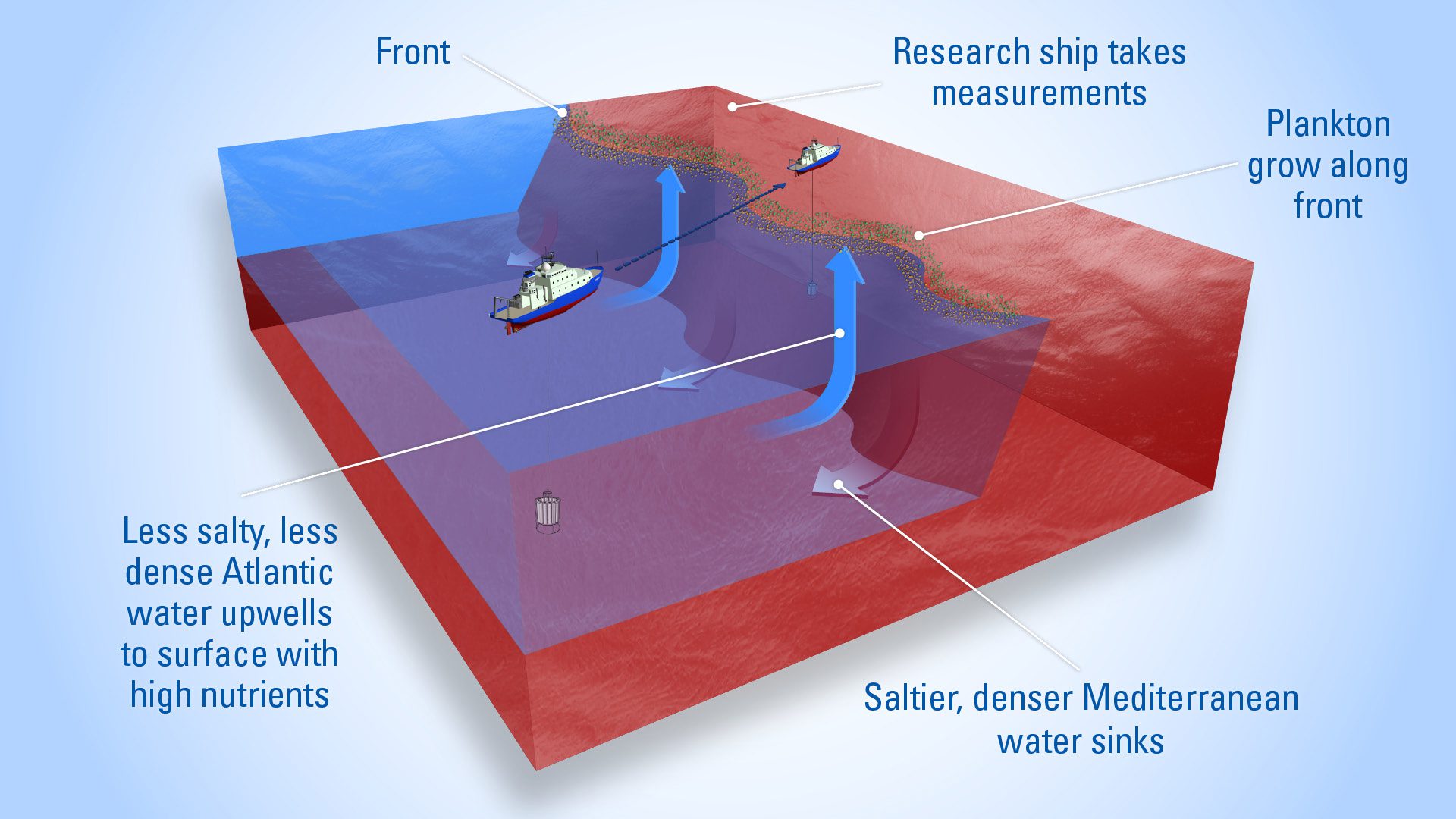
Plankton thrive where water masses meet—rising lighter water brings nutrients to the surface, fueling blooms in sunlit layers of the ocean.
Read MoreGlobal thermohaline circulation
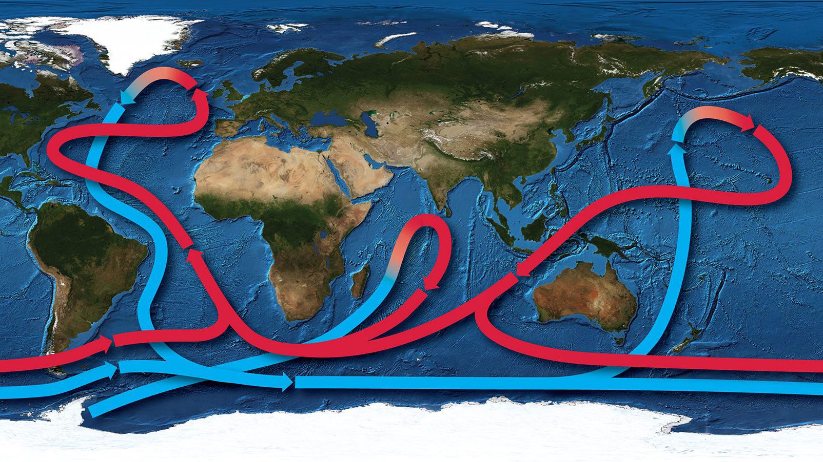
Map with bathymetry and generalized ocean currents driven by temperature and density differences, forming the global ocean conveyor belt.
Read MoreDust distribution across the ocean
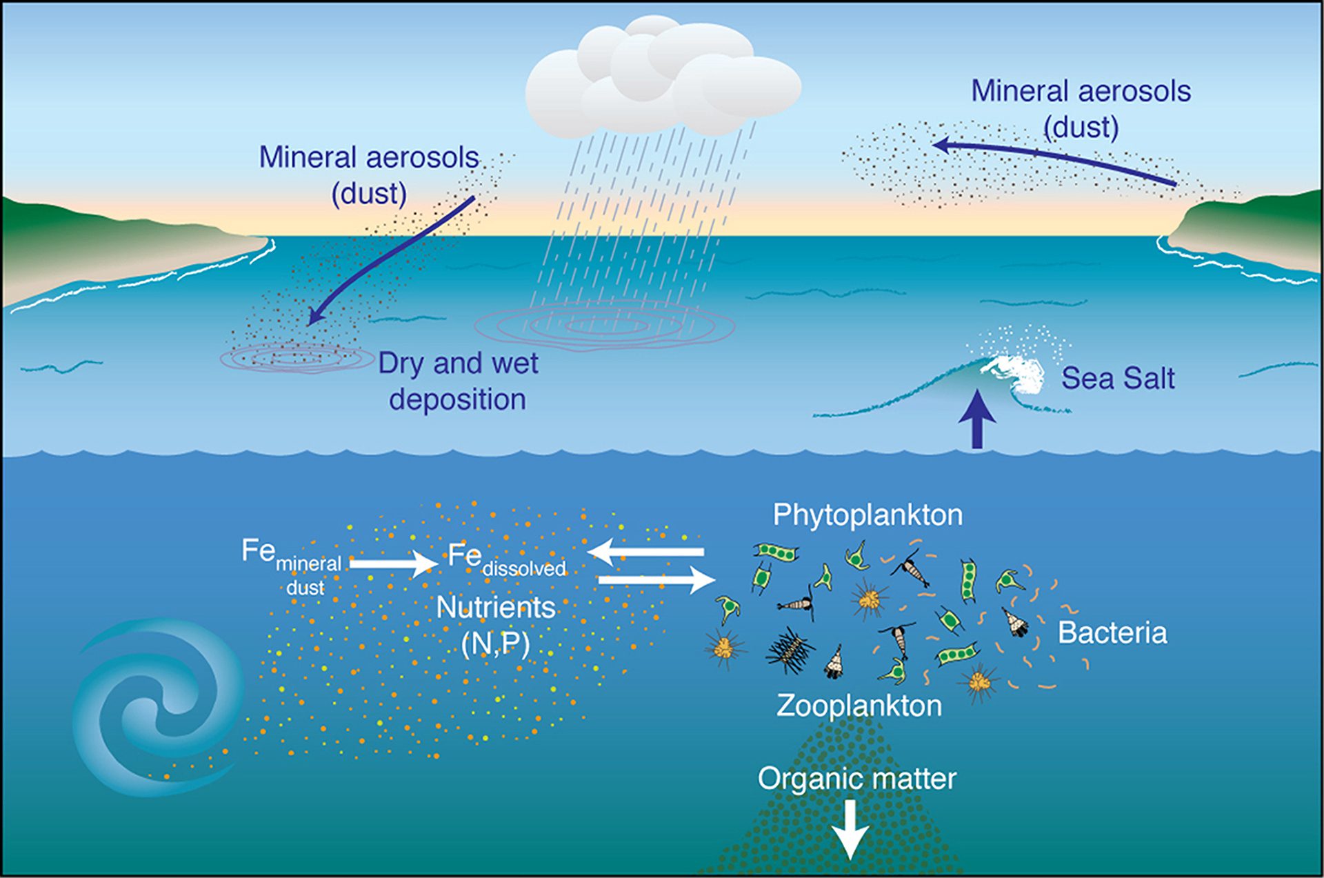
Iron-rich dust from land settles in the ocean, feeding phytoplankton. These support marine life and help transfer carbon to the deep sea through sinking matter.
Read MoreOcean circulation roadmap
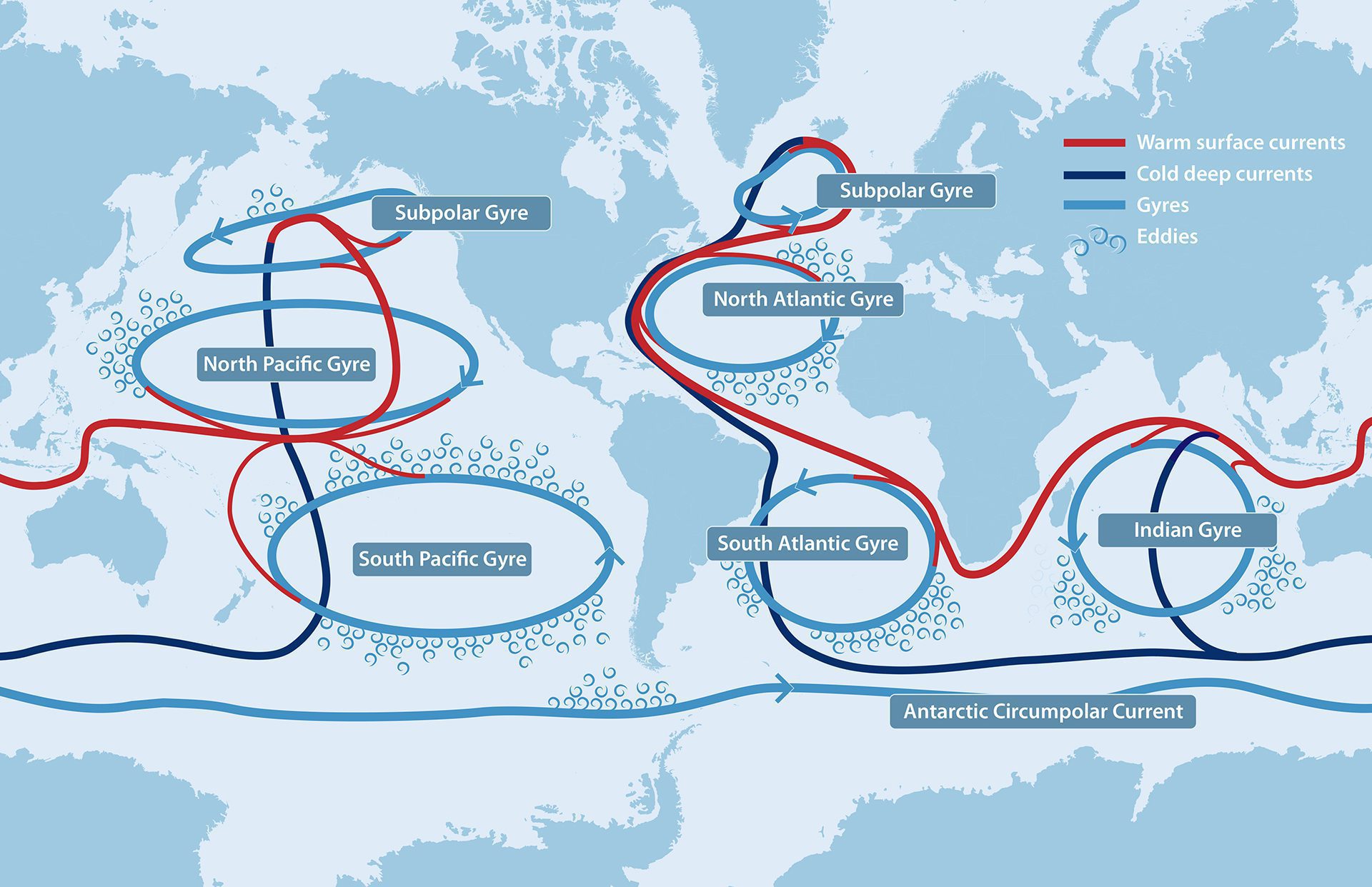
Illustrated roadmap of global ocean circulation, with temperature and flow shown as highways connecting gyre “roundabouts” across the world’s oceans.
Read MoreScope and benefits of a "Coastal Carbon Observing Network"
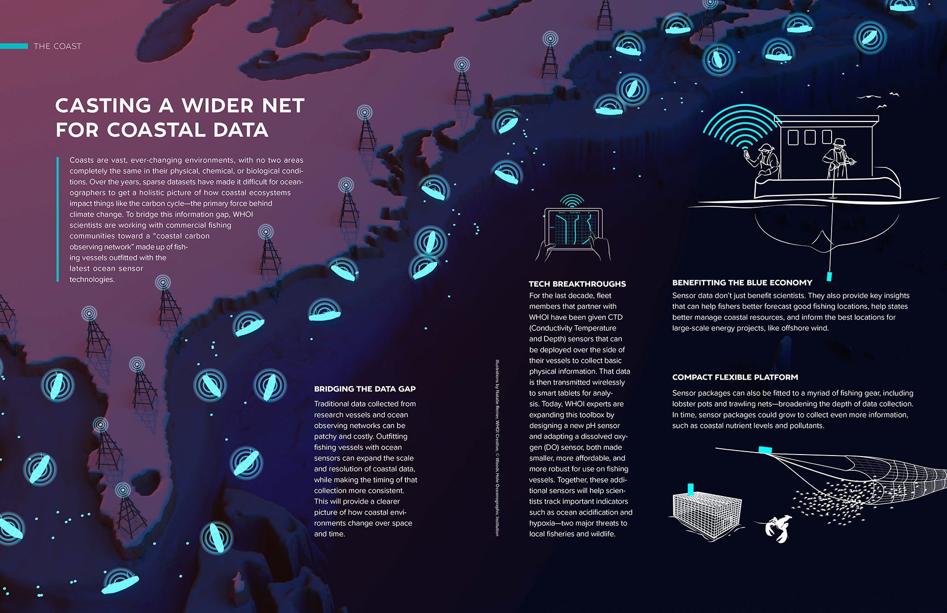
WHOI scientists are working with fishing communities toward a coastal carbon observing network made up of fishing vessels with the latest ocean technologies.
Read MoreSea Level Falls and Rises relative to land
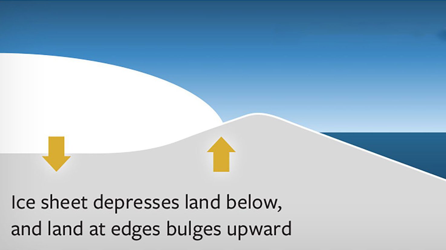
Ice sheets weigh down land, causing it to sink and edges to rise. When they melt, land rebounds and edges collapse, leading to a relative sea level rise.
Read MoreSeafloor topography at the Kermadec Trench
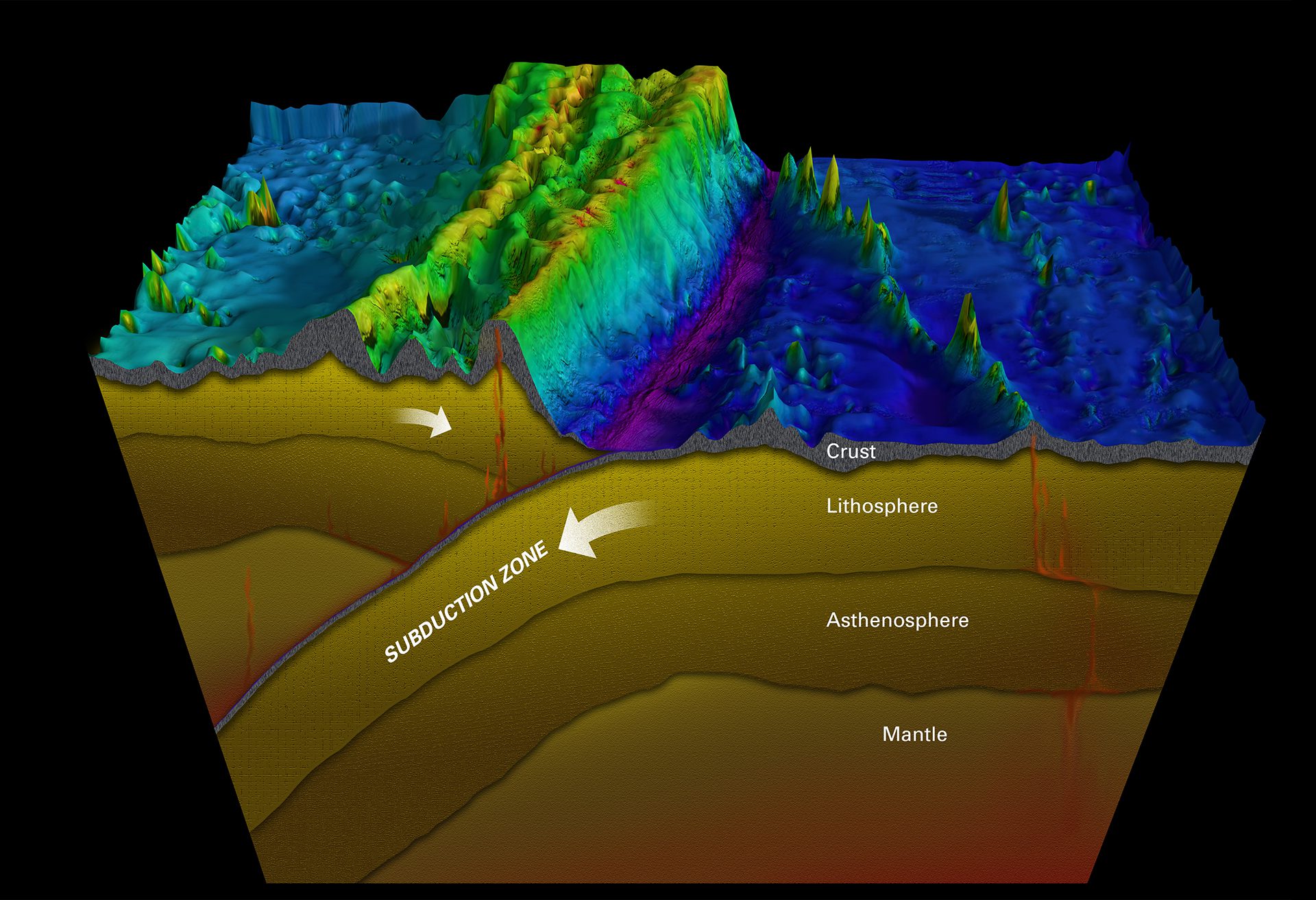
Ocean trenches form where one tectonic plate sinks beneath another, creating deep zones with volcanoes, quakes, and tsunamis—like Japan’s 2011 magnitude 9.0 quake.
Read MoreSection view of the different layers of Earth’s interior
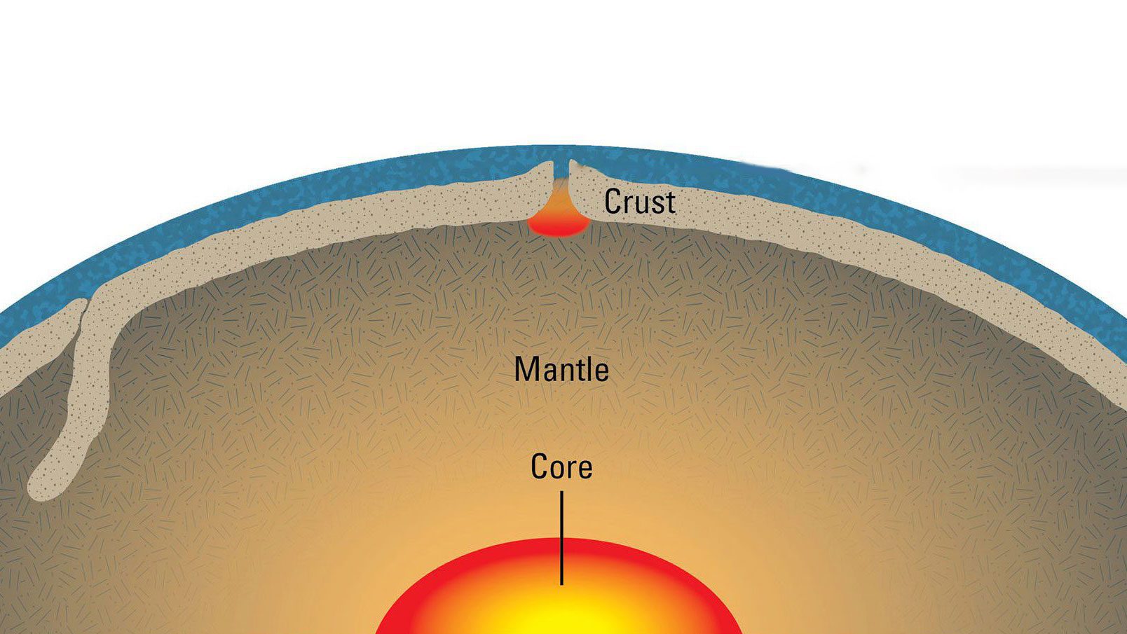
At mid-ocean ridges, rising mantle rock melts as pressure drops, forming new seafloor. Scientists study its melting point to better model this crust-forming process.
Read MoreFjords, glaciers, and sea level rise
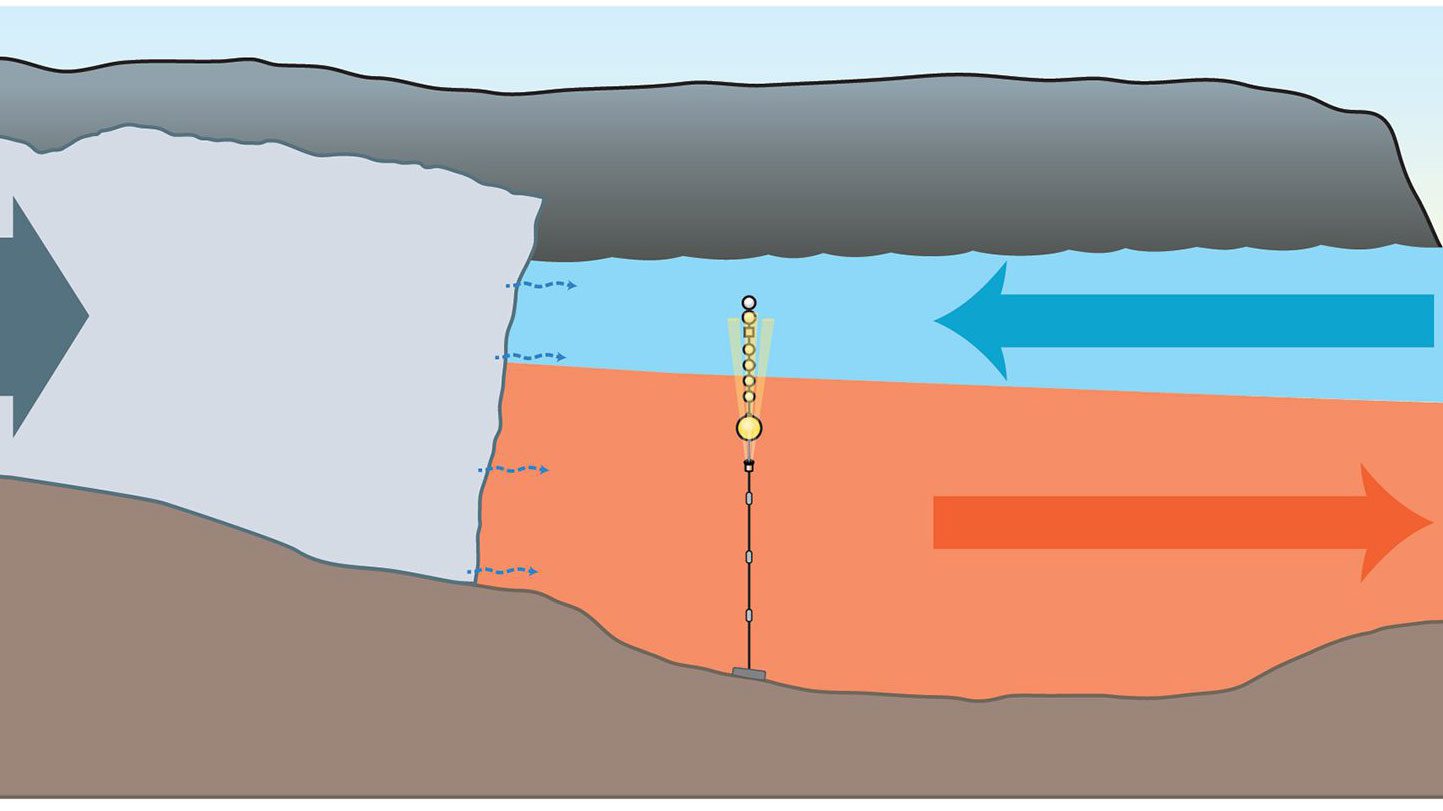
Researchers study how warming ocean waters in fjords like Sermilik drive glacial melt and ice flow, influencing sea level rise through shifting currents and water layers.
Read MoreOcean carbon cycle to twilight zone depth
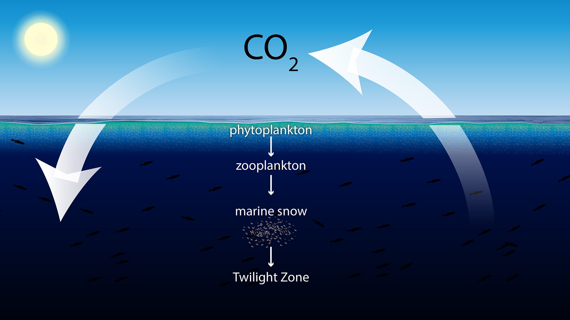
The ocean is a significant carbon sink, absorbing a large amount of CO2 from the atmosphere. This process helps regulate Earth’s climate but can also lead to ocean acidification.
Read MoreDiatoms and Bacteria: A Complex Ocean Partnership
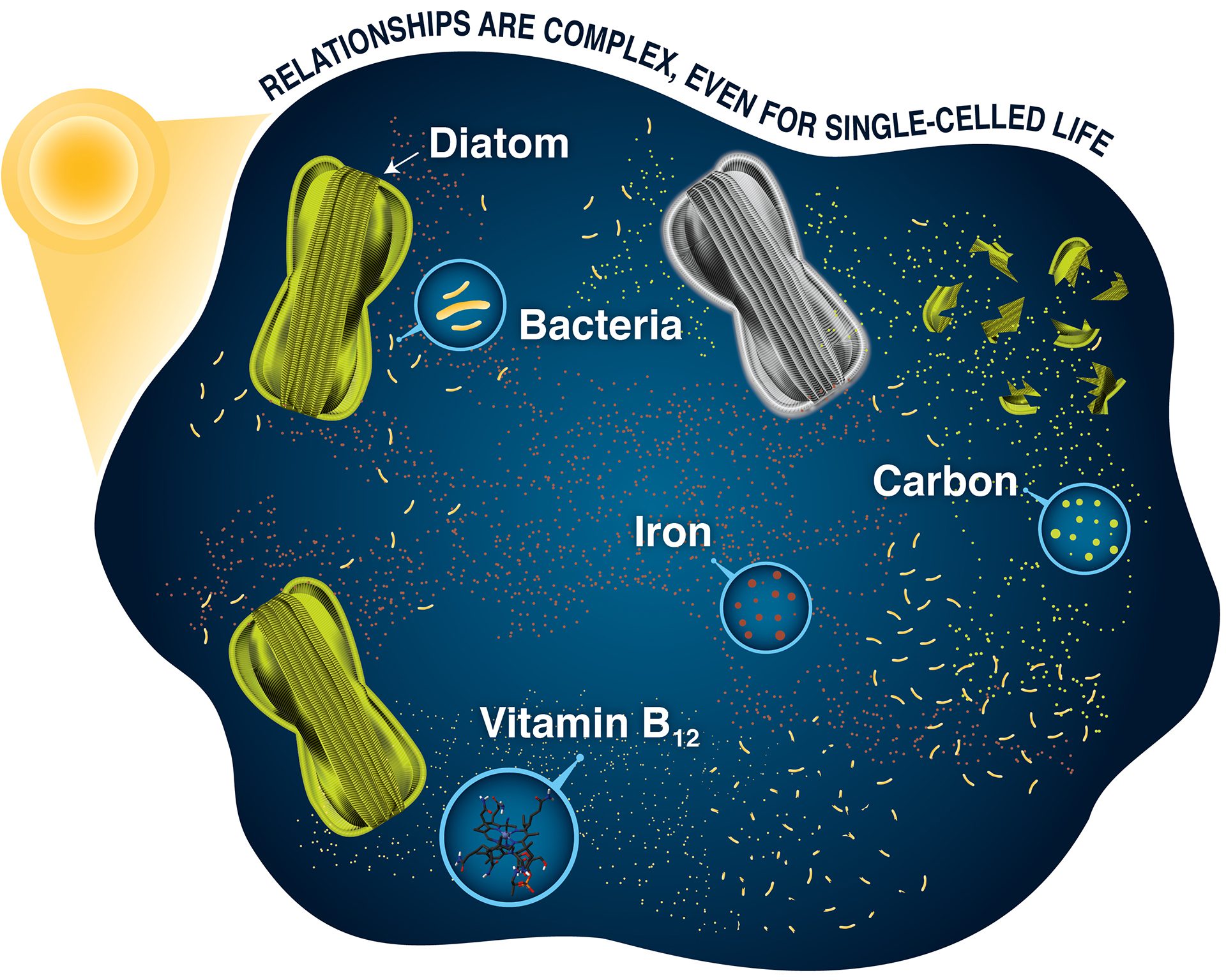
Diatoms and bacteria rely on each other for nutrients like organic carbon and B12 but compete for scarce iron, creating a delicate balance in ocean chemistry.
Read MoreHow Earth got its water
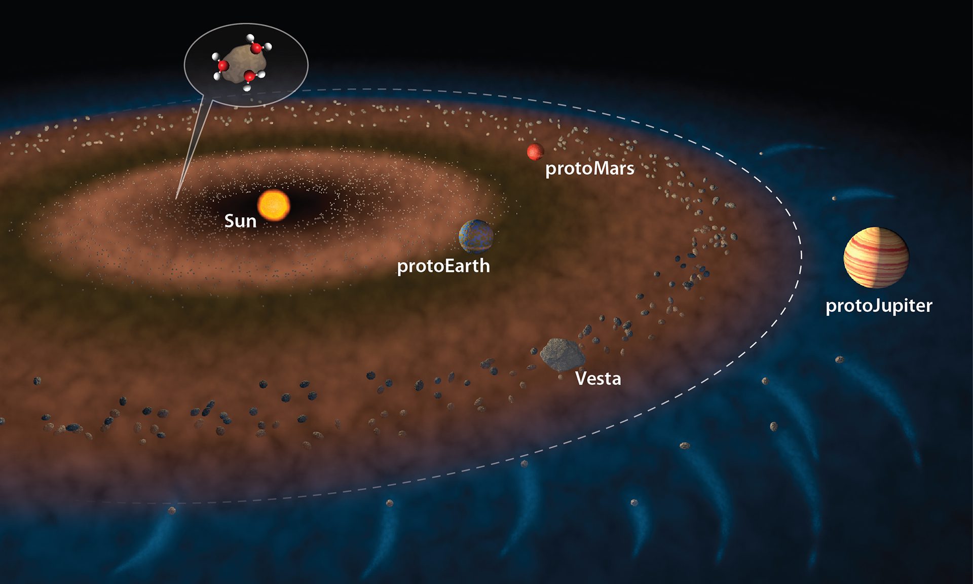
Water likely arrived in the inner solar system early on, flung by gravity from proto-Jupiter via meteorites, according to research on asteroid Vesta.
Read MoreMapping the seafloor with sound
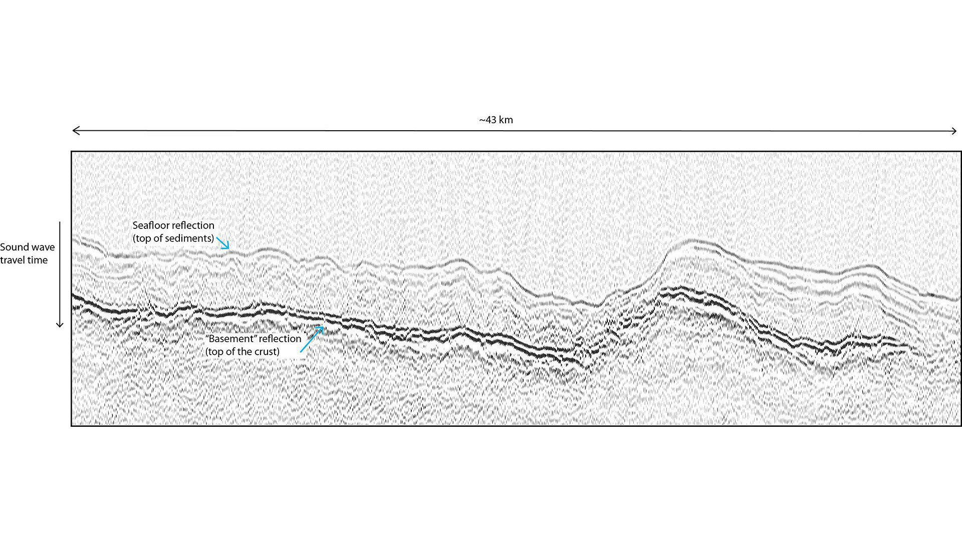
Scientists use sound waves to map layers beneath the seafloor by measuring how long waves take to bounce back from sediments and crust.
Read MoreSources of oil pollution in the ocean
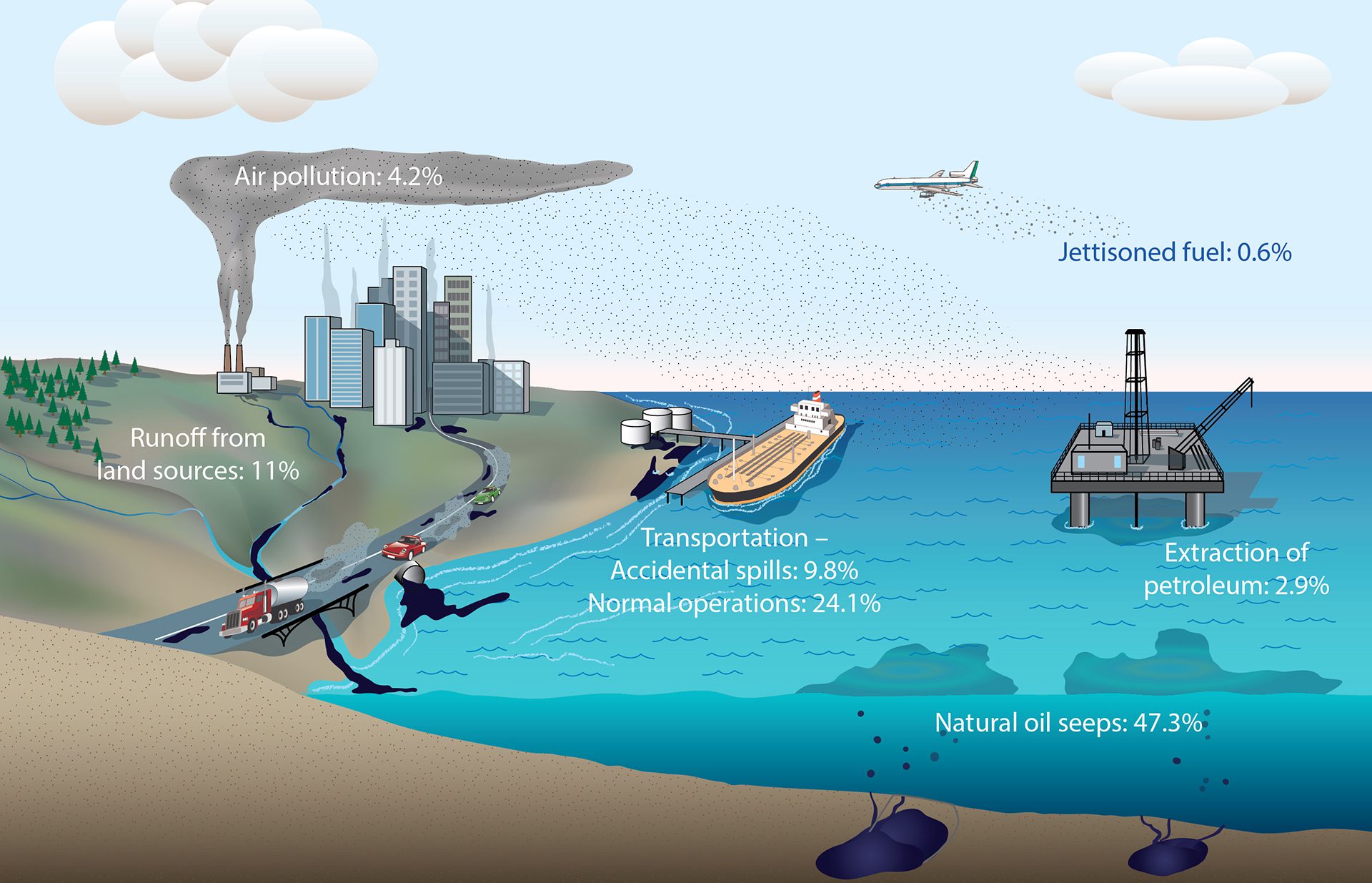
Roughly 380 million gallons of oil enter the ocean each year—most from human activities like shipping and runoff, with natural seeps also contributing.
Read MoreOne connected global ocean
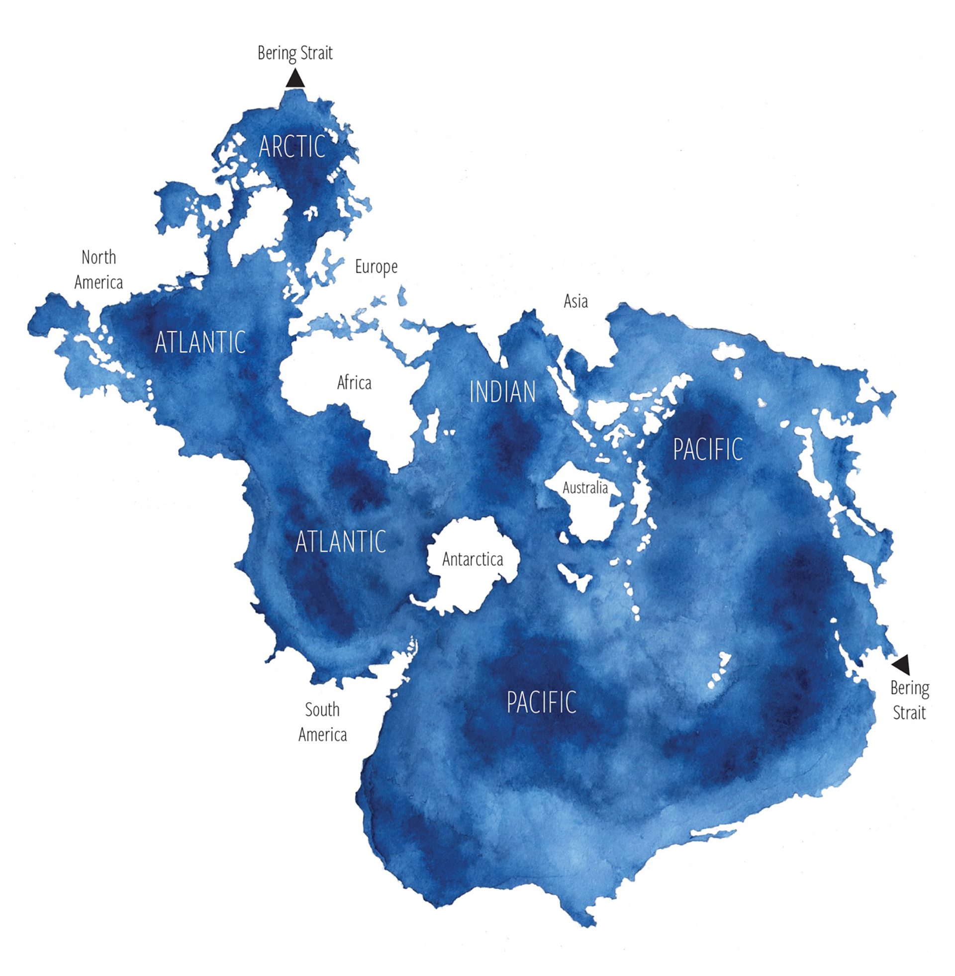
Watercolored map of the global ocean in the Spilhaus projection with regional labels
Read MoreSunlight speeds polystyrene breakdown
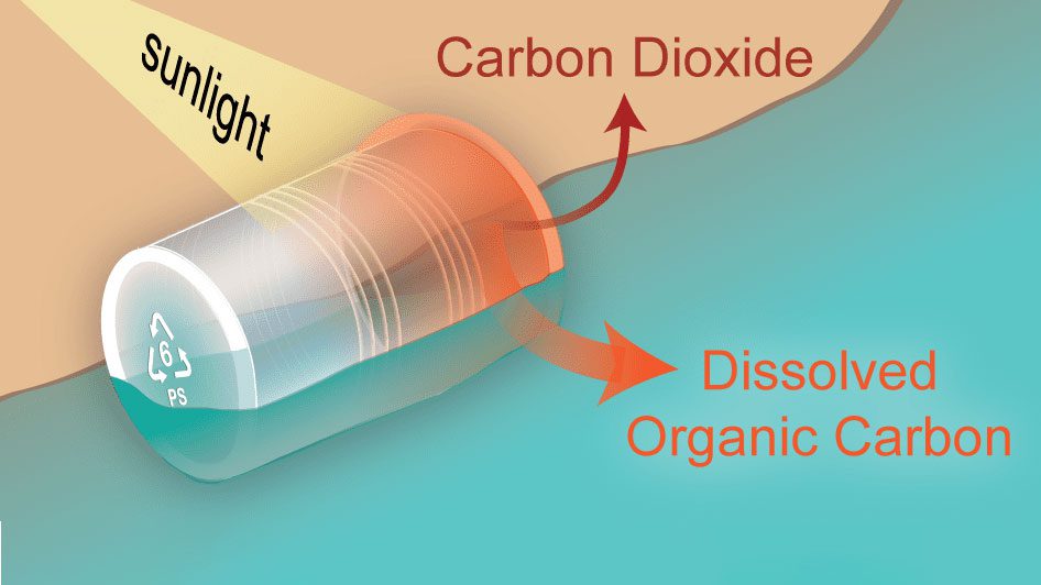
Sunlight triggers photochemical reactions that break down polystyrene into CO? and organic carbon, revealing faster plastic degradation than once thought.
Read MoreSunlit, Twilight, and Midnight Zones in a cube
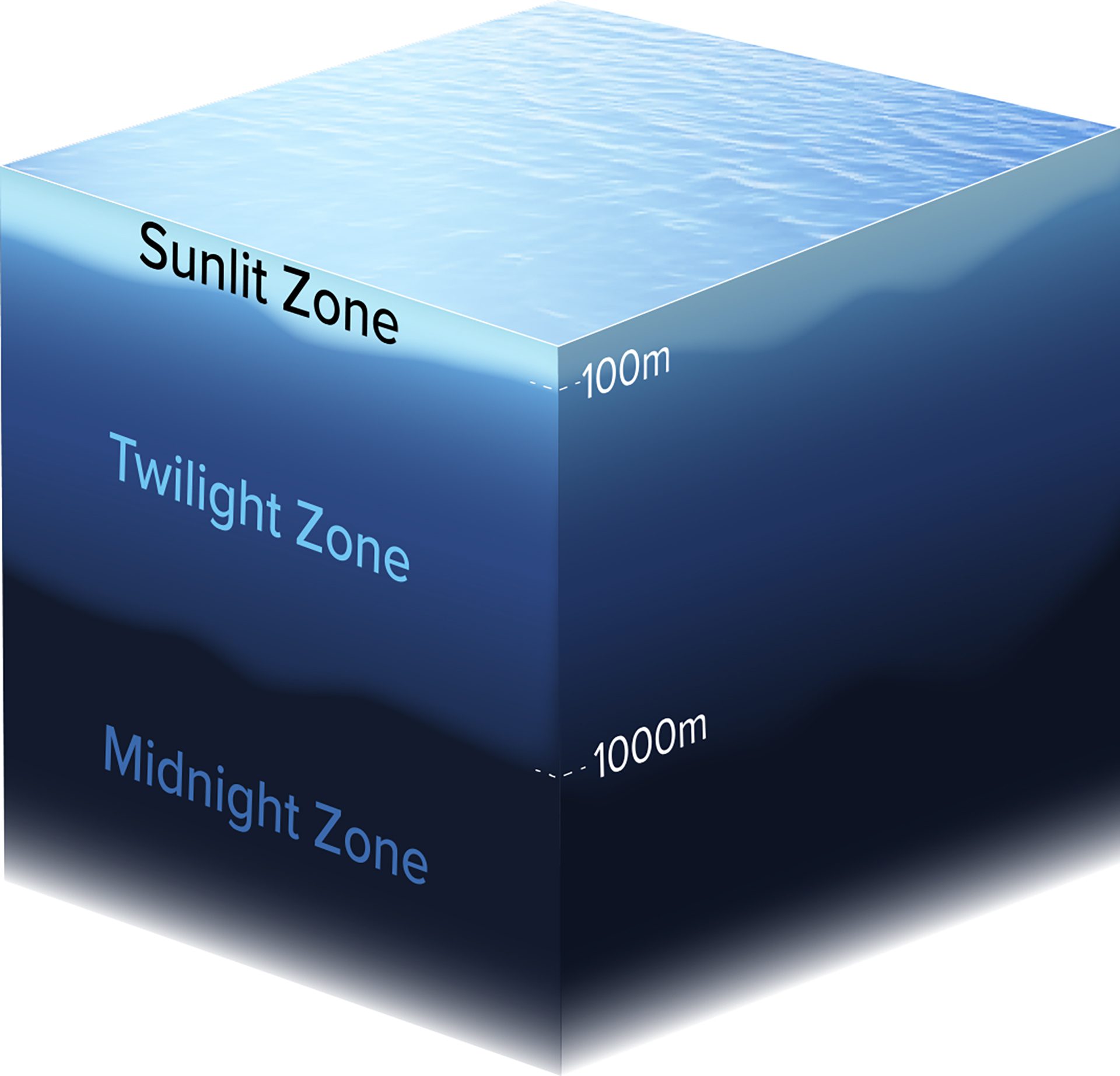
This cube shows the mesopelagic zone—an ocean layer from 1001000m deep—stretching from coastal EEZs to the high seas, including around island nations.
Read MoreThe Atlantic Meridional Overturning Circulation (AMOC)
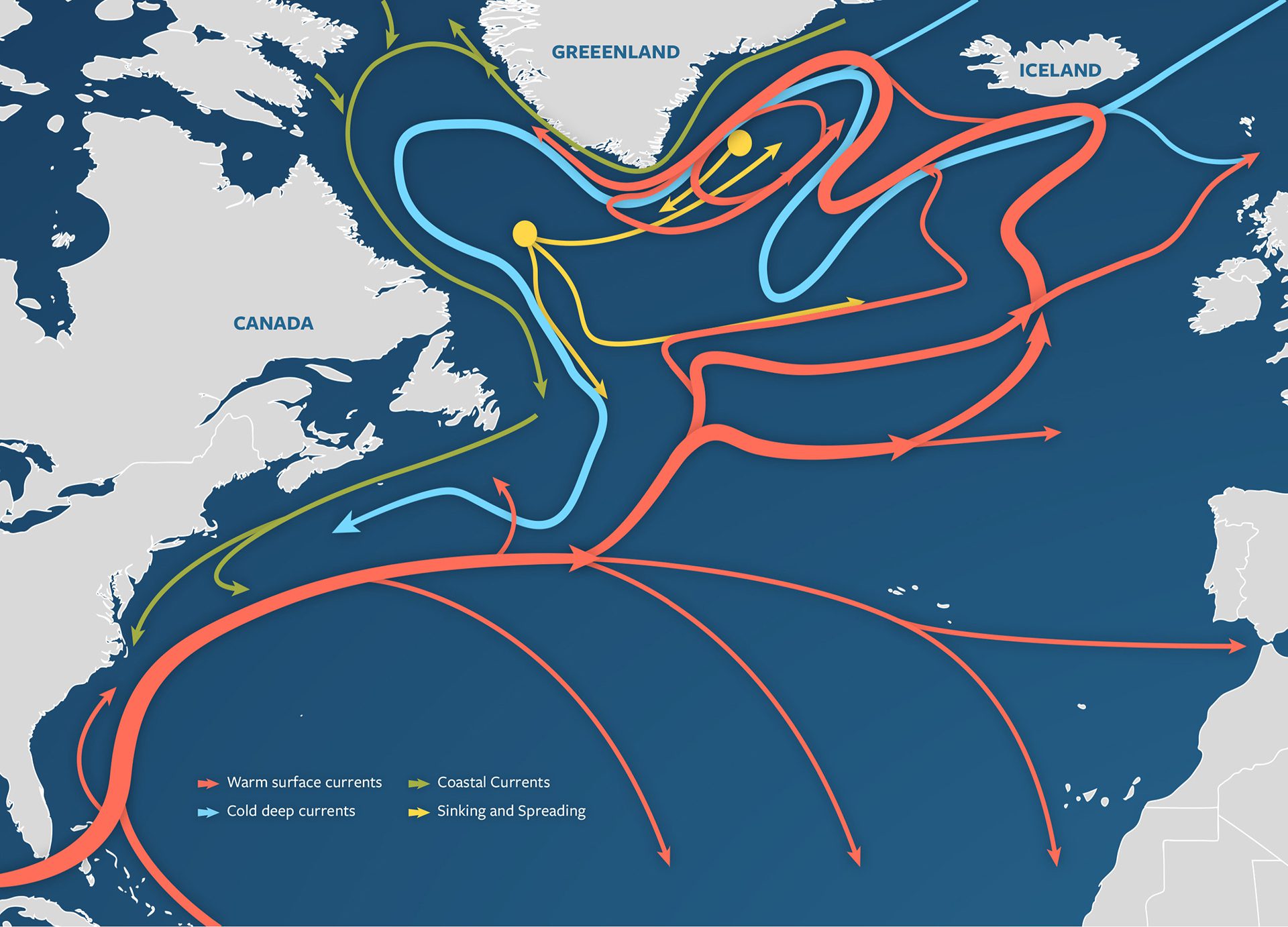
Illustrated map of the AMOC, part of global thermohaline circulation, showing warm surface flow, deepwater currents, and key sinking and spreading sites.
Read MoreThe Earth’s water supply in perspective

If all Earth’s water formed a ball, it would be just 950 miles wide—and only a tiny fraction of it is fresh and accessible for human use.
Read MoreThe formation of 18° mode water
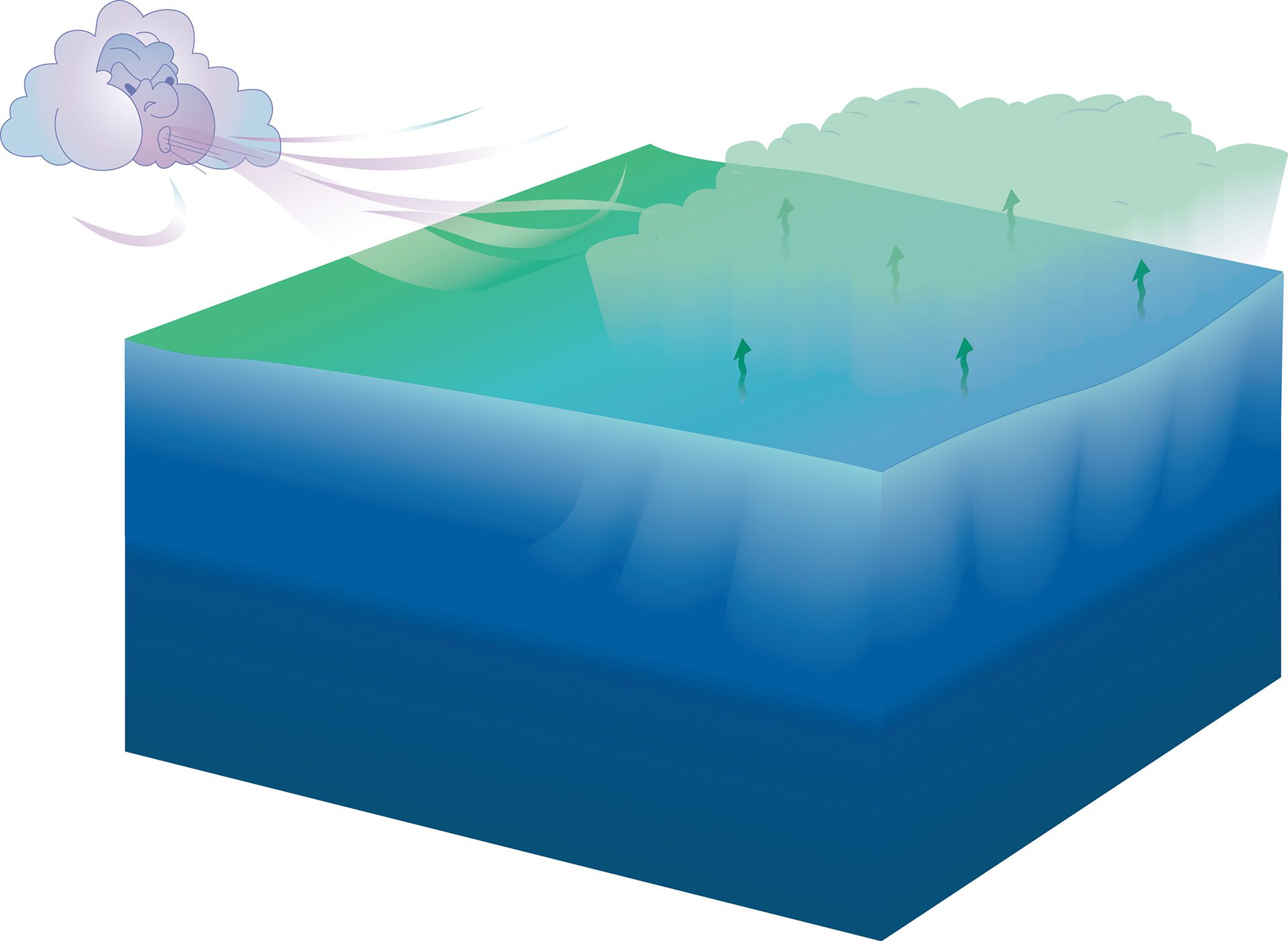
Cold winter winds cool warm ocean surfaces. The dense water left behind sinks, forming a distinct layer called 18° water between surface and deep seas.
Read MoreOpposing currents, Deep Western Boundary Current and Gulf Stream
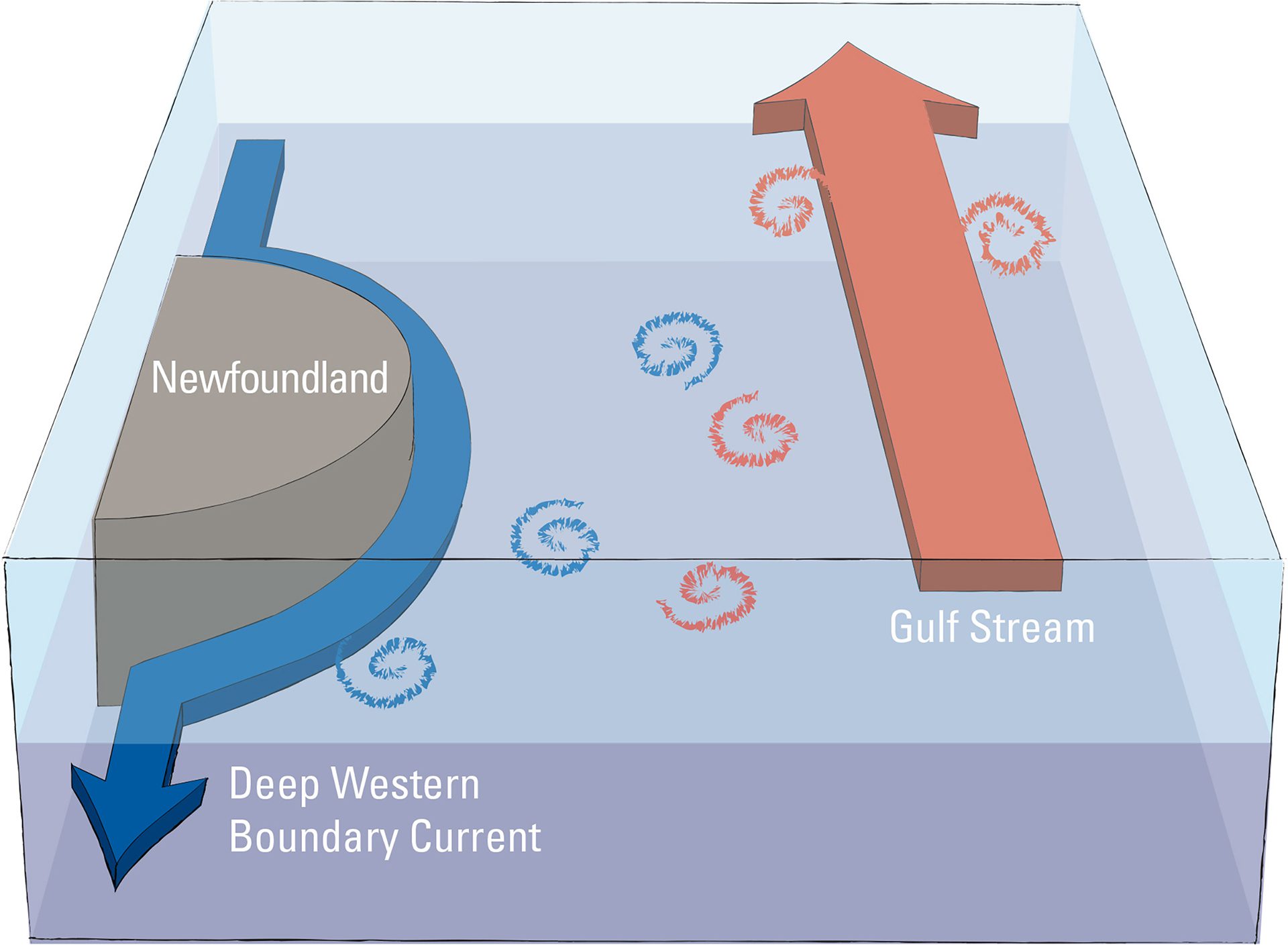
Scientists use mathematical models of the Deep Western Boundary Current, Newfoundland’s topography, and the Gulf Stream to study what causes water to divert from the current.
Read More