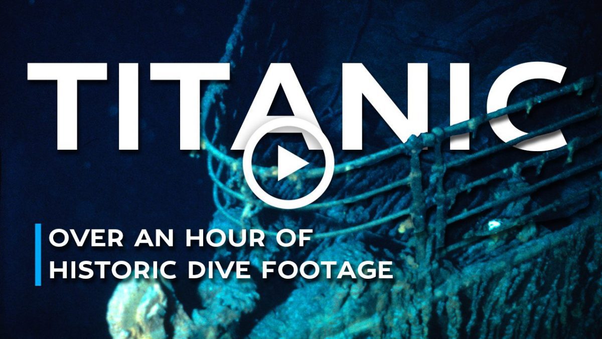
Ocean Topics

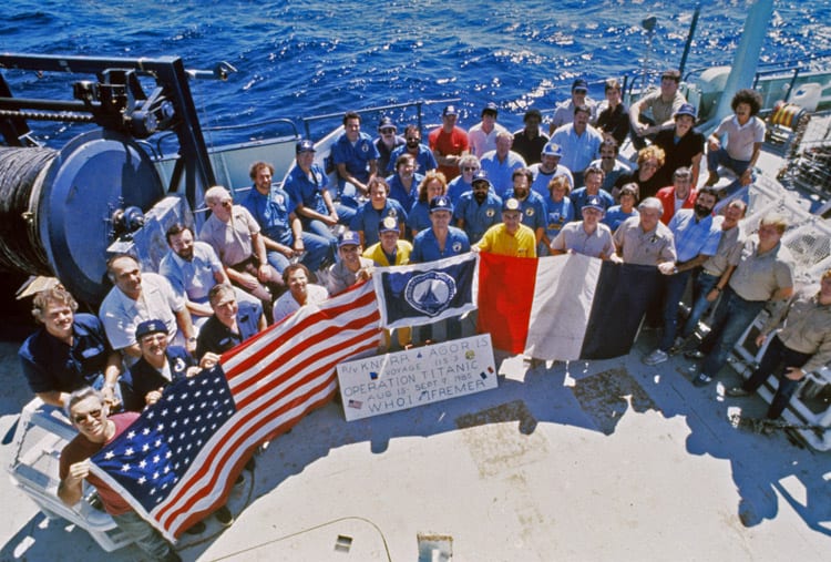
The discovery team poses on the R/V Knorr. (© National Geographic Society/Woods Hole Oceanographic Institution)
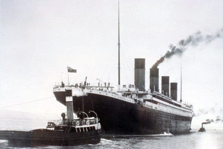
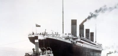
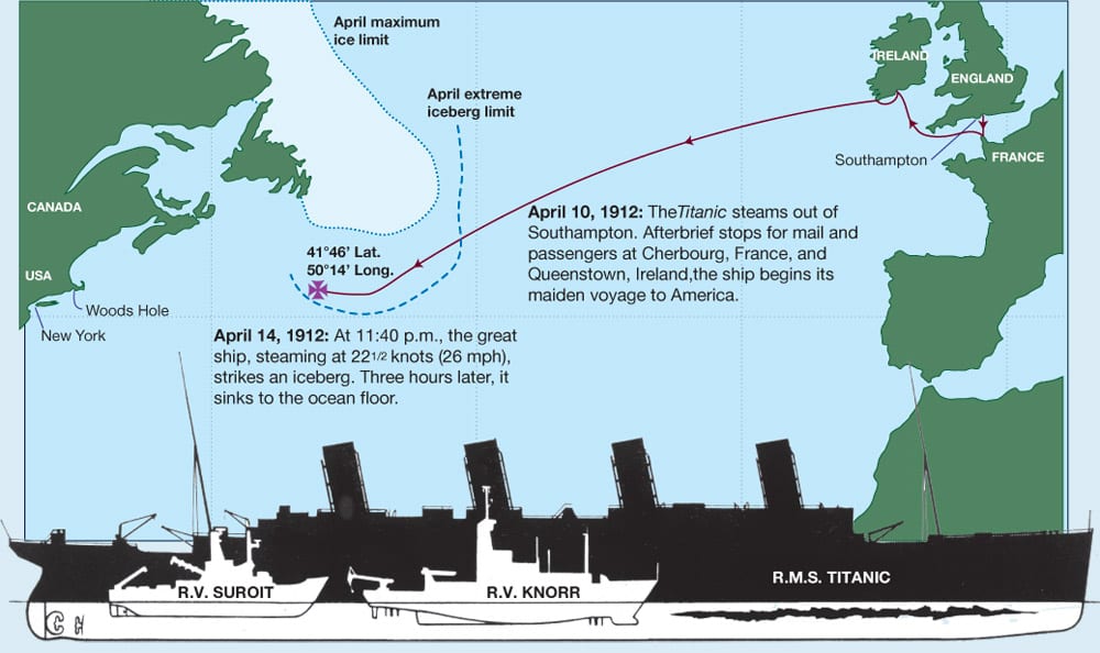
The discovery of the Titanic on September 1, 1985, is a tale of two research centers—Woods Hole Oceanographic Institution (WHOI) out of Woods Hole, Massachusetts U.S.A., and French National Institute of Oceanography (IFREMER), Toulon, France—of two ships—the Knorr and Le Suroit—and of two of the newest, most sophisticated underwater vehicles at the time, Argo and SAR.
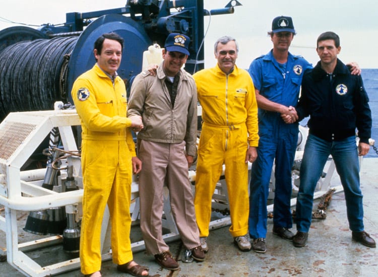
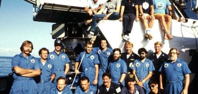
The discovery team leaders from left to right Jean-Louis Michel (IFREMER), Lt. George Ray (US Navy), Jean Jerry (IFREMER), Bob Ballard and Bernard Pillaud (IFREMER). (© National Geographic)
The first phase
A joint mission with WHOI and IFREMER, funded by the U.S. Office of Naval Technology, was put together to test to the abilities of these newly developed underwater imaging systems to locate items on the sea floor. Titanic provided a high-profile backdrop for the mission.
Team leaders Bob Ballard of WHOI and Jean Louis Michel of IFREMER researched the history of the Titanic disaster and had a thorough knowledge of the ship and of previous efforts to find Titanic. They narrowed the search field to 100 square miles and planned a two-phased strategy. (© Woods Hole Oceanographic Institution)
Team leaders Dr. Robert D. Ballard of WHOI and Jean Louis Michel of IFREMER researched the history of the Titanic disaster and had a thorough knowledge of the ship and of previous efforts to find Titanic. They narrowed the search field to 100 square miles and planned a two-phased strategy.
The first phase started on July 1, 1985, with the French team aboard Le Suroit systematically searching using the sonar system, SAR (System Acoustique Remorquè), in a pattern known as “mowing the lawn.” SAR, built by Michel, was a deep-towed side-looking sonar vessel, which produced black-and-white “shadow graphs” of the seafloor. In 1985 there were other sonar systems, but the newly-developed SAR was the most sophisticated, providing better quality imagery and creating almost a photograph of the seafloor.
During the 31-day cruise the Le Suroit encountered rough weather. When all their ship time had elapsed they still had not located the wreck, but they had eliminated more than 75% of the search area. It would be up to the WHOI team aboard research vessel Knorr—without the help of a large area mapping system—to find Titanic.
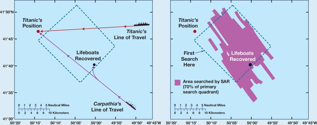
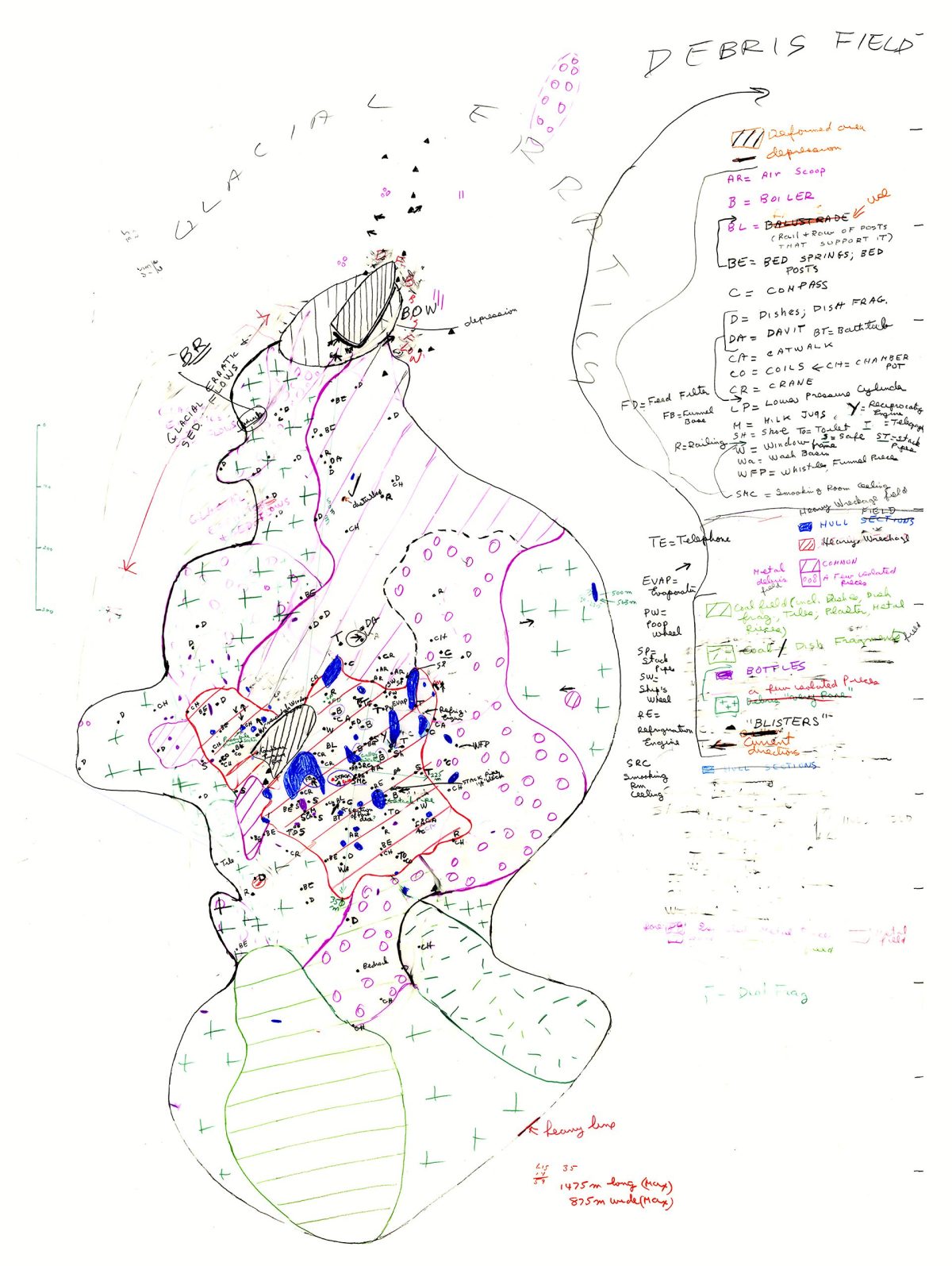
The search area is bisected from northeast to southwest by a submarine valley with many tributaries called Titanic Canyon. The geologic features in the area could obscure Titanic from sonar detection—providing confusing echoes. The strategy was to search in a methodical, overlapping pattern about 800 meters (1/2 mile) apart. This approach has been termed “mowing the lawn.” (©Woods Hole Oceanographic Institution)
The second phase
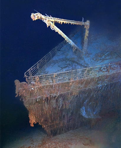
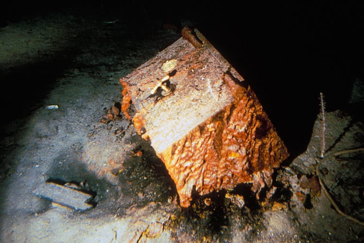
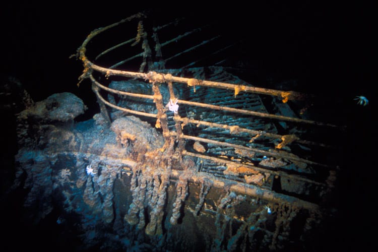
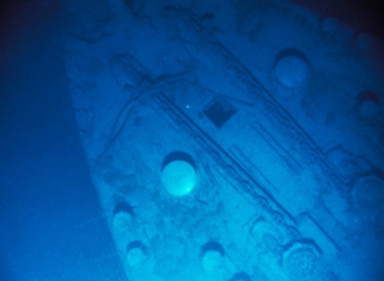
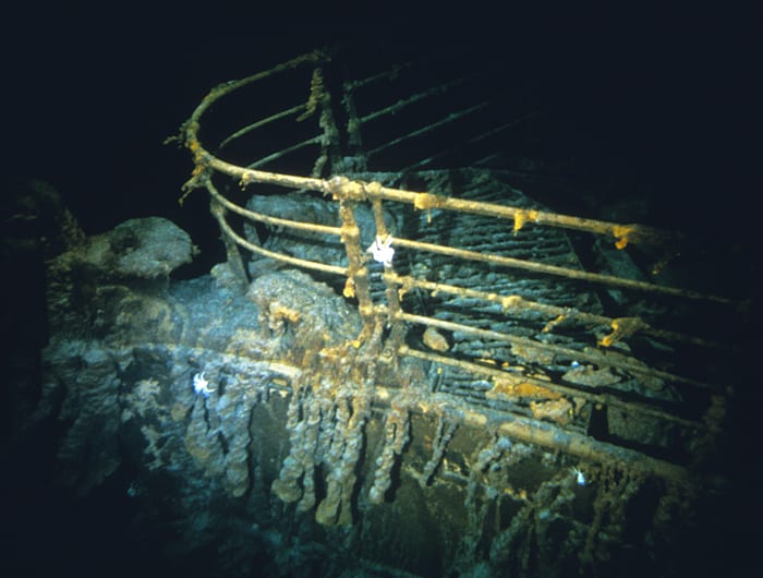
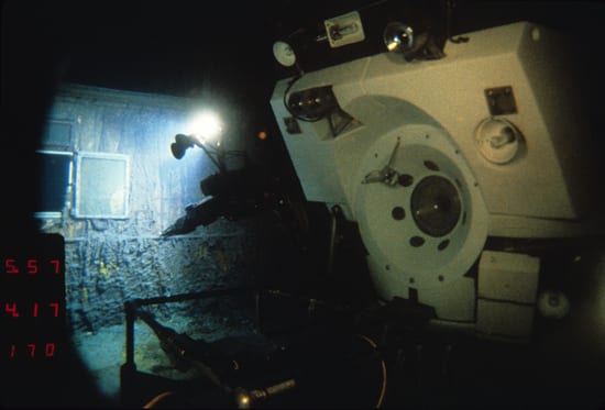
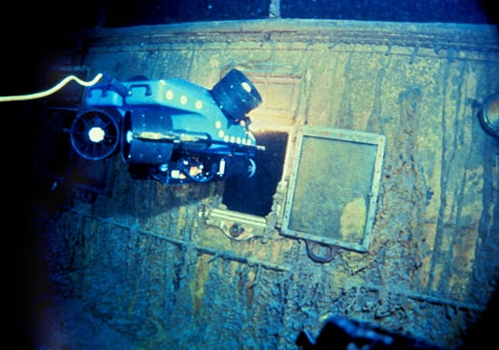
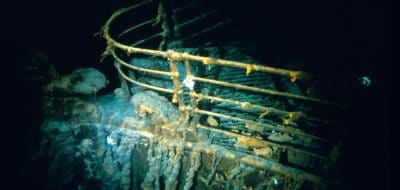
Three scientists from IFREMER joined the American cruise aboard the R/V Knorr August 15 in Ponta Delgada, Azores, for the trip across the Atlantic to the vessel's home port at Woods Hole, Massachusetts. They reached where the French team left off on August 22. With just 12 days of ship time to search, the WHOI team gambled on a radical approach for scanning the remaining search field. Rather than search for one large object—Titanic’s massive hull—they used their imaging tools, ANGUS (Acoustically Navigated Geological Underwater Survey) and the newly developed deep-towed sonar and video camera system Argo, to scour the seafloor for debris dispersed from the wreck in the current. The debris trail led to the wreck. Just after 1:00 a.m. on September 1, 1985, under more than 12,400 feet of water, one of the Titanic’s boilers was identified, confirming the wreck had been found. Video filming from Argo and 35-mm filming from ANGUS were conducted throughout the remaining four days of the voyage.
Return to Woods Hole
The R/V Knorr returned to Woods Hole Oceanographic Institution on September 9, 1985, to a joyous celebration. Thousands, including media organizations from around the world, filled the dock and surrounding waterfront areas to welcome the crew home. A press conference followed in the Institution’s nearby Redfield Auditorium, and several days later simultaneous press conferences were held in Washington, DC, and Paris.
"We are obviously very pleased and excited to have found the Titanic," WHOI Geologist and Expedition leader Robert Ballard reported to colleagues at the Institution during the voyage by high seas radio. "But we are also very aware of the significance of the Titanic as a maritime disaster." After the elation of the discovery, the remembrance of the tragedy struck home, and some of those aboard Knorr held a brief memorial service on the ship's fantail for those lost in the 1912 disaster. The discovery had been made at almost the same hour that Titanic sank beneath the waves 73 years earlier.
For the three organizations that partnered in the discovery, it proved the capabilities of new camera and sonar systems. Both Argo and SAR were undergoing sea trials and were not yet in final form. The primary mission of both French and American cruises was to conduct deep-water engineering tests, and finding Titanic was a secondary but dramatic bonus. The tests were significant advances in the development of the Argo/Jason system at WHOI for the US ocean research community, but were lost in the media attention given to the wreck’s discovery.
Argo, designed for large-area imaging of the ocean floor, returned to sea in December 1985 for its first scientific application following the successful test cruise to Titanic. Dr. Robert Ballard, who studied the mountains beneath the sea known as the mid-ocean ridge system, and his colleagues returned to sea and surveyed a 120-mile section of the East Pacific Rise, a submarine mountain range between San Diego and Manzanillo, Mexico. The East Pacific Rise is part of the 45,000-mile mid-ocean ridge, the world's largest geological feature covering some 23 percent of the planet’s surface. Since the first major efforts to study this system began in 1973, scientists had seen only some 50 miles of the ridge system, about one-half of one percent. The Argo survey in December 1985 nearly equaled the previous twelve years of work in just 20 days. Approximately 170 hours of videotape of the East Pacific Rise were taken during the cruise, confirming Argo's tremendous imaging capabilities and value to ocean exploration.
"Finding the Titanic is a dramatic demonstration of our present capability to explore the ocean depths for scientific purposes," Institution Director John H. Steele said of the Titanic discovery in 1985. "It has taken years of work by dedicated engineers and will prove its value to science and the nation in the years ahead."