More Floods & Higher Sea Levels
Geological records help forecast escalating coastal hazards
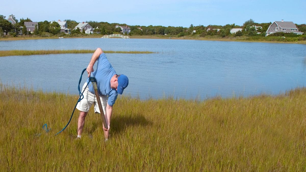
Jeff Donnelly can’t help but get his hands dirty in his work. You can often find him poking long, plastic cylinders into coastal marshes, or beaches, or the bottoms of lagoons—like an apple corer into an apple—to extract multi-layered plugs of mud and sediments. That’s his paydirt.
The layers built up over time, some of them forming as sea levels rose, or when hurricanes struck or storm surges flooded coastlines. Donnelly, a coastal geologist at Woods Hole Oceanographic Institution, examines the cores to reconstruct a history of geologic events on the coast. The deeper the cores, the further Donnelly can travel into the past.
The past puts the present, and the future, into context in two studies Donnelly took part in that received a lot of media attention. Both were published in 2016 in the journal Proceedings of the National Academy of Sciences.
The first study showed that global sea level rose faster in the 20th century than at any other time in the last 2,700 years. The rise was particularly fast over the last two decades, said Robert Kopp of Rutgers University, the study’s lead author.
For the study, scientists at Rutgers and Tufts University compiled a new database of geological sea-level records, including Donnelly’s, from marshes, coral atolls, and archaeological sites from around the world. The records spanned the last 3,000 years. They also tapped 66 tide-gauge records from the last 300 years.
A statistical analysis of the data showed that global sea level rose by about 5.5 inches from 1900 to 2000—a substantial increase, especially for vulnerable, low-lying coastal areas. What’s more, in the absence of global warming, the study showed that Earth’s sea level likely would have been lower and might actually have decreased.
The study also predicted that global sea level will rise by 1.7 to 4.3 feet in the 21st century if the world continues to rely heavily upon fossil fuels. If fossil fuels are phased out, the study predicted a sea level rise of between 0.8 and 2 feet.
The second study showed that the risk of flood hazard in New York City has increased significantly over the last two centuries. The scientists analyzed New York City tidal gauge records going back to 1856 and Donnelly’s geological records of sea levels and storm surges from the same area going back two millennia. The study’s lead author, Ning Lin of Princeton, combined the historical climate data with computer models of future climate conditions and storm surges to project future sea levels and storm intensities.
The study forecast that nine-foot floods—as intense as the one caused by Superstorm Sandy in 2012—are three times to 17 times more likely to occur over the next century.
The study reported that floods as intense as Sandy’s would have occurred about once every 400 years on average under the sea-level rise conditions in the year 2000. But over the 21st century, the accelerating rate of sea-level rise and changes in the size, intensity, and tracks of hurricanes will make Sandy-size flooding more probable.
Scientists at the following institutions contributed to these studies: Rutgers, The State University of New Jersey; Tufts University; Potsdam Institute for Climate Impact Research in Germany; Woods Hole Oceanographic Institution; University of York in the United Kingdom; and Harvard University. The research was funded by the National Science Foundation, the National Oceanic and Atmospheric Administration, the New Jersey Sea Grant Consortium, the Strategic Environmental Research and Development Group, the U.K. National Environmental Research Council, the Royal Society, and Harvard University.
Related Articles
- An introduction to marsh bothering
- Wilmington’s shark tooth divers can thank the last ice age for their treasure trove
- Novel tool sheds light on coral reef erosion
- With worsening storms, can the Outer Banks protect its shoreline?
- Dune buggies and diving:
- Adapt or retreat:
- The ocean science-art connection
- Marshes, Mosquitoes, and Sea Level Rise
- From Lab to Sea


