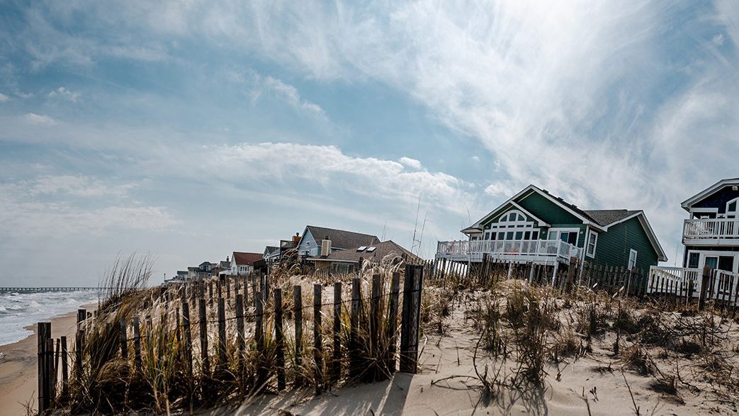
With worsening storms, can the Outer Banks protect its shoreline?
The double-whammy of more intense storms and a COVID-era real estate boom has scientists and planners focused on resiliency
 This article printed in Oceanus Winter 2022
Estimated reading time: 11 minutes
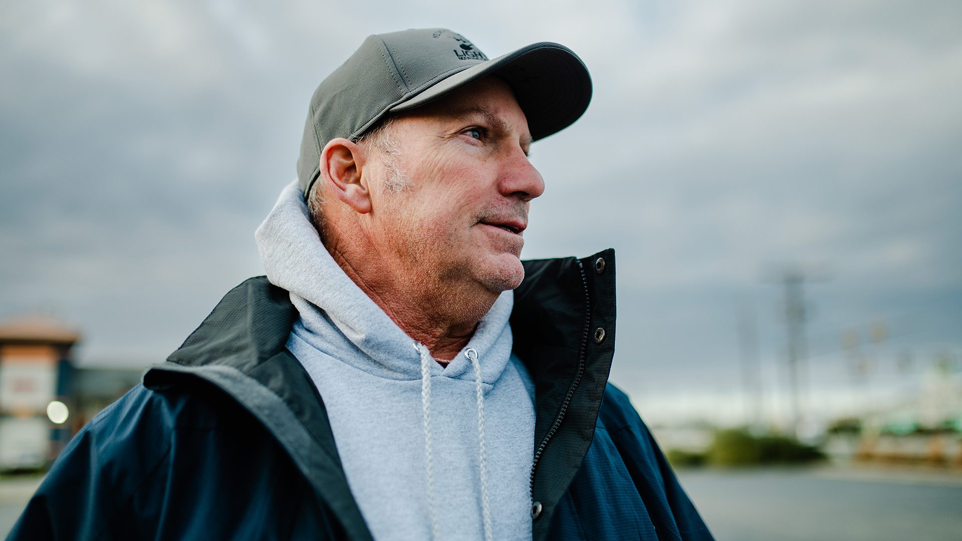
Duncan Aydlett was on a local vacation.
At least that’s what they call it in North Carolina’s Outer Banks when a storm’s barreling in, the tourists run for the hills, and locals take advantage of the day off from work to see friends and drive around watching Mother Nature do her thing.
It was Sunday of Labor Day weekend 2011, and Hurricane Irene had made landfall on the North Carolina coast the previous morning. Aydlett and his wife, Dana, drove their Chevy Avalanche pickup from their house on the Albemarle Sound side of the island in Kill Devil Hills to the Atlantic Ocean side to see what kind of muscle the storm was bringing. When they got to the beach off Ocean Bay Boulevard around noon, the seas were heavy, but the storm had already been downgraded to a category 1. To Aydlett, 65-mile-per-hour winds didn’t seem like a huge deal—he had seen far worse in the two decades he’d been living there and making a living building seawalls and putting houses on stilts.
If there was a hurricane going on that day, you might not have known it from standing on the beach. The towering dunes along the oceanfront row of stilt homes weren’t being inundated, and there was no storm surge flirting with the main road the way it often does during hurricanes.
Aydlett and his wife walked the beach for a while with a group of friends before climbing back into their truck and heading back over to the sound side of the island to check out conditions there. As they approached Albemarle Sound minutes later, Aydlett’s stomach tightened.
The water was gone.
“We were riding around the bypass and all the sudden we could see that the storm literally blew all the water out of the sound,” says Aydlett in his calm southern drawl.
While the Aydletts were driving around, winds from Hurricane Irene had shifted from the north to the west and stalled for several hours, forcing the water westward and draining the sound. What had been a coastal inlet now looked like a massive empty ditch lined with mud.
But hours later, that all changed. The water that had piled up along the western shore of the sound began rushing back eastward…right toward the Aydletts’ neighborhood.
“You couldn’t even drive down Bay Drive,” Aydlett recalls. “There were boats and piers and propane tanks littering the road, and huge mounds of marsh grass and vegetation that the storm brought with it.”
Aydlett parked his truck near the entrance of the battered road, and he and his wife headed off on foot toward their house—a cedar-shingled prefab built in 1974 on four-foot stilts.
“We were walking in shin-deep water,” he recalls. “I went ahead in front of her and all the sudden, I see this huge water snake swimming right in between us. It kinda took my breath away. I thought about yelling ‘Snake!’ but my wife was pregnant at the time, and I don’t know what she would have done. So, I turned around and just said, ‘Hey, look honey, you don’t need to come any further.’”
She went back to the truck while Aydlett kept on, slogging through what had become a wall of waist-high water. Despite the fact that the house was perched four feet above the ground, the surge had reached the lower level—flooding it, dousing the electrical and heating/cooling systems, and eroding parts of the foundation.
The couple was forced to spend the night at a friend’s house, with Aydlett experiencing a “level of worry that was about an 8 on a scale of 1 to 10.” Several weeks later, after persistent attempts to restore the house back to its pre-storm condition, he and his wife conceded to the damage from Irene and made one of the toughest calls that a homeowner ever has to make.
“There was no choice—we had to tear it down,” says Aydlett.
Year after year, the Outer Banks get battered by a broad range of storms, including hurricanes, tropical cyclones, and nor’easters. From a satellite’s view, the area looks only slightly bigger than a sandbar. But on the ground, it’s a narrow 200-mile string of barrier islands jutting into the Atlantic Ocean that is home to some 35,000 year-round residents—and a population that swells to more than 200,000 in the summer.
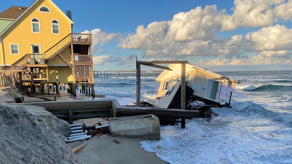
To say the Outer Banks are vulnerable is an understatement. The islands sit just a few meters above sea level in most spots, and seas there have risen nearly a foot since 1950, according to SeaLevelRise.org. The region’s vulnerability becomes most obvious when storms roll in. Angry ocean waves eat away at the beaches and dunes, rain can fall more than an inch an hour, and tidal inundation can turn main streets into rivers and cause beach roads to disappear. In some areas along the shoreline, beaches are shrinking more than 14 feet a year. And beachfront homes routinely collapse from the wrath of storm surge.
Experts suggest that as climate change worsens, the frequency and intensity of storm events around the Outer Banks will increase. At the same time, droves of people who can now work from wherever are flocking to the Outer Banks, which have seen record-breaking real estate sales over the past few years.
With the double-whammy of worsening weather extremes and an ongoing population surge, can the Outer Banks protect its shoreline?
Nearly 3,000 miles away from Aydlett’s old neighborhood in the Outer Banks, Britt Raubenheimer sits in her winter home in Sandpoint, Idaho, crunching numbers on her computer. She’s working through a massive data set filled with a variety of recorded measurement values: ocean currents, water levels, groundwater chemistry, rainfall, and storm surge height, to name a few.
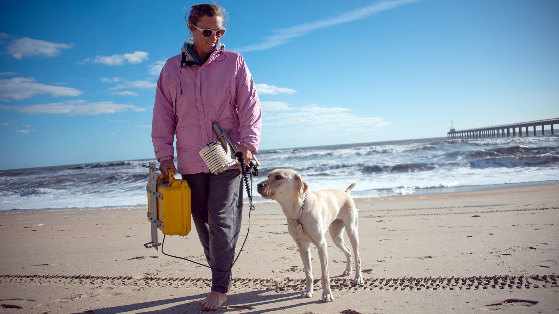
Raubenheimer, a senior scientist at Woods Hole Oceanographic Institution, along with research colleagues from U.S. and international universities and federal agencies, had collected the measurements between mid-August and the end of October 2021, from a network of sensors the researchers had set up on the beach in the Outer Banks town of Duck and on Pea Island to the south. The work is part of a multiyear field research project known as DUNEX (During Nearshore Event Experiment) aimed at understanding how the coast is responding to climate change and how scientists can help communities across the Outer Banks plan for a safer and more resilient future.
“We want to provide coastal managers there with information they can use to make better decisions,” says Raubenheimer. “For example, how often they should consider nourishing a beach; when they should bulldoze sand off the roadways; where’s the best place to put that sand. And if a road gets destroyed, should they rebuild it where it was, or somewhere closer to the ocean?”
To help local communities grapple with these questions, DUNEX researchers are trying to solve a very complex and nuanced puzzle. They’re investigating how the ocean, shoreline, dunes, groundwater, beach vegetation, and atmosphere all work together as a single system and studying what happens to that system during hurricanes and other storm events.
Using the beach as a massive living laboratory, the team deployed hundreds of sensors—many attached to steel poles jutting several feet out of the sand—to track conditions before, during, and after storms passed through. The instruments, which included current meters, wave-height sensors, sand-level and moisture sensors, and groundwater flow and chemistry sensors, logged more than two months’ worth of data. The coastline was getting an EKG.
“The ocean in the Outer Banks doesn’t just affect the beach—it can affect what happens as much as a kilometer inland,” says Raubenheimer. “So, we need to bring a lot of pieces together in our analysis to understand how these different variables work together to alter this island.”
There are, indeed, many forces influencing the ways storm events impact the Outer Banks. For example, it’s not uncommon during storms—particularly those with a lot of rainfall—for groundwater levels below the sand to rise higher than the land. The beach, explains Raubenheimer, acts as a massive sponge, absorbing more and more water from waves and rain over time. Beachgoers won’t see it happening under their feet, but this process can create a massive bulge of water that travels inland like an underground wave and ultimately causes low-lying streets and driveways to flood.
“A lot of roadways are going to flood during storms, even with no rain at all,” says Raubenheimer. “We’ve been tracking this flow of groundwater to try to determine and forecast the processes that contribute to flooding.”
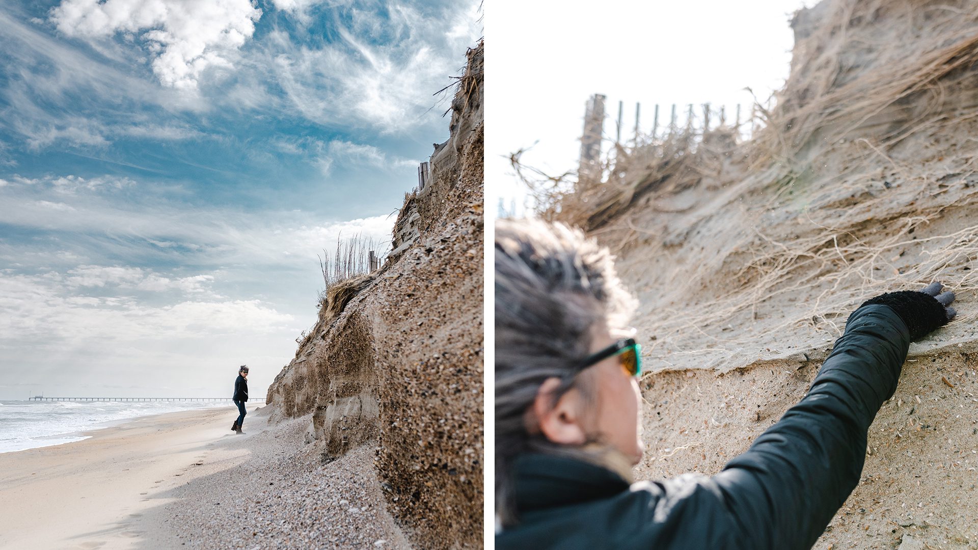
Storm-driven winds and ocean currents also work together to create an ever-shifting river of sand that runs laterally up and down the shoreline. Sandy Cross, a senior town planner in Duck, says that in some spots along the beach there can be a huge build-up of wind-blown sand along the dunes, whereas in others just meters away, there’s erosion in the form of steep-sloped escarpments, which look like walls carved by professional sand sculptors.
Raubenheimer often sees this phenomenon, but she’s more focused on the inherent fickleness of storms—and how, on a larger and more horrific scale, one beachfront home can be demolished while a neighboring home goes unscathed. She believes it has to do with the interactions among ocean waves, underwater sand levels, and the ways sand moves between the dunes and ocean.
“These processes can create changes in water levels and wave energy along the coast and cause small ocean eddies that circulate near shore during certain storm events,” Raubenheimer explains. “We’ve been tracking these land-ocean interactions and observing these mini-whirlpools as part of our work.”
In many places along the Outer Banks, the island runs less than a half-mile wide—which means that the ocean’s effects can reach all the way to the sound side, where Aydlett lost his home during Irene. To study this system, the DUNEX team deployed water-level sensors that tracked waves running up onto sound-side beaches during storms. The data will help determine how effective beach vegetation is in dampening the waves and how the sound’s water levels may affect groundwater processes, flooding, and sound-side erosion.
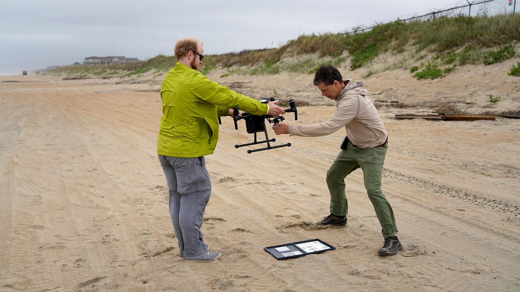
Aerial observations have also been a key tool for DUNEX researchers. Raubenheimer, along with WHOI senior scientist Steve Elgar, research associate Levi Gorrell, and MIT-WHOI Joint Program student Ciara Dooley, have developed new techniques for obtaining flow measurements using drone video of foam from breaking waves. This method provides higher-resolution data than current meters will allow.
Aerial imagery allows the researchers to get a visual read on how the shoreline morphs over time. Fixed-wing planes flown by the U.S. Geological Survey have captured aerial images of roughly 150 miles of coastline, from the North Core Banks up to the border with Virginia. These images, according to Raubenheimer, provide solid quantitative measurements of the beach and dune surfaces.
The ever-changing coastal landscape is also being eyed from the ground. Cross heads out to the beach before and after storms to film the gains and losses the wild weather invariably brings. With a GoPro camera mounted to the side mirror of a pickup truck, she drives the entire six-mile stretch of the beach in Duck, capturing high-definition video of dune profiles along the way. She tries to film from the same angle each time, so she and town engineers can easily compare beach conditions from before and after a storm and from storm to storm.
Noting that three nor’easters had already hit the Outer Banks before the end of January 2022, Cross is witnessing erosion occurring
“I would say that from what we’ve seen, these past two storms have created erosion in areas that I have never seen in my 19 years here,” she says. “The beach is just beat up,” she says. “I don’t know how else to put it.”
With more than 75 terabytes of coastline data from the Outer Banks on her computer, Raubenheimer says she now has several years of analysis to reckon with. As labor-intensive as the process will be, she knows that town planners like Cross who are working on resiliency plans, and contractors like Aydlett who are working to get homeowners’ properties higher off the ground, are counting on the science. They need the DUNEX team to present facts to inform sound decisions on near-term public safety and long-term coastal resiliency.
“We’re probably not going to be able to tell you that, during a particular storm, Joe’s house is going to get destroyed or that Steve’s house will be fine,” says Raubenheimer. “But the data we’re generating can help build stronger models that can at least tell us the risk that a particular dune or stretch of sound-side or oceanside beach could be wiped out.”
Having lived through a trio of nasty nor’easters in just the first month of 2022, residents and scientists might be hard-pressed to be optimistic about what the future holds for the Outer Banks. But one way Raubenheimer stays hopeful is by looking at history. She points out that many of the Outer Banks dunes that are still standing tall today were constructed in the 1930s to prevent lowland flooding and encroaching sediment during major storms.
“They’re still healthy in a lot of places,” she says. “It’s amazing how resilient our coastlines are.”
Funding for the research is provided by the US Coastal Research Program, National Science Foundation, Vannevar Bush Faculty Fellowship, and PADI Foundation.

