Letter from Kangiqsujuaq
A mooring in the remote Hudson Strait offers a finger on the pulse of unfolding Arctic change
Charlie’s Motel was a welcome break from Kangiqsujuaq’s airport in northernmost Quebec, where we had just spent six hours uselessly waiting for the plane that would take us home. But it was too windy for the plane to land that August day in 2006.
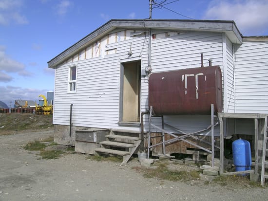
Charlie’s place was not much of a motel at all. It looked like a house, with no neon sign and, in fact, no vacancies—the house was rented to miners for the season. But, as Charlie simply put it, the miners were traveling, and if the plane was not going to land, they would not be back, and we needed a place. So he gave us the key, dropped us off, and said he would pick us up the following morning to take us to the airport.
We signed no papers and, to this day, we have not received a bill. (When we left, I pictured the miners going through the house asking, “Who slept in my bed?” and “Who ate from my plate?”)
While not luxurious, with its plywood furniture and screw handles, the “motel” provided a shelter from the relentless, cold wind that had been blowing since Jim Ryder, an engineer at Woods Hole Oceanographic Institution, and I had left the Canadian Coast Guard icebreaker Pierre Radisson early that morning. Charlie’s hospitality was a reminder of the simple, matter-of-fact approach to life of the Inuits, who live in a harsh territory, where there are no “extras,” and life is still very much about survival.
A pipeline to the North Atlantic
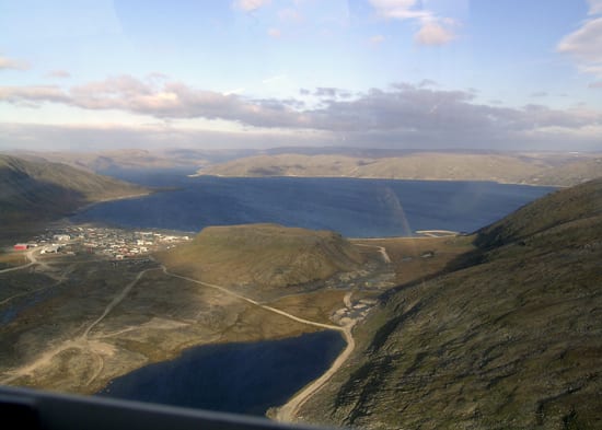
Kangiqsujuaq is nestled on a deep bay at the tip of Peninsule D’Ungava off Hudson Strait. The houses built along a beach offer breathtaking views of the water and mountains across the bay. I tried to picture this place in a few months, covered in snow and ice, the huge tides lifting the sea ice up and down on the beach. The locals wait for the 8-meter (26-foot) tide to recede, so they can dig a hole in the ice and collect the mussels that lie beneath.
Hudson Strait is like a pipe funneling a large amount of relatively fresh water from the Arctic region into the North Atlantic. The fresh water comes from rivers that drain into Hudson Bay, from melting sea ice in the bay, and also from the Arctic Ocean, via a maze of interconnecting, narrow straits. Small changes in the freshwater input into the North Atlantic can potentially induce large changes in ocean circulation and variations in our climate. (See “The Once and Future Circulation of the Ocean.”)
Although the Hudson Strait is the third largest source of fresh water to the North Atlantic, no one had ever measured or monitored it before because it lies in a remote region, full of strong currents and sea ice that are daunting for researchers and instruments.
The goal and rationale of my research when I first started was straightforward: to quantify the amount and timing of the freshwater flow into the North Atlantic via Hudson Strait, for the first time. So, with support from the WHOI Ocean and Climate Change Institute, and in collaboration with Canadian colleagues interested in the ecosystem of the region, we deployed three moorings in August 2004. We have returned each summer since, anxious to recover our mooring, see if it was safe and working, and then to redeploy it.
A new, under-the-ice device
Our helicopter ride to Kangiqsujuaq in 2006 had been bumpy, but I was so excited to fly across Hudson Strait that I barely noticed. It was my third year out here, but the first time that I could get an aerial view of the coast, close to the location where we had just deployed our mooring for another year of monitoring beneath the surface.
While Jim and I discussed whether we were flying right above it or not, the co-pilot pointed at the ocean beneath us and asked with his strong French accent: “Uat is zat big yelloo fing dere?” A wide grin spread across his face when he saw my split-second panic. He was only joking; the mooring was still in the water. Indeed, the big yellow top flotation sphere of our mooring, like most, did not extend to the surface, where sea ice and icebergs would have quickly damaged and destroyed it. Had we been able to see it, it would have meant that the mooring had broken loose.
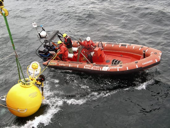
Unlike most moorings, ours had an experimental feature, called an Arctic Winch, housed on the top-float, which was designed to measure that crucial layer close to the surface where the freshest water sits. (See “A Sentry in the Atlantic Gateway.”) The sphere remains 60 meters (200 feet) beneath the surface, where it is safe from sea ice and icebergs that extend down and flow right over it. Once a day, the Arctic Winch unspools a cable with a small float that rises toward the surface collecting temperature and salinity data, and then is immediately pulled back down, out of harm’s way of ice.
The Artic region is changing
Researching the scientific literature about what is known about fresh water in this region, I found that the freshwater flow varied from year to year. It became obvious that to get a meaningful mean estimate, we would need to repeat our measurements for several years.
Through the literature, I also became aware that upstream of Hudson Strait, in the Hudson Bay region, things were changing rather quickly. Sea ice is forming later and melting earlier, with dramatic impacts on the local hunters—from the polar bears to the Inuits. The river input has been decreasing noticeably (offsetting a significant increase in river input to the Arctic Ocean). The permafrost is retreating, causing houses to sink in several Inuit villages. Not surprisingly, the 2001 report by the Intergovernmental Panel on Climate Change indicated that this region and its native inhabitants were among the most vulnerable to global warming.
The reports of what is happening in the Hudson Bay region have given me even greater motivation to continue these measurements. The Canadians and I have fought hard to keep them going. Through the continued support of the WHOI Ocean and Climate Change Institute and, more recently, the National Science Foundation, we are now in our third year.
I had gone into Hudson Strait, viewing it simply as a tap to the North Atlantic. Now, I know that these measurements are equally crucial to understanding the changes upstream in the Hudson Bay region.
It seems pretty straightforward to me. I think Charlie would agree.
Slideshow
Slideshow
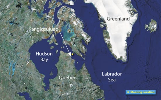
- Not far from the vilage of Kangiqsujuaq, WHOI researchers deployed a mooring (yellow star) to measure fresh water funneled out of Hudson Bay via the Hudson Strait into the North Atlantic. Fresh water potentially can induce changes in ocean circulation and climate. (Map courtesy of NASA)
- The village of Kangiqsujuaq in northern Quebec (population less than 500) is nestled on a deep bay off Hudson Strait. (Photo by Fiamma Straneo, Woods Hole Oceanographic Institution)
- When WHOI researchers were stranded in Kangiqsujuaq because weather canceled outgoing flights, the owner of Charlie's Motel (above) opened his doors to them. (Photo by Fiamma Straneo, Woods Hole Oceanographic Institution)
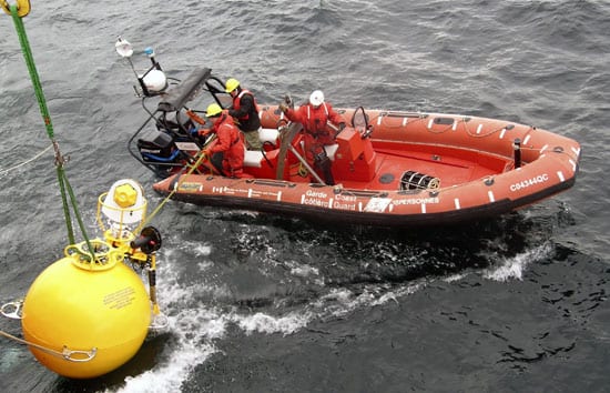
- Mariners from the Canadian Coast Guard icebreaker Pierre Radisson use an inflatable boat to deploy a mooring equipped with an Arctic Winch, the white and yellow device on top. The mooring will spend a year measuring the outflow of fresh water through the Hudson Strait. (Photo by Fiamma Straneo, Woods Hole Oceanographic Institution)
Video
Related Articles
Featured Researchers
See Also
- Fiamma Straneo's Research
- Monitoring the Freshwater Flow into the Atlantic through Hudson Strait
- Reaching Up into Icy, Perilous Waters from Oceanus magazine
- Fresher Ocean, Cooler Climate A less-salty North Atlantic Ocean could cool northern winters.
- The WHOI Ocean and Climate Change Institute

