The 10,000-foot view
WHOI’s Tom Bell tracks changes to vulnerable coastal ecosystems with aerial imagery
Estimated reading time: 4 minutes
 This article printed in Oceanus Summer 2024
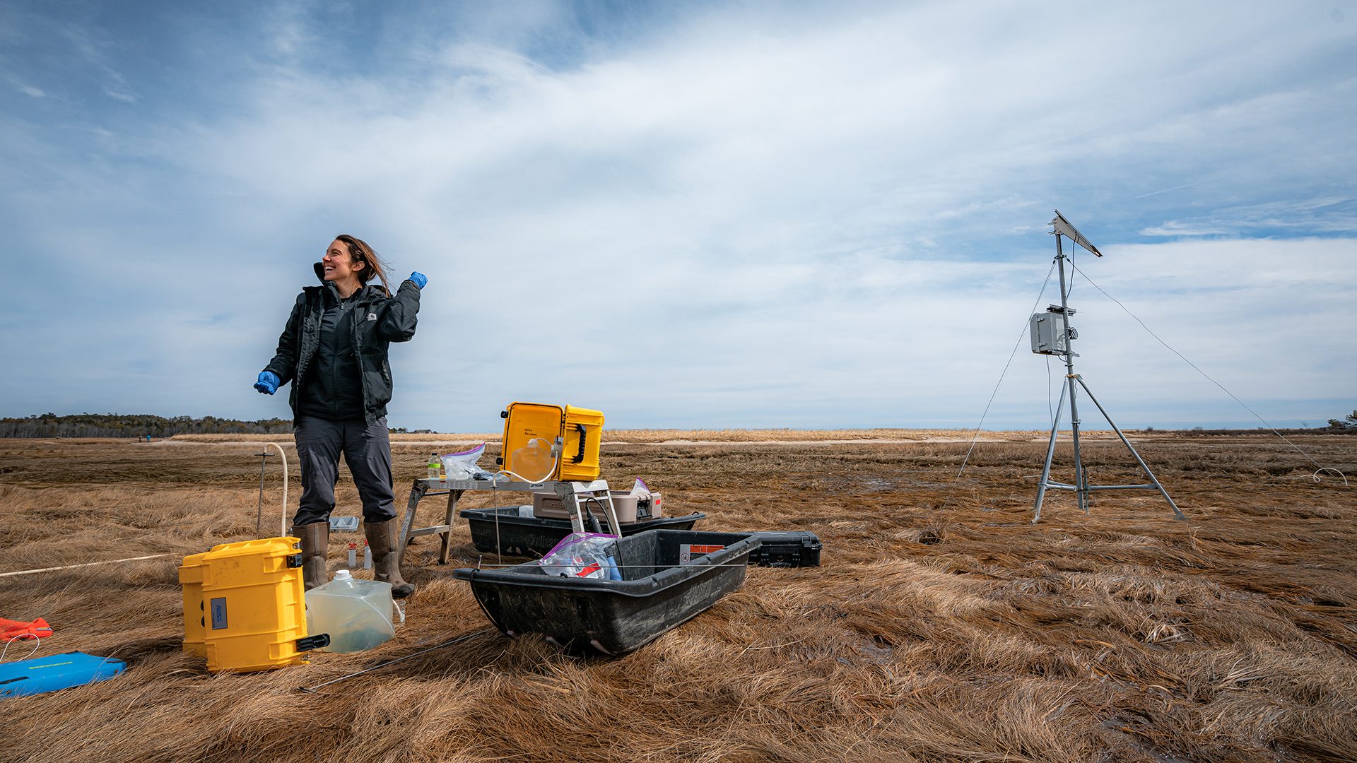
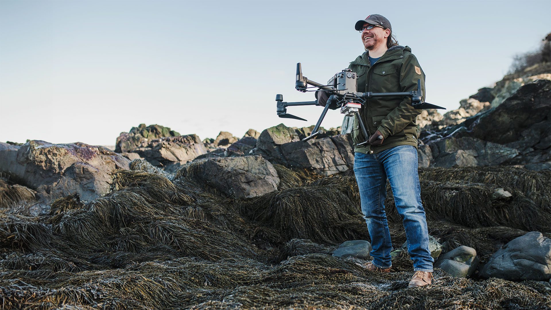
The wind whipping off of Massachusetts Bay in mid-February is hardly daunted by the jagged, ice-encrusted rocks exposed along the low-tide shoreline. But Tom Bell is not deterred as he removes a quadcopter-style drone outfitted with an advanced imaging system from its black case. “It’s under 25 miles per hour, so we’re good to fly,” he remarks, sending the drone up and away over the intertidal zone.
In collaboration with his colleagues at Northeastern University, Bell, a WHOI scientist who specializes in coastal remote sensing, is surveying macroalgae known as rockweed or bladderwrack growing along the rocky coast north of Boston. Stitched together and viewed within specific electromagnetic bands back at the lab, the grayscale images reveal a world beyond the range of the human eye: a near-infrared blur of white that reveals chlorophyll, black shades that signify seaweed cover, and gray dots that are actually barnacles. This bird’s-eye view, combined with Northeastern’s field sampling and analysis, establishes a baseline of ecosystem health and changes on a scale that would be impossible to do with only feet and eyes on the ground.
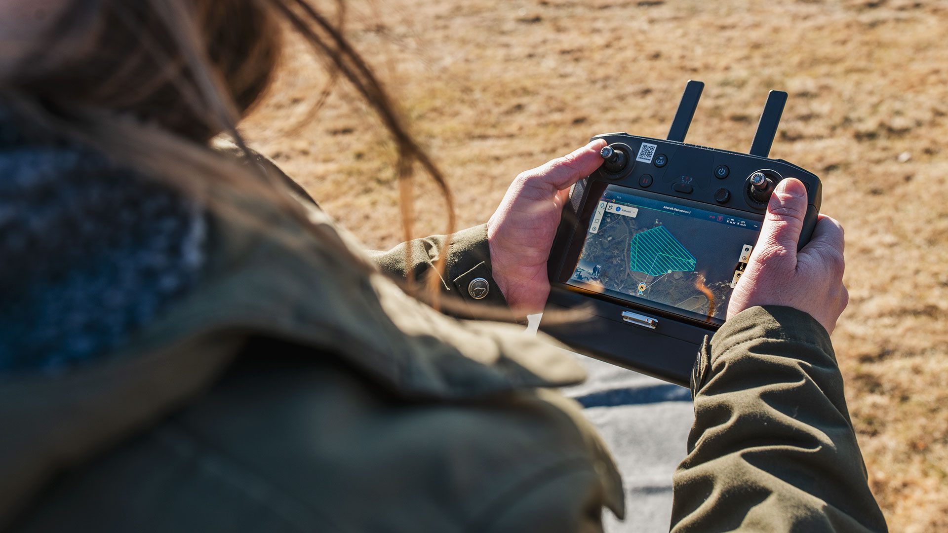
Tom Bell looks at his drone controller, which shows a readout of his flight path. (Photos by Tom Bell and Daniel Hentz, respectively, © Woods Hole Oceanographic Institution)
“Since the ’70s, there’s been a huge decrease in the amount of mussels that used to be the primary space holders in this area along the Gulf of Maine. And some of that has been replaced by barnacles, but also a lot has been replaced by macroalgae,” Bell said. “I’m interested in how the system dynamics are changing, and how that’s affecting the intertidal community and carbon cycling in the coastal ocean. By drilling into the different electromagnetic bands, we can look at biomass, density, and even the physiological condition of various coastal foundation species.”
Whether it’s an algae-carpeted intertidal zone or a tropical mangrove, a waving seagrass meadow or a fecund salt marsh, plants and seaweed are the engines of coastal biodiversity—a green-tinged litmus of ecosystem health and “blue carbon” capacity. For many years, these wetlands were thought of as wastelands that were drained, filled, or removed. Or, they were simply overlooked as various pollutants washed into the ecosystem, drastically diminishing their storm-tempering, carbon-sequestering, and fish nursery benefits. As a result, an estimated 30% of the world’s seagrass meadows and mangroves have disappeared in the last century, and we continue to lose the equivalent of two soccer fields’ worth of salt marsh every hour. We know about the rate and scale of loss thanks to Landsat satellites, which have silently captured the decline from 438 miles (705 kilometers) above Earth for over 40 years.

As a researcher at the University of California, Santa Barbara, Bell started wondering if he could use remote sensing with satellites to track the health of the West Coast’s prodigious kelp forests, which form canopies at the ocean surface. In partnership with researchers from NASA, the Nature Conservancy, and several academic institutions, Bell documented a 95% decline in bull kelp along 200 miles (322 kilometers) of the Northern California coast during the winter of 2014-2015, which the researchers attribute to a massive marine heatwave.
“My goal is to answer fundamental questions about how ecosystems work in general,” Bell said. “In the process, we’re creating toolboxes for people to have the opportunity to understand how systems are changing, and that can help with their conservation or restoration initiatives.”
"Having a 700-kilometer view of Earth gives you a view of spatial patterns and connections you would never otherwise see."
—Tom Bell, WHOI scientist
In 2021, shortly after coming to WHOI, Bell and his partners launched an open-source website called Kelpwatch.org, which allows users to visualize changes in kelp canopy dynamics over time via a simple user interface. Three years into the project, they have expanded coverage from the U.S. West Coast to southern Alaska, Argentina, and the Falkland Islands, and they have plans to bring Chile, Tasmania, New Zealand, South Africa, and the sub-Antarctic islands on board soon. It’s a high-touch process: Ashland Aguilar, a research assistant in Bell’s lab, cross-references the initial results with high-resolution imagery from Google Earth before working with local researchers to review them.
Kelpwatch, according to Bell, offers a reliable and efficient way to scale up monitoring of critical coastal ecosystems. But he isn’t completely satisfied with the 30-meter (98-foot) resolution provided by satellites. To get a more detailed picture, he started using aerial drones equipped with hyperspectral (more than 50 bands), multispectral (10 bands), and even regular old color (three bands) cameras to survey the coast. The resulting data helps him create a “digital twin” to test the effects of waves, tides, and sunlight on the growth patterns of intertidal species.
He has applied this imaging technique from the rocky coast of Massachusetts to South Africa, where his lab joined the first BioSCape field campaign in the Greater Cape Floristic Region with NASA and international collaborators in the fall of 2023. The confluence of Atlantic and Indian Ocean currents stirs up a potent cocktail of nutrients that sustain lush kelp forests in this biodiversity hotspot on the Cape of Good Hope. NASA airplanes outfitted with advanced imaging sensors were instrumental in surveying the canopy, adding to the data gathered by Bell’s team with drones and field sampling to show the bigger picture of how changing ocean conditions, phytoplankton diversity, and harmful algal blooms impact the kelp forest.
“Remote sensing with satellites and planes will never replace field work,” said Bell. “But having a 700-kilometer (434-mile) view of Earth gives you a view of spatial patterns and connections you would never see otherwise.”

The research in this article was funded by Northeastern University and a WHOI seed grant (Nahant, MA), NASA Ocean Biology and Biogeochemistry (Global Kelp Map & BioSCape), NASA Biodiversity and Ecological Conservation (BioSCape), and The Nature Conservancy (Kelpwatch.org).