A “Thinking Map” of North America
For geologist Brian Tucholke, creating a new Geologic Map of North America was a 23-year adventure. Published in February by the Geological Society of America (GSA), the map illustrates the geology of approximately 15 percent of Earth?s surface and spans an area from the North Pole to Venezuela, and from Ireland to Siberia.
For geologist Brian Tucholke, creating a new Geologic Map of North America was a 23-year adventure. Published in February by the Geological Society of America (GSA), the map illustrates the geology of approximately 15 percent of Earth’s surface and spans an area from the North Pole to Venezuela, and from Ireland to Siberia.
The new map was a cooperative effort by Tucholke, who mapped the seafloor geology, and John C. Reed Jr. of the U.S. Geological Survey and John O. Wheeler of the Geological Survey of Canada, who compiled the map’s continental geology. The last such map was published in 1965.
“This is the first continent-scale geologic map of North America published since the plate tectonic revolution, ” said Tucholke, a senior scientist in the Geology and Geophysics Department. “In addition to showing seafloor geology for the first time, it presents a whole new view of the geology of North America in a plate-tectonic context.”
In 1981 GSA officials asked Tucholke if he thought compiling the seafloor geology for a new North America map was realistic, and if he would do it. “I answered yes to both,” he said. “I didn’t realize what I was getting into.”
Tucholke started the work in 1982, doing everything from scratch, with only minor funding for the project compared to the magnitude of the task. With small amounts of support from the Office of Naval Research, the National Science Foundation, GSA, and WHOI, he did much of the work during evenings and weekends on his own time, extracting information from published literature, unpublished data from any sources he could “mine,” and contributions he solicited from other scientists.
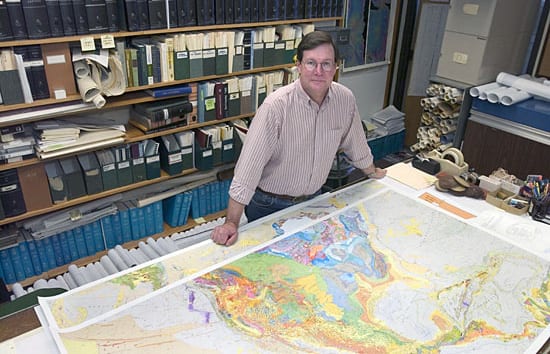
The 6-by-6-foot map is printed in 11 colors with about 700 shades and patterns. It distinguishes more than 900 rock units, 110 of which are offshore, and it depicts more than seven times as many on-land units as its 1965 predecessor. But perhaps its most significant additions are detailed geological attributes of the seafloor, including such diverse features as spreading centers, subduction zones, seamount chains, major faults, submarine drainage patterns, and ages and lithology of outcrops—all thanks to Tucholke.
In a pamphlet published with the map, Tucholke and his co-authors say the new geologic map is essentially a “thinking map” for earth-science professionals, students, and the public that “undoubtedly will lead to new ideas about how the geology of North America should be interpreted.”
“This, in turn, will make possible new insights into the evolution of the continent,” they wrote. “In practical terms, it will generate new exploration strategies for the discovery of mineral and energy resources and will facilitate development of better ways of assessing and mitigating environmental risks.”
For additional information:
Geology Society of America bookstore
or contact GSA Sales and Service, gsaservice@geosociety.org,
or call 1-888-443-4472
Image

Slideshow
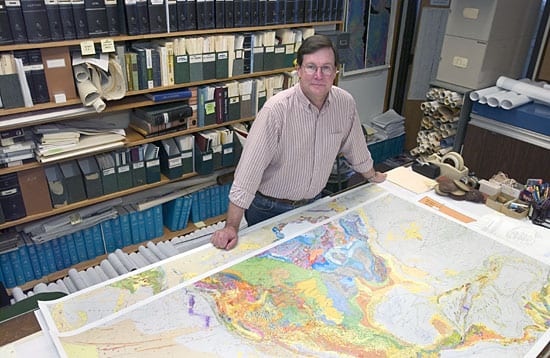
- MAPPING NORTH AMERICA—WHOI Senior Scientist Brian Tucholke helped create a newly published Geologic Map of North America for the Geological Society of America—the first such map since before the plate tectonic revolution of the late 1960s and the first that includes seafloor geology. (Credit: Tom Kleindinst)
Related Articles
- Our eyes on the seafloor
- Unlocking the Earth’s time capsule
- 3 memorable Jason Dives
- How did the ocean remain so quiet during Tonga’s eruption?
- With deep-sea mining, do microbes stand a chance?
- Coming full circle
- 7 Places and Things Alvin Can Explore Now
- The story of “Little Alvin” and the lost H-bomb
- Life at Rock Bottom
