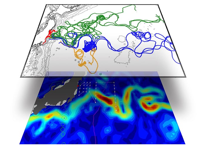
An international scientific team led by WHOI marine chemist Ken Buesseler completed a research cruise in June 2011 to assess the levels and dispersion of radioactive substances from the Fukushima nuclear power plant and potential impacts on marine life. The bottom map shows the sampling stations and cruise track across the powerful Kuroshio Current (shown in yellow and red). The top map shows color-coded tracks of surface drifters released by WHOI physical oceanographer Steven Jayne. The research indicated that the Kuroshio acted as both a highway and a barrier, carrying much of the radiation quickly away from shore while also largely preventing it from spreading south.(Image courtesy of Steven R. Jayne, Woods Hole Oceanographic Institution)
More Content From :
Ocean & Human Lives


Image and Visual Licensing
WHOI copyright digital assets (stills and video) on this website can be licensed for non-commercial use upon request and approval. Please submit your request via our Media Request Form.
For assistance or accessibility accommodations, call (508) 289-2647.