The Ghost Mooring
WHOI engineers find equipment lost in the Antarctic a decade ago
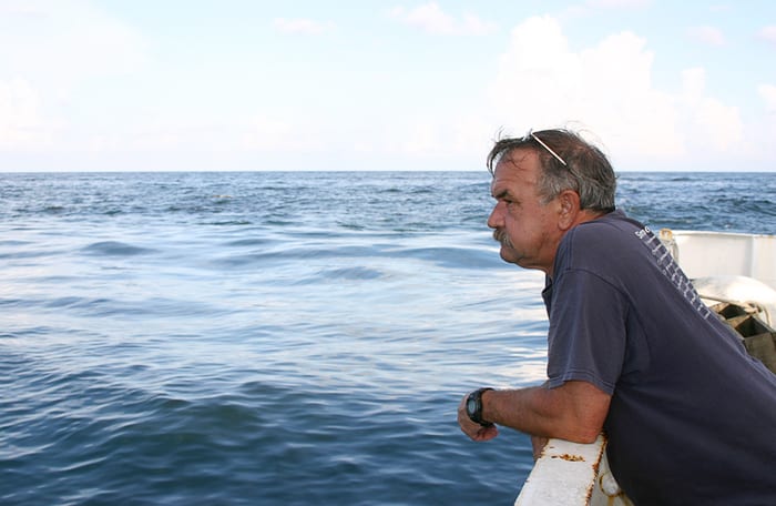
Just before leaving for a long-awaited vacation, Scott Worrilow came in to work on a Monday morning in April 2011, just for a few minutes, to do a routine daily task. Worrilow manages the Sub-Surface Mooring Operations Group at Woods Hole Oceanographic Institution (WHOI), whose engineers travel the globe to install deep-sea moorings that measure the ocean’s temperature, salinity, and currents. He checked his computer to make sure there were no incoming signals alerting him that a mooring somewhere in the world had malfunctioned.
There it was—a telltale alert indicating that a mooring had come loose and had surfaced unexpectedly. “I was ticked off,” Worrilow said. He saw his vacation slipping away, as he mobilized to try to retrieve the mooring and the hard-won data it had recorded.
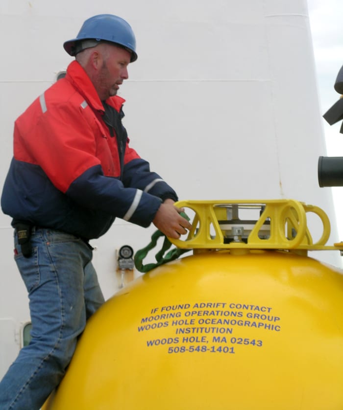
Moorings are instrument-bearing cables, sometimes miles long, that are anchored to seafloor and held upright in the water by buoys or subsurface floats. Just above the anchor is a device called an acoustic release. When it receives a sound signal from a ship at the surface, it disconnects the cable from the anchor, and the float rises to the surface. A transmitter on the float then turns on and sends out the mooring’s assigned number and its latitude and longitude—using a satellite tracking system called ARGOS—so that researchers can locate and retrieve it. If a mooring surfaces accidently, its owners are quickly notified and can begin to plan the mooring’s recovery.
The mooring number relayed to Worrilow in April was 23910. It had been assigned to an important mooring, part of a line of moorings Worrilow had placed the previous year for WHOI physical oceanographer John Toole, spanning the continental slope just north of the Gulf Stream in the Northwest Atlantic Ocean. “Losing John’s mooring—he’s my supervisor, and I work for him!” Worrilow said, shaking his head. He quickly checked the mooring’s longitude: 69.54° W. It matched the longitude where the Line W mooring had been placed.
Worrilow alerted Toole about the mishap and set out to find “a ship of opportunity”—a vessel in the vicinity that could retrieve the mooring.
Gone forever
More often than not, if a missing mooring isn’t located quickly by the ship and engineering team, the few moorings that become lost, stay lost. Unlike a sock that disappears in the dryer and mysteriously shows up weeks later in the back of a drawer, equipment lost in the deep wide ocean usually is never seen again. That’s what Worrilow’s more than three decades of experience at sea told him.
In 2001, for example, Worrilow and a group including WHOI engineer Jim Ryder placed six deep-water moorings west of the remote Antarctic Peninsula. They were part of a long-term project to study the currents that flow south along the west coast of the 745-mile-long peninsula and into Marguerite Bay, a vibrant nursery for the shrimplike krill that feed Antarctic cod, penguins, leopard seals, and whales.
The moorings were for work by WHOI scientists Bob Beardsley, Breck Owens, and Richard Limeburner, and for MIT/WHOI Joint Program graduate students, including Carlos Moffat, who planned to use the data for his Ph.D. research. Placed across a deep channel, the moorings’ instruments would collect the first data on how currents and ice moved around this part of Antarctica.
When the mooring group returned in 2002 to recover the moorings, they found five of them, but the last one didn’t respond to the acoustic signal to release the anchor. “We were really disappointed,” Beardsley said. “It was a vital mooring, and it didn’t come back at all. It was kind of a puzzle because the acoustic releases are extremely reliable.”
So Worrilow commenced operations to try to drag a thick wire horizontally near the seafloor in an effort to cut across the stuck mooring line and trip it, so that the instruments rose to the surface.
“It usually works,” Worrilow said. “We started dragging the 22nd of February, 2002. This was a 16-hour operation, a long day.”
In dragging, it’s not uncommon for the wire to catch on something on the ocean bottom, which builds tension on the wire, Worrilow said. When that occurs, the ships back up to diminish the strain. But in this case, the tension increased fast and furiously.
“Down in the lab, we heard a huge noise,” Worrilow said. “The drag line had pulled the ship’s winch off its mount. The winch, which probably weighed 15,000-20,000 pounds, went skidding along the deck for 20 feet. We were lucky no one was outside on deck. The winch skidded into two Zodiacs [inflatable boats] that were lashed down on deck, and they were the only thing that kept the winch from going over the rail. After that, we cut the drag wire and called it quits!”
The ‘Ghost Mooring’
The Antarctic mooring was gone, and 9 years later, Worrilow hoped that wouldn’t be the fate of the Line W mooring. He consulted his records, which meticulously annotate every mooring the WHOI group deploys. And he found something curious.
In 2009, with all hope lost that the Antarctic buoy was ever coming back, its Argos transmitter number, 23910, was assigned to another mooring—the one installed on Line W in 2010. It was deployed at longitude 69.41°W—approximately the same longitude as the Antarctic buoy—but at a latitude of 39.36°N, not 67.57°S.
“When the signal came back to Scott, he saw the number and looked at the first thing that came up: longitude,” Beardsley said. “The longitude at Line W was the same as Antarctica! Scott thought, ‘Oh, something came up on Line W.’ Then he saw that the real latitude was in the Southern Ocean and realized the number had originally been taken from the old Antarctic mooring.”
“When I realized what it was, a weight lifted off me,” Worrilow said. “But there was no way I was going to the Southern Ocean to recover it!”
“It was surprising that the transmitter still had enough battery life left to turn on and transmit when the mooring came to the surface,” Worrilow said. “Without this transmitter we would never have known it had surfaced.”
Worrilow told Toole the good news, went on vacation after all, and turned over to Dick Limeburner the task of trying to find a way to recover the decade-old mooring. Maybe, just maybe, it still retained important data about Antarctic currents.
Limeburner started making contacts. Was any ship in the area? He tried the British Antarctic Survey’s Rothera Base to see if they had vessels. He also checked to see if any United States vessels might be in the area.
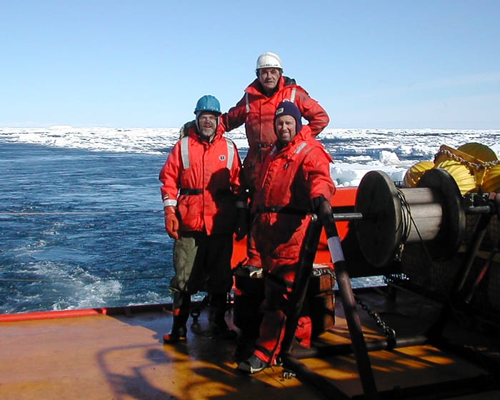
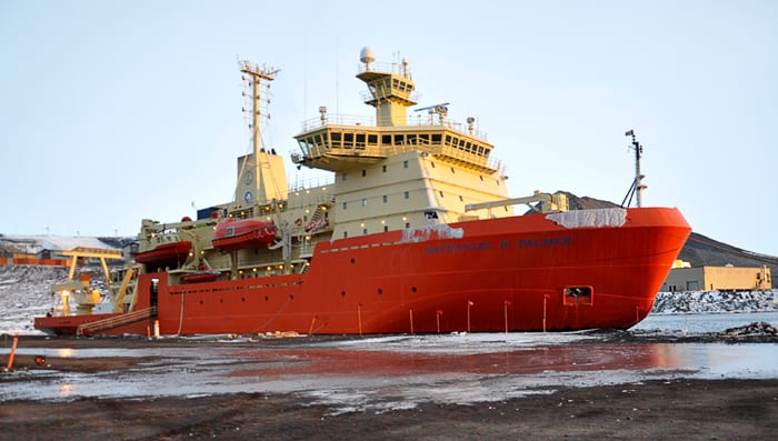
“Then the e-mail came back,” said Worrilow. The National Science Foundation’s icebreaker, Nathaniel B. Palmer, was within a day or two sail of the resurfaced mooring, and it had a little time available at the end of a research cruise to try to rescue it. The WHOI scientists’ luck got even better. Jim Ryder, veteran member of the WHOI buoy team and part of the group that had placed the Antarctic buoy in 2001, was aboard the Palmer to deploy moorings and could orchestrate the recovery.
“These are all remarkable chances,” Beardsley said. “You can’t script this kind of luck,” said Toole.
Limeburner told Moffat, now an assistant professor at the Universidad de Concepción in Chile, about the recovery. “I was completely shocked —in a good way,” Moffat said. “The chances of the mooring coming to the surface, combined with a vessel being available to recover it in such a remote location are tiny!”
He had used data from the other, recovered, Antarctic moorings for his thesis, and “from time to time, I’d mope a bit about not having the data available from the lost mooring, as it would have helped to understand the intrusion of warm, nutrient-rich water onto the shelf.”
Moffat said that this issue “remains relevant today, as researchers try to understand how this warm water contributes to the melting of the Antarctic ice. I’m looking forward to see what data can be recovered.”
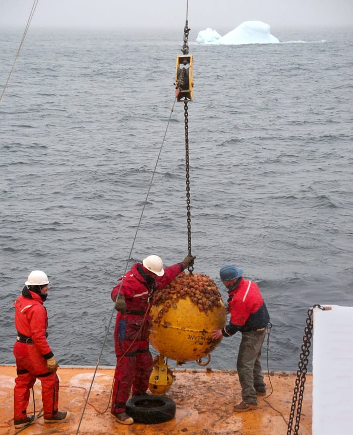
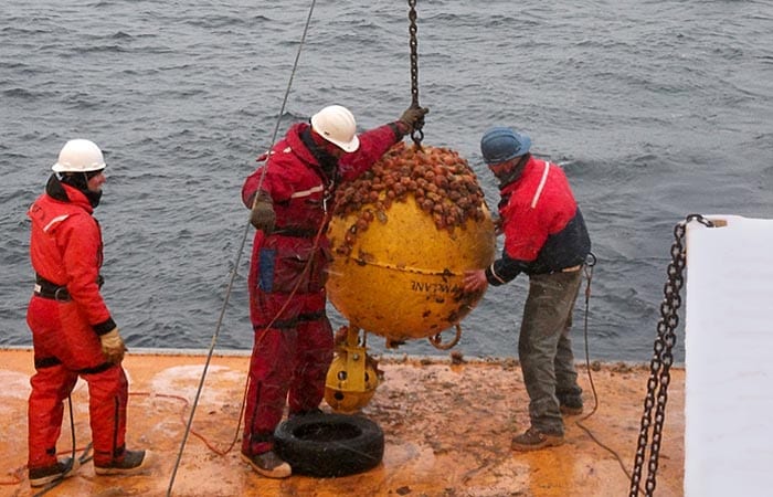
Also on the Palmer was Juan Botella, a high school science teacher who was aboard through the Polar TREC program, which sends teachers on polar scientific expeditions. In another coincidence, Botella had done graduate work at WHOI and was Moffat’s classmate. With still and video cameras in hand, he documented the entire recovery operation for the long-lost mooring the crew was now calling the “Ghost Mooring.”
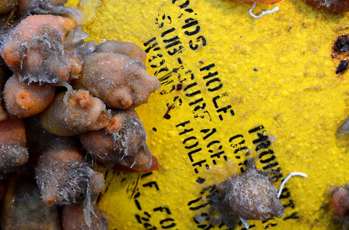
In the end, the mooring came back, with all instruments still attached and intact after 10 years. They had faithfully recorded data until their batteries ran low, far longer than the one year originally planned. Some stopped recording data, but there was still enough battery life to run their internal clocks. “After ten years in the water,” said Worrilow, “these instruments were running just an hour and 20 minutes slow!” Owens and other WHOI scientists will now start to analyze the more than two years of data—a message in a bottle that appeared unexpectedly from a remote, unexplored region of the sea, and from out of the past.
The Southern Ocean GLOBEC project, which included the lost mooring, was supported by the National Science Foundation. The Line W moorings were supported by the G. Unger Vetlesen Foundation, the WHOI Ocean and Climate Change Institute, and the National Science Foundation.
###
Slideshow