
Oceanus Online Archive
Building a Tsunami Warning Network
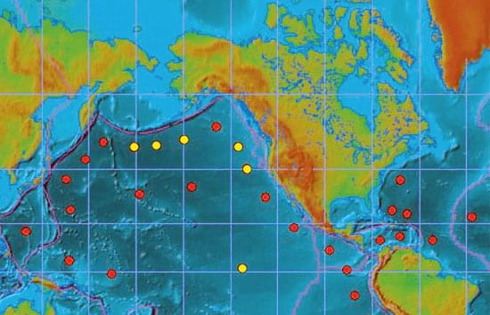
Since the great Indonesian earthquake and tsunami of December 26, 2004, policy-makers and scientists around the globe have been embracing a rare moment of public attention on the oceans, accelerating plans to create a comprehensive tsunami-warning network and to make citizens better prepared for the next massive wave. Another potent earthquake along the same fault on March 28, 2005, has increased that sense of urgency.
Read More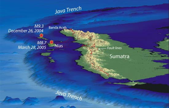
In the Tsunami’s Wake, New Knowledge About Earthquakes
If any good has come from the recent devastating earthquakes off Sumatra, it is that they are providing scientists with unprecedented clues to understanding how these large undersea earthquakes occur and how they create tsunamis.
Read More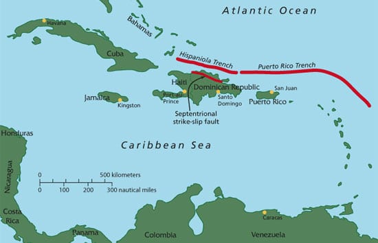
Tsunamis in the Caribbean? It’s Possible.
In a study published Dec. 24, 2004, in the Journal of Geophysical Research, Woods Hole geologists Uri ten Brink and Jian Lin reported a heightened earthquake risk from the Septentrional fault zone, which cuts through the highly populated Cibao valley in the Dominican Republic.
Read More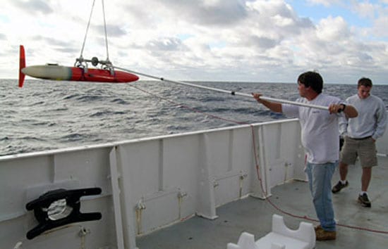
A Glide Across the Gulf Stream
News of the first successful Gulf Stream crossing by a glider last November—and the launching today (Thursday, March 24) of Spray’s seven-week round-trip mission from Bermuda across the Gulf Stream and back—has caused a ripple among scientists, who recall the dream of famed WHOI oceanographer Henry Stommel.
Read More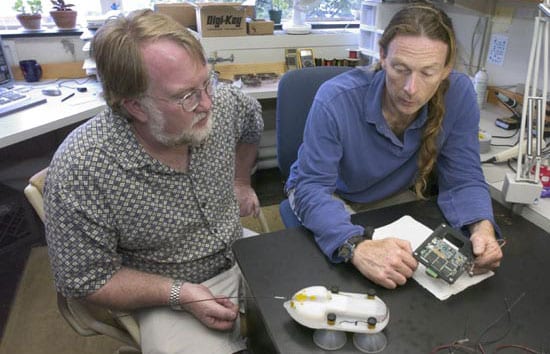
Playing Tag with Whales
The challenge of designing a device to learn what marine mammals do on dives is the stuff of dreams for an electronics engineer.
Read More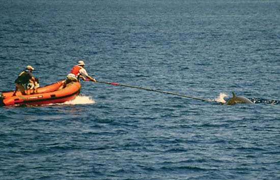
Run Deep, But Not Silent
For the first time in history, we can accompany a whale on its dive, hear what it hears, and observe its normal, natural, previously hidden behavior in the depths. Working closely together, scientists and engineers have created an innovative new device—the digital acoustic recording tag, or D-tag. It attaches to a living whale and records nearly everything that happens on its dives, without disturbing the animal.
Read More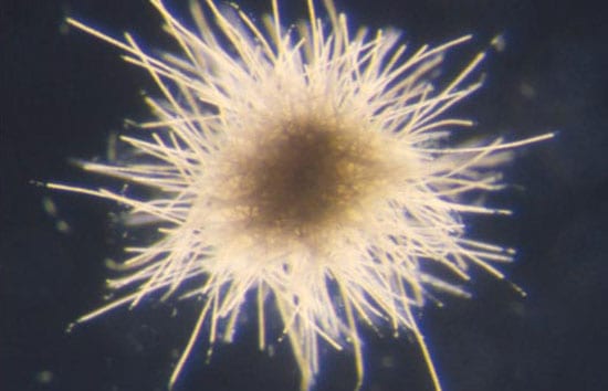
Little Things Matter A Lot
One group of bacteria—the cyanobacteria—has completely transformed Earth’s environment through their long history. Three billion years ago, ancestors of cyanobacteria infused Earth’s ancient atmosphere with the byproduct of their photosynthesis—oxygen—changing the chemistry of the planet and setting the stage for entirely new oxygen-breathing life forms to evolve. Without the cyanobacteria, the life we see around us, including humans, simply wouldn’t be here.
Read More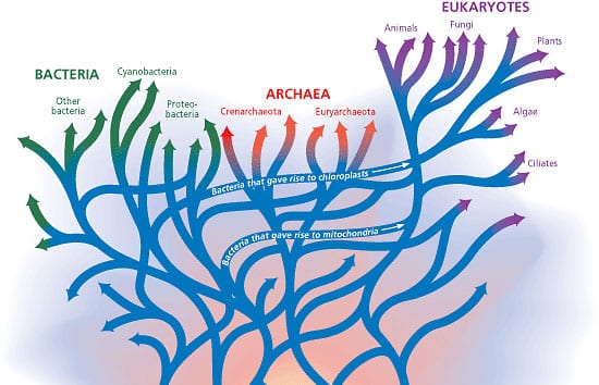
The Deeps of Time in the Depths of the Ocean
Wherever we have looked in the oceans, we have found previously unknown microorganisms. We have often found them living in conditions once thought to be incompatible with life, using unfamiliar physiologic and metabolic adaptations. These discoveries have radically changed our thinking about where and how life may have originated and evolved on this planet, and where it might exist on others.
Read More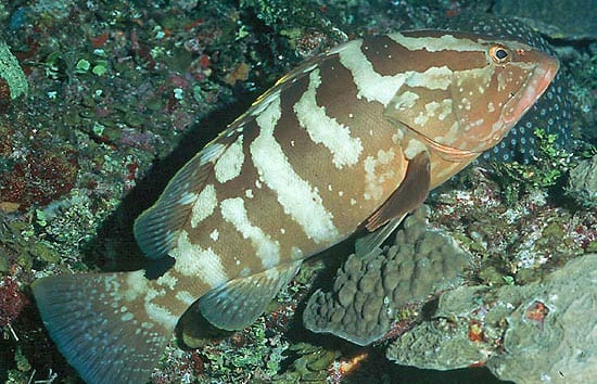
Tracking Fish to Save Them
For decades, the Nassau grouper (Epinephelus striatus) was one of the most sought-after fish species in the Caribbean and Gulf of Mexico, from the Bahamas to Central America. These large, delicious fish live among coral reefs and have a breeding behavior that makes them especially vulnerable. They come together in aggregations of thousands to spawn at specific times and places, making them easy to catch—and to overfish.
Read More
Mistaken Identity
Researchers at the Woods Hole Oceanographic Institution have found that two chemicals accumulating in the tissues of marine animals and suspected to be manmade pollutants actually came from natural sources.
Read More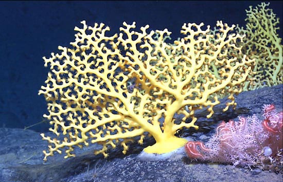
Coral Gardens in the Dark Depths
The words “coral reefs” conjure up images of a tropical paradise: shallow, warm, aquamarine waters, bright sunlight, white coral sand, and colorful, darting fish. But corals also live deep in the sea, in regions where the sun doesn’t penetrate and water temperatures remain just above freezing.
Read More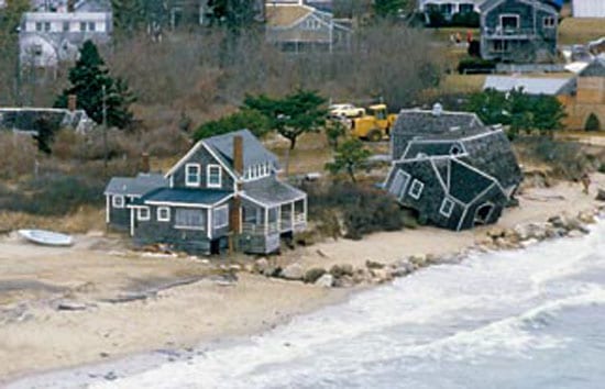
The Coastal Ocean Institute
We are all stewards of the coastal ocean. For some of us, the connection to the sea is clear and immediate; for others, it is subtle and distant. But whether you live on waterfront property or in a land-locked hamlet, your everyday activities affect this most sensitive and most threatened portion of the world?s oceans.
Read More
Do Marine Protected Areas Really Work?
Today, Marine Protected Areas, or MPAs—areas of the ocean temporarily or permanently closed to harvesting—are being proposed to restrict not only fishing, but also mineral and hydrocarbon extraction, and other activities. Some advocates of MPAs suggest that at least 20 percent of the coastal and open ocean should be set aside and permanently zoned to protect ecosystems, sustain fish stocks, and reduce conflicts between users of the oceans.
Read More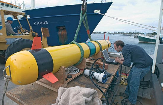
Robo-Sailors
In the mid-1990s, the Navy began funding research for small, robotic vehicles to perform unmanned reconnaissance in coastal waters. At WHOI, that helped spark the development of REMUS (Remote Environmental Monitoring UnitS), designed and built by Chris von Alt, Ben Allen, and colleagues in the Oceanographic Systems Laboratory.
Read More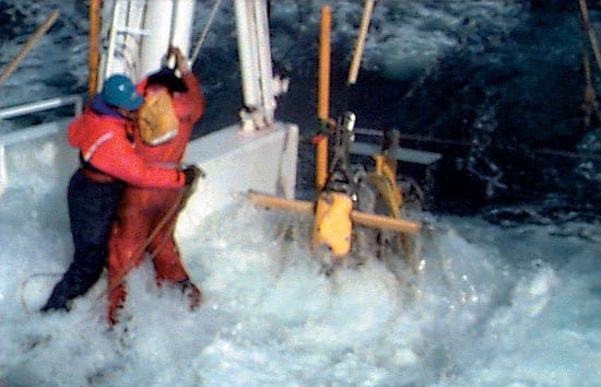
The Cacophony on the Coast
Unlike light, sound travels efficiently through water, and the Navy uses sound to monitor what’s going on in the ocean. To understand the sound messages transmitted through the seas, you need to understand the medium through which they are transmitted.
Read More
New Instrument Sheds Light on Bioluminescence
Bioluminescence is ubiquitous in the oceans, and especially prevalent in coastal regions where nutrients are abundant and life thrives. Yet scientists have little basic understanding of how bioluminescence is influenced by water temperatures, depths, seasons, geographic locations, even different times of day.
Read More
For the Navy, the Coast Isn’t Clear
Every so often, circumstances can conspire to make a battleship turn on a dime. Fifteen years ago, two geopolitical events prompted the U.S. Navy to abruptly change long-standing research priorities and steer rapidly in a new direction.
Read More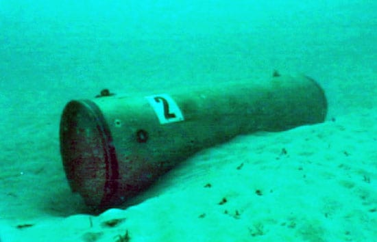
Where Are Mines Hiding on the Seafloor?
Eternally and incessantly, waves and currents stir up sand from the seafloor near the coast. Sediments get suspended in the ocean, carried onshore and off, and deposited elsewhere. In the process, objects on the seafloor—natural and unnatural—can get buried and uncovered.
Read More
Can We Catch More Fish and Still Preserve the Stock?
People have always fished. But the history of fishing is also the history of overfishing. For hundreds of years, the establishment and enforcement of fishery management policies have generated controversy, as competing authorities have searched for a way to balance competing goals—to catch as many fish as possible while conserving the resource. To resolve this dilemma, we have applied mathematics—and we are finding that the ancient solution may still prove effective in modern times.
Read More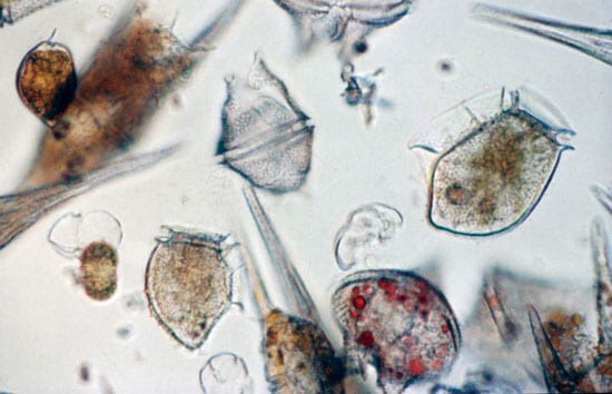
A Fatal Attraction for Harmful Algae
Estuaries are the borderlands between salt and freshwater environments, and they are incredibly diverse
both biologically and physically. The diversity and the high
energy of the ecosystem make estuaries remarkably resilient.
With a better understanding of these systems, we can reverse
their decline and restore the ecological richness of these
valuable, albeit muddy, environments.
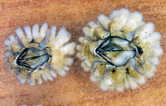
Rites of Passage for Juvenile Marine Life
The childhood of a barnacle is fraught with challenges. It hatches in shallow waters close to shore as a tiny larva, no bigger than a speck of dust. Currents sweep it to deeper, choppy waters, sometimes miles offshore. In these proving grounds each larva floats, at the mercy of hungry fish and swift ocean currents. Billions of larvae?including fish, lobsters, clams, starfish, and sea cucumbers?begin life this way. Only a few survive and return to shore, where they settle on rocks or sandy seafloor to become adults. Why larvae make their offshore journey remains unclear, but we are beginning to uncover the intricacies of their return trip?learning how waves, currents, eddies, tides, and other phenomena bring larvae back toward the shore.
Read More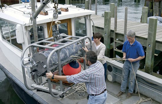
The New Wave of Coastal Ocean Observing
Estuaries are the borderlands between salt and freshwater environments, and they are incredibly diverse both biologically and physically. The diversity and the high energy of the ecosystem make estuaries remarkably resilient. With a better understanding of these systems, we can reverse
their decline and restore the ecological richness of these valuable, albeit muddy, environments.
Read More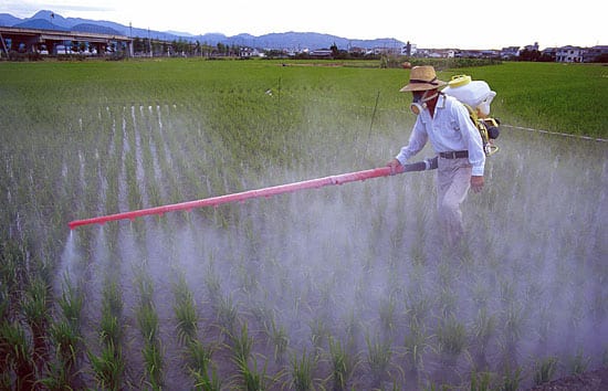
Red Tides and Dead Zones
The most widespread, chronic environmental problem in the coastal ocean is caused by an excess of chemical nutrients. Over the past century, a wide range of human activities—the intensification of agriculture, waste disposal, coastal development, and fossil fuel use—has substantially increased the discharge of nitrogen, phosphorus, and other nutrients into the environment. These nutrients are moved around by streams, rivers, groundwater, sewage outfalls, and the atmosphere and eventually end up in the ocean.
Read More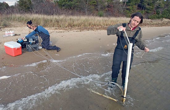
Water Flowing Underground
Groundwater discharge appears to be an important factor for determining the chemistry of the coastal ocean. As fresh groundwater flows toward the sea, it rises up over denser, salty water. The fresh and salty water mix along the interface, and the resulting fluid discharges at the shoreline. This interface between underground water masses has recently been described as a “subterranean estuary,” a mixing zone between fresh and salty water analogous to the region where a river meets the ocean.
Read More