Seeding the Oceans with Observatories
Taking the next strategic steps to explore the Dynamics of Earth and Ocean Systems (DEOS)
Ship-borne expeditions have been the dominant means of exploring the oceans in the 20th century. Scientists aboard ships made the observations and gathered the data that confirmed the revolutionary theory of plate tectonics, which demonstrated that the earth is a complex, multi-faceted system that changes over time. But that revelation also exposed a major shortcoming of the ship-based exploratory approach: its very limited ability to quantify change.
Geoscientists now realize that the earth is dynamic. It cannot be studied adequately in a static manner by simply examining limited regions. Consider these three examples:
- El Niño events, especially in 1982–1983 and 1997–1998, clearly demonstrated the profound societal impacts of dynamic earth and ocean processes and the importance of understanding their behavior.
- Over the past two decades, geoscientists have discovered entirely new ecosystems around hydrothermal vents, whose existence is linked to ongoing or episodic volcanic and magmatic processes on and below the seafloor near mid-ocean ridges. The vents have generated exciting new lines of inquiry about the origin of life on Earth and the possibility of life on other planetary bodies that are similarly endowed with water and volcanism.
- Less well-known but certainly equally complex processes occur at subduction zones, where old seafloor sinks back into the mantle. These processes occur on scales of tens to thousands of kilometers over months to hundreds of millions of years, yet they generate catastrophic earthquakes and tsunamis that occur in seconds over small areas around the Pacific “Rim of Fire,” for example. Subduction processes also play an important role in recycling chemicals to the mantle, and they are a primary cause of tectonic uplift and mountain- and island- building on Earth.To fully understand the causes and effects of all these phenomena, we need a much better grasp of Earth’s complex, dynamic processes before, as, and after they occur. This will entail a significant philosophical and cultural change in the way we conduct our science. It will require a coordinated investment in a new mode of marine geoscience investigations: the establishment of long-term ocean observatories. Such observatories offer an essential means to observe interrelated processes over time and to fill in the rather extensive gaps in remote ocean regions where data on deep Earth structures and properties have never been collected.While scientists have maintained observatories on land for centuries, the practice has not yet received broad support in the oceans. But many national deep-water geoscience initiatives have recently embraced strategies involving seafloor observatories to investigate the earth, including the Ridge Inter-Disciplinary Global Experiments (RIDGE), the MARGINS study of rifted and convergent plate boundaries, the Ocean Seismic Network (OSN), and efforts with the eponymous names BOREHOLE and CABLE, which seek to take advantage of Ocean Drilling Program (ODP) boreholes and submarine cables for geosciences research. Since 1997, scientists involved in these initiatives have joined in a planning effort supported by the National Science Foundation to lay the groundwork for a proposed longterm observatory program called Dynamics of Earth and Ocean Systems (DEOS). And this philosophy is also being embraced in other disciplines of ocean sciences, as well as internationally, so there is an unprecedented opportunity and need for cross-disciplinary, multi-national coordination of scientific objectives and infrastructure.
Observing dynamic global processes
Current and planned seafloor observatory efforts come in two flavors:
- “Active Process” observatories are located where particular Earth systems are presently most active near the surface. Many of the best examples are at plate boundaries: at mid-ocean ridges, the settings of possibly the most complex interplay among tectonic, magmatic, hydrothermal, and biological processes on Earth, and at subduction zones, where tectonic and magmatic processes have great destructive impact on society. Because these plate tectonic boundaries occur almost exclusively beneath the seas, a seafloor observatory capability is imperative on both scientific and societal grounds.
- “Global Imaging” observatories would provide “blanket” data coverage of the earth, collecting data from all the necessary places and angles to give us a “big-picture” perspective of our planet. Such a global network of observatories would allow us to fully image the interior of the earth and to provide a comprehensive view of processes that occur over very long time scales and over the entire globe. With 70 percent of the earth’s surface under the oceans, global networks will never be complete without seafloor observatories.
Because these observatories open windows onto Earth processes that occur over expanses of both space and time, they are valuable for scientists specializing in many fields. Consequently, observatory networks can be located, configured, and used for multi-disciplinary studies to maximize the investment required to establish them.
Although individual seafloor observatories may have different primary scientific goals, they share many common technological needs. To deploy and maintain long-term monitoring equipment in the remote and hostile seafloor environment, scientists will have to address several requirements. They will need to deliver long-term power to seafloor instruments, a link for data transmission from the seafloor to land (preferably in near real time), a means of remote command and control of seafloor instruments, and ways to facilitate deployment and retrieval of instruments for repair or refurbishment. Ocean scientists today do not customarily consider these factors. They will have to reorient themselves intellectually and innovate technologically.
Different observatories for different missions
In a series of working group meetings in 1998 and 1999, DEOS developed a strategy to pursue two technologically distinct approaches to implement a national seafloor observatory capability:
- Observatories linked by submarine cables to land and the Internet. These include observatories opportunistically deployed, using retired telecommunications cables that may become available in areas of current scientific interest, such as the Hawaii-2 Observatory (H2O). They also include deploying new cables to create observatories in a few selected locations where interesting Earth and ocean processes are most active and near to land. Examples include the Long-term Ecosystem Observatory (LEO-15), the planned Martha’s Vineyard Observatory , and NEPTUNE, the proposed North East Pacific Time-integrated Undersea Networked Experiments (see NEPTUNE article).
- Moored, buoyed observatories that provide power to seafloor instruments and a satellite communication link to land (see NEPTUNE article). These would require regular servicing and could be deployed in either of two ways: a) for long terms, to complete the distribution of global imaging observatories, or b) for moderate terms (up to a few years) in locations around the world where process- oriented problems can be investigated without a more extensive installation. Examples include experiments to examine processes that generate earthquakes (seismogenesis) in subduction settings, experiments in remote mid-ocean ridge locations, or experiments to investigate circulation and other physical processes that occur in the ocean.Both buoyed and cabled technologies could be used for “active-process” observatories. Cabled observatories would be appropriate for long-term installations at selected sites where high amounts of power are needed and large amounts of data are collected. Buoyed observatories would be suitable for shorter-term, less intensive two- to five-year studies. They could be used, for example, to compare processes that occur in hydrothermal vent areas at fast- and slow-spreading ridges, or to study seismogenesis at subduction zones. They would be the principal tool to create a global seismic-wave recording network to “image” Earth’s interior (except in the few cases where stations could be accommodated on retired cables).
Coordinating international efforts
Any of the observatory types discussed above— active process and global imaging, cabled and buoyed—may require deploying sensors beneath the seafloor, in the geologic formations where processes actually occur and/or where data quality is best. In many cases, DEOS seafloor observatories will include borehole components, such as CORKs (Circulation Obviation Retrofit Kits, see CORKS article), or the Ocean Seismic Network Ocean Bottom Observatory (see Oceanus, Vol. 41, No.1). Notably, the Ocean Drilling Program (ODP) highlights an initiative on Long-Term Monitoring of Geological Processes in its current long-range plan, and DEOS has established strong links to ODP.
DEOS goals also strongly mesh with ongoing international initiatives that require coordinated seafloor observatory capabilities. Prime examples include: the International Ridge (InterRidge) initiative for longterm monitoring of the northern Mid-Atlantic Ridge (MOMAR, or MOnitoring the MAR), international MARGINS initiatives to understand seismogenic zones in subduction settings (SEIZE, or SEIsmogenic Zone Experiments), and International Ocean Network (ION) activities to coordinate global network observatory efforts.
Bringing ocean science to the public & students
In addition to their scientific value, seafloor observatories with real-time communications capabilities offer an unprecedented opportunity for public outreach and education at all levels. Real-time data links to the deep ocean will allow seafloor instruments to serve as virtual extensions of the Internet and to involve students and the public directly in real science—as it is happening. The public is considerably interested in the remote seafloor in its own right, as well as its potential for learning about life on other planetary bodies. Consequently, DEOS is developing an open data access policy, with plans to devote a significant portion of its budgets to making seafloor data accessible to the public and to educational institutions.
Launching a new observatory initiative
Though DEOS originated in the geoscience community, we eagerly seek to cooperate with all branches of oceanography that share the desire and need to invest in seafloor observatory technologies. In the short term, DEOS aims to achieve broad consensus in the marine geosciences community on the scientific goals and financial resources necessary to establish a formal DEOS research program. Stimulated partly by DEOS, the Ocean Studies Board of the National Research Council launched a study of “Seafloor Observatories: Challenges and Opportunities” and convened a workshop, sponsored by the National Science Foundation, in January 2000, to assess the scientific community’s interest.
With representatives of all fields of ocean and earth sciences, as well as planetary exploration, we hope to launch the shortand long-term scientific and technological planning that will be required, at both national and international levels, to create a pioneering research program with lasting scientific impact. We believe that ocean observatories are an essential and exciting next step that will allow us to make a scientific quantum leap akin to the plate tectonics revolution. By gaining access to the depths, we can bring understanding of our planet to new heights.
Further information on DEOS, its working group reports, and links to its member initiatives can be found on the Internet at: http://www.coreocean.org/Dev2Go.web?id=208645
Slideshow
Slideshow
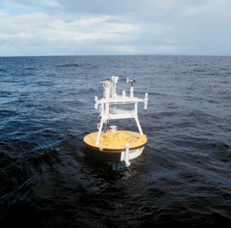
 In the midst of the vast ocean, a moored observatory does its work, continually taking measurements to track oceanic and air-sea processes that influence Earth's climate. (Roger Archibald.)
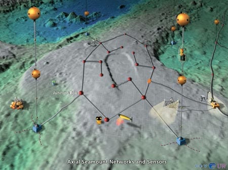
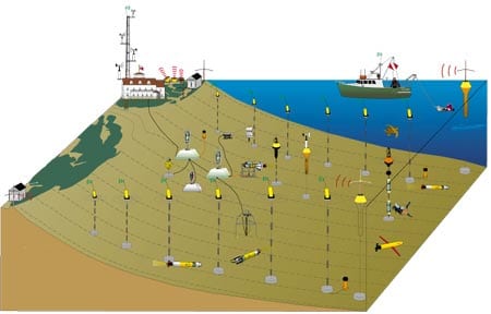
- Seafloor observatories, like this one conceived for the NEPTUNE project, could host an array of sensors and serve as a base for robotic exploration.
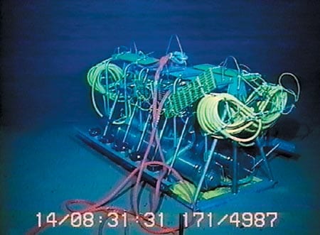
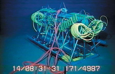
- The Hawaii-2 Observatory, the first longterm, mid-ocean seafloor observatory, was deployed in 1998, taking advantage of a retired trans-Pacific telephone cable.
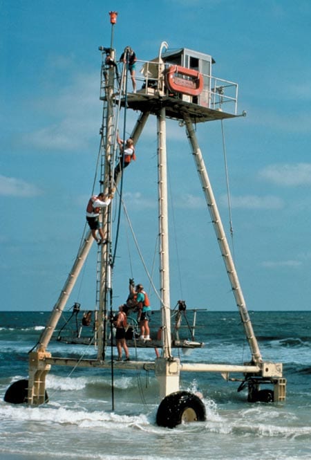
- Scientists at the Field Research Facility in Duck, North Carolina, use the Coastal Research Amphibious Buggy (CRAB) to deploy instruments for studies of the dynamic processes that shape beaches.
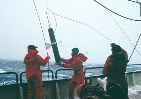
- A prototype Argo float is tested in the Labrador Sea. Scientists hope to seed the oceans with 3,000 similar floats to measure oceanic conditions and transmit data to shore via satellite. (George Tupper)
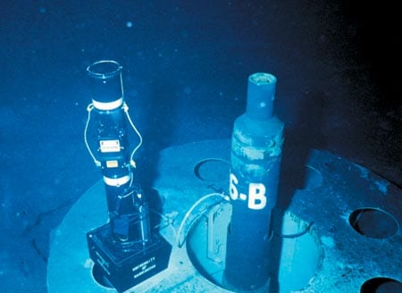
- A CORK (Circulation Obviation Retrofit Kit) sits in a seafloor borehole, measuring subseafloor fluid circulation processes that may affect earthquakes, ore formation, and subseafloor microbial communities.
- Coastal observatories, like LEO-15 in New Jersey, are linked by submarine cable and augmented by robots, radar, and buoyed meteorological sensors.
Related Articles
- Navigating new waters
- On the Move
- From Northern California to Ocean Engineer
- In the Ocean Twilight Zone, Life Remains a Mystery
- New glider design aims to expand access to ocean science
- Gift enables new investments in ocean technologies
- Can seismic data mules protect us from the next big one?
- Life at the Edge
- Ocean Observatories Initiative

