The Flywheel of the Arctic Climate Engine
Remote Beaufort Gyre expeditions reveal clues to climate change
The bottom line is that the top of the world will play a decisive role in determining how Earth’s climate changes. Global warming already may be tipping the Arctic’s delicately balanced system of air, ice, and ocean and poising it to trigger even larger, more widespread climate changes.
A key component of the Arctic climate clockworks is the Beaufort Gyre—a bowl of cold, icy, relatively fresh waters north of Alaska that is swept by prevailing winds into a circular swirl larger than the Gulf of Mexico. Andrey Proshutinsky, a physical oceanographer at Woods Hole Oceanographic Institution, calls it “the flywheel of Arctic climate.”
The gyre accumulates fresh water created when ice melts. More fresh water drains into it from big northern rivers. Winds typically corral this huge freshwater reservoir, but when they periodically diminish, the gyre weakens, vast volumes of trapped fresh water leak out, and climate conditions shift.
Recent evidence indicates that this accumulation-and-release mechanism may be tipping out of balance, but scientists can’t say for sure. The Beaufort Gyre is one of the least-studied bodies of water on the planet. Researchers haven’t gained sufficient access to this cold, icy, remote, and dark-for-half-the-year region to learn how it operates. They haven’t been able to stay long enough to monitor how it shifts naturally over seasons, years, or decades. In many ways, the ice-covered Beaufort Gyre remains a big white black hole.
Ice, ocean, and atmosphere
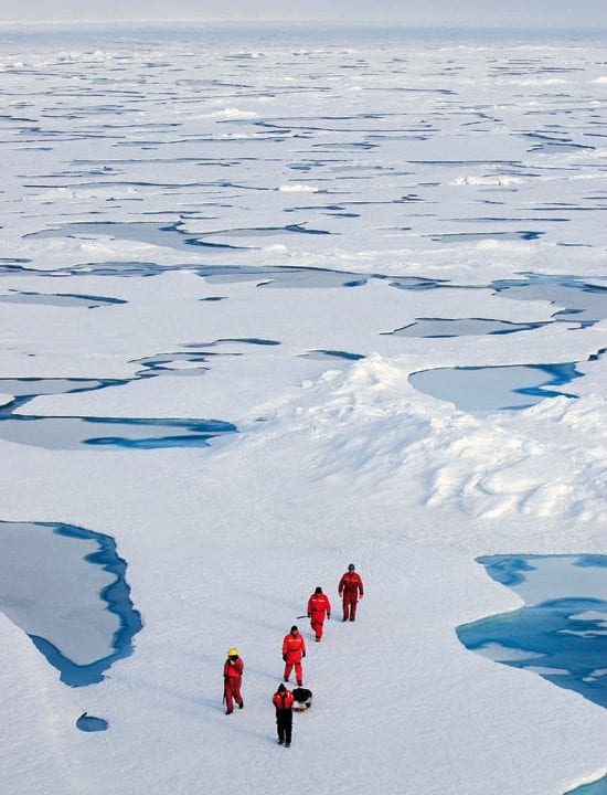
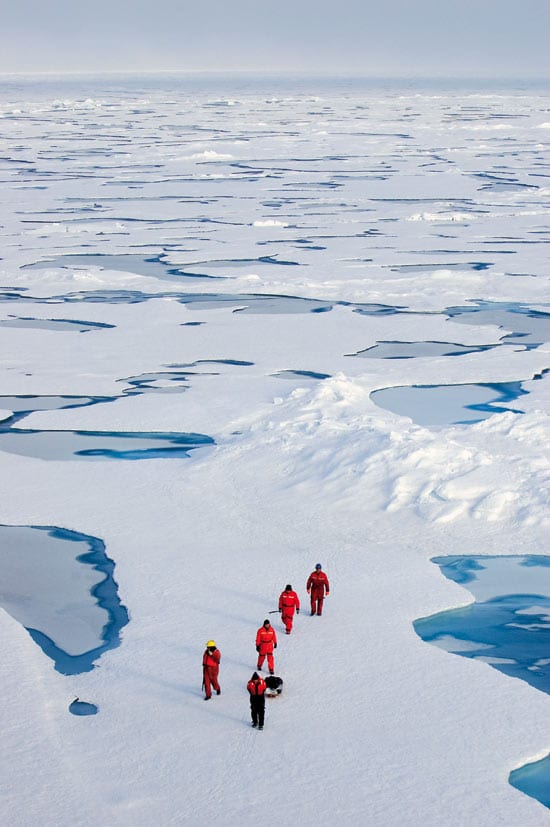
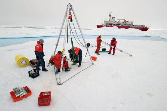
In 2003, the Office of Polar Programs at the National Science Foundation (NSF) funded Proshutinsky to lead an experiment to investigate the Beaufort Gyre. Joining other U.S., Canadian, and Japanese researchers aboard the Canadian Coast Guard icebreaker Louis S. St. Laurent, WHOI researchers deployed an array of newly developed instruments to collect data on the environment above, below, and within the floating icepack.
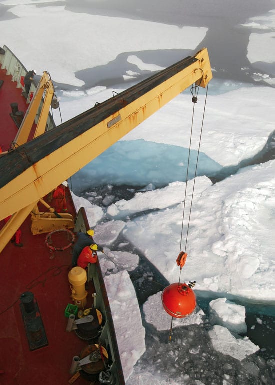
The WHOI team deployed three moorings in the gyre, with lines stretching between a seafloor anchor 3,800 meters (12,470 feet) deep and a flotation package 50 meters (164 feet) below the ice. Each line held instruments to measure currents, water temperature and salinity, sea ice draft, and sea surface heights. Researchers also collected hundreds of water samples at sites between the moorings, measuring temperature and salinity, as well as chemical tracers to determine the sources of water in the gyre. The expedition allowed researchers, for the first time, to measure conditions in the Beaufort Gyre over a full year.
“There are so many interactions between the ice, ocean, and atmosphere, and small changes can lead to big changes,” Proshutinsky said. “Here is an example: A warmer Arctic atmosphere can lead to less sea ice. That means more ocean is exposed in winter, absorbing solar radiation instead of reflecting it, as sea ice does. That warms the region further and melts more ice, which leads to more fresh water in the gyre.”
Fresh water is a critical ingredient for two reasons. Because it is lighter than the saltier, warmer waters that infiltrate the Arctic Ocean from the Atlantic, it lies atop the warmer waters and acts as a barrier preventing them from melting the sea ice. In addition, more fresh water leaking out of the Arctic can also block saltier, warmer waters in the North Atlantic from releasing their heat to the atmosphere, which tempers winters in North America and Europe.
Ice-Tethered Profilers
Initial NSF support ended with recovery of the moorings in 2004. But to continue monitoring this climatically sensitive region, the WHOI Ocean and Climate Change Institute stepped in to provide funds to redeploy the three moorings and establish the Beaufort Gyre Observing System.
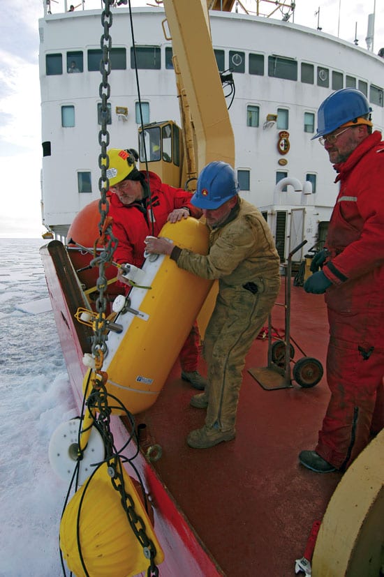
In 2004, the WHOI team also deployed a prototype new instrument, the Ice-Tethered Profiler (ITP). Designed and built by WHOI scientists and engineers—John Toole, Rick Krishfield, Ken Doherty, Keith von der Heydt, Terry Hammar, and Don Peters—the ITP has a small yellow surface capsule that dangles an anchored 800-meter (2,265-foot) line through a hole in an ice floe. An instrument travels up and down the line daily, measuring water pressure, temperature, and salinity. Data are transmitted via satellite to WHOI, along with a GPS location of the instrument on the drifting floe. The ITP has enough battery power to last for three years, barring a breakup of the ice floe or polar bear vandalism.
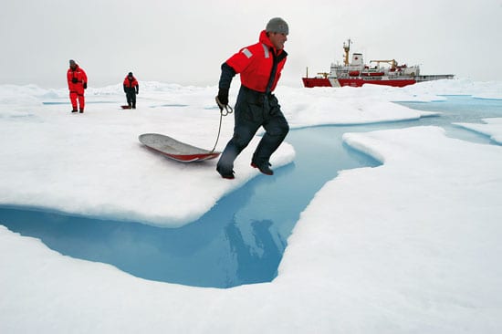
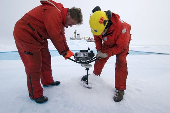
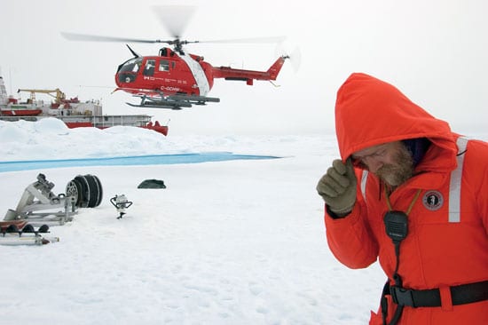
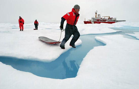
To deploy the ITP, a WHOI team of Krishfield, John Kemp, and Kris Newhall landed by helicopter on the ice and drilled a 25-centimeter (10-inch) hole in an ice floe 4 meters (13 feet) thick. A rifle-toting seaman watched for polar bear. The ITP was clustered with another buoy developed by U.S. Army researchers, which monitors atmospheric conditions and changes in the ice. The WHOI ITP sent back 244 profiles of the Arctic Ocean before it stopped transmitting in September 2004. “We think the ice broke,” Krishfield said.
The successes of these expeditions helped persuade NSF to resume funding to maintain the Beaufort Gyre Observing System through 2008. On the summer 2005 cruise, WHOI researchers installed two new ITPs, both of which were still returning data in December.
“Every morning at 8 a.m., I hear their modems click on in my office, and I know they are transmitting data from the Arctic back home,” Krishfield said. “Eventually, we’d like to distribute 20 to 30 ITPs to capture what’s going on in the ocean, air, and ice throughout the Arctic Ocean.”
Unraveling the data
The 2005 expedition also added a fourth mooring, forming the last corner of a box of moorings around the gyre. Kemp led the arduous efforts to recover and redeploy the other three moorings in waters choked with mammoth ice rafts.
“Each instrument contains a year’s worth of data,” said WHOI researcher Chris Linder. “It is an expensive instrument in itself, but with that data, it is now priceless. The data will tell a story. More than mere numbers, they are like the pieces of a puzzle that waits to be completed.”
With continuous monitoring over five years, the Beaufort Gyre Observing System should provide crucial clues to help scientists unravel the critical factors that change Arctic conditions naturally, or that may be changing them in response to global warming caused by humans.
“Are the changes we’re seeing catastrophic, or just a bump in the road?” Krishfield asked. “Is the flywheel broken, or is this a temporary phase in a natural cycle?”
Slideshow