
Engineering
How ocean robots keep tabs on the planet’s health
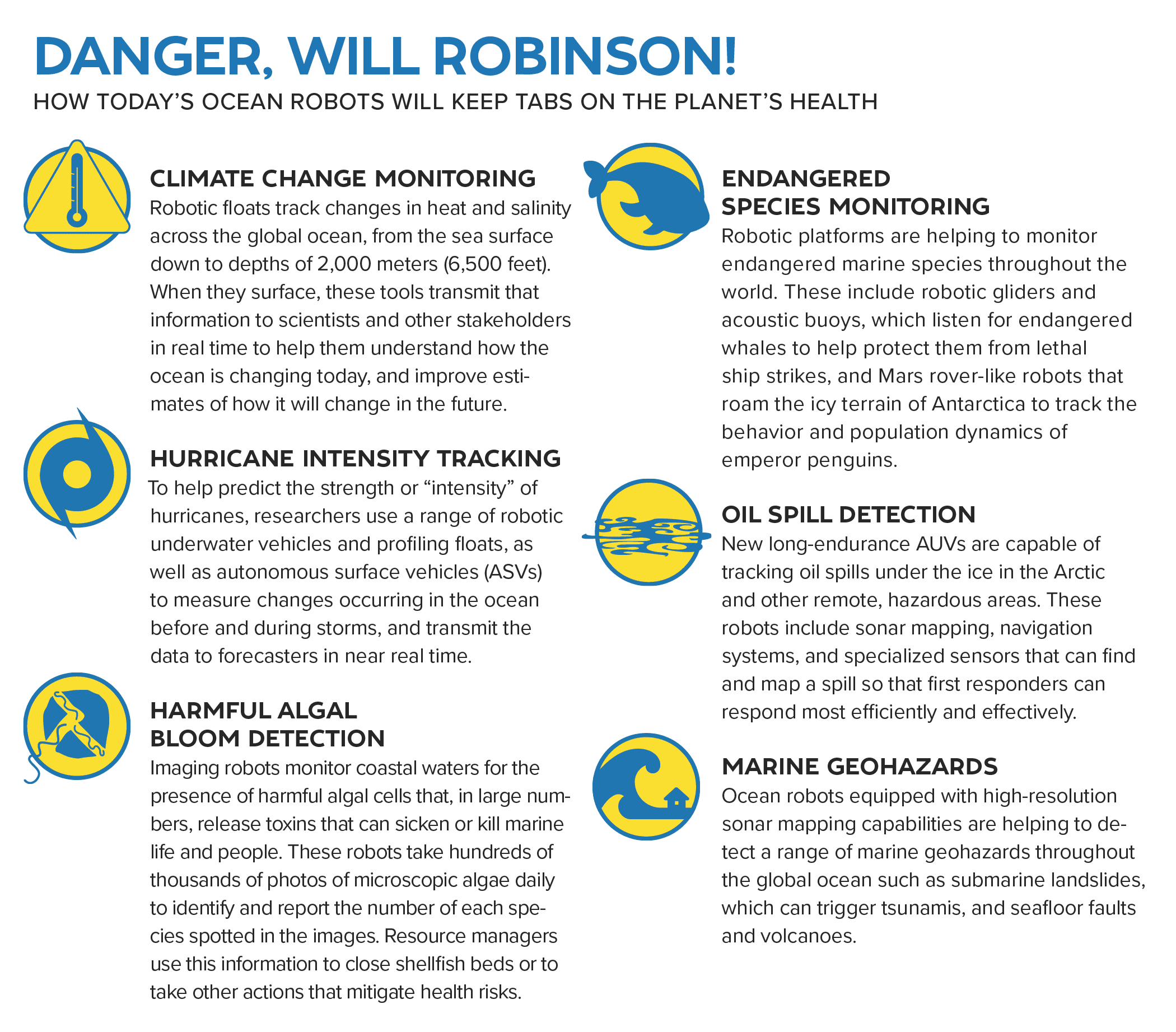
Learn how the next generation of ocean robots will help solve the planet’s most pressing problems.
Read MorePlankton blooms at ocean fronts
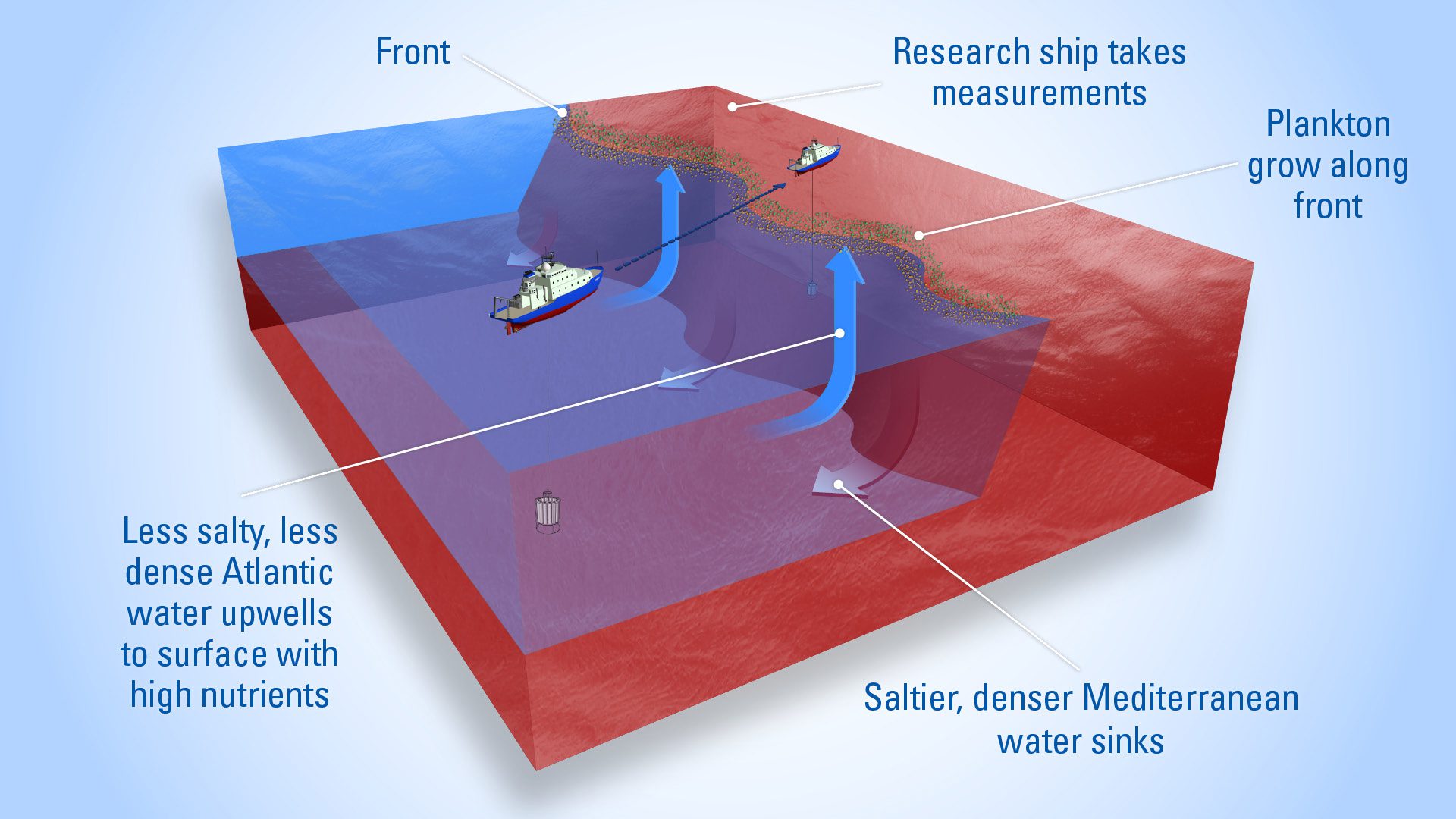
Plankton thrive where water masses meet—rising lighter water brings nutrients to the surface, fueling blooms in sunlit layers of the ocean.
Read MoreHunting hydrothermal plumes with a CTD Tow-Yo
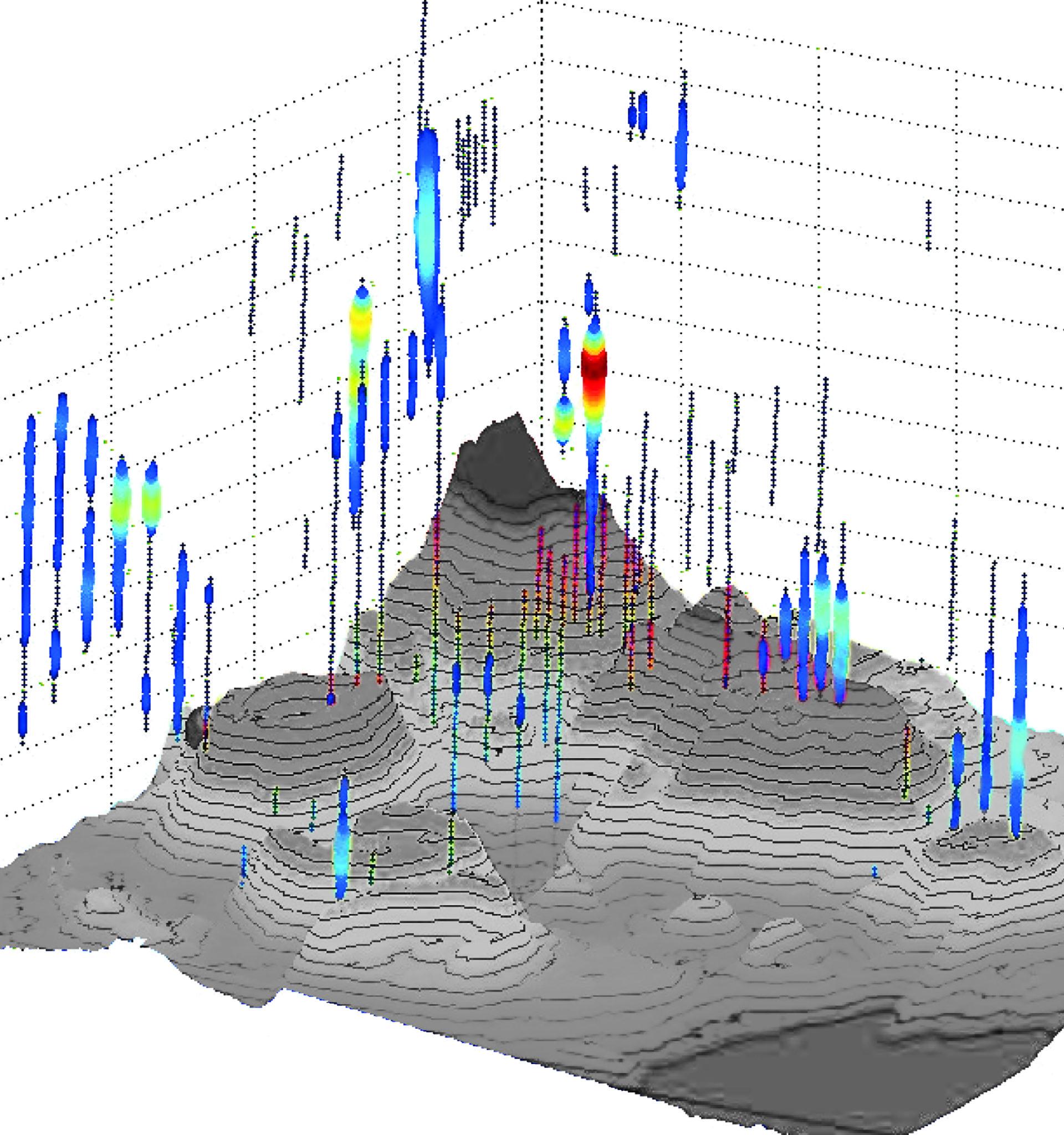
Oceanographers use a CTD—an instrument towed through deep water—to detect hydrothermal plumes by sensing heat, minerals, and chemicals below the surface.
Read MoreUnderwater charging stations positioned along a mooring line
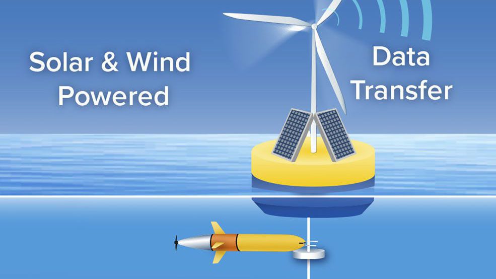
Underwater charging stations, like the one rendered here, could allow ocean robots to run longer-distance missions while reducing the time and costs.
Read MoreThe Ocean of Things
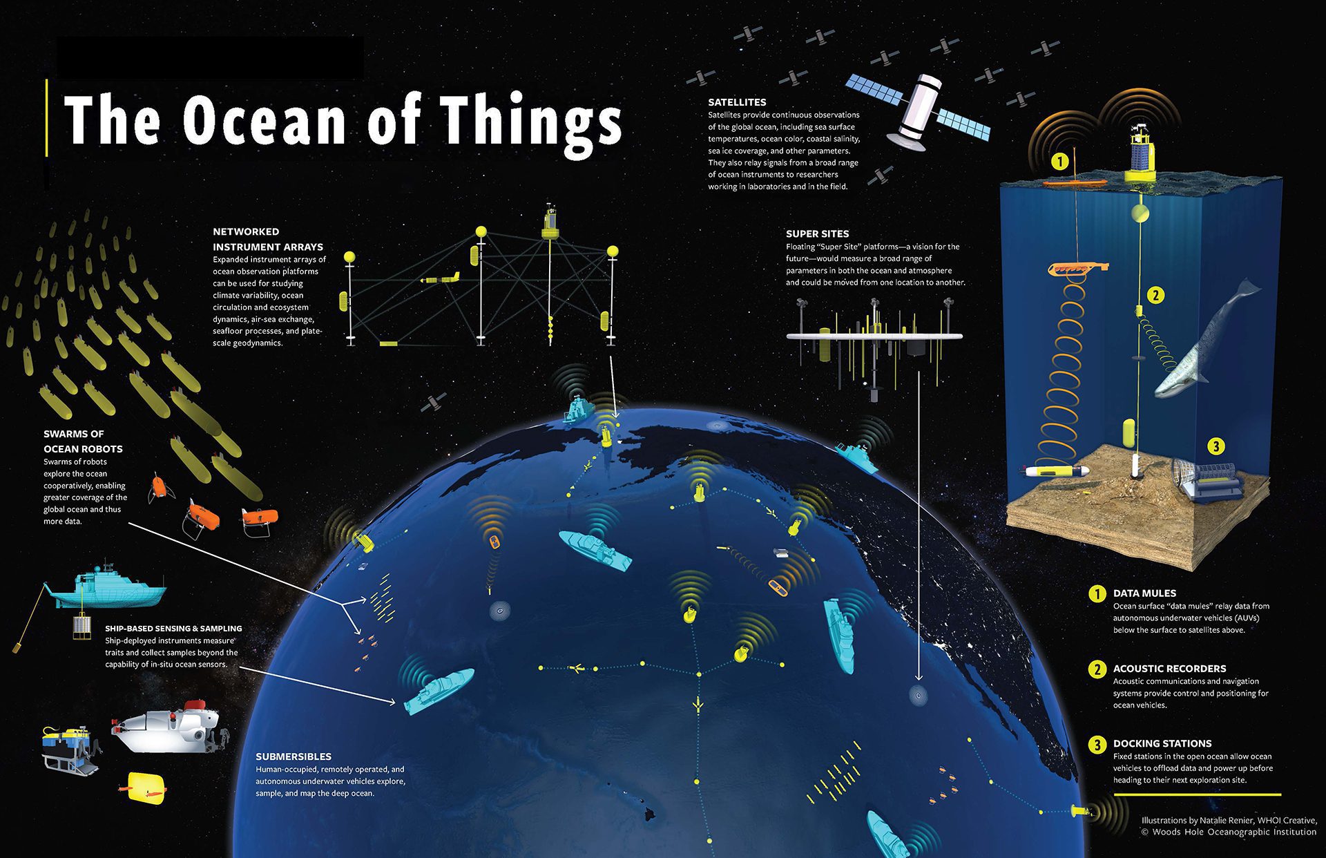
The digital ocean ecosystem of the future will rely on a network of underwater vehicles, sensors, and communications systems that will be always on and always connected.
Read MoreScope and benefits of a "Coastal Carbon Observing Network"
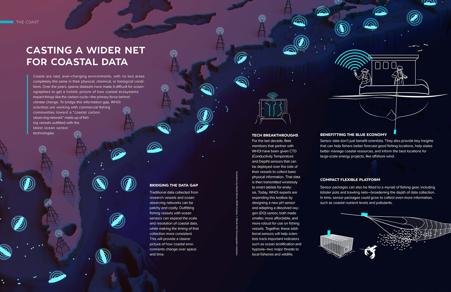
WHOI scientists are working with fishing communities toward a coastal carbon observing network made up of fishing vessels with the latest ocean technologies.
Read MoreRopeless fishing technology to release a trap line entangling a right whale
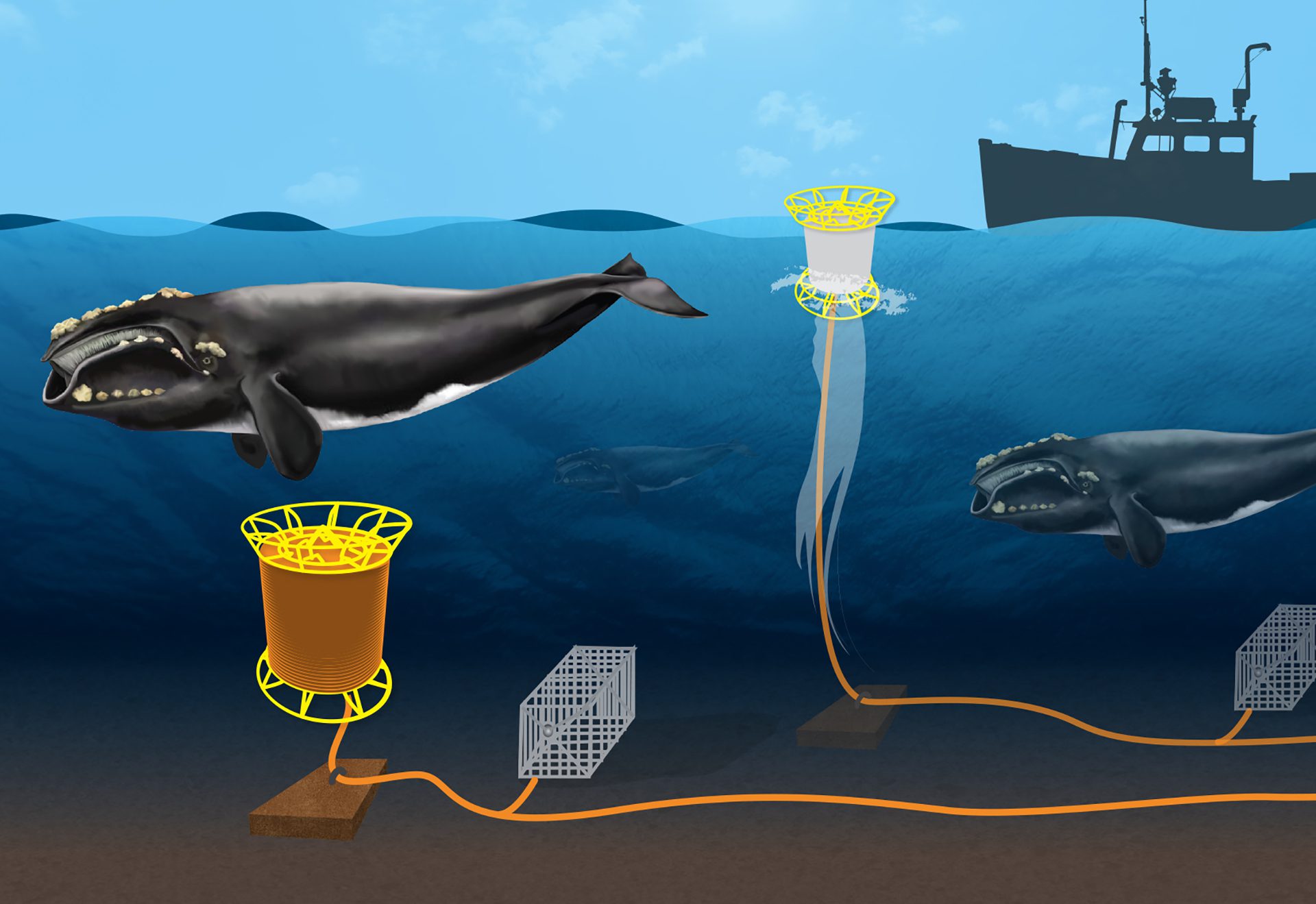
WHOI engineers created a ropeless fishing system that releases lines using acoustic signals—now moving from successful land tests to at-sea trials and refinements.
Read MoreRight whale detection mooring operation
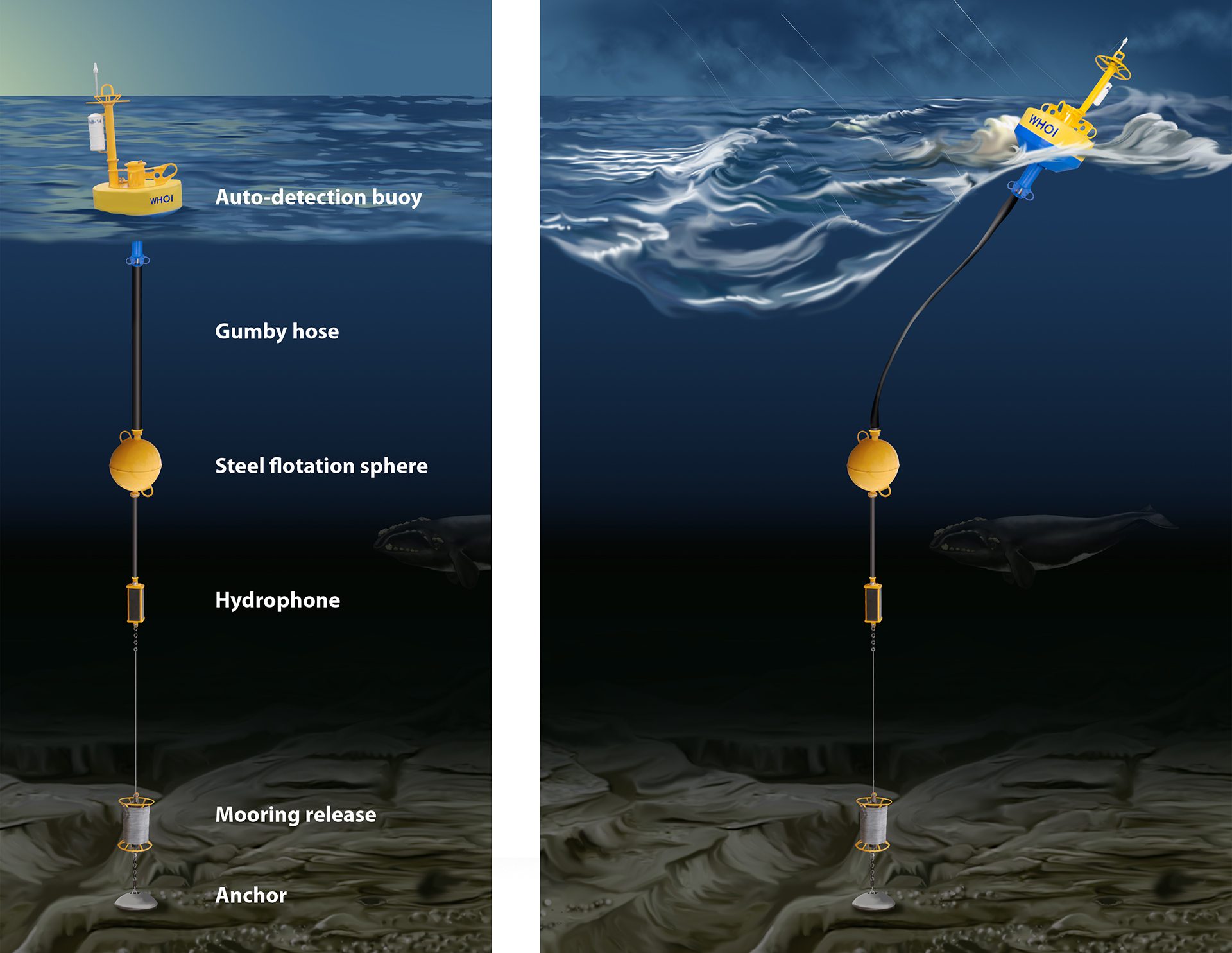
To quiet noisy recordings in rough seas, WHOI engineers created a two-tiered mooring. A bungee-like top line absorbs motion, keeping the hydrophone stable below.
Read MoreOriginal sketch of Titanic wreck site debris field
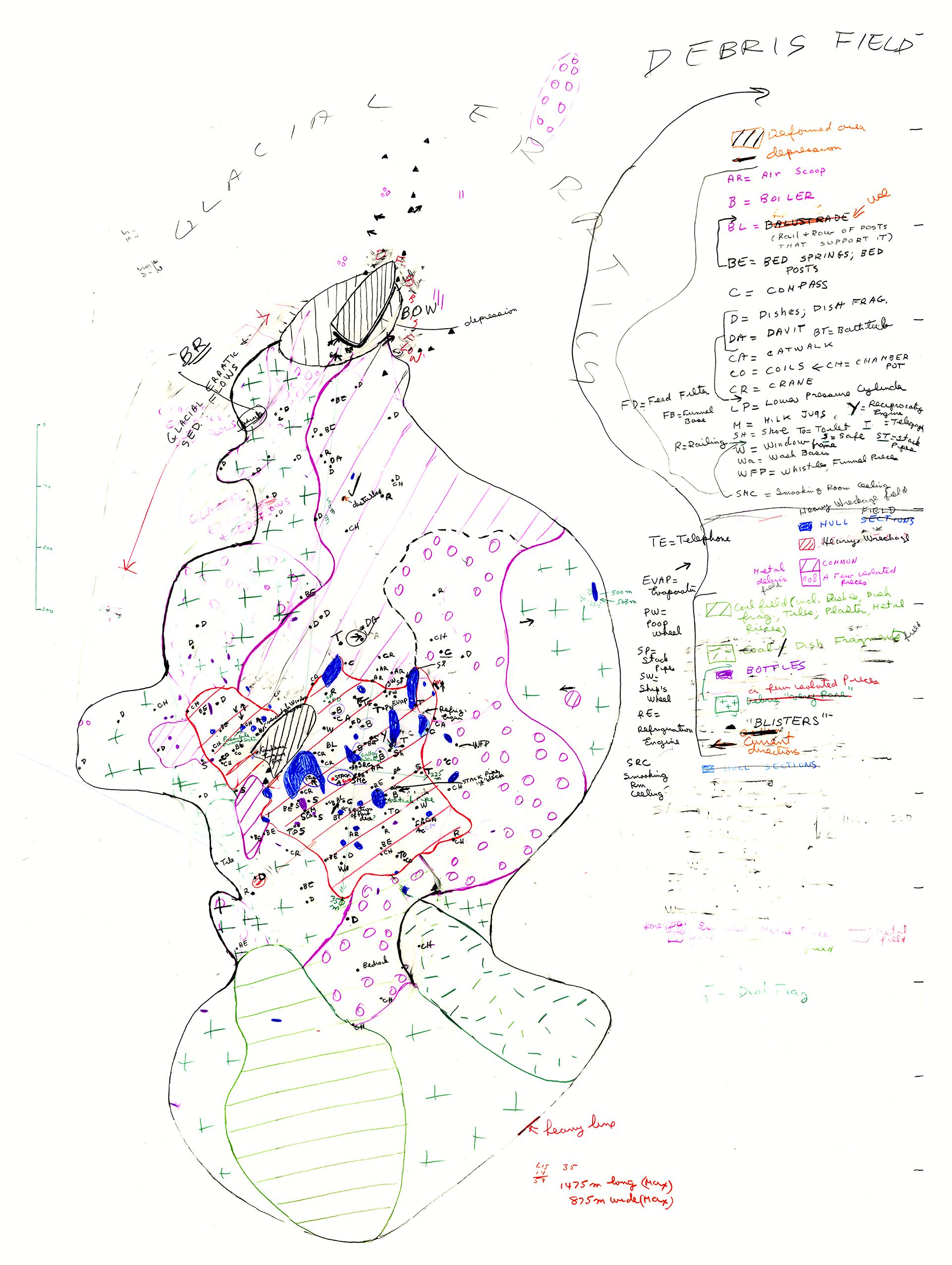
Hand drawn map of the wreck and surrounding debris field was created by the 1986 exploration team. Details were added to the map as the daily dives were completed.
Read MoreMethods for data collection under and on the world’s ocean
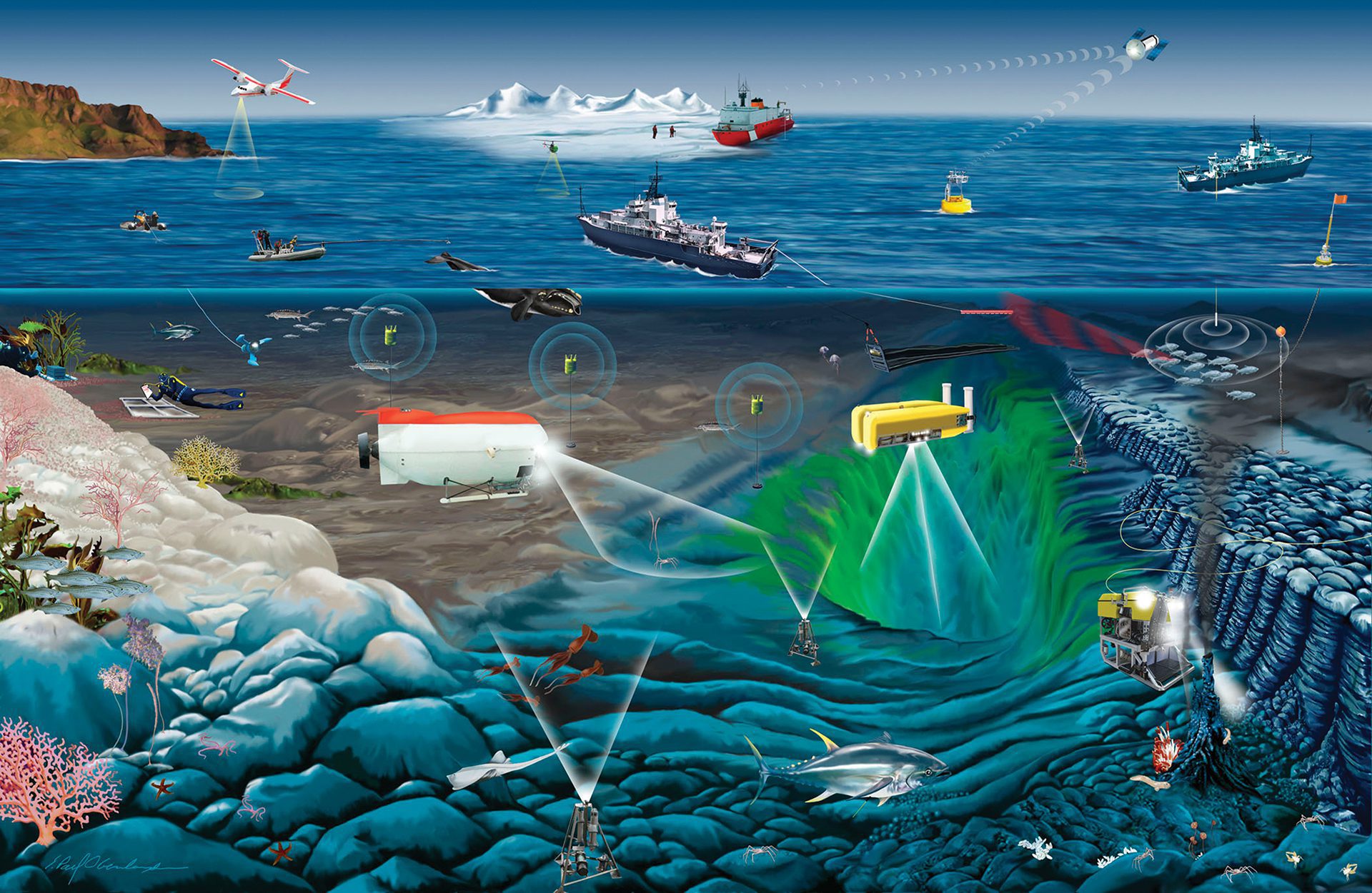
Methods for data collection under and on the world’s oceans
Read MoreThe "on-call" buoy
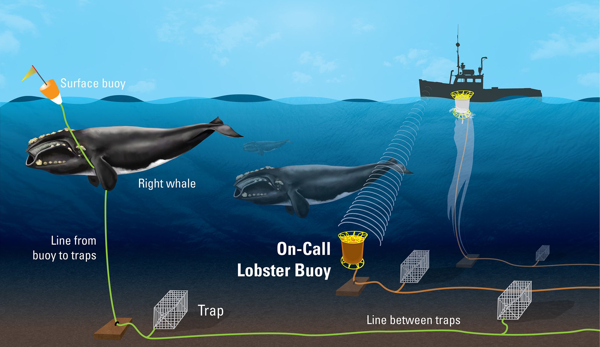
Whales risk fatal entanglement in vertical ropes from lobster traps. The “on-call” buoy coils lines on a buoyant spool, eliminating dangerous vertical lines.
Read MoreIron fertilization consideration
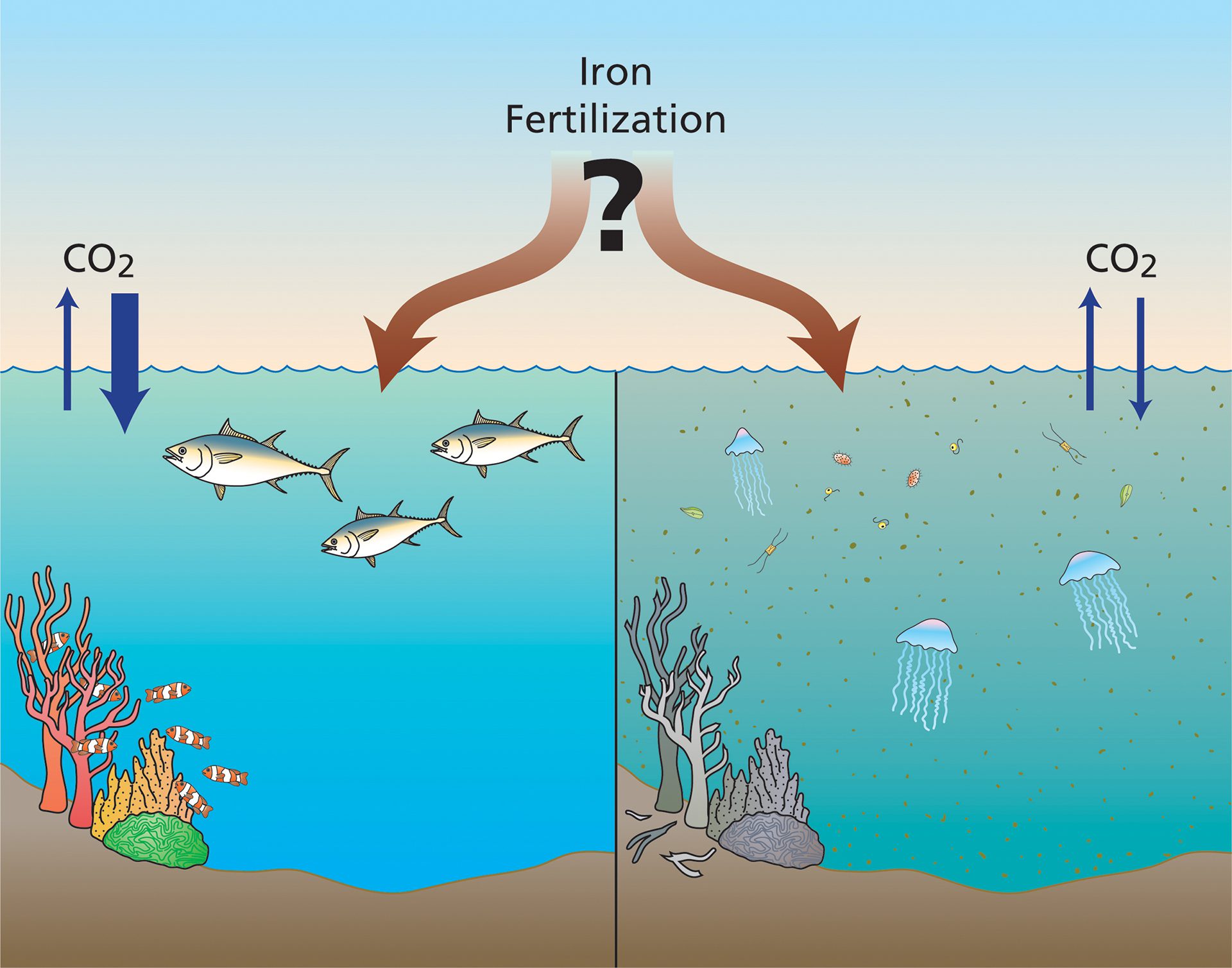
Iron fertilization is a Carbon Dioxide Removal technique that adds iron to the ocean’s surface, stimulating phytoplankton growth to help mitigate climate change.
Read MoreHow sidescan sonar works
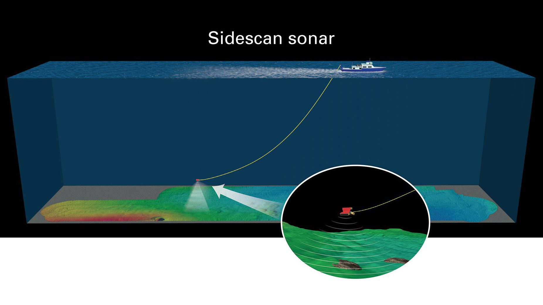
Sidescan sonar towed 500m above the seafloor maps surface textures. Soft mud appears dark; hard features like crusts or shells show up as bright images.
Read MoreIllustration of a whale-detection DMON buoy system
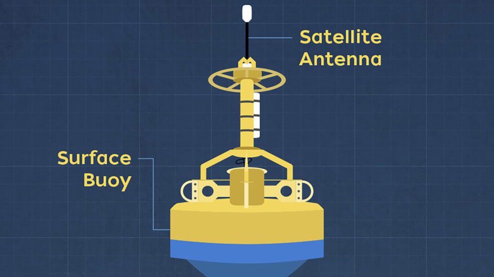
This whale detection system transmits information about whale sounds to shore in near real time.
Read MoreHow dispersants were used during the Gulf oil spill
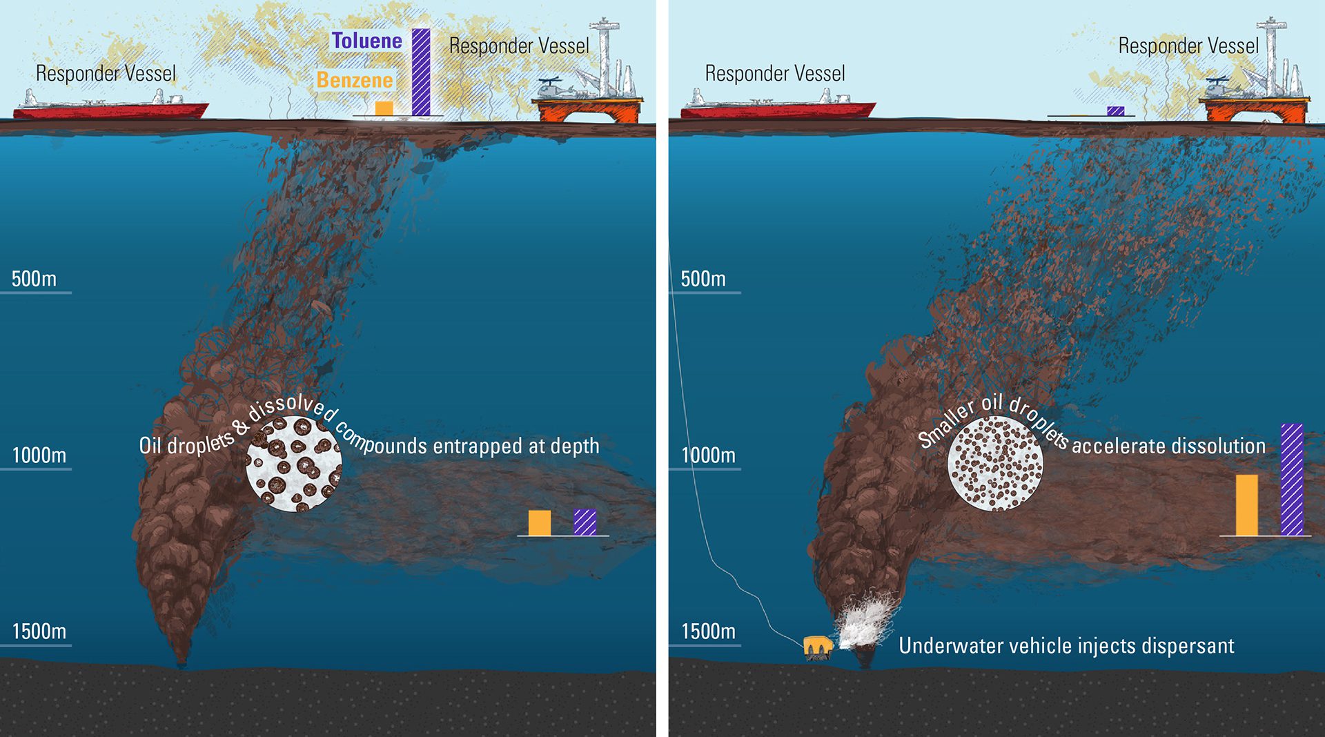
A study modeled the impact of dispersants during Deepwater Horizon, showing they reduced oil droplets, limiting toxic gas levels and health risks.
Read MoreHow multibeam sonar works
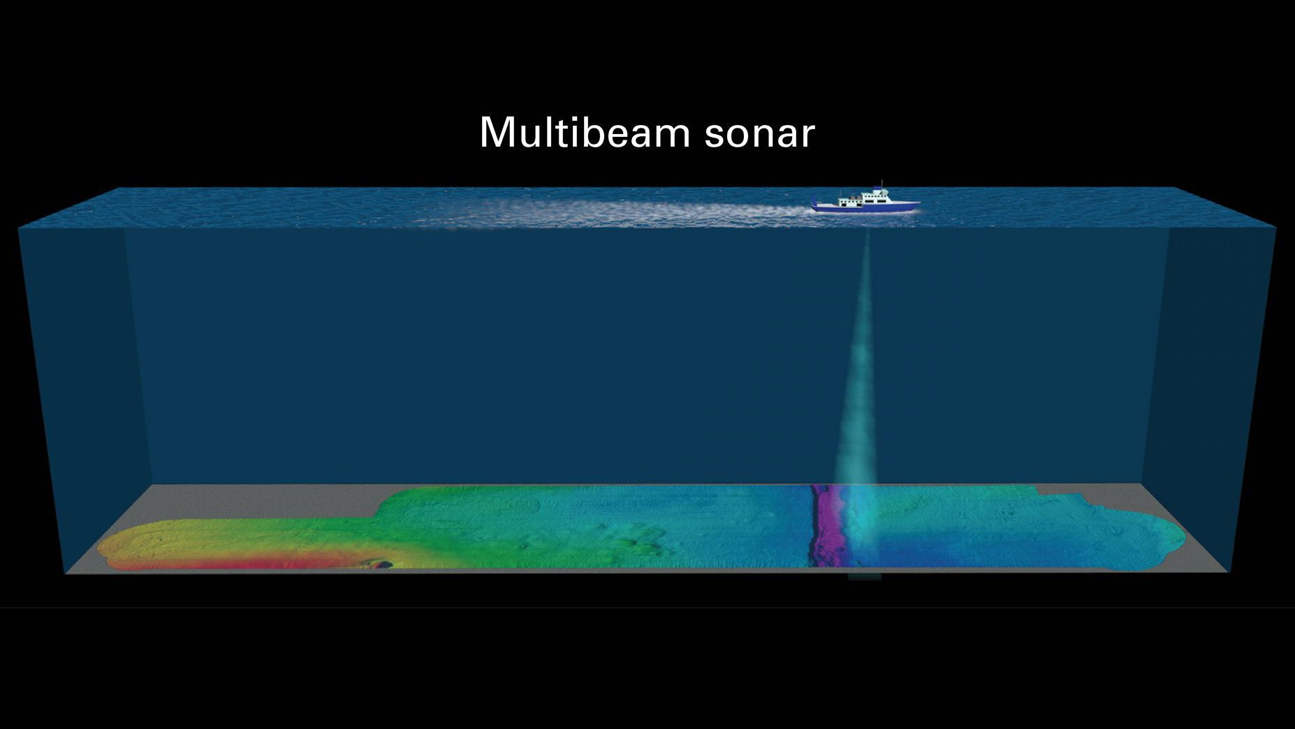
Multibeam sonar maps the seafloor by sending sound waves from ships or vehicles and measuring echoes to reveal depth, shape, and surface features.
Read MoreHow Right whale buoy detection system works
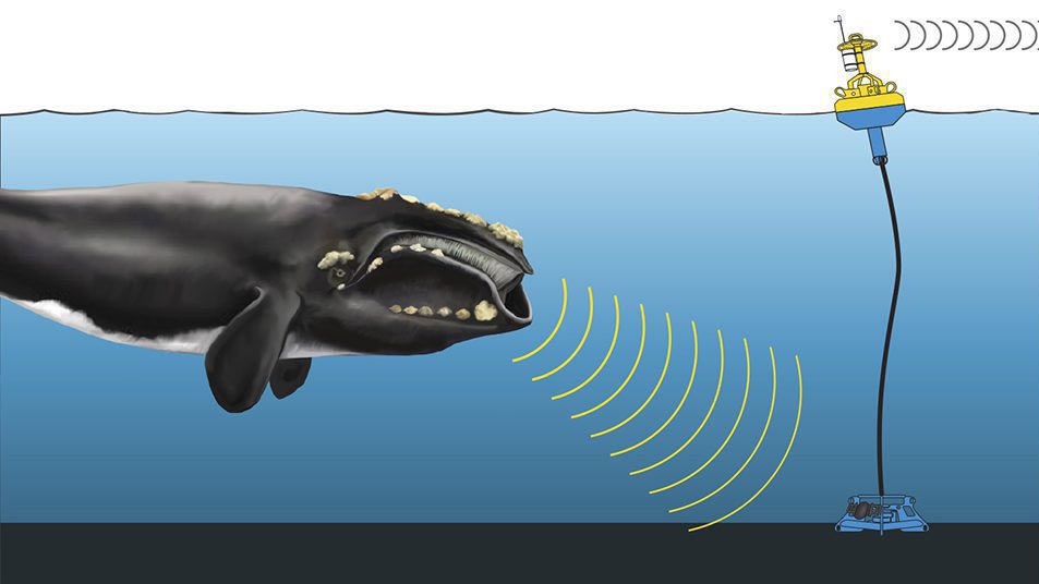
The DMON buoy detects whale calls, sends data via satellite to scientists in near-real time, helping identify species and reduce ship-whale collisions.
Read MoreLiquid Chromatography – Mass Spectrometry
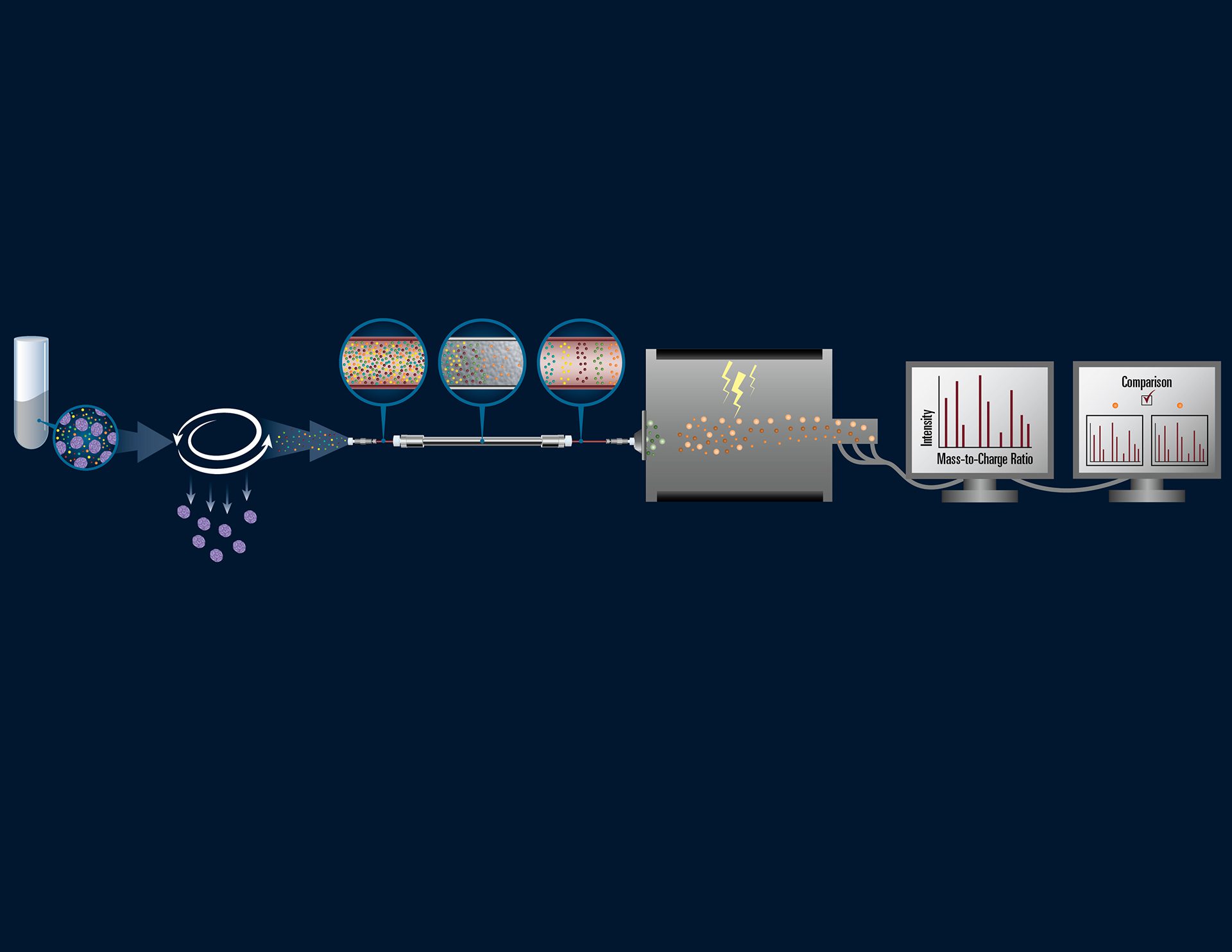
Phytoplankton samples are filtered, compounds extracted and separated by chemistry, then analyzed by mass spectrometry to identify and compare organic carbon types.
Read MoreHow the Dimethylsulfoniopropionate (DMSP) compound affects the environment
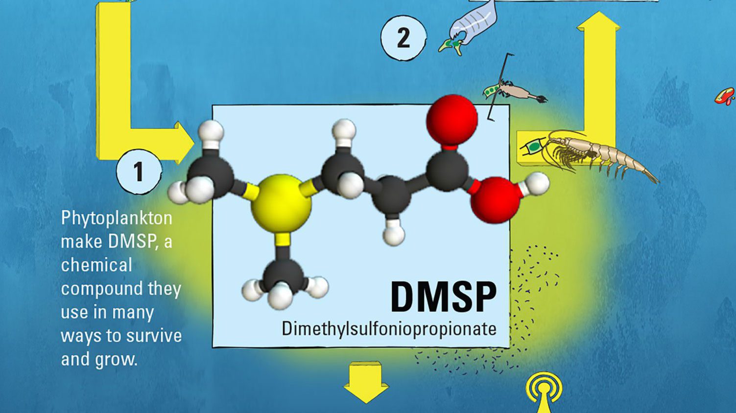
DMSP is synthesized by phytoplankton—the microscopic marine plants at the heart of the ocean food web—for a variety of beneficial uses.
Read MoreHydrophone on mooring listening to Bowhead whale
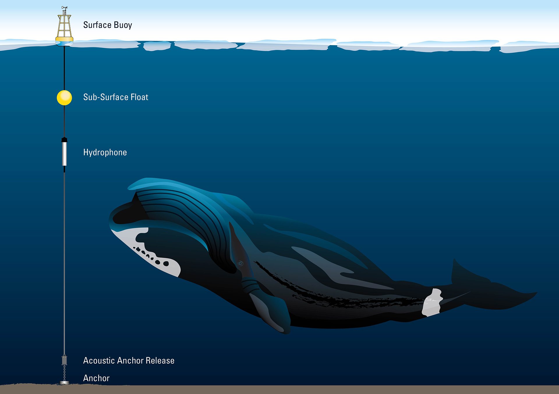
Scientists track bowhead whales in icy regions by recording their changing songs, studying how whales adopt new tunes to communicate and attract mates.
Read MoreHow a Thermal Glider operates autonomously in the ocean
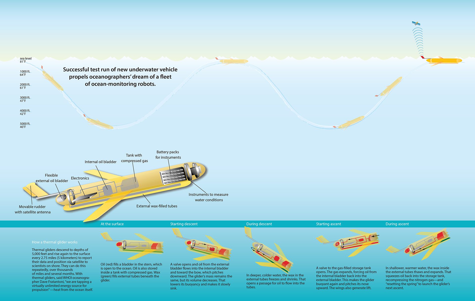
This robotic vehicle can propel itself for several months across thousands of miles, using only heat energy from the ocean.
Read MoreHow a DMON buoy operates to detect and transmit right whale location info
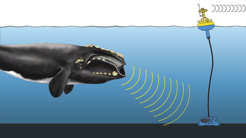
DMON buoys detect whale calls and transmit information about them from the cable to the buoy, which relays the information to a satellite and ultimately to scientists in near-real time.
Read MoreRadium rising signals arctic change
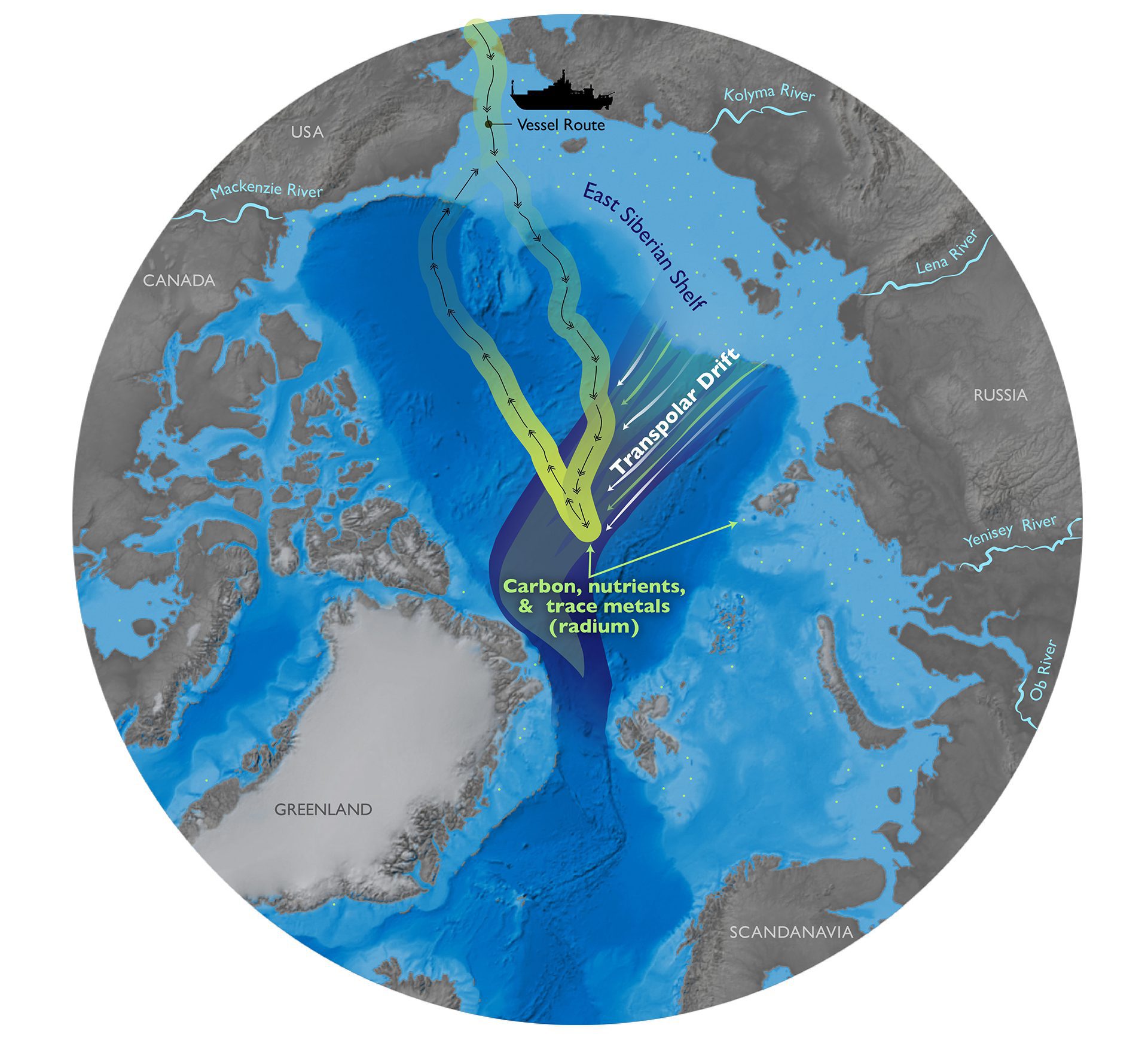
Arctic map showing vessel track and coastal transport sources for increased Radium levels measured offshore indicating changing climate conditions.
Read MoreKuroshio Current: Both highway and barrier for Fukushima radiation
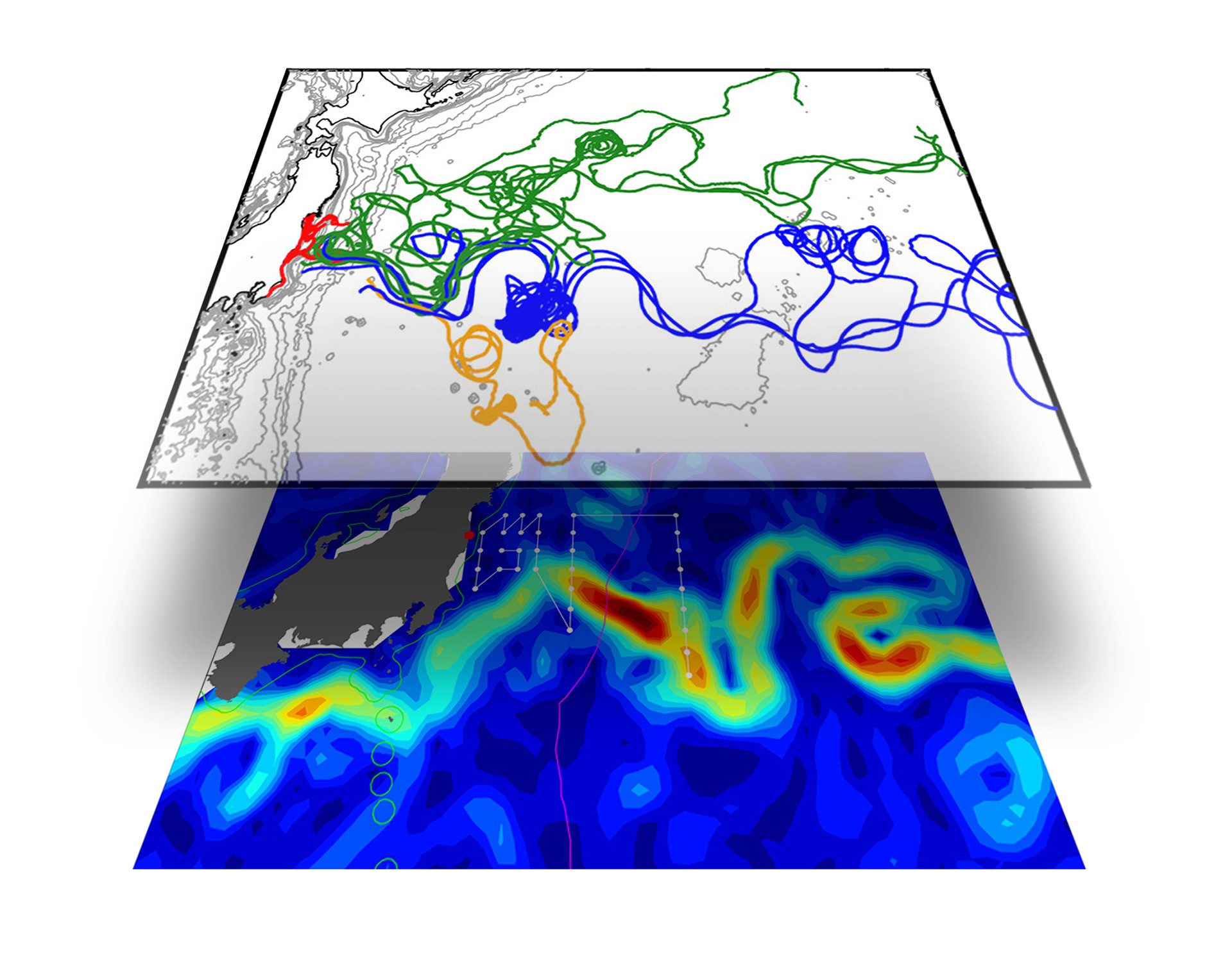
Map of drifter flow lines overlaid on the Kuroshio Current shows how Fukushima disaster radiation was swept away from shore, but blocked from flowing South.
Read More