|
| |
Cruise
Log: Thursday, April 1, 2004
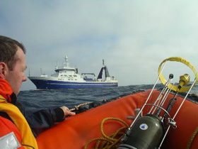
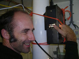
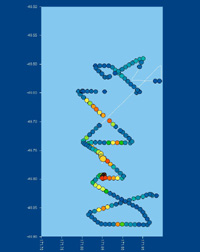
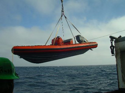
Contributor: Craig Stevens NIWA Wellington It's been a good couple of days. A break in the weather after we rejuvenated the patch with iron and tracer has enabled us to play catch-up with a couple of sampling techniques. This is an important period as the reduced wind enables near-surface waters to stratify, forming layers near the surface. The stratification affects how nutrients and phytoplankton are circulated as well as mediating rates of mixing due to breaking waves. Actually measuring these processes requires a suite of pretty unique devices. Yesterday we deployed two remote profilers - SkinDeEP (Brian Ward - WHOI) and Tramp (Craig Stevens - NIWA) which look like torpedoes but actually contain arrays of tiny environmental sensors. SkinDeEP makes profiles for several days autonomously. It is attached to a float which has an iridium cell phone and GPS receiver on board, and dials in its position to pinpoint accuracy every hour to another iridium cell phone on the ship. Tramp samples for a few hours at a time with turbulence sensors to look at the balance between mixing and stratification. Both profilers have small engines on board that drive them up and down repeatedly. The sensors are so delicate that they have to be deployed by hand from a zodiac so we get some wild rides. The fine weather also enabled us to trial a new spar buoy - basically a long pole with a float at one end and lots of weight at the other. The floats sit on the surface while the pole hangs beneath the water surface. Sensors mounted on the pole provide information about the water temperature and wave motion. This is used as validation data for the remote profilers as well as the ship-mounted NIWA wave radar. The hardest part of the whole process is getting the 5 m long buoy in and especially out of the water. The crew of the Tangaroa provides plenty of advice and expertise when it comes to bringing the ship alongside and then getting the long pole out of the water as it swings like a crazy pendulum.
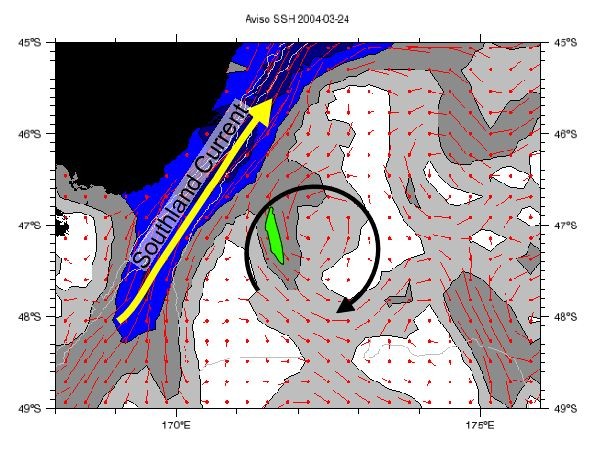
We now know that we are working on the most dynamic patch experiment ever attempted. The support team on shore (Mark, Melissa & Matt) are emailing constant updates of model results and satellite data. Our science meetings on board Tangaroa are now getting pretty focused as we position ourselves for what will be the endgame as the spinning eddy containing our patch hits the Southland current running up the southeastern side of South Island, New Zealand. We expect the patch to break up into filaments. Over the next couple of days we'll see how this proceeds and pick the best bit of water upon which to concentrate our measurements. Next Day >>
|
||||||||||||||||||||||||||||||||||||||||||||||||||||||||||||||||||||||||||||||||||||||||||||||||||||||||||
 |
||||||||||||||||||||||||||||||||||||||||||||||||||||||||||||||||||||||||||||||||||||||||||||||||||||||||||