
New program aims to improve hurricane predictions with ocean data
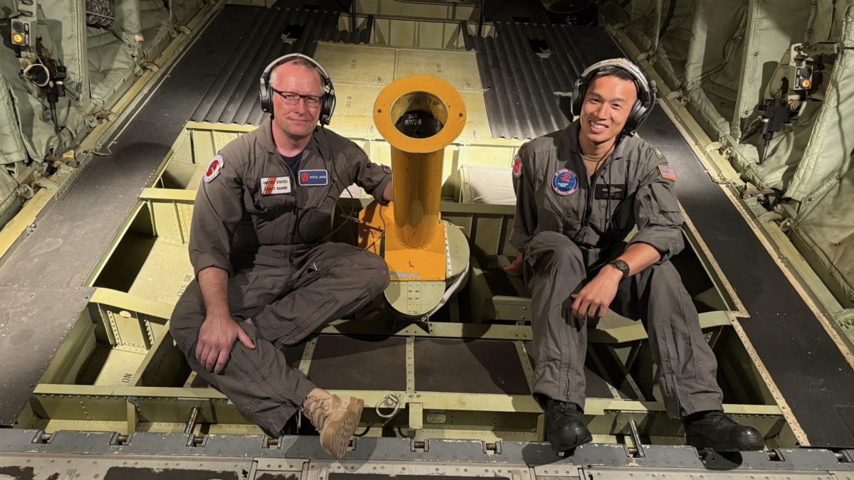 WHOI Physical Oceanographer Steven Jayne and MIT-WHOI Joint Program Student Lawrence Cen take part in a training flight ahead of peak hurricane season. (Photo by Manny Haenggi, Naval Oceanographic Office)
 August 4, 2025
Woods Hole, Mass. (August 4, 2025) – Researchers from the Woods Hole Oceanographic Institution (WHOI) are participating in a new initiative to enhance our understanding of extreme weather, such as hurricanes. The Study on Air-Sea Coupling with Waves, Turbulence, and Clouds at High Winds (SASCWATCH), funded by the Office of Naval Research, involves the deployment of a grid of ocean sensors ahead of hurricanes over the next 3 years. The coordinated combination of in situ observations, satellites, and high-resolution models allows us to fill gaps in our knowledge of air-sea interactions.
The transfer of momentum, heat, and moisture between the ocean and atmosphere plays a critical role in shaping when, where, and how intensely extreme weather events develop. Despite increasing recognition that these interactions are deeply interconnected, they’ve often been studied in isolation.
“This fragmented approach has led to an incomplete picture of how key factors, such as surface waves, ocean currents, and atmospheric turbulence, modulate fluxes under high-wind conditions,” said WHOI Physical Oceanographer Steven Jayne. “With the SASCWATCH program, we will be able to capture the full picture in real time.”
Jayne, a principal investigator of SASCWATCH, flies through major storms to deploy ocean monitoring tools as a member of the U.S. Air Force Reserve’s Hurricane Hunters. His lab utilizes two kinds of ocean robots, Argo and ALAMO, to gather real-time water temperature and salinity data.
Argo floats are deployed in the ocean from ships and take a profile of temperature and salinity every 10 days. As of this month, there are more than 4,000 floating robots taking inventory of the upper 2000 meters of the ocean, transmitting data back to shore every 10 days. During peak hurricane season, data transmission is more frequent, so near-real-time data is available to improve hurricane forecasts.
The Air-Launched Autonomous Micro Observer (ALAMO) is a smaller Argo-style profiling float that can be deployed through the chute installed in the back of a plane and communicate through satellite networks. Their size allows them to be more easily deployed out of aircraft, making ALAMO floats ideal for the rapid-response deployments necessary for studying shorter-term phenomena like hurricanes and other storms. Rather than mustering a slow-moving ship, air-deployable floats can utilize the Hurricane Hunter aircraft to deploy large numbers of instruments in and around developing hurricanes.
###
About Woods Hole Oceanographic Institution
Woods Hole Oceanographic Institution (WHOI) is a private, non-profit organization on Cape Cod, Massachusetts, dedicated to marine research, engineering, and higher education. Established in 1930, its mission is to understand the ocean and its interactions with the Earth as a whole, and to communicate an understanding of the ocean’s role in the changing global environment. WHOI’s pioneering discoveries stem from an ideal combination of science and engineering—one that has made it one of the most trusted and technically advanced leaders in fundamental and applied ocean research and exploration anywhere. WHOI is known for its multidisciplinary approach, superior ship operations, and unparalleled deep-sea robotics capabilities. We play a leading role in ocean observation and operate the most extensive suite of ocean data-gathering platforms in the world. Top scientists, engineers, and students collaborate on more than 800 concurrent projects worldwide—both above and below the waves—pushing the boundaries of knowledge to inform people and policies for a healthier planet. Learn more at whoi.edu.