
WHOI Scientist Catherine Walker Joins NASA-Selected EDGE Satellite Mission
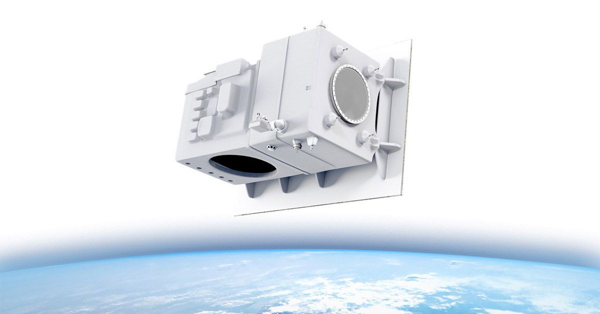 The Earth Dynamics Geodetic Explorer (EDGE) satellite is one of two next generation satellites selected by NASA to help better understand Earth and improve capabilities to foresee environmental events and mitigate disasters. (Image by Lanteris Space Systems)
 February 12, 2026
Satellite measuring land, polar, and coastal regions could launch by 2030
Woods Hole, Mass. (Feb. 12, 2026) — NASA has selected Earth Dynamics Geodetic Explorer (EDGE), a next-generation satellite mission led by the University of California, San Diego, as one of two new initiatives under the agency’s Earth System Explorers (ESE) Program. The EDGE team is comprised of 25 scientists and engineers from around the world, including Woods Hole Oceanographic Institution’s (WHOI) Catherine Walker, whose expertise in glacier and ice shelf dynamics will help advance global understanding of Earth’s rapidly changing land, ice, and coastal systems.
The ESE program conducts Earth science missions based on key priorities laid out by the science community and national needs. In keeping with this mission, EDGE is designed to dramatically improve scientists’ ability to observe Earth’s surface in three dimensions, enabling better forecasting of environmental change and supporting disaster preparedness, resource management, and national security. The project is expected to launch no earlier than 2030, pending a confirmation review in 2027.
“EDGE represents a major leap forward in how we observe the planet,” said Walker. “High-resolution, global measurements of Earth’s surface, from forests and coastlines to glaciers and ice sheets, will help us better understand the processes driving and responding to environmental change. It’s so exciting, after four-plus years of work to propose this mission, that we’ll actually get to the part where we can put designs into action and see this combination of new technology and scientific ideas get into space, which is the real challenge!”
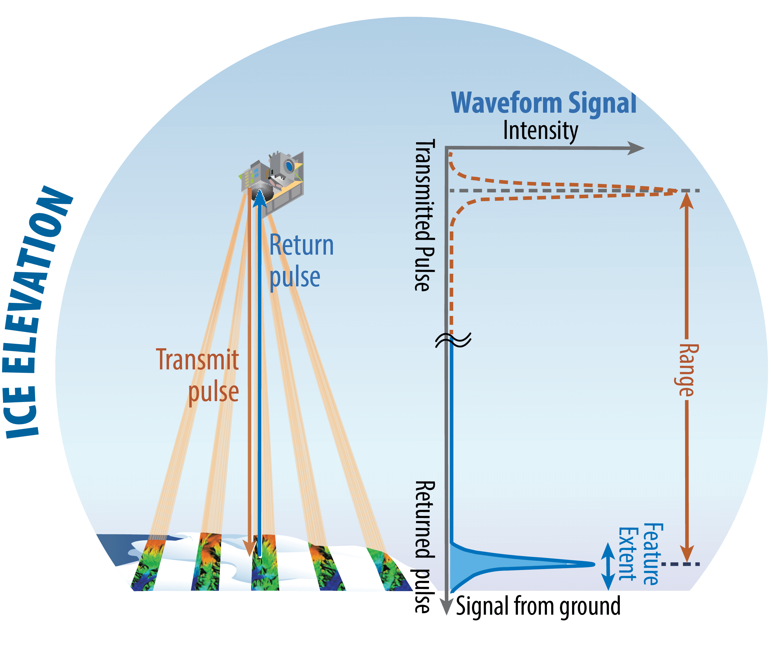
The mission will be the first global satellite imaging light detection and ranging (LIDAR) system, which makes extremely precise measurements of Earth’s surface height and structure. The system sends laser pulses to Earth’s surface and records the time it takes them to return to the spacecraft. Scientists then use these measurements to construct high-resolution, three-dimensional reconstructions features and ecosystems like forests, and the surface of glaciers, ice sheets, and sea ice.
(Image by NASA)
EDGE builds on the heritage of NASA’s ICESat-2 and Global Ecosystem Dynamics Investigation (GEDI) missions, which have transformed scientists’ ability to monitor Earth’s surface from space. EDGE will significantly expand this capability through swath-mapping LIDAR technology that captures five 120-meter-wide strips simultaneously, greatly increasing spatial coverage and accuracy of previous space-based mapping systems.
Data collected by EDGE will support a wide range of practical applications. EDGE measurements will support water-resource planning through improved understanding of snowfall patterns and mountain glacier ice flux that influence downstream water supply. For risk management, the data will support safer Arctic shipping by monitoring changing conditions along shipping lanes and help identify where ground sinking in permafrost regions could threaten roads, buildings, and other critical infrastructure. These capabilities will provide scientists, policymakers, and regional and local resiliency planners with actionable intelligence to better assess vulnerabilities and respond to environmental hazards.
“NASA uses the unique vantage point of space to study our home planet and deliver life-saving data into the hands of disaster response and decision-makers every day for the benefit of all, while also informing future exploration across our solar system to decision-makers,” said Nicky Fox, associate administrator for NASA’s Science Mission Directorate.
With this selection, EDGE will advance to the next phase of development. Each mission will be subject to confirmation review in 2027, which will assess the progress of the missions and the availability of funds.
For more information: https://www.nasa.gov/news-release/nasa-selects-two-earth-system-explorers-missions/
###
About Woods Hole Oceanographic Institution
The Woods Hole Oceanographic Institution is a private, non-profit organization on Cape Cod, Massachusetts, dedicated to marine research, engineering, and higher education. Established in 1930, its primary mission is to understand the ocean and its interaction with the Earth as a whole, and to communicate an understanding of the ocean’s role in the changing global environment. Top scientists, engineers, and students collaborate on more than 800 concurrent projects worldwide—both above and below the waves—pushing the boundaries of knowledge and possibility.