Tracking change in the Arctic Ocean
Long-term WHOI programs lead to important discoveries about changing Beaufort Gyre
Estimated reading time: 3 minutes
The Arctic Ocean is a dynamic place, and climate change is making it even more so. In order to find out what is changing—and what the future might hold—it’s essential to have a reliable picture of past conditions. That picture is gradually becoming clearer, thanks to data collected by the Beaufort Gyre Observation System (BGOS), an ocean monitoring network developed and maintained by Woods Hole Oceanographic Institution (WHOI) researchers for nearly two decades.
Since 2003, the multi-pronged BGOS—supported by the U.S. National Science Foundation, WHOI, and Fisheries and Oceans Canada—has provided researchers around the world with continuous, long-term monitoring of the Beaufort Gyre in the Canada Basin. As one of the primary drivers of Arctic Ocean circulation, researchers are closely monitoring this gyre to understand changes in the Arctic region and how it affects the climate at lower latitudes. More than 160 publications have tapped into data from BGOS in recent years, covering such topics as ocean circulation, sea ice changes, and ecosystem and biogeochemistry dynamics. One recent study from the Massachusetts Institute of Technology showed a clear correlation between summer ice melt and the formation of high-energy swirling water masses known as eddies in the Arctic Ocean. The authors say that as melting accelerates, the system is becoming more turbulent year-round.
“The BGOS has been so important to so many scientists as a platform for everybody to coordinate and do science there,” says Richard Krishfield, a WHOI senior research specialist. “It provides consistent observations over an extended period to do climate studies.”
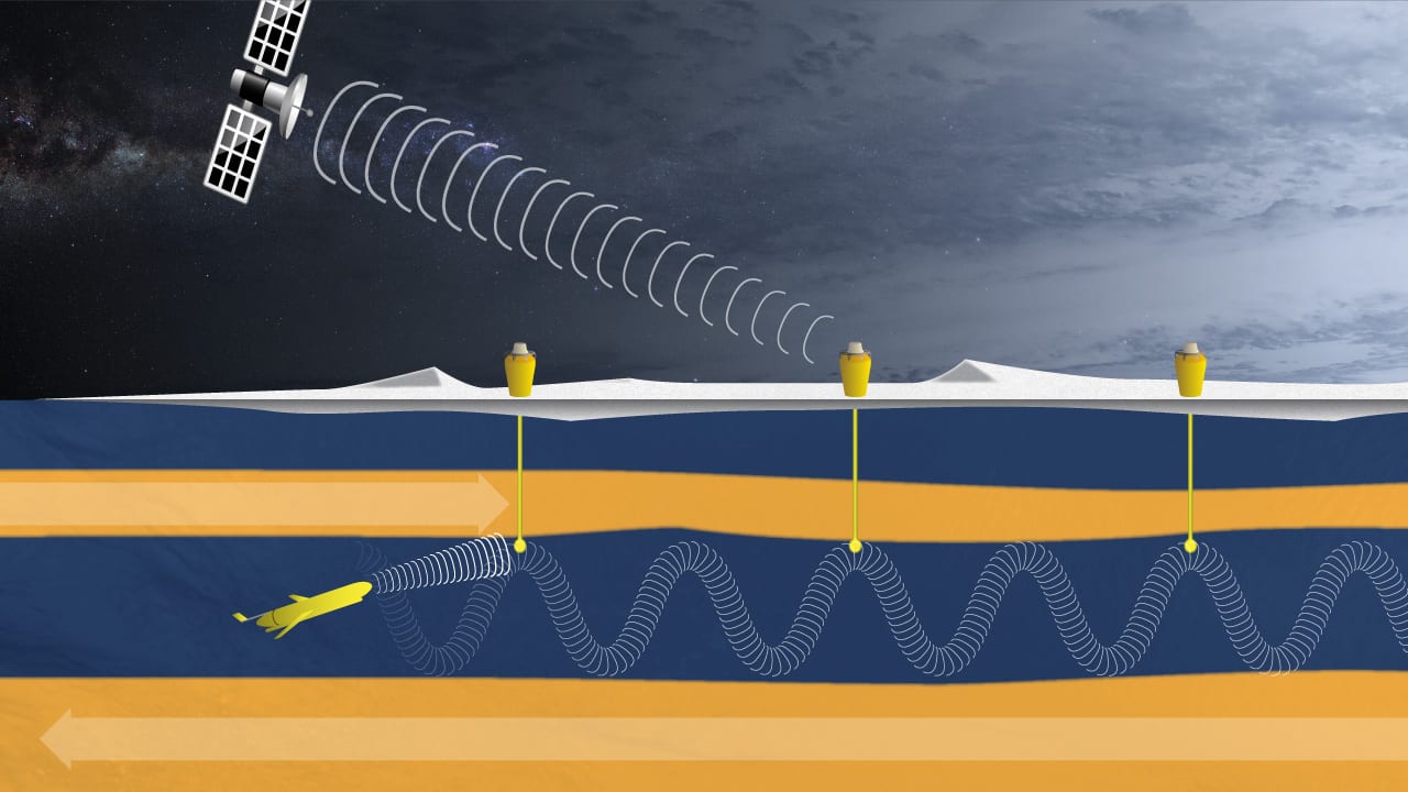
The components of the BGOS system include annual late summer shipboard measurements of water properties and deep-water moorings that can sample and measure to a depth of 2,050 meters (6,725 feet). In addition, Ice-Tethered Profilers (ITPs) attached to ice floes drifting in the Beaufort Gyre take measurements between the fixed moorings—and closer to the surface. Running continuously for three years on just a few watts of battery power per day, the float-like instruments measure the ocean down to 750 meters (2,500 feet) and send the data via satellite in near real time to computers on shore.
The long-term data collected through BGOS and the ITP program has been critical to discovering changes in the Beaufort Gyre over the last two decades. A 2019 analysis by WHOI senior scientist Andrey Proshutinsky and colleagues found that the gyre’s freshwater content had increased by about 40 percent since 2003. Proshutinsky, who is the lead investigator of the Beaufort Gyre Exploration Project, notes that this phenomenon is comparable to a freshening event in the late 1960s and early 1970s called the Great Salinity Anomaly.
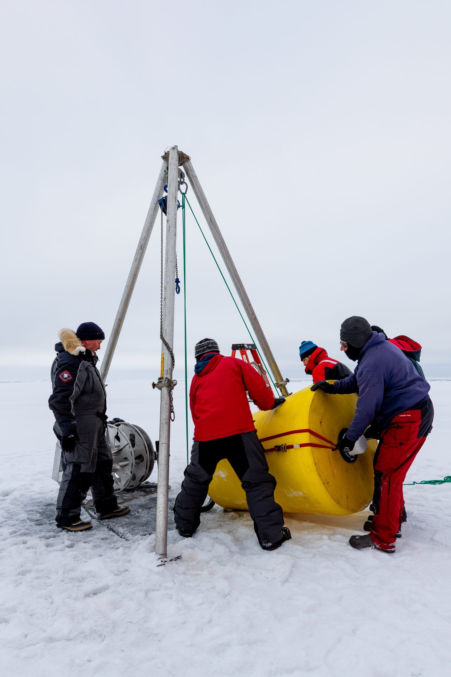
Researchers position an Ice-tethered Profiler mooring to sea ice in the Canada Basin during a 2018 research cruise to study the Beaufort Gyre. (Photo by Hugo Sindelar © Woods Hole Oceanographic Institution)
The stage has been set, the authors state, for another big release of freshwater to lower latitudes, with accompanying climate impacts, including changes in sea ice conditions, ocean circulation, and sub-Arctic ecosystems.
“You’d like to think that what you are investigating has some larger societal importance, and certainly global warming and the future of the planet are important to society,” adds John Toole, a WHOI senior scientist who co-developed the ice-tethered profilers. “It’s always in the back of your mind.”
Toole, Krishfield, and WHOI adjunct scientist and Yale professor Mary-Louise Timmermans drew on BGOS data for a 2018 paper which showed ocean temperatures nearly doubled in part of the Beaufort Gyre between 1987 and 2017. “We related this increased heat to reduced sea ice at the margins of the Arctic Basin,” Timmermans says, adding that as the sun melts sea ice, the resulting warmer surface waters are driven by wind to the interior of the Canada Basin.
“We can only say that this will continue because we’re not likely to see the sea ice increasing any time in the near future,” says Timmermans.

