Autonomous Ocean Vehicles Supply Key Data on Hurricane Florence
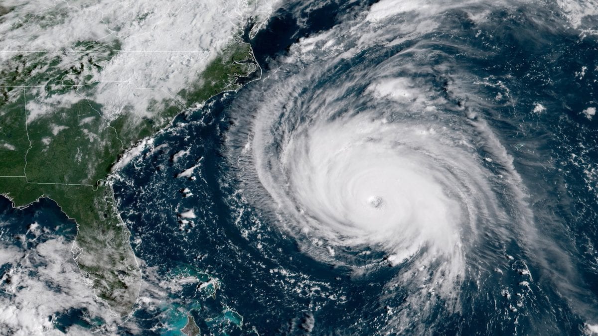
With Hurricane Florence bearing down on the North Carolina coast, researchers at Woods Hole Oceanographic Institution (WHOI) have mobilized autonomous vehicles and instruments to track changes in the ocean ahead of and beneath Florence.
With Hurricane Florence bearing down on the North Carolina coast, researchers at Woods Hole Oceanographic Institution (WHOI) have mobilized autonomous vehicles and instruments to track changes in the ocean ahead of and beneath Florence. The data will be relayed in near-real time to hurricane forecasters in an effort to help improve predictions of the storm’s path and intensity.
The instruments offer new information—from locations in front of storms that have been too dangerous for ships and people to occupy, and at depths satellites cannot penetrate.
Over the last half-century, scientists have made great strides in forecasting the “where” and “when” of hurricanes along the East Coast. But forecasting storm intensity has been more difficult to improve. That’s because scientists have been missing critical information for forecasting hurricanes accurately: the heat stored in the upper thousand meters of the ocean.
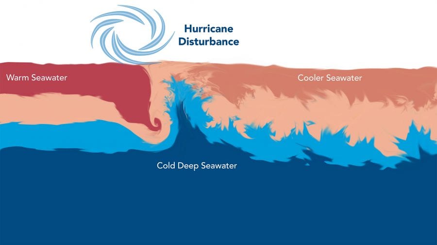
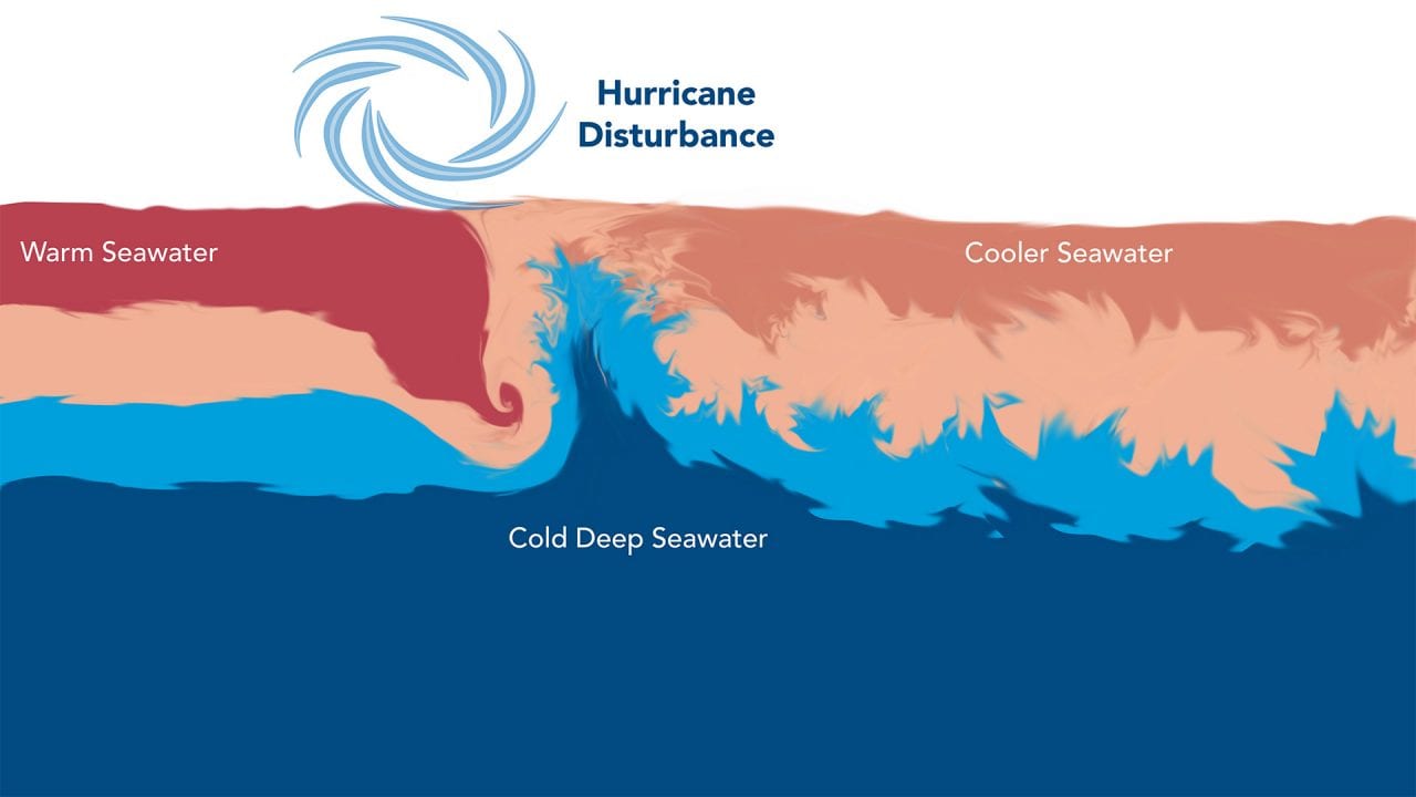
Large storms gather energy from warm water at the ocean surface. As high winds blow across the water, they can mix this warm surface layer with cooler water hundreds of feet below. If the warm surface layer is thin, cold water mixing to the surface will rob storms of their strength. But if warm waters extend down deeper, the surface will stay warm, even as deeper waters are mixed to the surface, giving the storm more energy to continue growing as it moves.
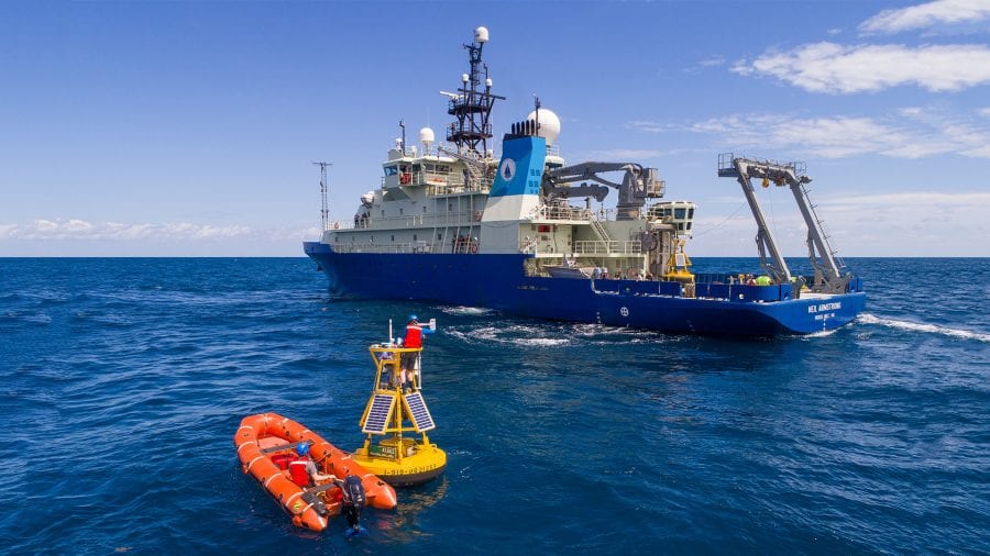
WHOI physical oceanographers Robert Todd, Magdalena Andres, and Glen Gawarkiewicz are part of an ongoing multi-institutional project known as PEACH (Processes driving Exchange At Cape Hatteras), which focuses on the major confluence of currents near Cape Hatteras. Since 2017, the researchers have deployed gliders, moorings, floats, and sensors to measure currents and atmospheric conditions off the coast of Cape Hatteras. Collaborators include the Skidaway Institute of Oceanography, the University of North Carolina, North Carolina State University, and the UNC Coastal Studies Institute.
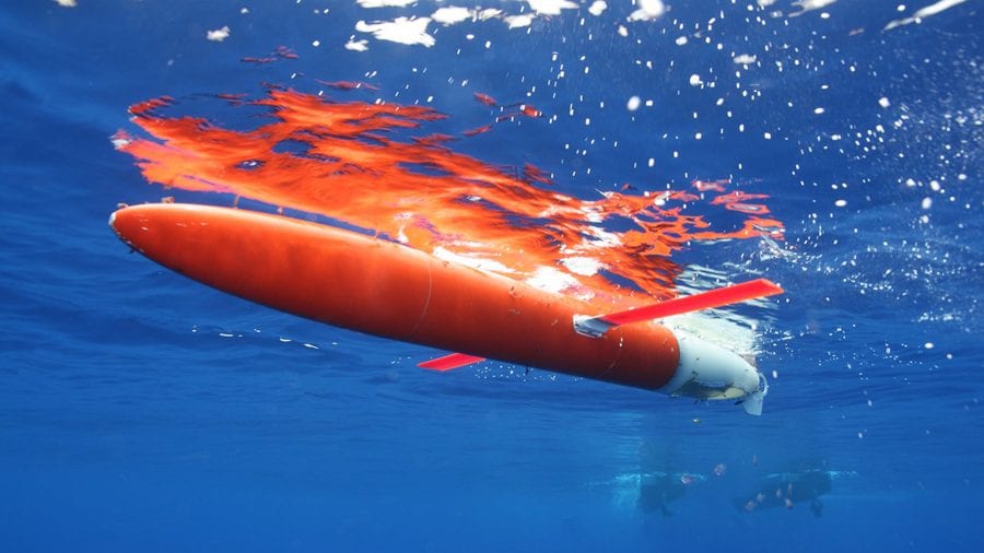
Todd routinely deploys autonomous underwater vehicles called Spray gliders off North Carolina’s Outer Banks as part of PEACH, as well as others that survey the Gulf Stream, a major source of warm waters along the East Coast. One glider is currently headed toward Florence’s track off North Carolina. Another was just launched in the Gulf Stream offshore of Miami, Florida.
The gliders repeatedly dive to depths of about 1 kilometer (3,280 feet) and have onboard sensors that measure seawater temperature, salinity, and current velocities as the vehicles zig-zag up and down through the ocean. When the gliders surface, they transmit their data via satellite in near-real time to Todd’s lab in Woods Hole, Mass., where he and his colleagues relay them on to hurricane forecasters.
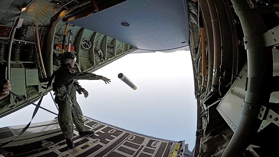
Meanwhile, WHOI physical oceanographer Steve Jayne is flying into Florence with the U.S. Air Force Hurricane Hunters. From the airplanes, he drops profiling devices newly developed at WHOI called ALAMO (Air-Launched Autonomous Micro-Observer) floats. They are parachuted into the ocean ahead of the storm. Like the gliders, ALAMOs sink to the depths, then record temperature and salinity of seawater on the way to the surface, where they relay their data via satellite. This information about the heat content below the sea surface is then provided to hurricane forecasters to help improve their predictions of hurricane intensity.
Together, Spray gliders and ALAMO floats are providing detailed information about the coastal ocean near Hurricane Florence’s track. By being in the water year-round at locations prone to hurricanes, the vehicles and instruments are filling a critical gap in our knowledge of the ocean’s role in driving the intensity of hurricanes.
The PEACH array will provide important information on how rapidly cooler coastal waters mix to the surface, which can reduce storm intensity shortly before landfall. The array will also measure how fresh water from expected torrential rains moves offshore into the deep ocean, which can affect ocean mixing for subsequent storms.
This research is funded by the National Science Foundation, the Office of Naval Research, the National Oceanic and Atmospheric Administration, Eastman Chemical Co., and Woods Hole Oceanographic Institution. The Instrument Development Group at the Scripps Institution of Oceanography, UC San Diego provides invaluable support to WHOI Spray glider operations.
Slideshow
Slideshow
- Measurements of the heat stored in the in upper 1,000 meters of the ocean is critical for forecasting hurricane intensity. Hurricanes gather energy from warm water at the ocean surface. As high hurricane winds blow across the water, they can mix this warm surface layer with cooler water hundreds of feet below. If the warm surface layer is thin, cold water mixing to the surface will rob storms of their strength. But if warm waters extend down deeper, the surface will stay warm, even as deeper waters are mixed to the surface, giving the storm more energy to continue growing as it moves. (Natalie Renier, Woods Hole Oceanographic Institution)
- ALAMO (Air-Launched Autonomous Micro-Observer) floats are launched from airplanes and into the ocean in front of oncoming hurricanes. They can obtain measurements of seawater temperature and salinity in locations that are too dangerous for ships and people to go. (U.S. Air Force, courtesy of Steve Jayne)
- WHOI scientists, along with colleagues from the University of North Carolina-Chapel Hill deploy a meteorological buoy off the research vessel Neil Armstrong near Cape Hatteras in April, 2017. The buoy joins an array of instruments being used as part of the PEACH (Processes Driving Exchange at Cape Hatteras) project. (John McCord, UNC Coastal Studies Institute)
- WHOI scientist Robert Todd uses autonomous underwater vehicles called Spray gliders to record measurements in the ocean that can help hurricane forecasters improve predications of a hurricane’s path and strength. (Robert Todd, WHOI)
Related Articles
- Commercial ship tracks Gulf of Mexico’s hurricane heat potential
- How historic hurricanes can help predict storm intensity
- Gliders Reveal Tango Between Hurricanes and the Gulf Stream
- Forecasting Future Hurricanes
- Unearthing Long-Gone Hurricanes
- New Air-Launched Devices Help Study Hurricanes
- Blue Holes and Hurricanes
- More Floods & Higher Sea Levels
- Recovering After a Hurricane
Featured Researchers
See Also
- Magdalena Andres
- Glen Gawarkiewicz
- Steve Jayne
- Robert Todd
- Forecasting Future Hurricanes Oceanus magazine video

