
How historic hurricanes can help predict storm intensity
Research into past hurricanes could help predict the strength of future storms, and inform infrastructure planning and emergency management decisions in southern New England
 This article printed in Oceanus Fall 2021
Estimated reading time: 4 minutes
In 2020, the Atlantic hurricane season had more named storms than any other season on record and inflicted more than $40 billion of damage on U.S. communities. As our planet continues to warm, climate models suggest that such storms will become even stronger and more destructive. Researchers at WHOI are working to refine our understanding of past hurricane events - work that can improve the predictive models that inform how coastal communities prepare for the future.
Instrumental records of hurricanes in the Atlantic only go back about 150 years, but paleoclimate data derived from tree rings, ice cores, and other sources stretch back much further. To reconstruct thousands of years of hurricane history and make connections with long-term climate trends, researchers have looked for evidence of past storms in sediment cores. Flooding from strong storms can sweep coarse sand and shells into new areas, creating distinctive layers in otherwise muddy soil. But this work has primarily focused on the frequency of past hurricanes, not their strength or how they reshaped the landscape. Lily Sanborn, an MIT-WHOI Joint Program doctoral student in the Coastal Systems Group at WHOI, is working on a project to change that.
Advised by WHOI scientist Jeffrey Donnelly, Sanborn is working with Northeastern University researchers Jim Chen and Samuel Muñoz to simulate how different properties of storms and coastlines change the way that beach sediment is moved by floods during a hurricane. Their work could help inform infrastructure planning and emergency management decisions in southern New England and other places that are likely to face hurricane flooding in the future.
"Coastal communities in New England and across the U.S. are vulnerable to hazards associated with beach erosion and flooding during major hurricane events," Sanborn says. "We rely on models that can predict the likelihood of future hurricane recurrence and provide the basis for coastal planning and management strategies."
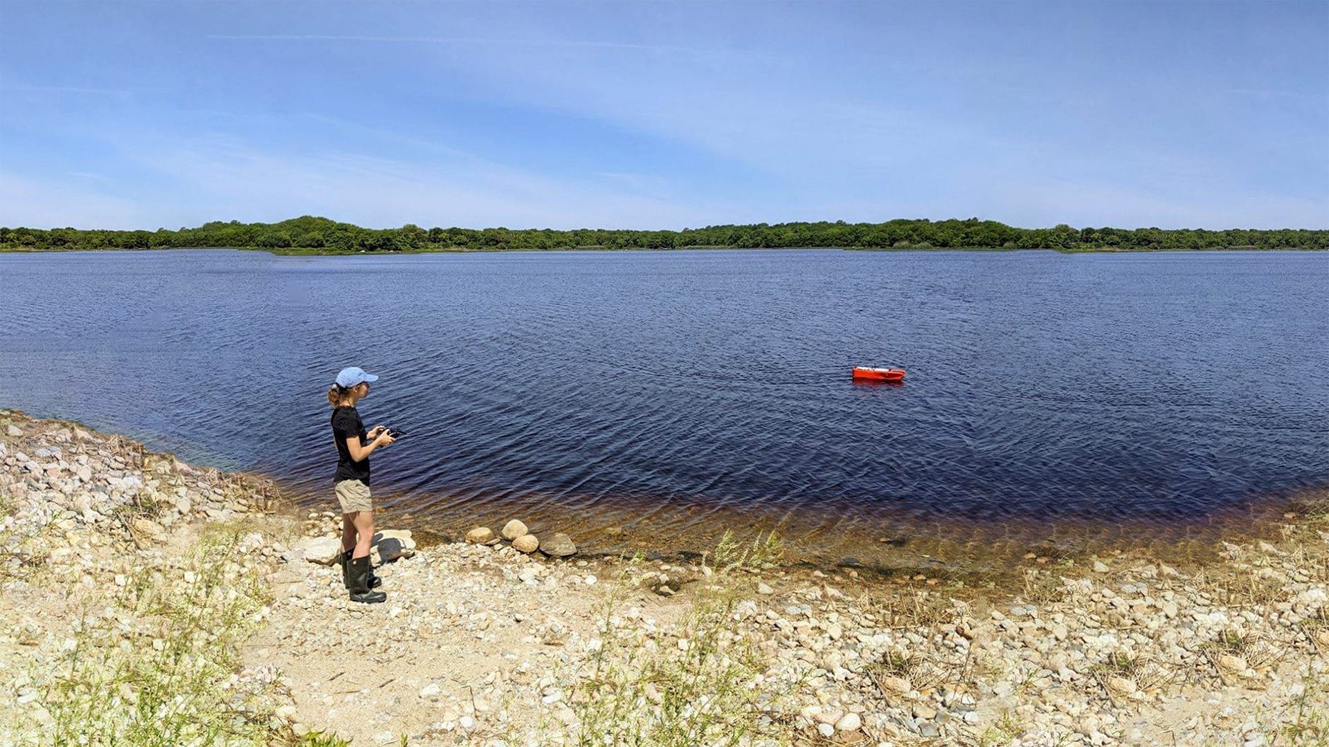
The first step of this project is to get their hands dirty-literally. In the summer of 2021, the researchers pulled up vertical cores of mud and muck from the bottom of coastal ponds in southern New England.
"When a hurricane strikes a coastline, it produces waves and storm surge, which often induce flooding," Sanborn says. "These floods tend to erode sediment from the shore, pick it up and carry it landward."
Floods wash sediment from the beach into coastal ponds, where it settles to the bottom as a thin layer of sand amongst the mud. Sanborn and her colleagues can examine plant fragments and other organic matter mixed into the sand to estimate when each storm happened using a technique called radiocarbon dating. Plants and other organisms absorb carbon when they are alive, a small amount of which is radioactive. When they die, the radioactive carbon breaks down at a steady rate. The ratio of radioactive to non-radioactive carbon isotopes can tell researchers roughly when organisms in a particular layer of sediment died, creating a vertical timeline through the mud. Using samples from different areas within each pond, Sanborn will be able to get an idea of how sediment was moved and distributed during each storm event. For more recent major hurricanes, such as Hurricane Bob in 1991 and Hurricane Carol in 1954, the researchers can match these sediment measurements with aerial images showing how the region's coastal geometry has been rearranged by the storms' ability to move beaches and carve inlets.
This information, as well as the well-documented wind speeds, storm tracks, and water levels associated with recent hurricanes, will be used to calibrate newly developed computer models.

Floods wash sediment from beaches in coastal ponds, where it settles to the bottom as a thin layer of gray-colored sand in between the darker mud layers seen in the sediment core sample shown here. Sanborn and her colleagues can examine plant fragments and other organic matter mixed into the sand layers to estimate when storms happened using a technique called radiocarbon dating. (Photo courtesy of Lily Sanborn, © Woods Hole Oceanographic Institution)
"We can simulate these storm events in models and compare the sediment deposition predicted by the model with what we've learned from our field-based data," Sanborn says. "Once we've done so, we can adjust the characteristics of the storms and of the beaches that we're interested in to explore how overwash patterns could change in different scenarios."
These models will allow researchers to use sediment distribution patterns to estimate the strength of historic hurricanes in New England and reconstruct how they impacted the coastline thousands of years ago. Paired with an understanding of historic climate conditions, this picture of the past becomes a window to our potential future.
"Determining the probability of major hurricane events in the future requires knowledge of the frequency of hurricane recurrence in the past," Sanborn says. "This research is aimed at enhancing our knowledge about the history of intense hurricane events."
This research is funded by the National Science Foundation.