
Earth, Wind, and Fire in Antarctica
Scientists unravel a story inscribed in lava and written by the wind
From a windy, isolated camp in southern Victoria Land, Antarctica, three scientists from Woods Hole Oceanographic Institution explore how the waterless, lifeless, volcanic terrain formed and evolved. Read the story and watch the video.
<!—->
When you get off the plane at McMurdo Station, Antarctica, you realize what people mean by the White Continent. You, your 60 fellow passengers, and the C-17 jet that brought you here are resting on 10 feet of fresh, flat sea ice—ice that had been open water at the end of last summer. Great mountains lounge in the distance like big game on a white savannah, a flat plain of ice streaked with the gray shadows of clouds.
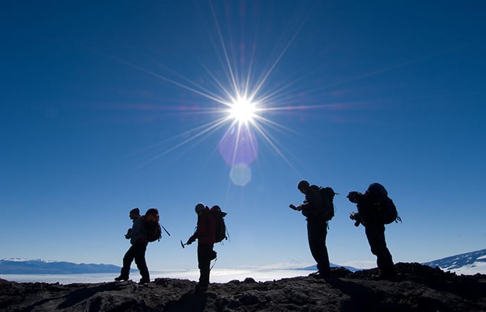
But you don’t really feel alone until a helicopter drops you at a field camp and leaves 10 minutes later in a cloud of blowing lava shards. When it dropped us on the slopes of Mount Morning, on Dec. 10, 2007, a stillness settled in that lasted for three days. We were five people, four tents, three working snowmobiles, two Coleman stoves, and a jackhammer, all heaped on a square of volcanic rubble the size of a basketball court. Beyond that stretched Antarctica, white to every horizon.
On the fourth day, the wind began.
In a sense, the wind was why we were there—that and the cold weather and the scrabble of young lava flows we were camping on. We were a team of three geologists from Woods Hole Oceanographic Institution (WHOI)—plus a writer and a photographer keen for a good story. We had come to this newly made ground to measure how quickly the elements tear it back down again. Our leader was geochemist Mark Kurz, the only Antarctic veteran among us; also along were volcanologist Adam Soule, a young researcher whose two favorite tools are a $10 hand lens and a $100,000 instrument called a LIDAR; and MIT/WHOI graduate student Andrea Burke, six years out of high school and 9,500 miles from her Connecticut hometown.
Much wind, no water
The volcanic landscape of Mount Morning is a story written by the wind and the cold. It doesn’t rain here, so water never runs over the rocks. And Mount Morning and the adjacent Dry Valleys region get very little snowfall, so glaciers haven’t touched most of the mountain, either. Its slopes are an angular patchwork of snowfields, lava-strewn plains, basalt pinnacles, and looming cinder cones.
“Look at this fantastic landscape,” Kurz said. “You wouldn’t have this here if there was running water.”
Just a half-mile from camp was the site of Mount Morning’s most recent eruption: Emperor Cone, a 150-meter-high pucker of cinders that never failed to remind me of a proud baboon surveying its domain.
Emperor’s latest eruption, 25,000 years ago, had rained down brick-red nuggets in sizes ranging from gumball to golf cart. Most of it had landed on the 150,000-year-old lava flow we were camped on. This older eruption had been sedate by comparison, a toothpaste-like outpouring of basalt rock colored the somber gray of a Mercedes Benz. Wind had been sculpting it ever since, chiseling pencil-sized grooves into the heavier rocks and sweeping away the lighter ones. Cold temperatures and blown snow had penetrated the porous lava, forming regular, roughly hexagonal cracks almost like frost heaves on asphalt. Seen from the air, the 20-foot-wide shapes had the look of huge reptilian scales spread across the slopes.
Kurz, Soule, and Burke were here to study the development of these “patterned ground” cracks. They were on the trail of some of the most basic questions a geologist can ask: How old is this land? How fast does it change? Isolated from the confounding effects of water erosion, these lava flows might give a clearer picture of the time it takes for wind and cold to break apart the rocks.
If Kurz’s team could estimate that, they’d have a ruler by which they could measure the age of the landscape here and in the Dry Valleys.
“And one of the reasons we want to know that,” Kurz said, “is to help settle the question of how stable the East Antarctic Ice Sheet has been.” Containing roughly half the planet’s freshwater, the 3-mile-thick East Antarctic Ice Sheet is the largest body of ice on Earth. It’s in no current danger of melting, but geologists disagree on how stable it has been in the distant past. If it has held steady for the last 15 million years, as many think, the evidence might be inscribed in the patterned ground.
A Tolkienesque landscape
That first day we set up camp in the 20ºF evening air: three teepee-like Scott tents, a kitchen tent shaped like a 7-foot tall loaf of bread, and a half-sized tent for our 5-gallon bucket of a latrine. Our lava-chunk campground proved impervious to stakes, so we guyed out our tents and anchored the lines under precarious piles of rock. We raided snow from a nearby drift to melt water, and settled in for a spaghetti dinner. Camp was only half set up, but we weren’t worried about daylight. Sunset wouldn’t come until late February.
Over the next few days we brought out the sampling equipment: First the rock hammers—sort of an extra appendage for a geologist. Kurz deployed his with no reticence. Three or four curt bashes broke off a chunk of rock, and he grabbed it for inspection without breaking rhythm. Often he found the rock dotted with tiny green crystals of olivine. Back at WHOI, he could hand-pick 100 milligrams (about four-thousandths of an ounce) of the crystals from a sample, analyze it for helium-3—a rare, light isotope of the element—and use that to determine the rock’s age.
Next, Soule brought out his LIDAR (Light Detection And Ranging), a laser scanning device used to make high-resolution, 3-D measurements over large areas. The microwave-oven-sized device mounts on a heavy-duty tripod with a motorized swiveling head. A laser, guided by precisely rotating mirrors, shoots out from the device. An equally accurate clock measures how fast the beam returns, using the elapsed time to calculate distance and elevation.
From a perch atop a lava promontory, the device (quickly dubbed the “All-Seeing Eye of Sauron” given our site’s resemblance to Mordor) can measure the size of every rock and pebble out to a distance of about 400 meters, staying accurate to less than a centimeter. After 80 minutes the LIDAR had collected some 30 million data points.
“When I was doing my Ph.D.,” Soule said, “I would walk a line over the lava and pick up every rock and measure it by hand. It took about a week.” Back home, Soule will analyze patterns in the rock sizes to complement the findings from Kurz’s age estimates.
Vibrating jackhammers and tents
To understand how the cracks form, Kurz and Soule wanted to look below the surface for evidence of churning: rocks moving gradually up and down as temperatures change day by day, season by season, decade by decade. So Soule and Burke dragged out the Wacker, our 60-pound jackhammer. Over the next four days we excavated a waist-deep trench, teaming up to hold the jittery beast steady.
This whole time the weather held, but we knew the wind was coming. For a place called Hurricane Ridge, Antarctica, it’s just a matter of time. By the fourth day all the clouds in the sky had been whisked hurriedly northward in a single creamy layer. Down on the dark rock it was still calm, sunny and warm. But over the higher ridges, quarter-mile-long plumes of snow snaked downwind.
When it came, the wind battered our tents so hard the walls knocked us off our seats. It was as if the tent itself was a film played on a jerky old projector, its outline flickering back and forth from moment to moment. Steam curled from our pot of snowmelt, then suddenly shifted 6 inches left, then back, in time with the vibrating tent walls.
Now I understood why every crack in the lava had a line of rocks arranged along it, and every crevice was jammed full of pebbles. Their varying colors—brick-red, orange-red, gray, and dark brown—suggested the volcanic plains they’d blown in from. The wind was painstakingly sorting the loose parts of the landscape like a clerk sorting letters.
Exit via helicopter
By this time it was Monday, day 8, and time for writer and photographer to leave. The wind had been steadily increasing for three days and was now a physical presence that we leaned against as we walked. The day before, during a foray over the lava, a single gust had briefly swept Kurz, Soule, and me off our feet and backwards. We probably looked like we were line dancing, badly.
Despite the weather, helicopter Zero Eight Hotel was on schedule. We gathered our things as it crept toward us from the ice shelf below. Shoving in our gear was like packing away the week itself: the stumbling over lava, wrestling with the Wacker, poring over maps, the ringing of rock hammers and the battering of tent sides, the hot breakfast cereal and cold lunches of nibbled chocolate, the rock, ice, and sky, the sun stubbornly circling our campsite. In the end, everything disappeared into the back seat, and then it was time to pack ourselves in.
We said goodbye under the rotor wash. The geologists had another 26 days ahead of them, here and at another camp nestled by the Taylor Glacier in the Dry Valleys proper. The next day was too windy for work, Kurz later told me. The day after that, gusts snapped a 2-inch-thick pole on the kitchen tent, necessitating a slapdash takedown and a scramble to batten down its contents. And the following day, after an unrelenting week of wind, the weather finally settled.
The three geologists dusted themselves off and picked up the Wacker. Over the next three weeks, they dug an astounding 11 more pits. Their rock samples are still in transit home from the ice. Back at Mount Morning, now entering a dark and bitter winter, the patterned ground is still buckling, and the wind is still scraping away at the mountain.
This research was funded by the National Science Foundation.