Ancient seas, future insights
WHOI scientists study the paleo record to understand how the ocean will look in a warmer climate
 This article printed in Oceanus Summer 2025
Estimated reading time: 5 minutes
Monster storms, megadroughts, and dwindling food stocks… It can feel daunting to prepare for the challenges of a warmer, more unstable climate. But the planet has indeed experienced tumultuous times before, and the ocean has been there to record it all.
At WHOI, paleo-scientists have developed new ways of probing the sea for ancient data that could help humanity better prepare for future changes. Some researchers sample deep layers in the seafloor, peering beneath rugs of sand and silt to find fossilized layers that archive changes from the world above. Others use computer simulations to reverse engineer the oceanographic conditions that preceded historic natural disasters and periods of bountiful sea life. With one eye on the past, these paleo-ocean experts are comparing today’s shifting climate to other epochs in the geologic record. Together, their work provides a clearer roadmap of the challenges that lie ahead and the ocean’s ever-evolving influence on Earth’s climate.
The following scientists remind us that of the many gifts the ocean bestows on humanity, perhaps the greatest is its capacity to remember.
Down the (blue) rabbit hole
 Higher-intensity hurricanes appear to be on the rise, yet we know very little about how the risk is evolving for coastal communities as storm patterns change. This can make it difficult for local and state officials to know where and how to brace their communities before a strong hurricane reaches them. Fortunately, WHOI geologist Jeff Donnelly is working to close this knowledge gap.
For more than a decade, Donnelly has reconstructed ancient storms using sediments at the bottom of blue holes around the Caribbean and Florida. These sinkhole-like features formed during the last ice ages when lower sea levels exposed bedrocks of limestone to the erosive force of rainwater. Eventually, rising seas flooded them, and for millennia, storms passed overhead, depositing larger debris such as coral fragments and foliage from nearby islands that amassed into distinct layers on the bottom. Donnelly and his team excavate cores from this substrate and interpret various kinds of information about the chunky storm layers within.
“I think we provide a perspective that really builds off of what Grandpa told you.” —Jeff Donnelly, WHOI geologist
After recovering hundreds of yards of sediment cores from dozens of blue holes, he and his lab have learned how to identify big storms in the paleo-record and codify new insights about where and when they might strike. His work is building a new baseline for high-intensity storm research, one that could help the public brace more effectively for future tempests.
“These high-intensity storms are infrequent enough that a lot of times we don’t have personal memories of them, but it may be sort of passed down from generation to generation,” said Donnelly. “I think we provide a perspective that really builds off of what Grandpa told you.”
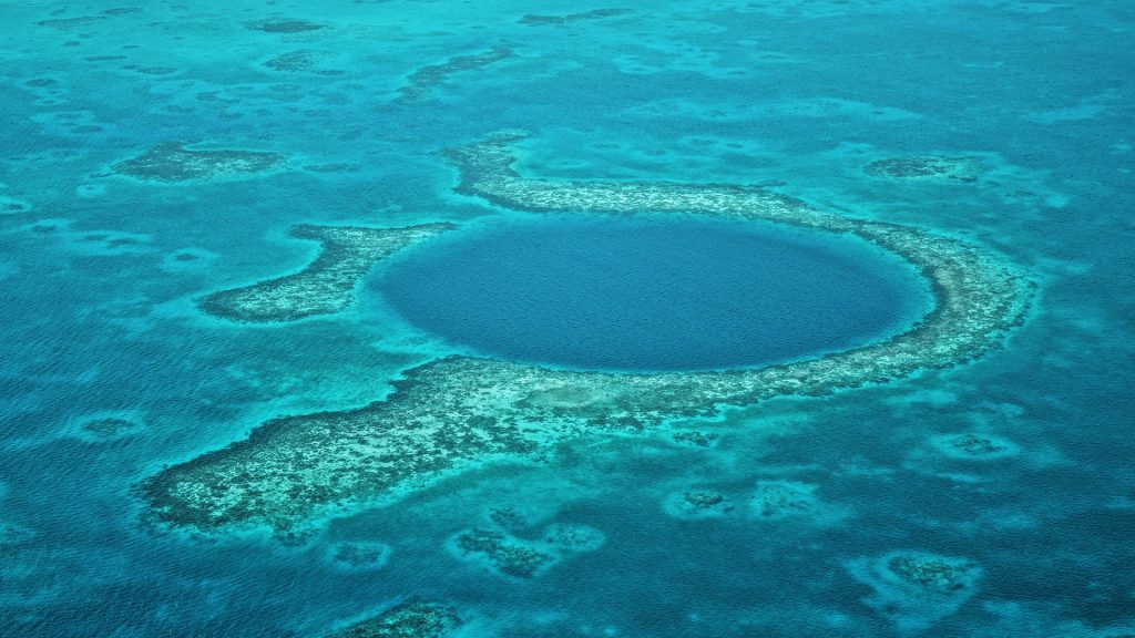
The Blue Hole Belize Lighthouse Reef. (Photo by Agnes Lee via Unsplash.com)
Lessons from a dynasty-killing megadrought
 WHOI physical oceanographers Caroline Ummenhofer and Shawn Wang study how cycles in the ocean set the stage for droughts around the world. Insights from a 380-year-old megadrought are teaching them how volcanic activity can amplify the effects of these cycles, leading to longer, more dangerous dry spells.
The Ming era, which spanned from 1368 to 1644, is known to historians as a period of artistic, cultural, and spiritual renaissance in China, cut short by a trifecta of misfortune. Amid peasant rebellions and poor leadership, a crippling seven-year-long drought led to a series of crop failures that put a nail in the dynastic coffin. Climatic cycles, such as the El Niño Southern Oscillation, drove wind patterns that likely reduced rainfall in Southeast Asia during this time but couldn’t have sustained this drought alone. Volcanic activity, it turns out, was also a contributing factor. Eruptions release aerosols that can reflect sunlight. This can cool down the atmosphere and lead to drier conditions in nearby regions.
"The researchers drew important connections to not just the Ming Dynasty Megadrought but several others."
Wang and Ummenhofer examined these historical conditions in computer simulations. Using simulated data of the 1641 Parker volcanic eruption in the Philippines, the researchers drew important connections to not just the Ming Dynasty Megadrought but several others that were tied to volcanic activity throughout the past 1,200 years.
“Seeing that in the data was one of those key moments that you live for in research, when it is all coming together,” said Ummenhofer. “Studies like this can help the global community prepare for the potential impacts of large tropical eruptions in a warmer world.”
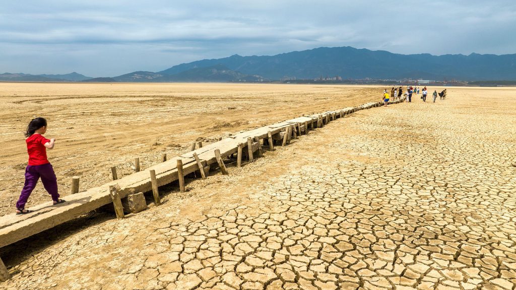
The Thousand eye Bridge under Poyang Lake is exposed due to drought in Jiujiang City, Jiangxi Province, China, September 3, 2022. (Photo by Cynthia Lee, © Alamy)
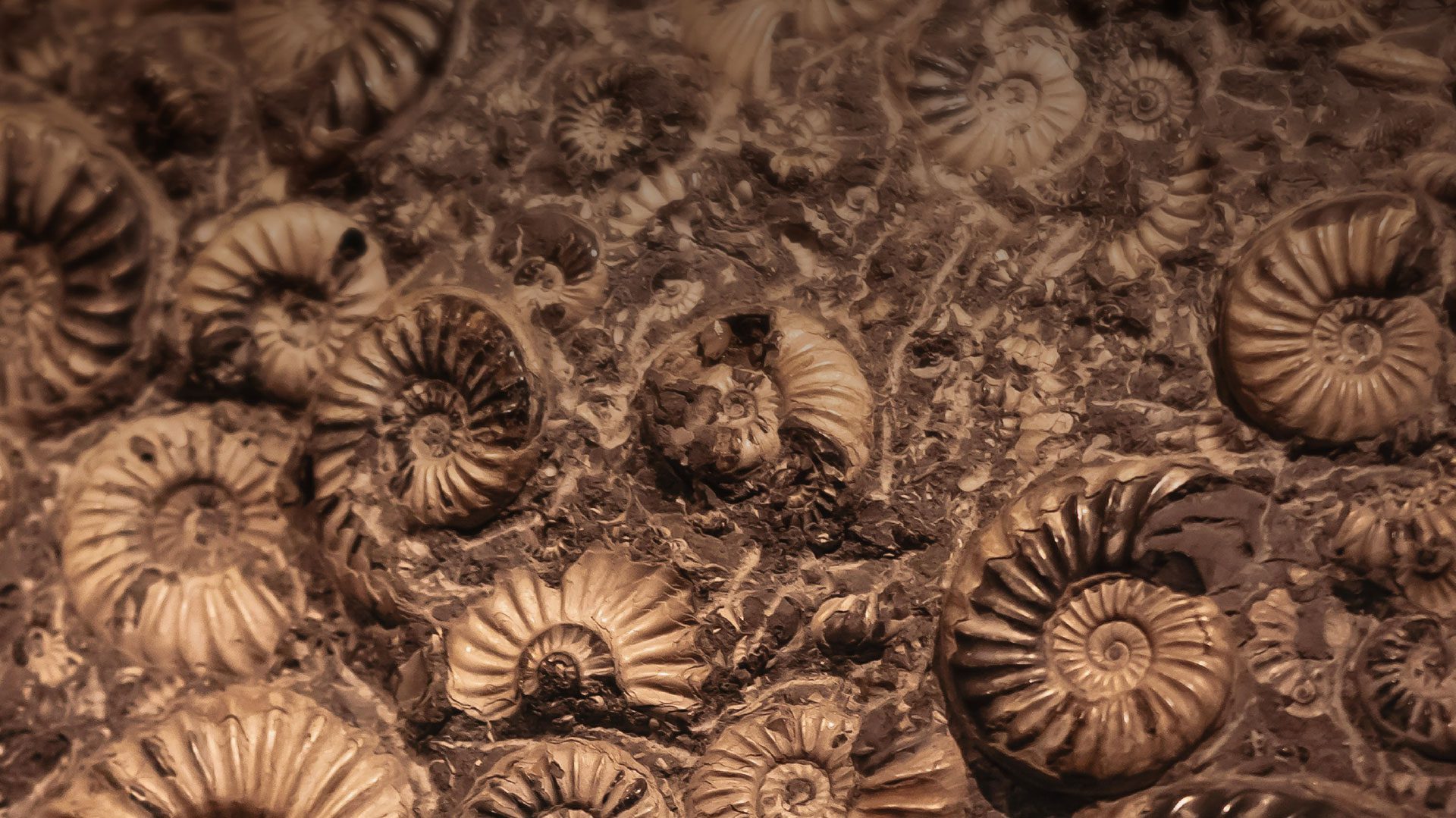
The predictive power of fish fossils
 In the past 120 years, average ocean surface temperatures have jumped by 1.5°F (0.83°C) due to the excess heat produced by the burning of fossil fuels. In response, many commercially valuable species, such as mackerel, herring, and tuna, are quickly emigrating poleward in search of cooler waters, leaving some nets with more questions than fish. WHOI ecological oceanographer Greg Britten is using data gleaned from fish fossils to help fisheries management anticipate and adapt to these changes.
He gets help from WHOI’s Paleo-FISHES lab, headed by assistant scientist Elizabeth Sibert. For millions of years, fish species have shed their teeth onto the seafloor. Sibert extracts sediment cores (much like the ones used by Jeff Donnelly), strains out the fossilized teeth inside, and quantifies fish abundance across distinct geological periods. These collections show Britten how fish productivity has changed during key periods of warming. From this, he can identify possible adaptations that may have helped species weather the heat.
His insights are a part of a larger data collection and modeling effort led by the Fisheries and Marine Ecosystem Model Intercomparison Project, or FishMIP, a multidisciplinary team that reports its findings to the International Panel on Climate Change so that it can provide informed guidance to global fisheries.
“Humans are applying a kind of bottleneck to fish populations with this extreme warming happening over a very short period of time,” said Britten. “Ultimately biology will thrive—that’s what biology does. But it’s just a question of which species and which combination of traits will thrive in this new, warmer environment.”
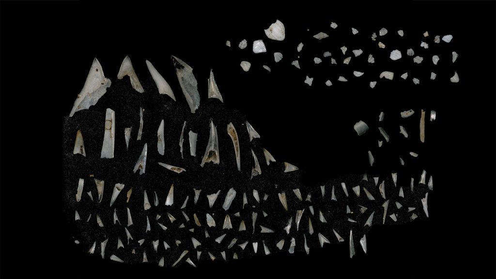
Earliest Eocene (55.4 million year old) shark scales (top) and fish teeth (bottom) recovered from the Deep Sea Drilling Project, Site 596, within the subtropical South Pacific Gyre. (Photo courtesy of Elizabeth Sibert, © Woods Hole Oceanographic Institution)