
Forecasting with Fins: Sharks can improve ocean temperature predictions, new study finds
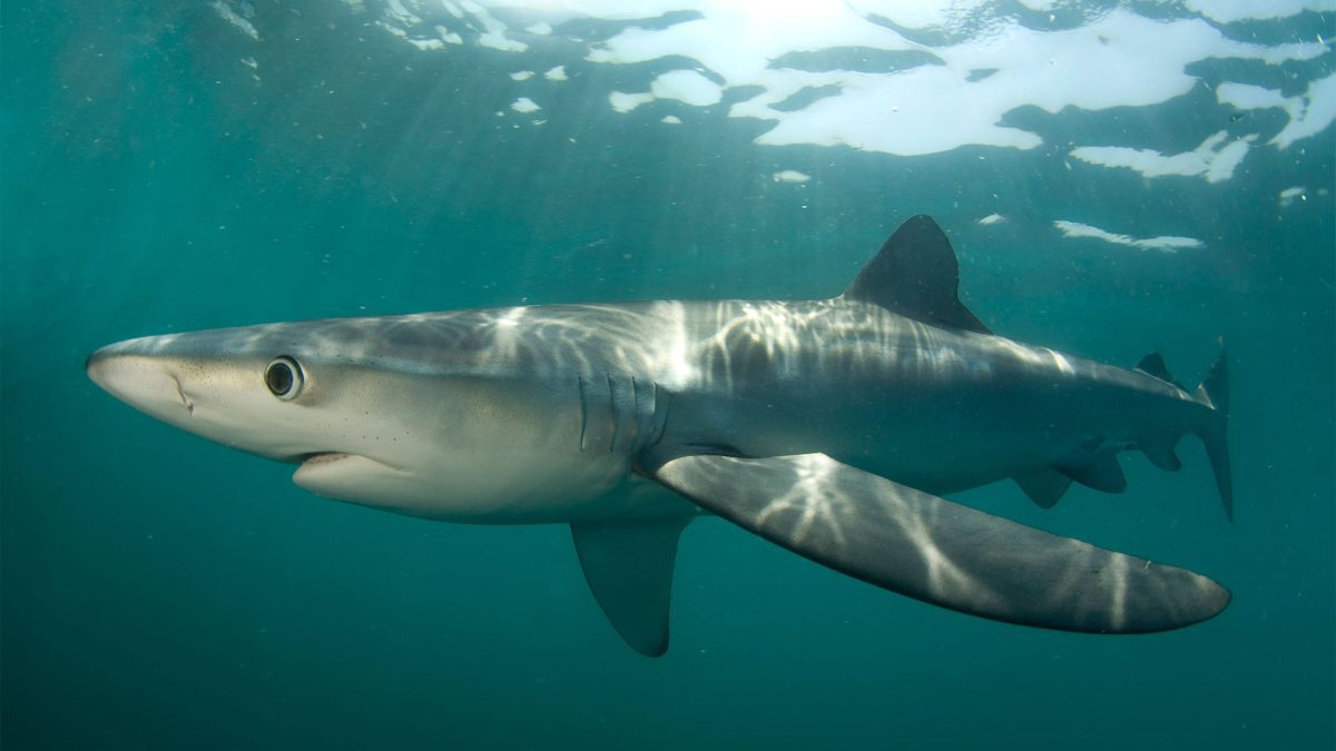 Photo ©Neil Hammerschlag
 April 30, 2026
Research demonstrates how animal-borne sensors can work in tandem with traditional tools to improve ocean predictions.
Woods Hole, Mass. — A new study, “Improved seasonal climate forecasting using shark-borne sensor data in a dynamic ocean” published in the journal npj Climate and Atmospheric Science, shows that electronically tagged sharks can serve as mobile sensors, collecting valuable ocean data in regions that are difficult to observe using conventional methods.
The study is led by Laura H. McDonnell a postdoctoral investigator at Woods Hole Oceanographic Institution (WHOI), who conducted the research as a doctoral student at the University of Miami Rosenstiel School of Marine, Atmospheric, and Earth Science and the Abess Center for Ecosystem Science and Policy. Her findings demonstrate that temperature and depth data gathered by tagged sharks can enhance ocean forecast accuracy in the Northwest Atlantic Ocean.
By incorporating shark-collected data into a seasonal climate model, McDonnell and her team found that forecast errors at the ocean surface decreased substantially, with improvements reaching as much as 40 percent in dynamic ocean regions.
This is the first study to experimentally integrate animal-borne sensor data into a seasonal climate model and quantify its impact on forecast performance, suggesting potential for future operational use. The findings point to a scalable new way to expand ocean observing systems by leveraging animals already moving through data-poor regions.
“Sharks are already moving through parts of the ocean that are challenging for us to observe,” said McDonnell. “This research shows that data they collect can help fill important gaps and, when used effectively, can improve how we predict ocean conditions.”

Interdisciplinary collaboration fuels innovation
The idea of using sharks as ocean observers grew out of an interdisciplinary collaboration that connected marine ecology with climate science between former Rosenstiel School shark scientist Neil Hammerschlag and atmospheric scientist Ben Kirtman, now dean of the Rosenstiel School. In 2018, they recognized that the data from shark-tagging studies used by Hammerschlag’s lab to study shark ecology could also benefit climate modeling. McDonnell, who began her doctoral studies that same year, was drawn to the project by the opportunity to bridge biology, oceanography, and climate science — exploring how tagging data could help answer questions beyond its usual ecological scope.
Satellite tags attached to sharks record depth and temperature as they travel through the ocean, collecting and transmitting this data in near real time. While these tags have long helped scientists track shark movements, the collaboration opened a new application and a chance to create a novel proof of concept: using the same data to improve ocean forecast.models.
“Marine predators like sharks naturally seek out dynamic ocean features such as fronts and eddies,” said Kirtman. “These are areas where models often lack sufficient observations.”
Testing sharks as ocean observers
McDonnell and Hammerschlag, working closely with WHOI oceanographer and study co-author Camrin Braun along with a local fisherman, tagged 18 blue sharks (Prionace glauca) and one shortfin mako shark (Isurus oxyrinchus) in the Northwest Atlantic. Over the next 6 months, the sharks transmitted more than 8,200 temperature-depth profiles across a wide range of locations and depths—down to nearly 2,000 meters (approximately 6,500 feet).
“Key to this study was repurposing a more advanced tag capable of transmitting location data along with temperature and depth information,” said Hammerschlag, co-author of the study and Executive Director of the Shark Research Foundation. “This allowed us to link subsurface ocean conditions directly to specific locations with known accuracy.”
The team compared observed ocean temperatures with forecasted temperatures from models with and without shark-derived data.
The results showed measurable improvements in forecast performance, particularly in dynamic coastal and shelf regions that are important for marine ecosystems and fisheries.
“Tagged sharks won’t replace conventional observing systems,” added McDonnell. “These preliminary results show that tagged marine predators can provide complementary in-situ observations as they move throughout the water column.”
Why it matters
Accurate ocean forecasts are critical for fisheries management, marine operations, and understanding how climate variability affects coastal communities. However, forecasts are often least reliable in regions where conditions change rapidly and observational data are lacking.
Animal-borne sensors could enhance predictions that support decision-making across multiple sectors, from seafood supply chains to climate adaptation planning.
“For fisheries and coastal communities, small improvements in ocean forecasts can make a big difference,” said Braun. “Reducing uncertainty helps people plan, whether that’s where to fish, how to manage resources, or how to respond to changing conditions.”
Funding for the research was provided by Cisco Systems, the University of Miami Abess Center, the NASA Biological Diversity and Ecological Conservation Program, NOAA, NSF, and the Robert L. James Early Career Scientist Chair at Woods Hole Oceanographic Institution.
###
About Woods Hole Oceanographic Institution
Woods Hole Oceanographic Institution (WHOI) is a private, non-profit organization on Cape Cod, Massachusetts, dedicated to marine research, engineering, and higher education. Founded in 1930, its mission is to understand the ocean, its interactions with the Earth, and its role in a changing global environment. WHOI’s pioneering discoveries arise from a unique blend of science and engineering that has made it one of the world’s most trusted leaders in ocean research and exploration. Known for its multidisciplinary approach, advanced ship operations, and unmatched deep-sea robotics, WHOI also operates the most extensive suite of ocean data-gathering platforms worldwide. More than 800 concurrent projects—driven by top scientists, engineers, and students—push the boundaries of knowledge to inform people and policy for a healthier planet. Behind the scenes, ship captains, mates, craftsmen, marine operations, and other skilled professionals provide essential support that makes this work possible. Learn more at whoi.edu.