
Image
Winging It
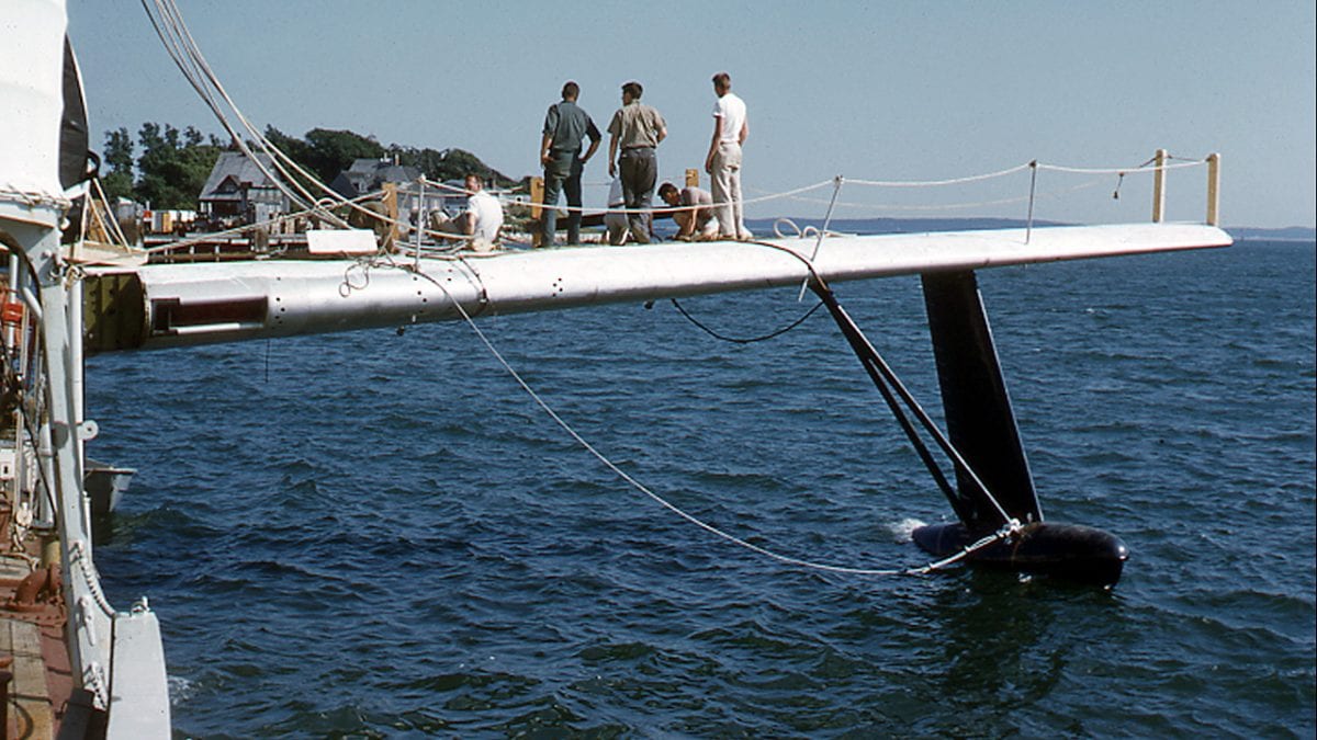
September 8, 2018In 1960, WHOI researchers on the research vessel Crawford devised a novel way of measuring the slope of the seafloor. They took sonar depth measurements from two fixed points about 50 feet apart: one from the ship itself and one from a P5 Marlin (P5M) seaplane wing attached to the side of the ship. Tests were conducted on several different ships: on WHOI’s Asterias in Woods Hole harbor, on the Crawford in Vineyard Sound, and on a U.S. Navy destroyer on the high seas. The system performed well in these initial tests, but the technique did not come into general use. (Photo courtesy of Woods Hole Oceanographic Institution Archives)
Image and Visual Licensing
WHOI copyright digital assets (stills and video) contained on this website can be licensed for non-commercial use upon request and approval. Please contact WHOI Digital Assets at images@whoi.edu or (508) 289-2647.