
Image
Undersea Volcano
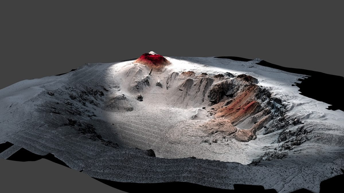
February 21, 2018This high-resolution map shows the seafloor topography of the caldera of the Havre volcano on the seafloor off the coast of New Zealand, which erupted in 2012. It was the largest underwater silicic eruption in the past century. A research expedition visited the site in 2015 for a close-up investigation. The WHOI-operated autonomous underwater vehicle Sentry produced this map of the volcano, which lies nearly a mile deep. Red areas show new lavas from the 2012 eruption. Scientists also used the WHOI-operated remotely operated vehicle Jason to explore the site and collect samples. (Image Courtesy of Rebecca Carey, University of Tasmania, and Adam Soule, WHOI, ©Woods Hole Oceanographic Institution)
Image and Visual Licensing
WHOI copyright digital assets (stills and video) contained on this website can be licensed for non-commercial use upon request and approval. Please contact WHOI Digital Assets at images@whoi.edu or (508) 289-2647.