
Simoes‐Sousa, I., Camargo, C., Tavora, J., Piffer‐Braga, A., Farrar, J., & Pavelsky, T. (2025). The May 2024 flood disaster in Southern Brazil: Causes, impacts, and SWOT‐based volume estimation. Geophysical Research Letters, 52(4). https://doi.org/10.1029/2024gl112442
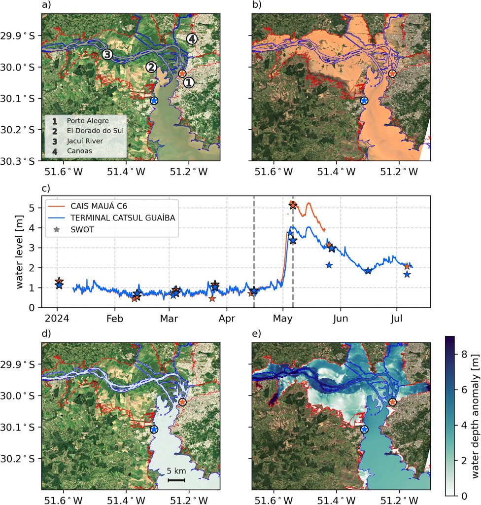
Image provided by Iury Simoes-Sousa
(a) Pre-flood Sentinel-2 true color composite showing typical water distribution near Porto Alegre, Brazil (15 April 2024). (b) Post-flood Sentinel-2 image (6 May 2024) showing extensive flooding. Orange areas indicate inundation with significant sediment deposition near rivers. (c) Water level time series at two gauge stations (CAIS MAUÁ C6 and TERMINAL CATSUL GUAÍBA) illustrating the rapid rise in water levels. Stars represent median SWOT water levels: thick stars denote pass 533, other stars pass 492. Gray dashed lines indicate snapshots for pre- and post-flood water depth anomaly maps (panels d, e). (d) Pre-flood Sentinel-2 composite with water depth anomaly from SWOT and FABDEM outputs. Blue lines show permanent water channels from land-cover data. (e) Post-flood water depth map (6 May 2024), with areas exceeding 5 m near rivers. Red and blue stars in (d, e) mark gauge station locations.